|
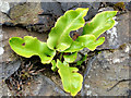
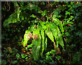
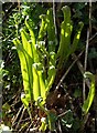
Hart's-tongue fern, Stranmillis, Belfast
by Albert Bridge
for square J3371
Harts-tongue fern Link growing... ( more) |
|
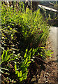
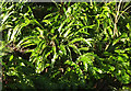
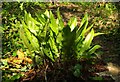
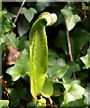
Hart's Tongue Fern, Fonthill Estate
by Maigheach-gheal
for square ST9331
Hart's Tongue fern grows in shaded places often forming large... (more)
|
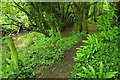
|
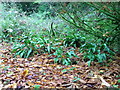
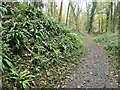
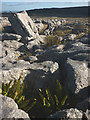
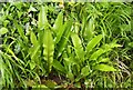
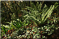
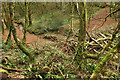
Ferns, Lower Coombe
by Derek Harper
for square SX7848
|
|
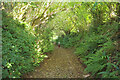
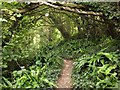
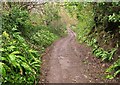
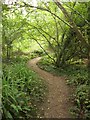
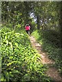
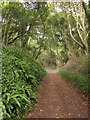
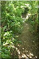
West Lane, Marldon
by Derek Harper
geograph for square SX8663
The green lane descends to the village between fern-covered banks.
|
|
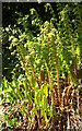
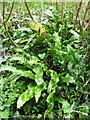
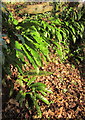
Ferns, Lower Brimley
by Derek Harper
for square SX7977
Hart's-tongue and male ferns catching the afternoon sun by Brimley Lane.
|
|
Hart's tongue fern, Ticknall limeyards
by Christine Johnstone
geograph for square SK3523
Asplenium scolopendrium on the south side of a Ticknall tramway cutting [opened 1802].
|
|
Harts-tongue Fern, Littlebredy
by Maigheach-gheal
for square SY5889
Hart's-tongue Fern can be found growing in damp, shady places in woodlands,... (more)
|
|
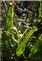
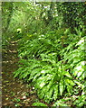
Fern, Woodpark Lane
by Derek Harper
for square SX8765
Harts-tongue fern fronds (Asplenium scolopendrium) on the green lane above South... (more)
|
|
Hartstongue fern, Holmepark Fell
by Karl and Ali
for square SD5479
Growing in the shelter of a grike.
|

|
Harts-tongue fern, Whitehill Lane
by Derek Harper
for square SX8658
The shadow is cast on the fern leaves by an umbel of ramsons turning to fruit.
|
|
Ferns, Lupton Park
by Derek Harper
for square SX9055
|
|
Ferns near Brownston
by Derek Harper
geograph for square SX6952
Hart's-tongue and male ferns dominate the undergrowth on this old track... (more)
|
|
Ferns, Ham Hill
by Derek Harper
for square ST4716
Harts-tongue ferns around a small exposure in the steep wooded hillside on the... (more)
|
|
The well at Crichton Castle
by M J Richardson
for square NT3861
No water in it, but a nice humid place, with a good growth of ferns [Hart's... (more)
|
|
Coast path near Bindon Cliffs
by Derek Harper
geograph for square SY2789
The path (Axmouth Footpath 2) spends most of its time along this coast in... (more)
|
|
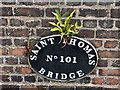
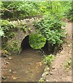
Detail of St Thomas canal Bridge
by Jonathan Hutchins
for square SJ9422
Bridge no.101 over the Staffordshire and Worcestershire Canal is Grade II... (more)
|
|
Harts Tongue Fern beside the path
by Robert Graham
for square NZ1759
Growing beside a large stone at the side of the Derwent Walk. It must like the... (more)
|
|
Harts-tongue fern near Bradley Manor
by Derek Harper
for square SX8470
|
|
Harts-tongue fern, Lummaton Hill
by Derek Harper
for square SX9166
A fine specimen of Asplenium scolopendrium in the woodland above Lummaton Quarry.
|
|
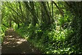
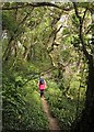
Whitehill Lane
by Derek Harper
geograph for square SX8658
The green lane drops between banks of hart's-tongue ferns to run close to... (more)
|
|
Ferns near Bow Creek
by Derek Harper
for square SX8256
Hart's-tongue ferns (Asplenium scolopendrium) beside Ashprington Footpath 3.
|
|
Hart's-tongue fern, Common Water Lane
by Derek Harper
for square ST4402
Asplenium scolopendrium catches the afternoon sunlight beside the Monarch's Way.
|
|
Hart's-tongue fern near Cockington
by Derek Harper
for square SX8963
Asplenium scolopendrium beside Vicarage Hill, the lane climbing east from the village.
|
|
Hart's Tongue Fern by the South-West Coast Path
by Steve Daniels
for square SS8948
|
|
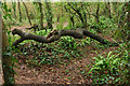
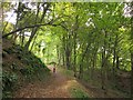
Manscombe Plantation
by Derek Harper
geograph for square SX8963
A fallen branch and a track in the background in the wood above Cockington.... (more)
|
|
Whitehill Lane #6
by Derek Harper
geograph for square SX8658
|
|
Ferns above the Dart
by Derek Harper
for square SX8456
|

|
Path into Ten Acre Brake
by Derek Harper
geograph for square SX8863
|
|
Coast path on Charton Cliff
by Derek Harper
geograph for square SY3090
Combpyne Rousdon Footpath 14 winds along the wooded landslip among ferns and ivy.
|
|
Fallen tree, Occombe valley
by Derek Harper
geograph for square SX8762
|
|
By Liverton Brook
by Derek Harper
geograph for square SX8174
Green ferns by a little path along the brook, seen from Ilsington footpath 54.
|
|
Coast path on Rousdon Cliffs
by Derek Harper
geograph for square SY2990
A flight of steps on Combpyne Rousdon Footpath 14 as it approaches the Charton... (more)
|
|
In the landslip
by Derek Harper
geograph for square SY2789
|
|
Coast path on Pinhay Cliffs
by Derek Harper
geograph for square SY3190
Following an easy track along Combpyne Rousdon Footpath 14 among beeches. In a... (more)
|
|
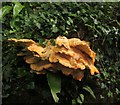
Fungus by Tuckenhay Creek
by Derek Harper
for square SX8156
Laetiporus sulphureus, the Chicken of the Woods, beside the John Musgrave... (more)
|

|
Winter heliotrope, Cockington
by Derek Harper
for square SX8963
Category: Christmas Day 2007
Petasites fragrans growing beside Hartstongue over the edge of the middle of the... (more)
|
|
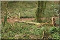
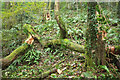
Broken trees, Hollicombe Lake valley
by Derek Harper
geograph for square SX8962
|
|
Lime kiln, Whitehill Lane
by Derek Harper
geograph for square SX8558
Beside Lidstone Quarry.
|
|
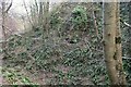
Structure, The Grove
by Derek Harper
for square SX9156
|
|
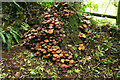
Fungi, Middle Rocombe
by Derek Harper
for square SX9069
I'd assume this is honey fungus growing at the foot of a tree (an ash, if... (more)
|
|
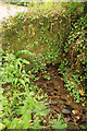
Stream near Allaleigh
by Derek Harper
geograph for square SX8153
Emerging from beneath a wall by Allaleigh Lane; it eventually ends up in the River Wash.
|
|
Stream, Trevilling
by Derek Harper
geograph for square SW9873
|
|
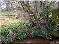
Matford Brook
by Derek Harper
for square SX9289
Crossed here by Trood Lane.
|
|
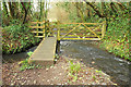
Footbridge over Hazel Brook
by Derek Harper
geograph for square ST5578
From the path up the valley to Blaize Castle.
|
|
Coast path on Pinhay Cliffs
by Derek Harper
geograph for square SY3190
For most of this square the coast path through the landslip is on a very easy... (more)
|
|
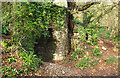
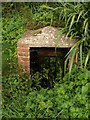
Doda Well, Coffinswell
by Derek Harper
for square SX8868
Category: Well
This "small 19th century brick well-house" is on one of the headwaters... (more)
|
|
Fallen trees, Occombe valley
by Derek Harper
geograph for square SX8762
|
|
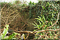
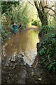
Puddle, Whitehill Lane
by Derek Harper
geograph for square SX8658
Encountered frequently in South Devon over the last few weeks. Wellies are de rigueur.
|
|
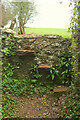
Stone stile above Compton
by Derek Harper
geograph for square SX8664
On Marldon footpath 1. You wonder how far the drop is on the other side; there... (more)
|
|
Path to Duck Street
by Derek Harper
geograph for square ST6601
Duck Street is visible ahead along this final, enclosed, stretch of footpath S13 25#2.
|