About tags on Geograph

Public Tags

Related Tags | Coverage Map
Prefix: postcode area    Tag:  DD9  
Other tags: Dd9    

Showing latest 50 of 63 images tagged with postcode area:DD9 tag.

View all tagged images - In Browser
:

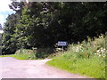
NO5665 : Kilgarie Farm sign by Stanley Howe Kilgarie Farm sign by Stanley Howe
geograph for square NO5665
At its access from a minor Road near Wellsden Farm.
NO5163 : Entering Balhall from the east by Stanley Howe Entering Balhall from the east by Stanley Howe
geograph for square NO5163
Balhall Crescent on the right of minor road, ahead.
Tags: postcode area:DD9   type:Geograph   subject:Hamlet   Housing   place:Menmuir   Minor Road   top:Roads, Road Transport   Village   top:Village, Rural Settlement  
NO5163 : Balhall Crescent by Stanley Howe Balhall Crescent by Stanley Howe
geograph for square NO5163
With public trampoline.
Tags: postcode area:DD9   type:Geograph   subject:Houses   Housing   top:Housing, Dwellings   place:Menmuir   Minor Road   top:Sport, Leisure   Trampoline   top:Village, Rural Settlement  
NO5063 : Bogton of Balhall by Stanley Howe Bogton of Balhall by Stanley Howe
geograph for square NO5063
Farmhouse.
Tags: postcode area:DD9   top:Farm, Fishery, Market Gardening   Farmhouse   subject:Farmhouse   place:Fern   type:Geograph   Minor Road  
NO5063 : A roadside copse by Stanley Howe A roadside copse by Stanley Howe
geograph for square NO5063
Between Bogton and Shandford.
Tags: Copse   postcode area:DD9   place:Fern   Field   type:Geograph   top:Grassland   Minor Road   top:Roads, Road Transport   subject:Woodland   top:Woodland, Forest  
NO4962 : Approach to Shandford by Stanley Howe Approach to Shandford by Stanley Howe
geograph for square NO4962
On the minor road from the east.
Tags: postcode area:DD9   Farm   top:Farm, Fishery, Market Gardening   place:Fern   type:Geograph   Minor Road   subject:Road   top:Roads, Road Transport  
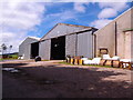
NO4962 : Shandford Farm buildings by Stanley Howe Shandford Farm buildings by Stanley Howe
geograph for square NO4962
By minor road to Fern.
Tags: postcode area:DD9   subject:Farm   Farm Buildings   top:Farm, Fishery, Market Gardening   place:Fern   type:Geograph   Minor Road   top:Roads, Road Transport  
NO4862 : Afflochie/Glentrusta Junction by Stanley Howe Afflochie/Glentrusta Junction by Stanley Howe
geograph for square NO4862
Off minor road at Balquharn.
Tags: postcode area:DD9   place:Fern   type:Geograph   junction:Minor Roads   subject:Road Junction   top:Roads, Road Transport   Signpost  
NO5163 : Telephone box, Balhall by Stanley Howe Telephone box, Balhall by Stanley Howe
geograph for square NO5163
Off minor road out of Kirkton of Menmuir. No longer in the position shown on the... (more)
Tags: top:Communications   postcode area:DD9   type:Geograph   place:Menmuir   Minor Road   subject:Telephone Box   Telephone Box   top:Village, Rural Settlement  
NO5264 : A Knowehead Farm cottage by Stanley Howe A Knowehead Farm cottage by Stanley Howe
geograph for square NO5264
The easternmost of a group of four by the minor road from Kirkton of Menmuit.
Tags: subject:Cottage   postcode area:DD9   Farm Cottage   type:Geograph   top:Housing, Dwellings   place:Menmuir   Minor Road   top:Roads, Road Transport   top:Village, Rural Settlement  
NO5263 : Access to Balconnel farmstead by Stanley Howe Access to Balconnel farmstead by Stanley Howe
geograph for square NO5263
From the public road; farmhouse on the left.
Tags: postcode area:DD9   subject:Farm   Farm Access Drive   top:Farm, Fishery, Market Gardening   Farmhouse   type:Geograph   place:Menmuir   Minor Road   top:Roads, Road Transport  
NO5364 : Menmuir Hall by Stanley Howe Menmuir Hall by Stanley Howe
geograph for square NO5364
Village Hall near Menmuir Kirk.
Tags: postcode area:DD9   type:Geograph   subject:Hall   place:Menmuir   Village Hall   top:Village, Rural Settlement  
NO5364 : Minor road to Ledmore by Stanley Howe Minor road to Ledmore by Stanley Howe
geograph for square NO5364
From Kirkton of Menmuir.
Tags: postcode area:DD9   type:Geograph   place:Menmuir   Minor Road   subject:Road   top:Roads, Road Transport  
NO5364 : Lethnot Junction by Stanley Howe Lethnot Junction by Stanley Howe
geograph for square NO5364
At Kirkton of Memuir.
Tags: postcode area:DD9   type:Geograph   place:Menmuir   Minor Road Junction   subject:Road   top:Roads, Road Transport  
NO5364 : Kirkton of Menmuir by Stanley Howe Kirkton of Menmuir by Stanley Howe
geograph for square NO5364
Village sign at minor road entry from the east.
Tags: postcode area:DD9   type:Geograph   place:Menmuir   Minor Road   subject:Road   top:Roads, Road Transport   top:Village, Rural Settlement  
NO5364 : Old style milepost at Tigerton junction by Stanley Howe Old style milepost at Tigerton junction by Stanley Howe
geograph for square NO5364
Distances cited to nearest quarter-mile.
Tags: postcode area:DD9   type:Geograph   place:Menmuir   Minor Road Junction   subject:Road   Road Direction Finger Post   top:Roads, Road Transport  
NO5364 : The Old Forge, Tigerton by Stanley Howe The Old Forge, Tigerton by Stanley Howe
geograph for square NO5364
NO5464 : A road victim by Stanley Howe A road victim by Stanley Howe
for square NO5464
At a summit of the minor road at Parkhill, just east of Tigerton.
Tags: type:Close Look   postcode area:DD9   Dead Deer   subject:Deer   place:Menmuir   Minor Road   top:Moorland   top:Roads, Road Transport   top:Wild Animals, Plants and Mushrooms  
NO5464 : Downhill to Tigerton from Parkhill by Stanley Howe Downhill to Tigerton from Parkhill by Stanley Howe
geograph for square NO5464
On the minor road from Inchbare.
Tags: postcode area:DD9   Downhill   type:Geograph   place:Menmuir   Minor Road   subject:Road   top:Roads, Road Transport  
NO5565 : A lone tree by road down from The Caterhuns by Stanley Howe A lone tree by road down from The Caterhuns by Stanley Howe
geograph for square NO5565
Near Forthill Farm.
Tags: postcode area:DD9   Downhill   type:Geograph   Lone Tree   Minor Road   top:Roads, Road Transport   subject:Tree   top:Woodland, Forest  
NO5565 : Forthill Farm by Stanley Howe Forthill Farm by Stanley Howe
geograph for square NO5565
From the minor road to The Caterthuns. A domestic wind turbine in shot.
Tags: postcode area:DD9   Domestic Wind Turbine   top:Energy Infrastructure   subject:Farm   Farm   top:Farm, Fishery, Market Gardening   Fields   type:Geograph   top:Roads, Road Transport  
NO5565 : Descent from The Caterthuns by Stanley Howe Descent from The Caterthuns by Stanley Howe
geograph for square NO5565
On the minor road past Forthill Farm.
Tags: postcode area:DD9   Domestic Wind Turbine   Downhill   type:Geograph   Minor Road   subject:Road   top:Roads, Road Transport   The Caterthuns  
NO5566 : Hikers to the Iron Age fort on the White Caterthun by Stanley Howe Hikers to the Iron Age fort on the White Caterthun by Stanley Howe
geograph for square NO5566
Seen from the car park picnic site; a climb of about 60 metres in half a kilometre.
Tags: postcode area:DD9   type:Geograph   Hikers   Hill Path   subject:Path   top:Paths   Picnic Spot   The Caterthuns  
NO5566 : A wire fence up to the Brown Caterthun by Stanley Howe A wire fence up to the Brown Caterthun by Stanley Howe
geograph for square NO5566
From the carpark at the col between the two Caterthuns.
Tags: postcode area:DD9   subject:Fence   type:Geograph   top:Moorland   The Caterthuns   Wire Fence  
NO5566 : Harebells in July, by The Caterthuns carpark by Stanley Howe Harebells in July, by The Caterthuns carpark by Stanley Howe
for square NO5566
Tags: type:Close Look   postcode area:DD9   subject:Flora   plant:Harebell   top:Paths   The Caterthuns   top:Wild Animals, Plants and Mushrooms  
NO5566 : Path to the Brown Caterthun by Stanley Howe Path to the Brown Caterthun by Stanley Howe
geograph for square NO5566
From the car park at the col between the two Caterthunes.
Tags: postcode area:DD9   type:Geograph   Hill Fort   Hillside Path   top:Historic Sites and Artefacts   subject:Path   top:Paths   subject:Signpost   The Caterthuns  
NO5566 : Ancient Monument path marker by Stanley Howe Ancient Monument path marker by Stanley Howe
geograph for square NO5566
To the White Caterthun.
Tags: postcode area:DD9   type:Geograph   Path   top:Paths   subject:Signpost   The Caterthuns  
NO5566 : Path to White Caterthun by Stanley Howe Path to White Caterthun by Stanley Howe
geograph for square NO5566
From the Carpark at the col between the twin Caterthuns.
Tags: postcode area:DD9   type:Geograph   subject:Hill Fort   Hillside Path   top:Historic Sites and Artefacts   top:Moorland   top:Paths   Picnic Spot   The Caterthuns   top:Uplands  
NO5566 : Welcome to 'The Caterthuns' by Stanley Howe Welcome to 'The Caterthuns' by Stanley Howe
for square NO5566
An information board at a carpark picnic enclosure, by a minor road crossing the... (more)
NO5665 : Donaldson Den by Stanley Howe Donaldson Den by Stanley Howe
geograph for square NO5665
Between Wellsden and Kilgarie (in background)
Tags: postcode area:DD9   Den   subject:Farm   top:Farm, Fishery, Market Gardening   type:Geograph   Silo   Track and Field  
NO5665 : Wellsden Farm by Stanley Howe Wellsden Farm by Stanley Howe
geograph for square NO5665
With its wind turbine electricity generator.
NO5867 : Dogleg bend in a minor road from Inchbare to The Caterthuns by Stanley Howe Dogleg bend in a minor road from Inchbare to The Caterthuns by Stanley Howe
geograph for square NO5867
The lane ahead is the access to Mains of Lundie.
Tags: Ancient Monument Sign   top:Country Estates   postcode area:DD9   Dogleg Bend in Road   type:Geograph   Lane Junction   Minor Road   subject:Road   top:Roads, Road Transport  
NO5867 : Stone gatepost, Dunlappie by Stanley Howe Stone gatepost, Dunlappie by Stanley Howe
for square NO5867
With farm name sign.
Tags: type:Close Look   postcode area:DD9   subject:Farm   Farm Name Sign   top:Farm, Fishery, Market Gardening   Gatepost  
NO5867 : Access to Dunlappie Farm by Stanley Howe Access to Dunlappie Farm by Stanley Howe
geograph for square NO5867
From the minor road near Dalhousie Bridge.
Tags: postcode area:DD9   subject:Drive   Driveway   Farm Name Sign   top:Farm, Fishery, Market Gardening   type:Geograph   Minor Road   top:Roads, Road Transport  
NO5967 : Dalhousie Bridge over West Water by Stanley Howe Dalhousie Bridge over West Water by Stanley Howe
geograph for square NO5967
Minor road with a 25 ton weight restriction.
NO5970 : B966 at Gannochy by Stanley Howe B966 at Gannochy by Stanley Howe
geograph for square NO5970
On the south bank of the River North Esk.
Tags: B966   postcode area:DD9   type:Geograph   subject:Road   top:Roads, Road Transport   Rural Hamlet   top:Village, Rural Settlement  
NO6070 : Bridge over River North Esk by Stanley Howe Bridge over River North Esk by Stanley Howe
geograph for square NO6070
B966 at Gannochy.
Tags: B966   subject:Bridge   postcode area:DD9   type:Geograph   river:North Esk (Angus)   top:Rivers, Streams, Drainage   Road Bridge Over River   top:Roads, Road Transport  
NO6070 : Entrance to 'The Burn House' by Stanley Howe Entrance to 'The Burn House' by Stanley Howe
geograph for square NO6070
From the B966.
Tags: B966   top:Country Estates   postcode area:DD9   subject:Gatehouse   Gatehouse   Gateway   type:Geograph   top:Roads, Road Transport  
NO5255 : Crosston School, Aberlemno by Stanley Howe Crosston School, Aberlemno by Stanley Howe
geograph for square NO5255
View from entrance by B9134.
Tags: place:Aberlemno   B9134   postcode area:DD9   top:Educational Sites   type:Geograph   top:Roads, Road Transport   building type:School   subject:School   School Playground  
NO5255 : Flemington farmstead, Aberlemno by Stanley Howe Flemington farmstead, Aberlemno by Stanley Howe
geograph for square NO5255
View from Pictish Stone by B9134.
Tags: place:Aberlemno   B9134   postcode area:DD9   subject:Farm   top:Farm, Fishery, Market Gardening   Farmstead   type:Geograph   top:Roads, Road Transport  
NO5255 : A view to Flemington by Stanley Howe A view to Flemington by Stanley Howe
geograph for square NO5255
Across fields from the sculpted Pictish Stone by the B9134.
Tags: place:Aberlemno   B9134   postcode area:DD9   subject:Farm   top:Farm, Fishery, Market Gardening   subject:Farmhouse   type:Geograph   top:Grassland  
NO5658 : Broomknowe Farm by Stanley Howe Broomknowe Farm by Stanley Howe
geograph for square NO5658
Farmhouse and steadings, as seen from B9134.
Tags: B9134   place:Brechin   postcode area:DD9   top:Farm, Fishery, Market Gardening   subject:Farmhouse   Farmstead   type:Geograph   top:Roads, Road Transport  
NO5859 : Upstream face of Stannochy Bridge by Stanley Howe Upstream face of Stannochy Bridge by Stanley Howe
geograph for square NO5859
Carrying the B9134 over the River South Esk near Brechin.
Tags: B9134   place:Brechin   subject:Bridge   Bridge Over the River   postcode area:DD9   type:Geograph   top:Rivers, Streams, Drainage   top:Roads, Road Transport   river:South Esk(Angus)  
NO5859 : View upstream, River South Esk by Stanley Howe View upstream, River South Esk by Stanley Howe
geograph for square NO5859
From Stannochy Bridge (B9134).
Tags: B9134   Bridge Over the River   postcode area:DD9   type:Geograph   bird:Mute Swan   subject:River   top:Rivers, Streams, Drainage   river:South Esk(Angus)   looking:Upstream  
NO5859 : Stannochy Bridge, B9134 by Stanley Howe Stannochy Bridge, B9134 by Stanley Howe
geograph for square NO5859
Over River South Esk near Brechin.
Tags: B9134   place:Brechin   subject:Bridge   Bridge Over the River   postcode area:DD9   type:Geograph   Narrow Bridge Sign   top:Rivers, Streams, Drainage   top:Roads, Road Transport  
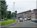
NO6059 : Junction of A935 with Witchden Road, Brechin by Stanley Howe Junction of A935 with Witchden Road, Brechin by Stanley Howe
geograph for square NO6059
The former Denburn Works with tower (now residential flats) ahead.
Tags: A935   place:Brechin   top:City, Town Centre   postcode area:DD9   housing:Flats   top:Housing, Dwellings   subject:Road Junction   Road Junction   top:Roads, Road Transport   former:Works  
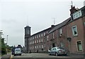
NO6059 : Flats on Montrose Street (A935), Brechin by Stanley Howe Flats on Montrose Street (A935), Brechin by Stanley Howe
geograph for square NO6059
Formerly the Denburn Works.
Tags: A935   place:Brechin   top:City, Town Centre   postcode area:DD9   subject:Dwelling   housing:Flats   top:Housing, Dwellings   top:Roads, Road Transport   former:Works  
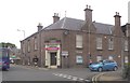
NO6060 : A print-shop on South Esk Street (A935), Brechin by Stanley Howe A print-shop on South Esk Street (A935), Brechin by Stanley Howe
geograph for square NO6060
At the junction with Commerce Street. These premises were previously a licensed... (more)
NO6060 : Dalhousie Memorial Fountain by Stanley Howe Dalhousie Memorial Fountain by Stanley Howe
geograph for square NO6060
View from A935 through St Ninian's Square.
NO6060 : Brechin Public Library and Museum by Stanley Howe Brechin Public Library and Museum by Stanley Howe
geograph for square NO6060
St Ninian's Square, Brechin.
Tags: place:Brechin   top:City, Town Centre   postcode area:DD9   subject:Library   Library and Museum   top:Public Buildings and Spaces   Public Square  
View more in the Image Search or in Browser
View images matching 'DD9' anywhere in the tags
Don't click these: PotMel 1 PotMel 2