
|
Private track near Pitsford, Northamptonshire
by Malc McDonald
geograph for square SP7367
A private track leading to a farm in Northamptonshire.
|

|
The track to Sheepcote Farm
by Christine Johnstone
geograph for square SE4330
The lath that runs from Ledston Luck to Ledsham has not developed into the... (more)
|
|
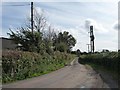
Private road to Grange Farm
by Christine Johnstone
geograph for square SE4021
Seen from the junction with New Road, Old Snydale.
|

|
Private track near Market Harborough
by Malc McDonald
geograph for square SP7586
A private track leading away from Harborough Road, near Market Harborough.... (more)
|

|
Private track leaves public track near South Creake
by Richard Humphrey
geograph for square TF8335
A private track heading north next to the trees leaves a public track which goes... (more)
|

|
Farm track near Goldhanger
by Malc McDonald
geograph for square TL9110
A private track leading to farms near Goldhanger, Essex.
|

|
Railway bridge on the Derwent Walk
by Christine Johnstone
geograph for square NZ1657
Spanning the private track to Low Friarside Farm.
|

|
Private farm track heading north to Holgate Road
by Christine Johnstone
geograph for square TF8336
With a 'private' sign, to avoid confusion.
|

|
Private farm track heading east across Croston Moss
by Christine Johnstone
geograph for square SD4716
The public footpath is parallel, but on the south / right side of the drain.
|

|
Private farm track heading south towards Caunce Wood
by Christine Johnstone
geograph for square SD4716
As the sign says, this is not a public footpath or right of way.
|

|
Private lane to Fincham House and Farm near Rougham
by Richard Humphrey
geograph for square TF8221
Incorrectly marked on OS Mapping as a public road this is actually a private... (more)
|

|
Empingham Estate, Private
by Christine Johnstone
geograph for square SK9610
Padlocked and gated track along the west side of Three Corner Plantation.
|

|
Private farm track heading south
by Christine Johnstone
geograph for square TF8336
Towards another track running east-west.
|

|
Private farm road to Southwold Farm
by Christine Johnstone
geograph for square SE9243
The sign warns people not to stray off Hudson Way, a former railway route which... (more)
|

|
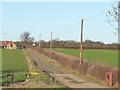
Private track to Beech Farm
by Christine Johnstone
geograph for square TF3070
Running east from Long Hedge Lane, alongside a partly-harvested oilseed rape crop.
|
|
Access track to Bluefield Farm
by Christine Johnstone
geograph for square TL0396
From its junction with Apethorpe Road.
|

|
Track to Cliff Hill
by Christine Johnstone
geograph for square SE5314
With Windmill Farm alongside.
|

|
Track across Middle Field
by Christine Johnstone
geograph for square SE5015
Seen from its junction with Middlefield Lane.
|

|
Farm track off Kirton Road
by Julian P Guffogg
geograph for square SE9100
The sign states "Private Farmland, No Public Right of Way"
|

|
Peacock Farm's private road
by Christine Johnstone
geograph for square TF7838
The white sign emphasises that this is no longer the way to Sunderland farm.
|

|
Private gated farm track heading north from Yoxall Road
by Christine Johnstone
geograph for square SK1218
A green lane, but not the Green Lane, which is a bridleway running east-west a... (more)
|

|
Private track off Hill Row Causeway
by Richard Humphrey
geograph for square TL4175
To the east of Earith
|

|
Farm track near Tollesbury, Essex
by Malc McDonald
geograph for square TL9512
|

|
Public footpath along a private farm track
by Richard Humphrey
geograph for square TL5597
Crossing land owned by Nordelph Farms on Upwell Fen
|

|
Nordelph Farms Ltd - PRIVATE - No entry ???
by Richard Humphrey
geograph for square TL5598
Situated at the end of a dead end lane on Upwell Fen near Nordelph. At this... (more)
|

|
Strip of woodland off a private farm track
by Christine Johnstone
geograph for square TF8335
The track runs north, connecting three parallel lanes with public access.
|

|
Track to Hunmanby Grange farm
by Martin Dawes
geograph for square TA0775
The farm buildings can be seen in the trees over the field. Not only a farm but... (more)
|

|
Private track to Moon's Rush and Overton Wood
by Christine Johnstone
geograph for square SE5458
Running south from Shipton Low Road.
|

|
Farm track off Magdalen Road
by Humphrey Bolton
geograph for square SE0908
This was originally the access track to Harden Moss Farm, but is now disused.... (more)
|

|
This way to Humber House Farm
by Christine Johnstone
geograph for square NZ1446
Northernmost of the two tracks leaving Humberhill Lane
|

|
Gated public footpath
by Christine Johnstone
geograph for square SE5315
Running from Cliff Hill to Greengate Road.
|

|
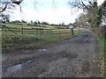
Track, Preston Farm
by Derek Harper
geograph for square SX7451
A private farm track leading to a barn and farmyard.
|
|
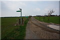
Private Farm Track ahead.
by jeff collins
geograph for square SX5051
The track ahead goes to Barn Farm and there is no public right of way on it. The... (more)
|
|
Track to High Spelder Banks
by Christine Johnstone
geograph for square SE2081
Runs northwards from Fearby Road at a 112 metre spot height.
|
|
Private drive
by J W Parker
geograph for square SU3412
This looks as if it might be a footpath that would lead you to Foxhills and... (more)
|

|
Unwelcoming sign
by Russel Wills
geograph for square NX8255
On the track to South Glen.
It says:
Private Farm Track
No Through Road... (more)
|

|
Private Farm Track
by David Pashley
for square TG3429
|

|
Private farm track heading west from Station Road
by Christine Johnstone
geograph for square TF7938
At the edge of a sugar beet field.
|
|
Twin tracks, Tunley
by Derek Harper
geograph for square ST6959
Running side by side away from Blind Lane.
|

|
Private farm track with barrier
by David Pashley
geograph for square TF8605
|

|
Track Approaching Glebe Farm
by Jonathan Clitheroe
geograph for square SK5826
This is actually a private access road which I had erroneously followed.
|

|
Private track to Wharram Percy Farm
by Christine Johnstone
geograph for square SE8362
With a substantial ditch alongside. Is this part of the ancient... (more)
|

|
Private Track with Sign
by David Pashley
geograph for square TG3334
|

|
Private gated track
by David Pashley
geograph for square TG2631
|

|
Private farm track leading to Great Limber Grange
by Ian S
geograph for square TA1505
|

|
Private farm track to Limber Road
by Ian S
geograph for square TA1606
|

|
Private farm track leading to Earswick
by Ian S
geograph for square SE6257
|

|
Private farm track leading to Earswick
by Ian S
geograph for square SE6257
|

|
Private farm track leading to Earswick
by Ian S
geograph for square SE6357
|

|
Private farm track running north-east to Chilbolton Down
by Christine Johnstone
geograph for square SU4036
Taken at a 92 metre spot height on a minor road, just south of the A30.
|
