Public Tags
Tag: Private·House
Showing images tagged with Private House tag.

|
Former national school near Ballywalter
by Rossographer geograph for square J6071 The former Dunover National School on the Dunover Road North near Ballywalter. A... (more)
Tags:
Date 1910
subject:Former National School
Former National School
type:Geograph
top:Historic Sites and Artefacts
subject:House
top:Housing, Dwellings
building type:National School
Private House
|

|
'Hillside' across Penglais Road, Aberystwyth
by John S Turner geograph for square SN5981 There is an Ordnance Survey Flush Bracket on the side wall of the private house... (more)
Tags:
Flush Bracket Benchmark
type:Geograph
top:Historic Sites and Artefacts
subject:House
top:Housing, Dwellings
Private House
Road
top:Roads, Road Transport
|

|
Formerly The Bird in Hand pub, Stock Green
by Mike Dodman geograph for square SO9959 Now a private house. See also Link from 2015.
Tags:
top:Farm, Fishery, Market Gardening
Former Public House
type:Geograph
subject:House
top:Housing, Dwellings
top:Lowlands
Private House
top:Roads, Road Transport
top:Village, Rural Settlement
|

|
Former miners Institute, Quebec
by Robert Graham geograph for square NZ1743 Now a private house , this was built in 1901 (date over the door), for the... (more)
|
|
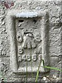
Flush Bracket OSBM G4681: Hogsthorpe
by Brian Westlake for square TF5372 Flush bracket bench mark on a former post office, now a private house. See... (more)
Tags:
subject:Benchmark
type:Close Look
top:Housing, Dwellings
Ordnance Survey Bench Mark
Private House
top:Village, Rural Settlement
|
|
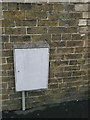
Cut Mark: Welton, Old School
by Brian Westlake for square TF0179 The old school, now a private house, carries a cut bench mark on its north face.... (more)
Tags:
Bench Mark
subject:Benchmark
top:Educational Sites
top:Housing, Dwellings
Old School
Ordnance Survey
Private House
top:Village, Rural Settlement
|

|
Cut Mark: Sandwich, Dover Road
by Brian Westlake for square TR3257 Cut mark on a former farm building now a private house. See... (more)
|
|
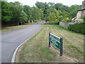
Holsart Close
by Marathon geograph for square TQ2256 This is the closest I could reasonably take a photograph of the private Holsart... (more)
|
|
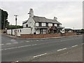
The former ‘Dun Cow’ pub by the A3400
by Robin Stott geograph for square SP1858 It was boarded up and to let in 2012 SP1858 : The Dun Cow and is now a private dwelling.... (more)
Tags:
road:A3400
Arden
postcode district:CV37
Former Pub
type:Geograph
top:Housing, Dwellings
top:Lowlands
Middle of Nowhere
near:Pathlow
Private House
near:Stratford-Upon-Avon
|
|
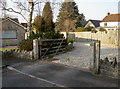
Walk through the drive
by Neil Owen geograph for square ST5859 A footpath appears to take the route through someone's private driveway.... (more)
Tags:
Footpath
top:Housing, Dwellings
subject:Path
top:Paths
Private House
top:Village, Rural Settlement
|

|
A window on the past
by Neil Owen for square ST7747 This sumptuous property includes a large building that was once a WWI drill hall... (more)
Tags:
top:City, Town Centre
Former World War 1 Drill Hall
subject:Hall
top:Historic Sites and Artefacts
top:Housing, Dwellings
Private House
|

|
Former chapel at Skirmett
by Graham Horn geograph for square SU7790 This building is at the heart of the village. It has all the look of a former... (more)
|

|
Roch Castle, 1953
by David M Murray-Rust for square SM8821 View from the entrance to the drive. Built c.1270, restored as a private... (more)
Tags:
period:13th Century
type:Cross Grid
top:Defence, Military
Grade I Listed
top:Historic Sites and Artefacts
Medieval Castle
Private House
top:Village, Rural Settlement
|
|
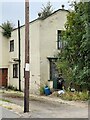
House with a Benchmark
by Brian Westlake geograph for square TF5372 There is a flush bracket bench mark on this house, a former post office. It is... (more)
Tags:
type:Geograph
subject:House
top:Housing, Dwellings
Ordnance Survey Bench Mark
Private House
top:Village, Rural Settlement
|
|
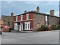
House on the Corner by Gainsborough Bridge
by Brian Westlake geograph for square SK8189 This house carries a cut bench mark dating from the mid nineteenth century First... (more)
Tags:
1GL Bench Mark
top:City, Town Centre
type:Geograph
subject:House
top:Housing, Dwellings
Ordnance Survey Bench Mark
Private House
|

|
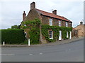
House in Dover Road
by Brian Westlake geograph for square TR3257 This house carries a cut bench mark on the nearest angle. See... (more)
|
|
The Crown House in Wormegay
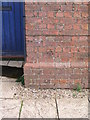
by Richard Humphrey geograph for square TF6611 |
|
Cut Mark: Baumber, Old Police House
by Brian Westlake for square TF2174 Cut bench mark on the frontage of the cottage. See... (more)
|

|
Sandwich, New Street, former Sandwich Arms
by Brian Westlake geograph for square TR3357 This former public house carries a cut bench mark on the nearest angle. See... (more)
|

|
Manorbier Castle, 1954 – 3
by David M Murray-Rust geograph for square SS0697 South side of the inner ward with the late 19th century house built within the castle.
Tags:
period:14th Century
period:19th Century
top:Defence, Military
type:Geograph
Grade I Listed
top:Historic Sites and Artefacts
top:Housing, Dwellings
Inner Ward
place:Manorbier
Manorbier Castle
Private House
Scheduled Monument
|

|
Cut Mark: Moorby, Brookside House
by Brian Westlake for square TF2964 A cut bench mark is located on the left face of the angle, 5 and 6 brick courses... (more)
Tags:
Bench Mark
subject:Benchmark
top:Housing, Dwellings
Ordnance Survey
Private House
top:Village, Rural Settlement
|

|
Glenacres, Seatown, formerly Seatown Farm
by Brian Westlake for square SY4291 The house carries a cut bench mark on the angle adjoining the stone-built wall.... (more)
|

|
Cut bench mark on house Glenacres, Seatown
by Brian Westlake for square SY4291 Cut bench mark on the former Seatown Farm. See... (more)
|

|
Longdon Hall
by Michael Westley geograph for square SP1777 View from right-of-way crossing Copt Heath Golf Course
Wildlife not responsive :)
|

|
Benchmark on 'Evaglades', Low Bentham
by John S Turner for square SD6469 Ordnance Survey benchmark on the former Infants School, now... (more)
Tags:
subject:Benchmark
Benchmark
type:Close Look
top:Educational Sites
Former Infants School
top:Historic Sites and Artefacts
top:Housing, Dwellings
Private House
|

|
Cut Bench Mark near Gainsborough Bridge
by Brian Westlake for square SK8189 This cut bench mark dates from the mid nineteenth century First Geodetic... (more)
Tags:
1GL Bench Mark
subject:Benchmark
top:City, Town Centre
type:Close Look
top:Housing, Dwellings
Ordnance Survey Bench Mark
Private House
|

|
Eagle Gatepost
by Roger W Haworth geograph for square V3673 Google maps say that this house is in a settlement is called Coarha Beg Lower.... (more)
|

|
Cut Mark: Brackenborough, 1 Brackenborough Road
by Brian Westlake for square TF3390 The cottage at the entrance to Brackenborough Hall estate carries a cut bench... (more)
|

|
Cottage at entrance to Brackenborough Hall
by Brian Westlake geograph for square TF3390 The cottage carries a cut bench mark near the ground floor window. See... (more)
|

|
Cut Mark: Sandwich, New Street, former Sandwich Arms
by Brian Westlake for square TR3357 See Link for a wider view and... (more)
|

|
Corner of Chandos Square and Victoria Parade
by Brian Westlake geograph for square TR3967 A cut bench mark is located on the side facing Chandos Square. See... (more)
|

|
Cut Mark: Broadstairs, #18 Victoria Parade
by Brian Westlake for square TR3967 See Link
 for details of the mark and... (more) |

|
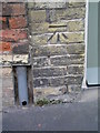
Cut bench mark on 3 Woodnesborough Road
by Brian Westlake for square TR3258 See Link
for details. |
|
Cut bench mark on 15 Moat Sole
by Brian Westlake for square TR3258 See Link
for details. |

|
The Old Stables, Linden Avenue, Dorchester
by Brian Westlake geograph for square SY6990 A cut bench mark is located in the stonework to the right of the entrance. See... (more)
|
|
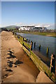
The Front Haverigg from River Lazy
by Andy Deacon geograph for square SD1678 The properties at The Front, Haverigg are seen from the sandy west bank of the... (more)
Tags:
sky:Blue
top:Coastal
county:Cumbria
long distance path:Cumbria Coastal Way
Cumbria Coastal Way
top:Docks, Harbours
Dry Weather
top:Estuary, Marine
Harbour
near:Millom
Private House
River
top:Rivers, Streams, Drainage
Rotting Groyne
Sand
Sandy
Sandy Beach
Sea Defences
Seafront Housing
Towns and Villages in Cumbria
Village
bucket:Wideangle
|
