Geograph - photograph every grid square
About tags on Geograph
Tags
Geographical Context
Subjects
Types
Other Prefixes
Public Tags
Related Tags
|
Coverage Map
Prefix:
quadcopter
Tag:
DJI·Phantom·3·SE
Showing images tagged with
quadcopter:
DJI Phantom 3 SE
tag.
View all tagged images
-
In Browser
Bruiach Farm Steading aerial
by
Craig Wallace
for square
NH5041
The steading has been disused for a number of years. It is now up for sale, with... (
more
)
Tags:
type:
Aerial
Aerial Photograph
top:
Construction, Development
quadcopter:
DJI Phantom 3 SE
top:
Farm, Fishery, Market Gardening
top:
Roads, Road Transport
Snow
Steading
Steading Conversion
top:
Village, Rural Settlement
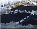
The Cruives from above
by
Craig Wallace
for square
NH5043
An aerial view of the Cruives on the River Beauly, on a snowy day. Cruives Lodge... (
more
)
Tags:
type:
Aerial
Aerial Photograph
Cruive
quadcopter:
DJI Phantom 3 SE
Lodge
top:
Lowlands
River Beauly
top:
Rivers, Streams, Drainage
Snow
place:
The Cruives
Kiltarlity Old Parish Church
by
Craig Wallace
for square
NH4943
An aerial view of the old church, on a snowy day. The church is said to be... (
more
)
Tags:
type:
Aerial
bucket:
Aerial
Aerial Photograph
listed building:
Category B
former:
Church
quadcopter:
DJI Phantom 3 SE
Fence
top:
Historic Sites and Artefacts
top:
Religious Sites
Scheduled Monument
Snow
View more in the Image Search
or
in Browser
View images matching 'DJI Phantom 3 SE' anywhere
in
the tags
Don't click these:
PotMel 1
PotMel 2
☰
Home
View
Search
Marked Images
Maps
Browser
Explore
Showcase
New Images
Collections
Interact
Games
Discussions
Blog
Contributors
Submit
Statistics
Leaderboards
General
FAQ
Help Pages
Sitemap
Contact Us
Support Us
sponsored by
🔍︎
What to search:
Photos
Enter keywords or a location/postcode to search nearby images
Enter a Grid Reference
Placenames
Collections
Website Pages
Everything
Others:
Advanced Search
|
Image Browser
Or:
Coverage Map
|
Searchable Map
You are not logged in
|
login
|
register