|
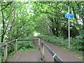
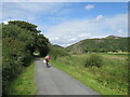
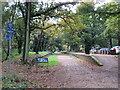
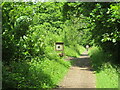
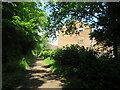
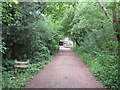
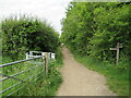
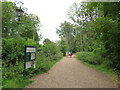
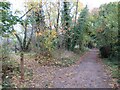
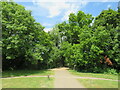
Hornsea Rail Trail, Hornsea
by Malc McDonald
geograph for square TA2047
This path heading out of Hornsea is a former railway route which now forms part... (more)
|
|
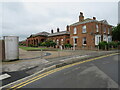
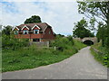
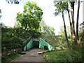
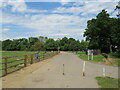
Former Hornsea Town railway station
by Malc McDonald
geograph for square TA2047
Hornsea Town railway station closed in 1964. The main buildings survive,... (more)
|
|
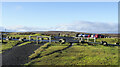
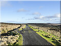
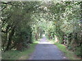
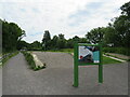
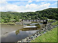
Car park along the Waskerley Way
by Trevor Littlewood
geograph for square NZ0345
The Waskerley Way, a path and cycleway, uses the old rail bed of the defunct... (more)
|
|
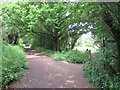
Mawddach Trail near Barmouth
by Malc McDonald
geograph for square SH6314
The Mawddach Trail is on the route of the Cross Britain Way. Here, a bridge... (more)
|
|
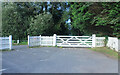
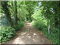
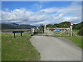
Access to the Old Railway
by Des Blenkinsopp
geograph for square SZ5485
An old railway line used to cross the road here. It is now a path and cycleway... (more)
|
|
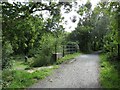
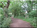
Waskerley Way with barrier
by Trevor Littlewood
geograph for square NZ0144
The Waskerley Way is an old railway route now in use as a path and cycleway.... (more)
|
|
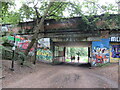
Site of Crouch End railway station
by Malc McDonald
geograph for square TQ2987
Crouch End railway station closed in 1954. The railway line was dismantled and... (more)
|
|
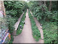
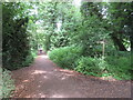
Parkland Walk near Crouch End
by Malc McDonald
geograph for square TQ2987
This section of the Parkland Walk is also on the route of the Capital Ring. The... (more)
|
|
Mawddach Trail at Arthog, near Barmouth
by Malc McDonald
geograph for square SH6314
A cyclist makes their way along the Mawddach Trail at Arthog. The trail is on... (more)
|
|
Mawddach Trail near Barmouth
by Malc McDonald
geograph for square SH6314
The Mawddach Trail is on the route of the Cross Britain Way.
It follows the... (more)
|
|
Mawddach Trail near Barmouth
by Malc McDonald
geograph for square SH6314
The Mawddach Trail is on the route of the Cross Britain Way. Here, a bridge... (more)
|
|
Mawddach Trail near Barmouth
by Malc McDonald
geograph for square SH6313
The Mawddach Trail is on the route of the Cross Britain Way.
|
|
Former railway station at Cole Green, near Hertford
by Malc McDonald
geograph for square TL2811
Cole Green railway station closed to passengers in 1951. The route of the... (more)
|
|
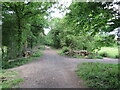
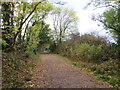
Downs Link near Bramley
by Malc McDonald
geograph for square TQ0143
The Downs Link path follows a dismantled railway line for most of its length.... (more)
|
|
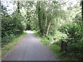
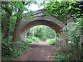
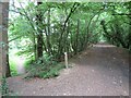
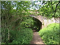
Bridge over the Downs Link path near Cranleigh
by Malc McDonald
geograph for square TQ0242
The Downs Link path follows a dismantled railway line for most of its length.... (more)
|
|
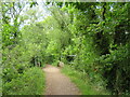
Downs Link near Cranleigh
by Malc McDonald
geograph for square TQ0341
The Downs Link path follows a dismantled railway line for most of its length.... (more)
|
|
Downs Link near Cranleigh
by Malc McDonald
geograph for square TQ0341
The Downs Link path follows a dismantled railway line for most of its length.... (more)
|
|
Downs Link, near Cranleigh
by Malc McDonald
geograph for square TQ0439
The Downs Link path follows a dismantled railway line for most of its length.... (more)
|
|
Downs Link, Cranleigh
by Malc McDonald
geograph for square TQ0539
The Downs Link path follows a dismantled railway line for most of its length.... (more)
|
|
Downs Link near Cranleigh
by Malc McDonald
geograph for square TQ0637
The Downs Link path follows a dismantled railway line for most of its length.... (more)
|
|
Downs Link near Cranleigh
by Malc McDonald
geograph for square TQ0636
The Downs Link path follows a dismantled railway line for most of its length.... (more)
|
|
Downs Link near Cranleigh
by Malc McDonald
geograph for square TQ0635
The Downs Link path follows a dismantled railway line for most of its length.... (more)
|
|
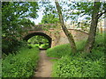
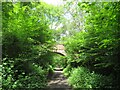
Bridge over the Downs Link path near Rudgwick
by Malc McDonald
geograph for square TQ0833
A view of the Downs Link path near Rudgwick in West Sussex. The path follows a... (more)
|
|
Downs Link at Rudgwick station site
by Malc McDonald
geograph for square TQ0833
The Downs Link path follows a dismantled railway line for most of its length.... (more)
|
|
Downs Link, Rudgwick
by Malc McDonald
geograph for square TQ0833
A view of the Downs Link path at Rudgwick in West Sussex. The path follows a... (more)
|
|
Downs Link, near Slinfold
by Malc McDonald
geograph for square TQ0932
A view of the Downs Link path as it approaches Slinfold in West Sussex. The... (more)
|
|
Downs Link, near Slinfold
by Malc McDonald
geograph for square TQ1031
A view of the Downs Link path near Slinfold in West Sussex. The path follows a... (more)
|
|
Downs Link, near Slinfold
by Malc McDonald
geograph for square TQ1031
A view of the Downs Link path as it approaches Slinfold in West Sussex. The... (more)
|
|
Downs Link at Slinfold, near Horsham
by Malc McDonald
geograph for square TQ1130
A view of the Downs Link path passing through Slinfold in West Sussex. The path... (more)
|
|
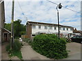
Downs Link at Slinfold, near Horsham
by Malc McDonald
geograph for square TQ1130
The path to the left of the houses forms part of the Downs Link path, which... (more)
|
|
Downs Link approaching Slinfold
by Malc McDonald
geograph for square TQ1130
A view of the Downs Link path as it approaches Slinfold in West Sussex. The... (more)
|
|
Downs Link, near Slinfold
by Malc McDonald
geograph for square TQ1230
The Downs Link path near Slinfold in West Sussex, with a footpath leading off to... (more)
|
|
Downs Link, near Slinfold
by Malc McDonald
geograph for square TQ1230
A view of the Downs Link path near Slinfold in West Sussex. The path follows a... (more)
|
|
Downs Link near Horsham
by Malc McDonald
geograph for square TQ1330
The Downs Link walking and cycling path near Horsham in West Sussex. The path... (more)
|
|
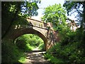
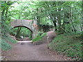
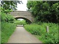
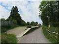
Downs Link near Horsham
by Malc McDonald
geograph for square TQ1329
A bridge carrying a road over the Downs Link path near Horsham. The path also... (more)
|
|
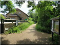
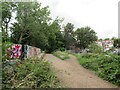
Former railway platform at Christ's Hospital, near Horsham
by Malc McDonald
geograph for square TQ1429
A disused platform at Christ's Hospital railway station, near Horsham in... (more)
|
|
Downs Link at Christ's Hospital, near Horsham
by Malc McDonald
geograph for square TQ1429
The Downs Link path at Christ's Hospital, near Horsham. The path also... (more)
|
|
Disused platform at Christ's Hospital station, near Horsham
by Malc McDonald
geograph for square TQ1429
This platform at Christ's Hospital railway station was used by trains to... (more)
|
|
Parkland Walk near Crouch End
by Malc McDonald
geograph for square TQ3087
This section of Parkland Walk is also on the route of the Capital Ring.
|
|
Parkland Walk, Highgate
by Malc McDonald
geograph for square TQ2887
This section of Parkland Walk also forms part of the route of the Capital Ring.
|
|
Parkland Walk, Muswell Hill
by Malc McDonald
geograph for square TQ2889
A path on the route of a dismatled railway at Muswell Hill, in north London.... (more)
|
|
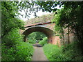
Bridge over Afon Arthog, near Barmouth
by Malc McDonald
geograph for square SH6414
A bridge carries the Mawddach Trail across Afon Arthog. The Mawddach Trail... (more)
|
|
Mawddach Trail at Arthog, near Barmouth
by Malc McDonald
geograph for square SH6414
A bridge takes the Mawddach Trail across the Afon Arthog. The path is on the... (more)
|
|
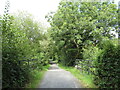
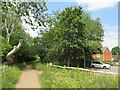
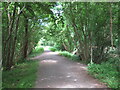
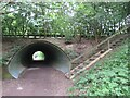
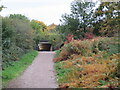
Cole Green Way, near Welwyn Garden City
by Malc McDonald
geograph for square TL2710
A view along Cole Green Way, looking towards an underpass taking the route... (more)
|
|
Cole Green Way, Letty Green, near Hertford
by Malc McDonald
geograph for square TL2811
|
|
Cole Green Way, Letty Green, near Hertford
by Malc McDonald
geograph for square TL2811
|
|
Downs Link near Cranleigh
by Malc McDonald
geograph for square TQ0242
The Downs Link path follows a dismantled railway line for most of its length.... (more)
|
|
Downs Link near Cranleigh
by Malc McDonald
geograph for square TQ0242
The Downs Link path follows a dismantled railway line for most of its length.... (more)
|
|
Downs Link, Cranleigh
by Malc McDonald
geograph for square TQ0538
The Downs Link path follows a dismantled railway line for most of its length.... (more)
|
|
Downs Link, Cranleigh
by Malc McDonald
geograph for square TQ0538
The Downs Link path follows a dismantled railway line for most of its length.... (more)
|