Public Tags
Tag: Relief·Road
Showing images tagged with Relief Road tag.
|
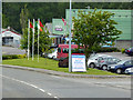
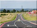
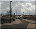
Bandon Relief Road passing the Retail Park
by David Dixon geograph for square W5054 Tags:
BypassX
type:GeographX
road:N71X
camera:Panasonic Lumix TZ60X
Relief Road
Ring RoadX
top:Roads, Road TransportX
|
|
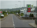
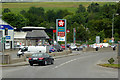
Applegreen Service Station on the Bandon Relief Road
by David Dixon geograph for square W4954 |
|
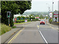
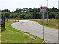
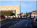
Traffic Lights on the Bandon Relief Road
by David Dixon geograph for square W4954 The N71 by-passing the town of Bandon.
Tags:
BypassX
type:GeographX
road:N71X
camera:Panasonic Lumix TZ60X
Relief Road
Ring RoadX
top:Roads, Road TransportX
Traffic LightsX
|
|
Gypsum Way
by David Lally geograph for square SK5329 A relief road around the south east of Gotham. The name suggests it was built... (more)
Tags:
Relief Road
top:Roads, Road TransportX
|
|
Ashton Northern Relief Road
by Gerald England geograph for square SJ9499 A recently opened stretch of road bypassing Penny Meadow SJ9499 : Penny Meadow and... (more)
|
|
Dewsbury inner relief road
by Stephen Craven geograph for square SE2422 Also known as the Dewsbury Bypass, although it's closer to the town centre... (more)
|
|
Concord Avenue bridge over the Oxford Canal
by Stephen Craven geograph for square SP4540 Part of the Banbury inner relief road.
|
|
Concord Avenue, Banbury
by Stephen Craven geograph for square SP4540 Part of the inner relief road to the east of the town centre. A plaque on the... (more)
|
|
Castle Donington Relief Road
by Ian Calderwood geograph for square SK4326 Opened in 2020 to take traffic away from the village centre and serve the new... (more)
Tags:
BypassX
type:GeographX
Relief Road
subject:RoadX
top:Roads, Road TransportX
top:Village, Rural SettlementX
|
|
Castle Donington Relief Road
by Ian Calderwood geograph for square SK4327 Opened in 2020 to take traffic away from the village centre and serve the new... (more)
Tags:
BypassX
type:GeographX
Relief Road
subject:RoadX
top:Roads, Road TransportX
top:Village, Rural SettlementX
|
|
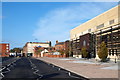
Jubilee Way, Loughborough, Leics
by David Hallam-Jones geograph for square SK5319 The Magistrates Court(s) building on one side of the 'new' Inner... (more)
Tags:
top:Business, Retail, ServicesX
top:City, Town CentreX
CourtX
Former CinemaX
top:Public Buildings and SpacesX
Relief Road
subject:RoadX
top:Roads, Road TransportX
top:Sport, LeisureX
|
|
Albion Way
by Gerald England geograph for square SJ9399 The A6043, Albion Way is a relief road opened in 2012 to bypass Wellington Road... (more)
Tags:
road:A6043X
Drop Off PointX
top:RailwaysX
Relief Road
top:Roads, Road TransportX
Station Car ParkX
|
|
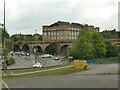
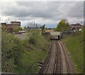
Romney Street Bridge
by Gerald England geograph for square SJ9499 The bridge over the Stalybridge to Manchester Victoria railway line is now for... (more)
|
|
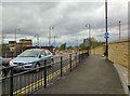
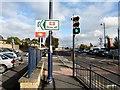
Pinfoldgate, Loughborough, Leics
by David Hallam-Jones geograph for square SK5319 This is the mid-point (approximately) of Pinfoldgate, with the north-easterly... (more)
Tags:
top:Business, Retail, ServicesX
top:City, Town CentreX
CourtX
top:Housing, DwellingsX
top:Public Buildings and SpacesX
Relief Road
subject:StreetX
|
|
From Romney Street bridge
by Gerald England geograph for square SJ9499 Looking over the litter-strewn cutting carrying the Stalybridge to Manchester... (more)
|
|
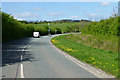
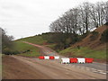
Bypass in the Aikengall valley
by M J Richardson geograph for square NT7071 An access road to the Aikengall Community Wind Farm. Presumably the heavy wind... (more)
Tags:
BarrierX
top:Construction, DevelopmentX
place:East LothianX
type:GeographX
place:InnerwickX
top:LowlandsX
Relief Road
subject:RoadX
top:Roads, Road TransportX
TreesX
Wind FarmX
top:Woodland, ForestX
|
|
Filling Station on the N71 at Bandon
by David Dixon geograph for square W4955 Bandon (Irish: Droichead na Bandan) is a town in County Cork. The name in Irish... (more)
Tags:
top:Business, Retail, ServicesX
BypassX
CentraX
Filling StationX
type:GeographX
road:N71X
camera:Panasonic Lumix TZ60X
Petrol StationX
Relief Road
Ring RoadX
top:Roads, Road TransportX
Service StationX
top:Suburb, Urban FringeX
|
|
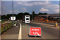
New Fosse Way (Selly Oak New Road, Phase 1)
by Phil Champion geograph for square SP0483 Phase one of the Selly Oak New Road scheme involved the construction of a link... (more)
|
|
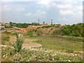
Waste land next to Aston Webb Boulevard (Selly Oak New Road, Phase 1)
by Phil Champion geograph for square SP0482 In the distance can be seen the construction site for phase 2, involving a new... (more)
|
|
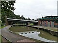
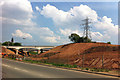
Selly Oak New Road
by Phil Champion geograph for square SP0483 The new railway and canal bridges were constructed in December 2010. New link... (more)
|
|
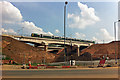
Railway bridge over Selly Oak New Road Phase 2
by Phil Champion geograph for square SP0483 The railway bridge for the Cross City Line and the parallel canal bridge were... (more)
|