Public Tags
Tag: Reservoir·Outlet
Showing images tagged with Reservoir Outlet tag.

|
Grazing sheep above the Damflask outlets
by Alan Murray-Rust geograph for square SK2890 Looking down from Loxley Road near Stacey Bank.
Tags:
top:Farm, Fishery, Market Gardening
top:Grassland
bucket:Landscape
Reservoir Outlet
Sheep
top:Water Resources
|

|
Ladybower Reservoir
by Stephen Burton geograph for square SK1985 This water outlet is one of two on the reservoir. The reservoir is supplied by... (more)
Tags:
Ladybower Reservoir
subject:Reservoir Outflow
Reservoir Outlet
season:Spring
top:Water Resources
|

|
Eccup reservoir - syphon pipe
by Stephen Craven geograph for square SE3041 This fairly new arrangement allows water to be drawn off from deep in the... (more)
|

|
Eccup reservoir - rotork housing
by Stephen Craven geograph for square SE3041 This fairly new arrangement allows water to be drawn off from deep in the... (more)
|

|
Eccup reservoir - syphon arrangement, upstream valve
by Stephen Craven geograph for square SE3041 This valve set into the upstream surface of the dam about half a metre below top... (more)
|

|
Outlet of Farnley Balancing Reservoir
by Stephen Craven geograph for square SE2533 The collection channels from each end of the dam SE2533 : Collection channel, Farnley Balancing Reservoir meet at this point... (more)
Tags:
Reservoir Outlet
top:Rivers, Streams, Drainage
|

|
Damflask outflow
by Alan Murray-Rust geograph for square SK2890 The curved outflow channel allows water to be released into the River Loxley to... (more)
|

|
Spillway channel outlet, Greenside Reservoir, Dunbartonshire
by Claire Pegrum geograph for square NS4775 When the reservoir is at capacity, excess water flows down the spillway channel... (more)
|

|
Glen Finglas Reservoir Outlet into Loch Katrine
by David Dixon geograph for square NN4907 Bridge over the artificial waterfalls from the outlet of the tunnel bringing... (more)
Tags:
Artificial Waterfalls
Bridge
loch:Katrine
Lake
top:Lakes, Wetland, Bog
Loch
Path
Reservoir Outlet
Trossachs
top:Water Resources
|

|
Spillway and outlet, Gladhouse Reservoir
by Jim Barton geograph for square NT3054 The spillway is in the foreground, currently dry.
Tags:
type:Geograph
top:Lakes, Wetland, Bog
Reservoir Dam
Reservoir Outlet
Reservoir Spillway
top:Water Resources
|

|
Swineshaw Brook, Outlet from Brushes Reservoir
by David Dixon geograph for square SJ9999 Above the Brushes Valley in the Stalybridge Country Park.
|

|
Loch Katrine
by David Dixon geograph for square NN4907 The bridge taking the cyclepath over the artificial waterfalls from the outlet... (more)
|

|
Northern arm of Gladhouse Reservoir
by Jim Barton geograph for square NT3054 The dam and bridge to the outlet tower seen from the shore near Gladhouse.
|

|
Rudyard Reservoir outlet
by Graham Hogg geograph for square SJ9558 The reservoir was constructed in the late 1700s to feed the Caldon Canal.
|

|
Outlet from Deer Hill Reservoir, Lingards
by Humphrey Bolton for square SE0711 This flow goes into Bradley Brook, and then either continues down the... (more)
|

|
The outlets of Killington Reservoir
by Karl and Ali geograph for square SD5990 The largest dam at the south end of the reservoir where Peasey Beck emerges.
Tags:
Dam
Footbridge
top:Grassland
top:Lowlands
Reservoir Outlet
top:Rivers, Streams, Drainage
top:Water Resources
|

|
Farnley Reservoir: collection channel
by Stephen Craven geograph for square SE2533 Fixed size discharge pipes through the dam permit water to flow out of the... (more)
|

|
Farnley Reservoir: steady outflow
by Stephen Craven geograph for square SE2533 Water flowing out of the reservoir into the Farnley Beck at a steady rate,... (more)
Tags:
Reservoir Outlet
top:Rivers, Streams, Drainage
|
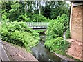
|
Outlet Stream from Common Bank Lodge
by David Dixon geograph for square SD5616 The stream carries the overflow from Common Bank Lodge to the River Yarrow.
|

|
Below Swinsty Reservoir
by Derek Harper geograph for square SE1952 An alternative view of the outlet shown in SE1952 : Portal and twin pipeline, Norwood, from footpath 15 105/42/1.
Tags:
top:Grassland
Grassy Embankment
top:Lowlands
top:Paths
Pipelines
Reservoir Outlet
Trees
Valley
top:Water Resources
Woodland
|

|
Ardindly Reservoir
by PAUL FARMER geograph for square TQ3328 Tags:
Ardingly
Ardingly Reservoir
type:Geograph
top:Lakes, Wetland, Bog
subject:Reservoir
Reservoir
subject:Reservoir Outflow
Reservoir Outlet
top:Water Resources
|

|
Walkerwood Reservoir
by David Dixon geograph for square SJ9999 Lying above the Brushes Valley in the Stalybridge Country Park.
|

|
Walkerwood Reservoir, Outflow
by David Dixon geograph for square SJ9898 Lying above the Brushes Valley in the Stalybridge Country Park.
|

|
The River Lune exits Selset Reservoir
by Karl and Ali geograph for square NY9121 Looking west towards the head of the reservoir on a January late afternoon.
Tags:
top:Lakes, Wetland, Bog
place:North Pennines
Reservoir
Reservoir Outlet
Reservoir Spillway
top:Uplands
top:Water Resources
|

|
River South Esk exits Gladhouse Reservoir
by Jim Barton geograph for square NT3054 The South Esk rises in the Moorfoot Hills south of the reservoir and continues... (more)
Tags:
Reservoir Outlet
top:Rivers, Streams, Drainage
|

|
Outflow from Withins Reservoir
by David Dixon geograph for square SD7808 Water from the former reservoir (SD7808 : Withins Reservoir, Radcliffe) drains to feed the Manchester,... (more)
Tags:
top:Canals
type:Geograph
canal:Manchester Bolton and Bury
MBBC
camera:Panasonic DC-G9
Reservoir Outlet
Reservoir Overflow
top:Suburb, Urban Fringe
top:Water Resources
|
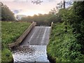
|
Overflow from Common Bank Lodge
by David Dixon geograph for square SD5616 The overflow from the small reservoir flows into the River Yarrow.
Tags:
camera:Iphone 4s
subject:Reservoir Outflow
Reservoir Outlet
Reservoir Overflow
top:Suburb, Urban Fringe
top:Water Resources
Yarrow Valley Park
|

|
Valve tower, bridge and outflow, Pontsticill Reservoir
by Robin Drayton geograph for square SO0511 The reservoir was opened in 1927.
The structure shown here is Grade II listed.... (more)
|

|
Castleshaw Reservoir Drain
by David Dixon geograph for square SD9910 The drain from the upper to the lower reservoir.
Tags:
Drain
Hills
top:Lakes, Wetland, Bog
Moor
top:Moorland
Moorland
Pennine
Reservoir
Reservoir Outlet
top:Rivers, Streams, Drainage
top:Uplands
top:Water Resources
|
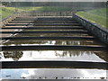
|
Water run-off at Underbank
by Dave Pickersgill for square SK2598 Water run-off at Underbank Reservoir, Stocksbridge.
Tags:
top:Lowlands
Reservoir
Reservoir Outlet
Reservoir Overflow
place:Stocksbridge
place:Underbank
top:Water Resources
|

|
Water run-off at Underbank
by Dave Pickersgill for square SK2599 Water run-off at Underbank Reservoir, Stocksbridge.
Tags:
top:Lowlands
Reservoir
Reservoir Outlet
Reservoir Overflow
place:Stocksbridge
place:Underbank
top:Water Resources
|

|
The River Lune exits Selset Reservoir
by Karl and Ali geograph for square NY9121 Only a short run down to the next impounding at Grassholme.
Tags:
place:North Pennines
Reservoir
Reservoir Outlet
Reservoir Spillway
top:Uplands
top:Water Resources
|

|
The run-off from Underbank Reservoir
by Dave Pickersgill geograph for square SK2599 Tags:
type:Geograph
subject:Reservoir Infrastructure
subject:Reservoir Outflow
Reservoir Outlet
place:Sheffield
place:Stocksbridge
top:Suburb, Urban Fringe
place:Underbank
top:Uplands
top:Water Resources
|

|
Lyne Water exit from Baddinsgill Reservoir
by Jim Barton geograph for square NT1255 Channels below the reservoir dam. The Lyne Water joins the Tweed at Lynesmill... (more)
|
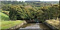
|
The run-off from Underbank Reservoir
by Dave Pickersgill geograph for square SK2599 Tags:
type:Geograph
subject:Reservoir Outflow
Reservoir Outlet
place:Sheffield
place:Stocksbridge
top:Suburb, Urban Fringe
place:Underbank
top:Uplands
top:Water Resources
|

|
Bridge over Reservoir Outflow
by David Dixon geograph for square SD5616 This bridge carries Yarrow Valley Way over the footpath and the stream carrying... (more)
Tags:
Bridge
Footpath
camera:Iphone 4s
Path
top:Paths
Reservoir Outlet
Reservoir Overflow
top:Rivers, Streams, Drainage
Stream
top:Suburb, Urban Fringe
Yarrow Valley Park
|

|
Irrigation Pipe
by Bill Nicholls for square SU6086 Behind me are the remains of a reservoir, and the pipe you see was part of the... (more)
Tags:
type:Close Look
top:Historic Sites and Artefacts
Reservoir Outlet
top:Village, Rural Settlement
|

|
The River Balder outflow from Balderhead Reservoir
by Karl and Ali geograph for square NY9318 I'm not sure what the fixed stone blocks are for - perhaps some form of... (more)
|

|
The Balder emerges
by Karl and Ali geograph for square NY9318 The River Balder emerges from Balderhead Reservoir.
|

|
Water overflow
by Dave Pickersgill geograph for square SK2895 The overflow at More Hall Reservoir, north of Sheffield on a misty Sunday in November.
|

|
Launde Upper Reservoir - drawoff
by Stephen Craven geograph for square SK7904 A drawoff valve tower and footbridge. For context, see SK7904 : Launde Upper Reservoir.
|

|
Penwhirn Burn In Full Flow
by Mary and Angus Hogg geograph for square NX1369 When I passed this burn earlier in the afternoon, it was trickling down. There... (more)
|

|
Penwhirn Burn In Full Flow
by Mary and Angus Hogg geograph for square NX1369 When I passed this burn earlier in the afternoon, it was trickling down as shown... (more)
|

|
Pond at the head of Black Brook below Scammonden dam
by Humphrey Bolton geograph for square SE0516 The tunnel must, I think, be an overflow and drain-down conduit. There must... (more)
Tags:
type:Geograph
top:Lowlands
subject:Pond
Reservoir Outlet
top:Rivers, Streams, Drainage
top:Water Resources
|

|
Outflow from Tatton Mere
by Stephen Craven for square SJ7580 The stream flowing from the mere is no more than about 3 metres below the top of... (more)
|
