|
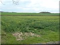
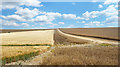
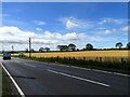
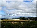
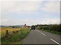
Ripening oil seed rape off Hummerbeck Lane
by Christine Johnstone
geograph for square NZ1623
Looking south, about 155 metres above sea level.
|
|
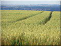
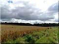
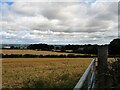
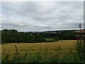
Ripening Wheat on Elsham Hill
by David Wright
geograph for square TA0213
|
|
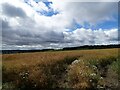
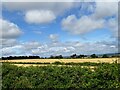
Early gold
by Neil Owen
geograph for square ST6162
The strange weather of 2018 has brought about some unusually early ripening of the fields.
|
|
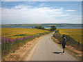
Heading for Kiltearn Beach
by Karl and Ali
geograph for square NH6065
Along a country lane near Evanton lined by ripening grain fields. The Cromarty... (more)
|
|
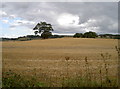
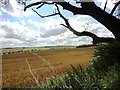
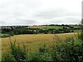
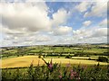
Shades of Brown
by Des Blenkinsopp
geograph for square SU2985
Different crops, different colours. Fields nearing harvest time on Woolstone Hill.
|
|
Rape crop beside Lead Road
by Robert Graham
geograph for square NZ1361
Oilseed rape in a field south of Lead Road.
|
|
View south from Lobleyhill Road
by Robert Graham
geograph for square NZ1957
Just to the west of High Marley Hill. At 700 ft, the road here offers... (more)
|
|
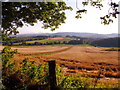
Power line across a field at Flinton Hill
by Robert Graham
geograph for square NZ3454
Huge field of ripe oats south of Flinton Hill Farm, Herrington.
|
|
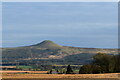
Long-distance view of East Lomond...
by Bill Harrison
for square NO2406
...from Auchtermuchty, some 6.5 km away.
|
|
Looking down the road from near Horsegate Bank
by Robert Graham
geograph for square NZ1259
View looking south on Clayton Terrace Road north of Chopwell.
|
|
Roadside view from Kyo Lane
by Robert Graham
geograph for square NZ1261
Looking north over the fields from beside Kyo Hall. A wide view can be seen over... (more)
|
|
View NW from Kyo Lane
by Robert Graham
geograph for square NZ1261
West Kyo Farm can be seen across the fields, with wide views of Northumberland beyond.
|
|
Looking north from Kyo Lane.
by Robert Graham
geograph for square NZ1261
There is a fine vantage point at the roadside just past Kyo Hall. The Tyne... (more)
|
|
Field of oats at Castleside
by Robert Graham
geograph for square NZ0748
Beside Healeyfield Lane, south of the village, which can be seen in the distance.
|
|
Fields beside Healeyfield Lane
by Robert Graham
geograph for square NZ0748
Field north of the road, running down to the Watergate Burn. Castleside village... (more)
|
|
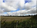
Track through Barley
by Des Blenkinsopp
geograph for square SP3014
A simple, midsummery sort of picture at Potter's Hill near Leafield.
|
|
Approaching Huntleywood on A6105
by Martin Dawes
geograph for square NT6243
|
|
Looking north from the road to Cornsay
by Robert Graham
geograph for square NZ1544
Running right on the top of the south escarpment of the Browney valley, this... (more)
|
|
A cornfield south of West Learney
by Stanley Howe
geograph for square NJ6203
At harvest time.
|
|
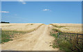
View south from Howford Lane
by Robert Graham
geograph for square NY9266
This narrow lane leads west from the village of Acomb to the former railway and... (more)
|