Public Tags
Other tags: Coquet
Showing latest 50 of 101 images tagged with river:Coquet tag.
|
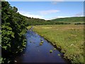
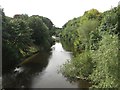
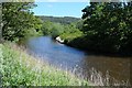
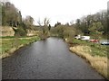
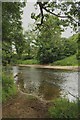
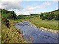
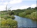
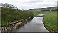
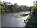
River Coquet west of Alwinton Bridge
by Andrew Curtis geograph for square NT9205 Looking towards the junction with the River Alwin and the riverside grasslands... (more)
|
|
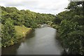
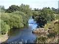
The River Coquet, west of Warkworth
by Graham Robson geograph for square NU2304 Looking upstream along the River Coquet from a footbridge crossing the river... (more)
|
|
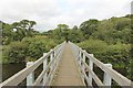
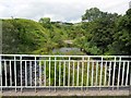
Footbridge crossing the River Coquet
by Graham Robson geograph for square NU2304 A footbridge crossing the River Coquet near Coquet Moor House. A ford a short... (more)
|
|
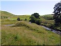
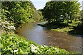
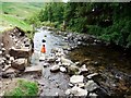
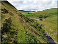
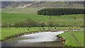
The junction of Ridlees Burn (right) and River Coquet (left) near Linshiels
by Andrew Curtis geograph for square NT8906 There was an old ford here across the River Coquet, in use as the main route... (more)
Tags:
river:Coquet
top:Farm, Fishery, Market GardeningX
top:GrasslandX
Hay FieldsX
top:Rivers, Streams, DrainageX
Stream JunctionX
top:UplandsX
|
|
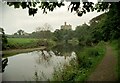
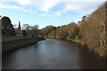
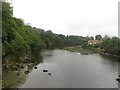
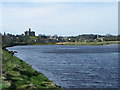
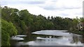
Warkworth Castle from the R. Coquet
by Martin Tester geograph for square NU2405 Tags:
subject:CastleX
river:Coquet
type:GeographX
top:Historic Sites and ArtefactsX
top:Rivers, Streams, DrainageX
top:Village, Rural SettlementX
place:WarkworthX
|
|
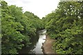
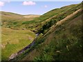
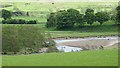
Junction of Rowhope Burn and River Coquet
by Andrew Curtis geograph for square NT8511 There is an almost aerial view of this location by Geoff Holland here... (more)
Tags:
river:Coquet
former:Drove RoadX
PoemX
top:Rivers, Streams, DrainageX
Road BridgeX
Stream JunctionX
top:UplandsX
|
|
The River Coquet at Brainshaugh
by Graham Robson geograph for square NU2003 Looking upstream along the River Coquet from a grade II listed bridge which... (more)
|
|
The River Coquet, Felton
by Graham Robson geograph for square NU1800 Looking upstream from the older of the two bridges which cross the River Coquet... (more)
|
|
River Coquet, Felton
by Graham Robson geograph for square NU1800 Looking south along the River Coquet from the oldest of the two bridges which... (more)
|
|
View downstream along the River Coquet
by Graham Robson geograph for square NU1900 Looking downstream along the River Coquet from St Oswald's Way which... (more)
|
|
River Coquet, Felton
by Graham Robson geograph for square NU1800 Looking down stream along the River Coquet from the bridge which crosses the... (more)
|
|
The River Coquet
by Philip Halling geograph for square NU0701 The River Coquet beside the B6344, downstream from Rothbury.
|
|
The River Coquet
by Philip Halling geograph for square NU0601 The River Coquet just downstream from Rothbury.
|
|
The River Coquet
by Philip Halling geograph for square NU0601 The River Coquet near Rothbury.
|
|
The River Coquet, Warkworth
by Graham Robson geograph for square NU2406 Looking upstream along the River Coquet from Warkworth Bridge.
|
|
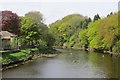
The River Coquet at Weldon
by Graham Robson geograph for square NZ1398 Looking upstream from Weldon Bridge along the River Coquet. NZ1398 : The River Coquet from Weldon Bridge shows... (more)
|
|
Looking across the River Coquet
by Graham Robson geograph for square NU1900 Looking across the River Coquet to the east of Felton.
|
|
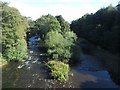
View downstream along the River Coquet, Rothbury
by Graham Robson geograph for square NU0501 Looking downstream along the River Coquet from the centre of the footbridge... (more)
|
|
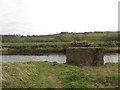
Piers of former bridge across the River Coquet
by Graham Robson geograph for square NU0401 These large lumps of concrete appear to have once been the piers supporting a... (more)
|
|
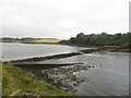
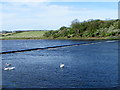
Weir on the River Coquet
by Graham Robson geograph for square NU2505 A weir on the River Coquet between Amble and Warkworth.
|
|
Looking downstream along the River Coquet, Warkworth
by Graham Robson geograph for square NU2406 Looking downstream from the modern road bridge which carries traffic over the... (more)
|
|
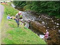
River Coquet near Warkworth
by Maigheach-gheal geograph for square NU2505 With runs of salmon and sea trout and an excellent population of wild brown... (more)
|
|
Old trackway between Quickening Cote and Linshiels
by Andrew Curtis geograph for square NT8906 The track ascends the ridge between the River Coquet (seen ahead to the left)... (more)
|
|
The weir on the Coquet river near Warkworth Castle
by Pauline E geograph for square NU2505 Category: Weir The 40 mile long River Coquet rises in the Cheviot Hills, flows northeast, then... (more)
|
|
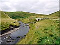
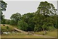
Ford across the River Coquet
by Graham Robson geograph for square NZ1699 A track used by farm vehicles crossing the River Coquet via a ford a small... (more)
|
|
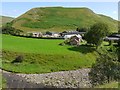
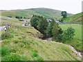
Linbriggs from south bank of River Coquet
by Andrew Curtis geograph for square NT8906 The hill above the farm (unnamed) terminates the ridge south-west of Green Side.... (more)
|
|
Bridge across the River Coquet
by Graham Robson geograph for square NZ1499 A low bridge built of stone carrying a private track across the River Coquet.
|
|
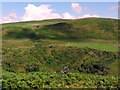
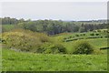
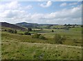
Over the Coquet valley from above Barrow Scrogs
by Andrew Curtis geograph for square NT9006 Looking across the Coquet valley to the Coquetdale road which runs below the... (more)
|
|
Archaeological excavation of Barrowburn Fulling Mill
by Andrew Curtis geograph for square NT8610 An excavation of the remains of a C13th fulling mill by members of the... (more)
Tags:
Archaeological ExcavationX
river:Coquet
top:Historic Sites and ArtefactsX
top:Rivers, Streams, DrainageX
top:UplandsX
|
|
Archaeological excavation of Barrowburn Fulling Mill
by Andrew Curtis geograph for square NT8611 Members of Coquetdale Community Archaeology Group at excavation of remains of a... (more)
Tags:
Archaeological ExcavationX
river:Coquet
top:Historic Sites and ArtefactsX
top:Rivers, Streams, DrainageX
top:UplandsX
|
|
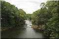
River Coquet, Morwick
by Richard Webb geograph for square NU2304 Crags and woods on steep slopes above the river.
Tags:
river:Coquet
top:Farm, Fishery, Market GardeningX
top:Rivers, Streams, DrainageX
top:Rocks, Scree, CliffsX
top:Woodland, ForestX
|
|
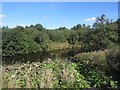
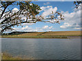
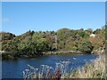
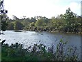
Coquet / Alwin confluence
by Richard Webb geograph for square NT9205 The River Alwin on the right, crossing a flood plain with a lot of deposited rock.
|
|
River Coquet near Warkworth
by Maigheach-gheal geograph for square NU2505 The river rises in the Cheviot Hills and enters the sea at Warkworth.... (more)
|
|
Footpath above the River Coquet
by Andrew Curtis geograph for square NT8906 There is a view in the other direction here NT8906 : Footpath above the River Coquet
The wide area of the... (more)
|
|
Footpath above the River Coquet
by Andrew Curtis geograph for square NT8906 A faint and hazardous trod that purports to be a footpath around the steep... (more)
|
|
River Coquet from farm bridge north of Linshiels
by Andrew Curtis geograph for square NT8906 Looking towards Quickening Cote. There is a view down river here NT8906 : The Coquet at Linshiels
|
|
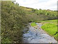
River Coquet near Barrow
by Andrew Curtis geograph for square NT9106 The steep wooded slopes on the north bank of the river ahead are called Barrow Scrogs.
|
|
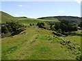
Valley of the River Coquet above Windyhaugh
by Andrew Curtis geograph for square NT8611 The vehicles parked alongside the road opposite the farm indicate the location... (more)
|
|
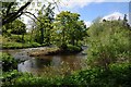
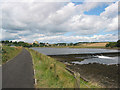
River Coquet
by Pauline E geograph for square NU2505 Category: River Tags:
river:Coquet
top:Rivers, Streams, DrainageX
|
|
River Coquet
by Richard Webb geograph for square NY9899 View upstream from opposite Hepple. Moorland and rough grazing is taking over... (more)
|
|
River Coquet
by Richard Webb geograph for square NU0401 View upstream of Rothbury.
Tags:
river:Coquet
top:Rivers, Streams, DrainageX
|
|
River Coquet, Warkworth
by Richard Webb geograph for square NU2406 An upstream view from the bridge.
Tags:
river:Coquet
top:Rivers, Streams, DrainageX
|
|
River Coquet
by Richard Webb geograph for square NT9900 Upstream of the gravel pits at Caistron.
|
|
River Coquet, Hepple
by Richard Webb geograph for square NT9800 Downstream view from a road bridge.
|
|
River Coquet, Hepple
by Richard Webb geograph for square NT9800 Downstream view from the bridge.
|
|
River Coquet, Warkworth
by Richard Webb geograph for square NU2406 Downstream from the bridges.
Tags:
river:Coquet
top:Rivers, Streams, DrainageX
|
|
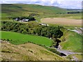
Quickening Cote from above Linbriggs bridge
by Andrew Curtis geograph for square NT8906 In the foreground, the River Coquet sweeps around the base of the hill and under... (more)
Tags:
river:Coquet
FarmX
top:Farm, Fishery, Market GardeningX
top:Rivers, Streams, DrainageX
Road BridgeX
top:UplandsX
ValleyX
|
|
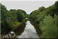
River Coquet
by Gerald England geograph for square NU2406 Looking downstream from the end of Brewery Lane.
|
|
River Coquet
by Gerald England geograph for square NU2406 Looking upstream from the end of Brewery Lane.
|
|
River Coquet
by Gerald England geograph for square NU2406
Looking downstream.
|