About tags on Geograph

Public Tags

Related Tags | Coverage Map
Prefix: river    Tag:  Deben  

Showing latest 50 of 371 images tagged with river:Deben tag.

View all tagged images - In Browser
:

TM2747 : View down the Deben past Kyson Point by Christopher Hilton View down the Deben past Kyson Point by Christopher Hilton
geograph for square TM2747
TM3041 : Sunset over the River Deben, Ramsholt by Christopher Hilton Sunset over the River Deben, Ramsholt by Christopher Hilton
geograph for square TM3041
Tags: river:Deben   Estuary   subject:Estuary   top:Estuary, Marine   type:Geograph   Mudflats   river:River Deben   River Deben   Sunset   time:Sunset   over:The River Deben   Tidal Mudflats  
TM3041 : Sunset over the River Deben, Ramsholt by Christopher Hilton Sunset over the River Deben, Ramsholt by Christopher Hilton
geograph for square TM3041
Tags: top:Air, Sky, Weather   river:Deben   subject:Estuary   Estuary   top:Estuary, Marine   type:Geograph   Mudflats   river:River Deben   River Deben   time:Sunset   Sunset   over:The River Deben   Tidal Mudflats  
TM2747 : Kyson Point, looking down the Deben by Christopher Hilton Kyson Point, looking down the Deben by Christopher Hilton
geograph for square TM2747
Martlesham Creek enters the Deben from the right. The path here forms part of... (more)
TM2560 : Open woodland along the River Deben, at Brandeston ford by Christopher Hilton Open woodland along the River Deben, at Brandeston ford by Christopher Hilton
geograph for square TM2560
Tags: river:Deben   type:Geograph   trees:Poplar   tree:Poplar   Poplar Trees   trees:Poplars   Poplars   River   river:River Deben   top:Rivers, Streams, Drainage   Trees   top:Woodland, Forest  
TM2845 : Looking towards the Deben over arable land, Waldringfield by Roger Jones Looking towards the Deben over arable land, Waldringfield by Roger Jones
geograph for square TM2845
The River Deben seen in the distance from a bridleway running through arable... (more)
TM2747 : View down the Deben from Kyson Point by Christopher Hilton View down the Deben from Kyson Point by Christopher Hilton
geograph for square TM2747
The path here forms part of two routes: the Sandlings Walk (which runs parallel... (more)
TM2942 : Soggy footpath near the Deben, Hemley by Roger Jones Soggy footpath near the Deben, Hemley by Roger Jones
geograph for square TM2942
Marshy footpath close to the River Deben. The footpath signpost is the same... (more)
Tags: river:Deben   top:Flat Landscapes   Footpath Signpost   place:Hemley   top:Paths   Public Footpath  
TM2943 : Channel through the saltings, Waldringfield by Roger Jones Channel through the saltings, Waldringfield by Roger Jones
geograph for square TM2943
This is part of the Deben Estuary SSSI.
TM2748 : Woodbridge - River Deben by Chris Allen Woodbridge - River Deben by Chris Allen
geograph for square TM2748
The tide mill and granary buildings are seen in the distance with a sailing... (more)
Tags: river:Deben   former:Granary   top:Historic Sites and Artefacts   subject:River   top:Rivers, Streams, Drainage   Slipway   Tide Mill   Woodbridge  
TM3238 : Looking to the River Deben over saltings, Felixstowe Ferry by Roger Jones Looking to the River Deben over saltings, Felixstowe Ferry by Roger Jones
geograph for square TM3238
Tags: river:Deben   top:Estuary, Marine   place:Felixstowe   place:Felixstowe Ferry   type:Geograph   top:Rivers, Streams, Drainage   subject:Salting  
TM2748 : River Deben - Woodbridge by Chris Allen River Deben - Woodbridge by Chris Allen
geograph for square TM2748
An into the sun shot.
TM2844 : Crane at Waldringfield Quay by Roger Jones Crane at Waldringfield Quay by Roger Jones
geograph for square TM2844
Crane, boats and tractor at Waldringfield Quay, on the River Deben.
Tags: Boat   Boatyard   top:Business, Retail, Services   Crane   river:Deben   top:Docks, Harbours   Quay   top:Rivers, Streams, Drainage   county:Suffolk   place:Waldringfield  
TM2941 : Looking over Kirton Creek to boats in the Deben, Hemley by Roger Jones Looking over Kirton Creek to boats in the Deben, Hemley by Roger Jones
geograph for square TM2941
Tags: Boats   river:Deben   top:Estuary, Marine   place:Hemley   Mud   top:Rivers, Streams, Drainage  
TM2748 : Woodbridge - boatyard by Chris Allen Woodbridge - boatyard by Chris Allen
for square TM2748
There is a nice Scotch derrick at this boatyard on the tidal Deben at Woodbridge.
Tags: subject:Boat Business   Boatyard   Crane   river:Deben   top:Industry   top:Rivers, Streams, Drainage   Woodbridge  
TM3040 : Looking to the Deben over Falkenham Creek by Roger Jones Looking to the Deben over Falkenham Creek by Roger Jones
geograph for square TM3040
Tags: Boats   subject:Creek   river:Deben   top:Estuary, Marine   place:Falkenham   type:Geograph   Mud   Mudflats   top:Rivers, Streams, Drainage   Saltings  
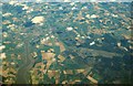
TM3049 : Area around Woodbridge from air, 2001 by Derek Harper Area around Woodbridge from air, 2001 by Derek Harper
for square TM3049
An aerial photo of the Deben estuary and the town of Woodbridge (left). Two... (more)
Tags: type:Aerial   top:Air Transport   former:Airfield   disused:Airfield   type:Cross Grid   river:Deben   Disused Airfield   Estuary   top:Estuary, Marine   top:Farm, Fishery, Market Gardening   Farmland   Forest   top:Lowlands   top:Suburb, Urban Fringe   Town   top:Woodland, Forest  
TM3056 : Deben Mills, Wickham Market (listed buildings) by Roger Jones Deben Mills, Wickham Market (listed buildings) by Roger Jones
geograph for square TM3056
The listed buildings, with list entry numbers, left to right are: 240, High... (more)
Tags: Bridge   river:Deben   Industrial Heritage   top:Industry   Listed Building   Mill   top:Rivers, Streams, Drainage   county:Suffolk   place:Wickham Market  
TM3338 : Looking to Bawdsey Marshes by Roger Jones Looking to Bawdsey Marshes by Roger Jones
geograph for square TM3338
Looking north from the bend in Ferry Road. The water in shot is probably... (more)
Tags: place:Bawdsey   river:Deben   top:Estuary, Marine   top:Farm, Fishery, Market Gardening   top:Flat Landscapes   bucket:Landscape   Marshes   county:Suffolk   top:Village, Rural Settlement  
TM3337 : Boarding the Deben Ferry by Roger Jones Boarding the Deben Ferry by Roger Jones
geograph for square TM3337
The ferry travels from Bawdsey Quay to Felixstowe Ferry: a small hamlet rather... (more)
Tags: place:Bawdsey   river:Deben   top:Docks, Harbours   top:Estuary, Marine   Ferry   Passenger Ferry   bucket:People   county:Suffolk   top:Village, Rural Settlement  
TM3237 : Ferry Cafe by Roger Jones Ferry Cafe by Roger Jones
geograph for square TM3237
Or as the sign says the Famous Ferry Cafe, serving welcome hot food at Felixstowe Ferry.
Tags: Cafe   top:Coastal   river:Deben   top:Docks, Harbours   place:Felixstowe Ferry   top:Sport, Leisure   county:Suffolk  
TM2748 : Repairs at the Tide Mill by Roger Jones Repairs at the Tide Mill by Roger Jones
geograph for square TM2748
The present structure dates back to the C17. See... (more)
TM3337 : Ferry signalling device by Roger Jones Ferry signalling device by Roger Jones
for square TM3337
Wave this bat at the other shore to signal the ferryman. See also TM3337 : Boarding the Deben Ferry
Tags: place:Bawdsey   river:Deben   top:Docks, Harbours   top:Estuary, Marine   Passenger Ferry   county:Suffolk   top:Village, Rural Settlement  
TM2748 : Woodbridge quayside from Ferry Cliff by Chris Holifield Woodbridge quayside from Ferry Cliff by Chris Holifield
geograph for square TM2748
TM2950 : Wilford Bridge from the new King Charles III Coast Path by Chris Holifield Wilford Bridge from the new King Charles III Coast Path by Chris Holifield
geograph for square TM2950
TM2844 : River Deben at Waldringfield by Sandy Gerrard River Deben at Waldringfield by Sandy Gerrard
geograph for square TM2844
Tags: Boats at Anchor   top:Coastal   top:Docks, Harbours   type:Geograph   top:Lowlands   subject:River   river:River Deben   top:Rivers, Streams, Drainage   top:Sport, Leisure   top:Village, Rural Settlement  
TM2950 : River Deben at Wilford Bridge by Sandy Gerrard River Deben at Wilford Bridge by Sandy Gerrard
geograph for square TM2950
Tags: top:Estuary, Marine   type:Geograph   top:Lowlands   subject:River   River Deben   top:Rivers, Streams, Drainage  
TM2844 : Small dock on the River Deben at Waldringfield by Chris Holifield Small dock on the River Deben at Waldringfield by Chris Holifield
geograph for square TM2844
Tags: subject:Dock   top:Docks, Harbours   top:Estuary, Marine   type:Geograph   River Deben   river:River Deben   top:Village, Rural Settlement  
TM2748 : Morning mist on the Deben at Woodbridge by Chris Holifield Morning mist on the Deben at Woodbridge by Chris Holifield
geograph for square TM2748
Tags: top:Air, Sky, Weather   top:Estuary, Marine   type:Geograph   subject:River   river:River Deben   subject:River Deben   River Deben   top:Rivers, Streams, Drainage  
TM2748 : Looking across the Deben towards Ferry Farm by Chris Holifield Looking across the Deben towards Ferry Farm by Chris Holifield
geograph for square TM2748
The poppies in the field provide a splash of colour
TM2844 : Waldringfield: over the river against the light by John Sutton Waldringfield: over the river against the light by John Sutton
geograph for square TM2844
A January-morning view from the slipway by The Maybush.
Tags: top:Air, Sky, Weather   top:Estuary, Marine   type:Geograph   river:River Deben   top:Sport, Leisure   place:Suffolk   season:Winter  
TM2845 : Salt marsh and Waldringfield PhotoPost by John Sutton Salt marsh and Waldringfield PhotoPost by John Sutton
geograph for square TM2845
The notice on the post on the left explains that "Waldringfield PhotoPost... (more)
Tags: top:Air, Sky, Weather   top:Estuary, Marine   type:Geograph   top:Paths   river:River Deben   Salt Marsh   place:Suffolk   season:Winter  
TM2845 : The view from the Waldringfield PhotoPost by John Sutton The view from the Waldringfield PhotoPost by John Sutton
geograph for square TM2845
This is an iPhone photo taken from the PhotoPost shown in TM2845 : Salt marsh and Waldringfield PhotoPost. A... (more)
Tags: top:Air, Sky, Weather   top:Estuary, Marine   top:Flat Landscapes   type:Geograph   river:River Deben   Salt Marsh   place:Suffolk   season:Winter  
TM3236 : The coastal path to Felixstowe Ferry by John Sutton The coastal path to Felixstowe Ferry by John Sutton
geograph for square TM3236
Looking past the golf course and Martello Tower towards the mouth of the River... (more)
Tags: top:Air, Sky, Weather   top:Coastal   top:Estuary, Marine   type:Geograph   top:Historic Sites and Artefacts   top:Paths   river:River Deben   top:Sport, Leisure   place:Suffolk   season:Winter  
TM3237 : Felixstowe Ferry: the mouth of the Deben by John Sutton Felixstowe Ferry: the mouth of the Deben by John Sutton
geograph for square TM3237
Approaching the Martello Tower on the coastal path from Felixstowe on a fine... (more)
Tags: top:Air, Sky, Weather   top:Coastal   top:Estuary, Marine   type:Geograph   top:Historic Sites and Artefacts   river:River Deben   place:Suffolk   top:Village, Rural Settlement   season:Winter  
TM3237 : At Felixstowe Ferry by John Sutton At Felixstowe Ferry by John Sutton
geograph for square TM3237
Looking inland past the ferry pier on aa fine Sunday afternoon in late January.
Tags: top:Air, Sky, Weather   top:Estuary, Marine   type:Geograph   river:River Deben   place:Suffolk   top:Village, Rural Settlement   season:Winter  
TM2749 : Woodbridge  seen  over  the  River  Deben  from  Sutton  Hoo by Martin Dawes Woodbridge seen over the River Deben from Sutton Hoo by Martin Dawes
for square TM2749
From the woodland walk at Sutton Hoo
TM3041 : North towards Ramsholt Dock by John Sutton North towards Ramsholt Dock by John Sutton
geograph for square TM3041
This telephoto shot was taken from a boat sailing down the Deben. The tide was... (more)
TM3041 : Anchored off Ramsholt by John Sutton Anchored off Ramsholt by John Sutton
geograph for square TM3041
A view from a boat sailing upstream as a sunny spell was drawing to a close on... (more)
TM3041 : Sailing past Ramsholt Church by John Sutton Sailing past Ramsholt Church by John Sutton
geograph for square TM3041
A view from a boat sailing upstream as a sunny spell was drawing to a close on... (more)
TM2844 : Waldringfield: across the Deben on a cloudy evening by John Sutton Waldringfield: across the Deben on a cloudy evening by John Sutton
geograph for square TM2844
The tide was beginning to come in.
Tags: top:Air, Sky, Weather   top:Estuary, Marine   type:Geograph   river:River Deben   top:Sport, Leisure   place:Suffolk   top:Village, Rural Settlement  
TM2939 : Footpath through arable land, near Falkenham Woods by Roger Jones Footpath through arable land, near Falkenham Woods by Roger Jones
geograph for square TM2939
Tags: Arable Land   place:Falkenham   top:Farm, Fishery, Market Gardening   type:Geograph   Hedgerow   Hedgerow Trees   subject:Path   top:Paths   Public Footpath   near:River Deben  
TM2939 : Hedgerow Trees on arable land, Falkenham by Roger Jones Hedgerow Trees on arable land, Falkenham by Roger Jones
geograph for square TM2939
Tags: Arable Land   place:Falkenham   top:Farm, Fishery, Market Gardening   type:Geograph   Hedgerow   Hedgerow Trees   top:Paths   Public Footpath   near:River Deben   subject:Tree  
TM2940 : Footpath through arable land, Kirton by Roger Jones Footpath through arable land, Kirton by Roger Jones
geograph for square TM2940
Tags: Arable Land   top:Farm, Fishery, Market Gardening   top:Flat Landscapes   type:Geograph   Hedgerow   Hedgerow Trees   place:Kirton   subject:Path   top:Paths   Public Footpath   near:River Deben  
TM2840 : Looking to the Deben over arable land, Kirton by Roger Jones Looking to the Deben over arable land, Kirton by Roger Jones
geograph for square TM2840
Tags: Arable Land   top:Farm, Fishery, Market Gardening   subject:Field   top:Flat Landscapes   type:Geograph   place:Kirton   near:River Deben  
TM3141 : Valley Cottage, Ramsholt by Roger Jones Valley Cottage, Ramsholt by Roger Jones
geograph for square TM3141
Overlooking the Deben Valley is Valley Cottage, and behind it the old School.... (more)
TM3041 : Through the gate and onto the footpath, Ramsholt by Roger Jones Through the gate and onto the footpath, Ramsholt by Roger Jones
geograph for square TM3041
Public footpath to the River Deben.
Tags: Deben Valley   top:Flat Landscapes   type:Geograph   subject:Path   top:Paths   Public Footpath   place:Ramsholt   near:River Deben  
TM3042 : Bridleway to the River Deben, Ramsholt by Roger Jones Bridleway to the River Deben, Ramsholt by Roger Jones
geograph for square TM3042
Runs alongside the side of Ramsholt All Saints church and heads towards the... (more)
Tags: subject:Bridleway   Deben Valley   type:Geograph   top:Paths   place:Ramsholt   near:River Deben  
TM3237 : Felixstowe Ferry from the south by Christopher Hilton Felixstowe Ferry from the south by Christopher Hilton
geograph for square TM3237
On the left, the Martello tower that guards the entrance to the River Deben. In... (more)
TM3337 : Yacht near Bawdsey Quay, River Deben by Robin Drayton Yacht near Bawdsey Quay, River Deben by Robin Drayton
geograph for square TM3337
The riverside houses were built to house military officers based at the nearby... (more)
View more in the Image Search or in Browser
View images matching 'Deben' anywhere in the tags
Don't click these: PotMel 1 PotMel 2