|
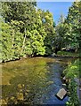
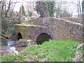
Harbourne River at Bow Bridge, Ashprington
by Rob Farrow
geograph for square SX8156
|
|
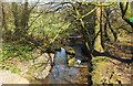
River Harbourne from Gidley Bridge
by Derek Harper
geograph for square SX7063
|
|
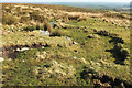
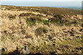
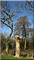
Harbourne Head
by Derek Harper
geograph for square SX6965
The source of the Harbourne River, though it's hard to pinpoint exactly... (more)
|
|
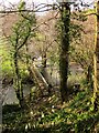
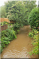
Footbridge over Harbourne River
by Derek Harper
geograph for square SX7758
Harberton Footpath 6 dropping from Vicarage Ball to cross the Harbourne on its... (more)
|
|
Stream junction, Harbourne River
by Derek Harper
geograph for square SX7758
A small stream joins the river (flowing from right to left) from the opposite... (more)
|
|
Harbertonford
by Derek Harper
geograph for square SX7856
Category: Village
The bridge over the River Harbourne, with the Victorian church and the Maltsters... (more)
|
|
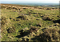
Harbourne Head
by Derek Harper
geograph for square SX6965
|
|
Harbourne Head
by Derek Harper
geograph for square SX6965
|
|
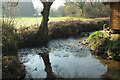
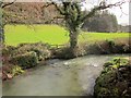
Harbourne River, Harbertonford
by Derek Harper
geograph for square SX7856
Looking upstream from Harbertonford Bridge. The river is very muddy after rain.
|
|
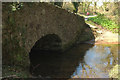
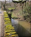
Gidley Bridge
by Derek Harper
geograph for square SX7063
"At the south side are signs on an earlier ford" on the downstream... (more)
|
|
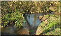
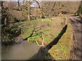
Harbourne River, Leigh Bridge
by Derek Harper
geograph for square SX7658
|
|
Carving by Harbourne River
by Derek Harper
for square SX7658
|

|
Gidley Bridge
by Derek Harper
geograph for square SX7063
|
|
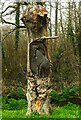
Stump by Harbourne River
by Derek Harper
geograph for square SX7658
|
|
Harbourne River near Leigh Bridge
by Derek Harper
geograph for square SX7658
|
|
Harbourne River, Leigh Bridge
by Derek Harper
geograph for square SX7658
|
|
Harbourne River
by Derek Harper
geograph for square SX7756
|
|
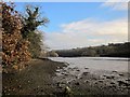
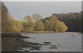
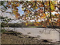
Bow Creek
by Derek Harper
geograph for square SX8256
Looking downstream from the foreshore where Ashprington Footpath 3 ends. Bow... (more)
|
|
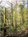
Footpath, Vicarage Ball
by Derek Harper
geograph for square SX7758
A view down the footpath, Harberton Footpath 6, shown leaving the lane in... (more)
|
|
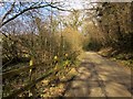
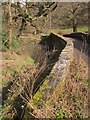
Lane past Leigh Bridge Copse
by Derek Harper
geograph for square SX7658
Climbing away from Leigh Bridge with steep woodland on the right. Below on the... (more)
|
|
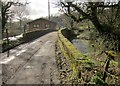
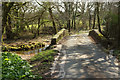
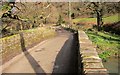
Leigh Bridge
by Derek Harper
geograph for square SX7658
The Harbourne River is flowing to the left under the listed bridge... (more)
|
|
Harbourne River at Leigh Bridge
by Derek Harper
geograph for square SX7658
|
|
Leigh Bridge
by Derek Harper
for square SX7658
|
|
Harbourne River at Leigh Bridge
by Derek Harper
geograph for square SX7658
|
|
Leigh Bridge
by Derek Harper
geograph for square SX7658
Looking along the upstream parapet of the bridge over the Harbourne River.... (more)
|
|
Rolster Bridge
by Derek Harper
geograph for square SX7756
Category: Bridge
A distinctively shaped bridge over the Harbourne River, and doubtless built of... (more)
|
|
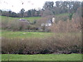
Woodcourt
by Derek Harper
geograph for square SX7755
Category: Farmhouse
Seen looking south from across the little Harbourne River, an old farm close to... (more)
|
|
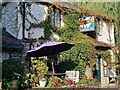
Bow Bridge, Ashprington - The Waterman's Arms - Colourful front
by Rob Farrow
for square SX8156
The Waterman's Arms is a cosy inn in a beautiful location at Bow Bridge... (more)
|
|
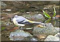
Grey Wagtail (Motacilla cinerea)
by Rob Farrow
for square SX8156
|
|
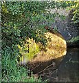
Bow Bridge, Ashprington
by Rob Farrow
for square SX8156
Looking at the sunlit underside of Bow Bridge which gives its name to this... (more)
|
|
Gidley Bridge
by Derek Harper
geograph for square SX7063
Also shown in Link , and... ( more) |
|
Trees by Bow Creek
by Derek Harper
for square SX8356
A detail of the scene in SX8256 : Bow Creek. The trees are by Langham Wood Point... ( more) |
|
Leigh Bridge
by Derek Harper
geograph for square SX7658
|

|
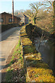
Lane at Leigh Bridge
by Derek Harper
geograph for square SX7658
Across the listed bridge... (more)
|
|
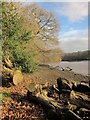
Wall and fence, Bow Creek
by Derek Harper
geograph for square SX8256
At the point where Ashprington Footpath 3 begins, on the right. Obviously... (more)
|
|
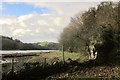
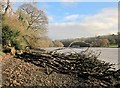
Fallen tree, Bow Creek
by Derek Harper
geograph for square SX8256
A second fallen tree on the foreshore east of Ashprington Footpath 3 to follow... (more)
|
|
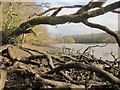
Bow Creek
by Derek Harper
geograph for square SX8256
Oak leaves overhang the northern foreshore. On the left is one of numerous... (more)
|
|
Leigh Bridge
by Derek Harper
geograph for square SX7658
|
|
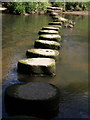
Stepping stones, Bow Creek
by Derek Harper
for square SX8156
Category: Stepping stones
|
|
Fallen tree, Bow Creek
by Derek Harper
geograph for square SX8256
|
|
Fallen tree, Bow Creek
by Derek Harper
geograph for square SX8256
The trunk has been cut through so you can get past this obstruction easily, but... (more)
|
|
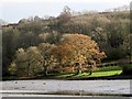
Oaks by Bow Creek
by Derek Harper
for square SX8356
From the north foreshore of the creek, looking across the central channel at low... (more)
|