Public Tags
Other tags: Lambourn
Showing images tagged with river:Lambourn tag.
|
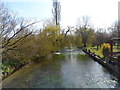
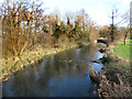
The River Lambourn at Boxford
by Bikeboy geograph for square SU4271 The River Lambourn eventually runs into the River Kennet between Thatcham and... (more)
|
|
What's left of the Lambourn
by Des Blenkinsopp geograph for square SU3676 The Lambourn upstream of Great Shefford often doesn't flow all year round.... (more)
|
|
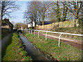
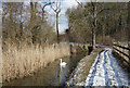
Two Paths in Upper Lambourn
by Des Blenkinsopp geograph for square SU3180 One for people, one for horses, two tracks beside the River Lambourn.
|
|
River Lambourn at Westbrook
by Des Blenkinsopp geograph for square SU4272 Tags:
river:Lambourn
top:Rivers, Streams, DrainageX
|
|
River Lambourn at Shaw
by Des Blenkinsopp geograph for square SU4768 Upstream of the Western Avenue road bridge.
Tags:
river:Lambourn
top:Rivers, Streams, DrainageX
|
|
The River Lambourn by Station Road
by Steve Daniels geograph for square SU3875 Tags:
river:Lambourn
top:Rivers, Streams, DrainageX
|
|
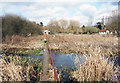
Sluice Gate on the Lambourn
by Des Blenkinsopp geograph for square SU4370 The river divides into several channels here and flows around some old water meadows.
|
|
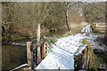
Footbridge over the Lambourn
by Des Blenkinsopp geograph for square SU4569 A narrow bridge from the village onto Rack Marsh Nature Reserve.
Tags:
Footbridge Over RiverX
type:GeographX
river:Lambourn
top:PathsX
top:Rivers, Streams, DrainageX
|
|
Shaw Gauging Weir
by Des Blenkinsopp geograph for square SU4768 Not changed much since Julian's 2007 picture SU4668 : Weir on the river Lambourn save only to add... (more)
|
|
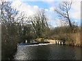
The River Lambourn by Station Road
by Steve Daniels geograph for square SU3875 |
|
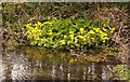
Marsh marigolds by the River Lambourn
by Steve Daniels for square SU3875 Tags:
river:Lambourn
plant:Marsh MarigoldX
top:Rivers, Streams, DrainageX
top:Wild Animals, Plants and MushroomsX
|
|
Swan on the Lambourn
by Des Blenkinsopp geograph for square SU4370 This is a side channel around some old water meadows.
|
|
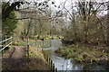
The Lambourn at Hunt's Green
by Des Blenkinsopp geograph for square SU4370 |
|
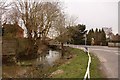
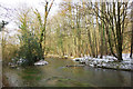
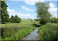
The Lambourn at Easton
by Des Blenkinsopp geograph for square SU4172 |
|
The Lambourn at Woodspeen
by Des Blenkinsopp geograph for square SU4469 |
|
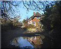
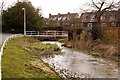
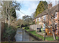
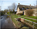
Riverside Houses at Woodspeen
by Des Blenkinsopp geograph for square SU4469 Beside the Lambourn.
|
|
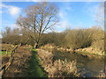
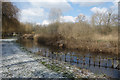
The Lambourn at Maidencourt Farm
by Des Blenkinsopp geograph for square SU3775 |
|
Water in Upper Lambourn
by Des Blenkinsopp geograph for square SU3180 Very often, groundwater flooding is more of a nuisance than a disaster.
High... (more)
Tags:
Groundwater FloodingX
river:Lambourn
top:Rivers, Streams, DrainageX
top:Village, Rural SettlementX
|