Public Tags
Showing images tagged with river:Leach tag.

|
Looking for the Leach 4
by Des Blenkinsopp geograph for square SP1906 This is about 100 metres upstream from the temporary source of the River Leach.... (more)
|

|
Looking for the Leach 1
by Des Blenkinsopp geograph for square SP1906 Ephemeral streams, where only part of the course flows permanently, are not... (more)
|

|
The Dry River Leach
by Des Blenkinsopp geograph for square SP1806 An unusual river, the Leach flows permanently near its source and in its lower... (more)
Tags:
top:Farm, Fishery, Market Gardening
type:Geograph
river:Leach
Limestone Dry Valley
top:Rivers, Streams, Drainage
|
|
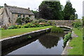
Cottage and the River Leach
by Philip Halling geograph for square SP1114 Cotswold stone built cottage and the infant River Leach near its source. This... (more)
|

|
Spring Pond, River Leach
by Des Blenkinsopp geograph for square SP2005 The lower source of the Leach which is unusual in having a middle section which... (more)
|

|
River Leach above Northleach
by Derek Harper geograph for square SP1014 More or less a portrait version of SP1014 : Former prison, Northleach, which describes the prison... (more)
Tags:
top:Boundary, Barrier
long distance path:Diamond Way
top:Educational Sites
top:Farm, Fishery, Market Gardening
Grass Fields
top:Historic Sites and Artefacts
river:Leach
Listed Building Grade II(star)
top:Lowlands
long distance path:Monarchs Way
Museum
Parish Boundary
top:Paths
former:Police Station
former:Prison
top:Rivers, Streams, Drainage
Trees
Wall
|

|
Looking for the Leach 3
by Des Blenkinsopp geograph for square SP1906 Another view of the temporary source of the lower River Leach, pictured and... (more)
|

|
Looking for the Leach 2
by Des Blenkinsopp geograph for square SP1906 This is about 20 metres downstream from the start of flow in the River Leach... (more)
|

|
Ford across the Leach
by Derek Harper geograph for square SP1309 Just about enough early morning light to see this track (not a right of way)... (more)
|

|
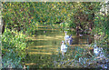
River Leach at Sheep Bridge
by Des Blenkinsopp geograph for square SP1906 A lot of water in the river after an unusually wet period. Very often there is... (more)
|
|
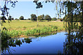
River Leach at Coate Mill
by Des Blenkinsopp geograph for square SP2004 A footbridge crosses the river just here.
|
|
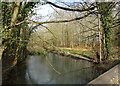
River Leach at Eastleach
by Des Blenkinsopp geograph for square SP2004 Looking quite deep and full here above an old mill. In fact, flows are quite low... (more)
|
|
River Leach at Little Faringdon
by Des Blenkinsopp geograph for square SP2201 Viewed from the A361 bridge upstream from Little Faringdon Mill.
|

|
River Leach at Southrop 2
by Des Blenkinsopp geograph for square SP2003 On the south side of the road bridge.
|

|
River Leach at Southrop 1
by Des Blenkinsopp geograph for square SP2003 In a garden on the north side of the road bridge.
|

|
River Leach below Eastington
by Derek Harper geograph for square SP1313 With a track fording the stream beside the lane to Stephen's Barn.... (more)
Tags:
Barn
Ford
Lane
river:Leach
top:Lowlands
Pasture
top:Rivers, Streams, Drainage
top:Roads, Road Transport
fence:Timber
Trees
|

|
Hampnett
by Derek Harper geograph for square SP0915 On the right is the River Leach, which rises from a spring just out of shot.... (more)
Tags:
top:Historic Sites and Artefacts
Houses
top:Housing, Dwellings
river:Leach
Listed Building
top:Lowlands
top:Park and Public Gardens
Pasture
fence:Post and Wire
top:Rivers, Streams, Drainage
Trees
Village
Village Green
top:Village, Rural Settlement
Walls
|

|
River Leach below Eastington
by Derek Harper geograph for square SP1313 Very much a small stream here, even though several miles from its source. In the... (more)
Tags:
top:Farm, Fishery, Market Gardening
river:Leach
top:Lowlands
Pasture
top:Rivers, Streams, Drainage
Trees
|

|
River Leach
by Derek Harper geograph for square SP1311 Seen from the lane between Aldsworth and Eastington, as it runs downstream... (more)
|

|
River Leach
by Derek Harper geograph for square SP1310 The view, upstream from the lane shown in SP1310 : Road across the Leach, is also shown in SP1310 : Upper River Leach.
Tags:
Bush
top:Farm, Fishery, Market Gardening
river:Leach
top:Lowlands
Pasture
top:Rivers, Streams, Drainage
Trees on Field Boundaries
|

|
Lane across the Leach
by Derek Harper geograph for square SP1310 Until it reaches the river, the lane carries the parish boundary between... (more)
Tags:
Country Road
top:Farm, Fishery, Market Gardening
river:Leach
top:Lowlands
Pasture
top:Rivers, Streams, Drainage
top:Roads, Road Transport
Roadside Trees
|
|
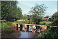
Keble's Bridge, Eastleach
by Des Blenkinsopp geograph for square SP2005 The twin villages Eastleach Martin and Eastleach Turville... (more)
Tags:
Clapper Bridge
top:Historic Sites and Artefacts
river:Leach
top:Paths
top:Rivers, Streams, Drainage
top:Village, Rural Settlement
|

|
Former prison, Northleach
by Derek Harper geograph for square SP1014 Looking down the course of the infant River Leach, with the Monarch's Way... (more)
Tags:
top:Boundary, Barrier
top:Business, Retail, Services
top:Educational Sites
top:Farm, Fishery, Market Gardening
Grass Fields
top:Historic Sites and Artefacts
river:Leach
Listed Building Grade II(star)
top:Lowlands
long distance path:Monarchs Way
Museum
Parish Boundary
top:Paths
former:Police Station
fence:Post and Wire
former:Prison
top:Public Buildings and Spaces
top:Rivers, Streams, Drainage
top:Suburb, Urban Fringe
Trees
Wall
|
|
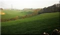
Leach valley
by Derek Harper geograph for square SP1311 A view from bridleway KAL 14/1 a little further north-north-east of... (more)
Tags:
Electricity Pylons
top:Energy Infrastructure
river:Leach
top:Lowlands
Pasture
top:Rivers, Streams, Drainage
Telegraph Poles
Valley
top:Woodland, Forest
Woods
|

|
Road across the Leach
by Derek Harper geograph for square SP1310 A few metres along the road shown in SP1310 : Lane across the Leach.
Tags:
Country Road
Electricity Pylon
top:Farm, Fishery, Market Gardening
river:Leach
top:Lowlands
Pasture
fence:Post and Wire
top:Rivers, Streams, Drainage
top:Roads, Road Transport
|
|
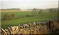
Leach valley
by Derek Harper geograph for square SP1310 Looking over a dry stone wall from bridleway KAL 14/1, with the line of trees... (more)
Tags:
top:Boundary, Barrier
Electricity Pylons
top:Energy Infrastructure
top:Farm, Fishery, Market Gardening
river:Leach
top:Lowlands
Parish Boundary
Pasture
fence:Post and Wire
top:Rivers, Streams, Drainage
Trees on Field Boundary
Valley
Wall
top:Woodland, Forest
Woods
|
|
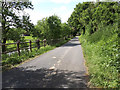
Minor road approaching Coate Mill
by Vieve Forward geograph for square SP2004 Tags:
Country Lane
type:Geograph
river:Leach
Minor Road
top:Rivers, Streams, Drainage
top:Roads, Road Transport
|
