Public Tags
Other tags: Medway
Showing latest 50 of 105 images tagged with river:Medway tag.

|
Bridge over the Medway near Tonbridge
by Malc McDonald geograph for square TQ6047 According to the map, this bridge across the River Medway is a footbridge.
In... (more)
Tags:
county:Kent
river:Medway
Reflection
River Bank
river:River Medway
top:Rivers, Streams, Drainage
Riverside Path
near:Tonbridge
|

|
Footbridge and weir near Tonbridge
by Malc McDonald geograph for square TQ6047 A footbridge crossing a drain channel off the River Medway near Tonbridge. The... (more)
Tags:
Footbridge
Footbridge Over Stream
Footpath
path:Footpath
county:Kent
river:Medway
top:Paths
Public Footpath
river:River Medway
top:Rivers, Streams, Drainage
Riverside Path
near:Tonbridge
Weir
|

|
Submarine in the Medway, Rochester
by Malc McDonald geograph for square TQ7469 This Russian submarine was built by the Soviet navy in 1967. It was... (more)
Tags:
Cold War Relic
county:Kent
river:Medway
River Medway
river:River Medway
top:Rivers, Streams, Drainage
place:Rochester
Submarine
|

|
Footpaths meet, near Paddock Wood
by Malc McDonald geograph for square TQ6447 Two long distance footpaths, the Medway Valley Walk and the Weald Way, meet at... (more)
Tags:
Footpath
path:Footpath
Footpath Marker
county:Kent
Long Distance Footpath
Long Distance Path
Long Distance Path Sign
Long Distance Paths
river:Medway
near:Paddock Wood
top:Paths
Public Footpath
Public Footpath Sign
river:River Medway
top:Rivers, Streams, Drainage
Wooden Sign Post
Wooden Signpost
|

|
Footbridge over a drainage channel, near Tonbridge
by Malc McDonald geograph for square TQ6147 This wooden bridge carries two long distance paths, the Weald Way and the Medway... (more)
Tags:
Footbridge
Footbridge Over Stream
path:Footpath
Footpath
county:Kent
river:Medway
top:Paths
Public Footpath
River Bank
river:River Medway
top:Rivers, Streams, Drainage
Riverside Path
near:Tonbridge
Wooden Bridge
Wooden Footbridge
|

|
Footbridge over a weir, near Tonbridge
by Malc McDonald geograph for square TQ6047 This footbridge carries the Medway Valley Walk and the Weald Way over a drainage... (more)
Tags:
Footbridge
Footbridge Over Stream
path:Footpath
Footpath
county:Kent
river:Medway
top:Paths
Public Footpath
River Bank
river:River Medway
top:Rivers, Streams, Drainage
Riverside Path
near:Tonbridge
Weir
|

|
Horrid Hill, Riverside Country Park, Rainham
by Roger Jones geograph for square TQ8168 A view across the foreshore at Horrid Hill during late afternoon light. The... (more)
Tags:
Brickwork
Coastal Erosion
Coastal Landscape
Coastline
top:Derelict, Disused
Estuary
top:Estuary, Marine
Foreshore
type:Geograph
place:Horrid Hill
Industrial Heritage
Kent
river:Medway
Medway Estuary
place:Rainham
Riverside Country Park
Ruins
Saltmarsh
Shingle Beach
|

|
Saxon Shore Way near Gillingham
by Malc McDonald geograph for square TQ8068 This path through the Riverside Country Park forms a section of the Saxon Shore... (more)
Tags:
Country Park
top:Estuary, Marine
near:Gillingham
county:Kent
river:Medway
National Cycle Network
National Cycle Route 1
NCN1
top:Paths
river:River Medway
River Medway
Riverside Cycle Path
Riverside Path
national cycle network:Route 1
Shared Path
Shared Use Path
|

|
River Medway at Branbridges, East Peckham
by Malc McDonald geograph for square TQ6748 The River Medway at Branbridges, close to the village of East Peckham.
Tags:
place:East Peckham
county:Kent
river:Medway
River Medway
river:River Medway
top:Rivers, Streams, Drainage
|

|
Hulk on the Foreshore, Horrid Hill, Riverside Country Park, Rainham
by Roger Jones geograph for square TQ8068 An abandoned, rusted vessel sits firmly grounded on the causeway to Horrid Hill... (more)
Tags:
Boat Wreck
Derelict Vessel
top:Derelict, Disused
Estuary Landscape
top:Estuary, Marine
Foreshore
type:Geograph
place:Horrid Hill
Kent
river:Medway
Medway Estuary
Mudflats
place:Rainham
Riverside Country Park
Saltmarsh
Wooden Piles
Wreck
|
|
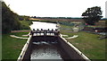
East Lock, River Medway near Tonbridge
by Malc McDonald geograph for square TQ6447 East Lock is one of a series enabling boats to navigate this stretch of the... (more)
Tags:
top:Flat Landscapes
county:Kent
Lock
Lock Gates
river:Medway
river:River Medway
top:Rivers, Streams, Drainage
near:Tonbridge
|

|
M2 Medway Bridge, 1988
by Christopher Hilton geograph for square TQ7267 Taken in 1988 and thus long before the Channel Tunnel Rail Link was constructed:... (more)
Tags:
motorway:M2
river:Medway
top:Railways
River Medway
top:Rivers, Streams, Drainage
top:Roads, Road Transport
|

|
River Medway near Teston Bridge
by Paul Gillett geograph for square TQ7053 Teston Bridge is a road bridge which crosses the River Medway between Teston... (more)
|

|
River Medway near Paddock Wood
by Malc McDonald geograph for square TQ6447 Tags:
county:Kent
river:Medway
near:Paddock Wood
Reflection
river:River Medway
top:Rivers, Streams, Drainage
near:Tonbridge
|
|
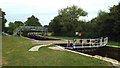
East Lock, near Tonbridge
by Malc McDonald geograph for square TQ6447 East Lock is one of a series which enable boats to navigate this stretch of the... (more)
Tags:
county:Kent
Lock
Lock Gates
river:Medway
river:River Medway
top:Rivers, Streams, Drainage
near:Tonbridge
|

|
River Medway near Tonbridge
by Malc McDonald geograph for square TQ6347 |

|
River Medway near Barming
by Paul Gillett geograph for square TQ7153 Tags:
river:Medway
top:Rivers, Streams, Drainage
|

|
River Medway near Whatman Park
by Paul Gillett geograph for square TQ7556 |

|
Maidstone Rail Bridge
by Paul Gillett geograph for square TQ7556 Crossing the River Medway near to Maidstone East Station
|

|
Archbishop's Palace, Maidstone
by Paul Gillett geograph for square TQ7555 Viewed from the River Medway
Tags:
top:City, Town Centre
top:Historic Sites and Artefacts
place:Maidstone
river:Medway
Palace (Former)
top:Rivers, Streams, Drainage
|

|
Boats near Market Hall
by Paul Gillett geograph for square TQ7555 On the River Medway at Maidstone
|

|
Teston Bridge
by Paul Gillett geograph for square TQ7053 Road Bridge crossing the Medway between Teston and West Farleigh
|

|
River Medway at Barming
by Paul Gillett geograph for square TQ7153 |

|
Barming Bridge
by Paul Gillett geograph for square TQ7253 Footbridge across the River Medway
|

|
River Medway near East Farleigh
by Paul Gillett geograph for square TQ7353 |

|
River Medway at East Farleigh
by Paul Gillett geograph for square TQ7353 Moorings west of East Farleigh Bridge
|

|
East Farleigh Lock
by Paul Gillett geograph for square TQ7353 On the River Medway near East Farleigh Bridge
|

|
River Medway at East Farleigh
by Paul Gillett geograph for square TQ7353 Photo taken onboard the Kentish Lady river cruiser
|

|
Narrowboat at East Farleigh
by Paul Gillett geograph for square TQ7353 By the side of the River Medway near to East Farleigh Lock
|

|
River Medway, near Bydews farm
by Paul Gillett geograph for square TQ7454 |

|
Pigeons on Towpath, Maidstone
by Paul Gillett geograph for square TQ7555 Beside the River Medway with the Kentish Lady river cruiser and Maidstone Town... (more)
Tags:
Bridge
place:Maidstone
river:Medway
top:Paths
Pigeons
River Boat
top:Rivers, Streams, Drainage
top:Roads, Road Transport
Towpath
|

|
Palace Gardens by the River Medway
by Paul Gillett geograph for square TQ7555 View taken from Maidstone Town Bridge, the River cruiser Kentish Lady can be... (more)
Tags:
Gardens
place:Maidstone
river:Medway
top:Park and Public Gardens
River Boat
top:Rivers, Streams, Drainage
top:Sport, Leisure
|

|
River Medway, Maidstone
by Paul Gillett geograph for square TQ7555 View from the Town Bridge
|
|
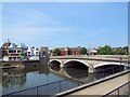
Maidstone Town Bridge
by Paul Gillett geograph for square TQ7555 Viewed from Bishop's Way, the bridge carries the A20 across the River Medway
Tags:
road:A20
Bridge
top:City, Town Centre
place:Maidstone
river:Medway
top:Rivers, Streams, Drainage
top:Roads, Road Transport
|
|
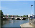
Maidstone Town Bridge
by Paul Gillett geograph for square TQ7555 Carrying the A20 across the River Medway
Tags:
road:A20
Bridge
place:Maidstone
river:Medway
top:Rivers, Streams, Drainage
top:Roads, Road Transport
|
|
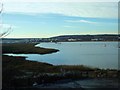
River Medway estuary
by Paul Gillett geograph for square TQ7367 |

|
River Medway, Rochester
by Paul Gillett geograph for square TQ7367 |

|
Tower Reach, River Medway
by Paul Gillett geograph for square TQ7368 looking from the Esplanade at Rochester towards Strood
|

|
Flood barrier above Tonbridge
by Stephen Craven geograph for square TQ5646 Category: Flood alleviation structure The barrier prevents flooding in Tonbridge by permitting the land west of it to... (more)
|

|
Pontoons on River Medway, Rochester
by Paul Gillett geograph for square TQ7368 |

|
Buildings on the river bank, Gillingham
by Malc McDonald geograph for square TQ7969 Industrial buildings on the bank of the River Medway at Gillingham. The river... (more)
Tags:
top:Estuary, Marine
place:Gillingham
top:Industry
county:Kent
Low Tide
river:Medway
river:River Medway
River Medway
|
|
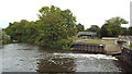
River Medway near Tonbridge
by Malc McDonald geograph for square TQ6447 The trees ahead are on an island in the River Medway. In the background to the... (more)
|
|
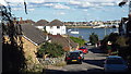
Admiralty Road, Upnor, near Strood
by Malc McDonald geograph for square TQ7570 At the bottom of the road is the River Medway.
Tags:
county:Kent
river:Medway
river:River Medway
River Medway
near:Strood
place:Upnor
top:Village, Rural Settlement
|

|
Beacon at The Strand, Gillingham
by Malc McDonald geograph for square TQ7869 This beacon is on the bank of the Medway estuary at The Strand, Gillingham.... (more)
Tags:
Beacon
top:Estuary, Marine
place:Gillingham
county:Kent
Low Tide
river:Medway
river:River Medway
River Medway
|

|
East Farleigh Bridge
by Paul Gillett geograph for square TQ7353 View from the West
The bridge is medieval and was probably constructed in the... (more)
Tags:
Bridge
place:East Farleigh
river:Medway
top:Rivers, Streams, Drainage
top:Roads, Road Transport
|

|
Teston Lock
by Paul Gillett geograph for square TQ7053 |

|
East Farleigh Bridge
by Paul Gillett geograph for square TQ7353 The bridge is medieval and was probably constructed in the 14th century. It... (more)
Tags:
Bridge
place:East Farleigh
river:Medway
top:Rivers, Streams, Drainage
top:Roads, Road Transport
|

|
East Farleigh Bridge and Lock
by Paul Gillett geograph for square TQ7353 The Bridge is grade 1 listed having been built in the 14th century
|

|
Swans by the riverbank
by Paul Gillett geograph for square TQ7554 Opposite Millers Wharf at Tovil in the southern suburbs of Maidstone
|

|
Aylesford and its bridge
by Christopher Hilton for square TQ7258 |
