|
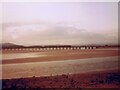
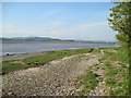
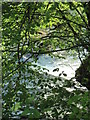
Arnside foreshore
by Gerald England
geograph for square SD4578
Looking across to a train on the Kent Viaduct.
|
|
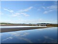
Early morning view of Kent viaduct
by Marika Reinholds
for square SD4579
The Kent Viaduct, also known as the Arnside Viaduct, carries the railway line... (more)
|
|
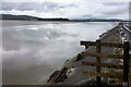
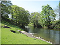
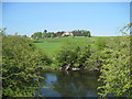
River Kent at Storth
by David Dixon
geograph for square SD4780
|

|
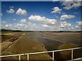
Into the sun over the River Kent estuary
by Martin Dawes
geograph for square SD4579
From the train crossing the Kent viaduct. Arnside in the distance with Arnside... (more)
|

|
Kent Estuary, Milnthorpe Sands
by David Dixon
geograph for square SD4780
|
|
Kent Viaduct western end looking upriver
by Martin Dawes
geograph for square SD4579
To the left Meathop Marsh the southern lake district in the distance
|
|
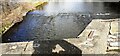
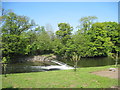
View of weir on River Kent viewed over NE parapet of Nether Bridge
by Roger Templeman
geograph for square SD5191
|
|
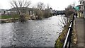
River Kent passing Benson Green towards A6 bridge
by Luke Shaw
geograph for square SD5193
|
|
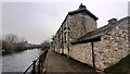
Outbuilding and houses of Benson Green beside River Kent
by Roger Templeman
geograph for square SD5193
|
|
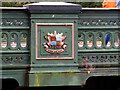
Victoria Bridge, Kendal
by Chris Allen
for square SD5193
Cast iron bridge built 1887 over the River Kent. This shows the Kendal coat of... (more)
|
|
Victoria Bridge, Kendal
by Chris Allen
geograph for square SD5193
A cast iron bridge opened in 1887 over the River Kent. The rectangular panels... (more)
|
|
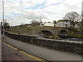
Stramongate Bridge, Kendal
by Chris Allen
geograph for square SD5192
A four arch limestone masonry bridge across the River Kent with date stone 1793... (more)
|
|
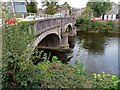
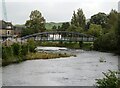
Miller Bridge, Kendal
by Chris Allen
geograph for square SD5192
Over the River Kent and dated 1818. Designed by Francis Webster to replace an... (more)
|
|
River Kent viewed from Romney Bridge
by Luke Shaw
geograph for square SD5191
|

|
Kent Viaduct on a misty morning at low tide
by Martin Dawes
geograph for square SD4578
|
|
Kent Viaduct from coastal footpath to Arnside
by Martin Dawes
geograph for square SD4578
|
|
Weir on the River Kent
by Martin Dawes
geograph for square SD5087
Just downstream of Wilsons Place
|
|
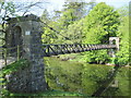
Footbridge over River Kent
by Martin Dawes
geograph for square SD5087
|
|
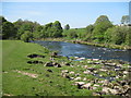
River Kent approaching Wilson Place
by Martin Dawes
geograph for square SD5087
|
|
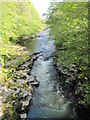
River Kent entering the gorge below Hawes Bridge
by Martin Dawes
geograph for square SD5189
|
|
Footpath alongside the River Kent
by Martin Dawes
geograph for square SD5190
|
|
Footpath over field to River Kent
by Martin Dawes
geograph for square SD5190
|
|
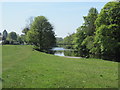
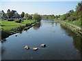
River Kent downstream from Romney Bridge
by Martin Dawes
geograph for square SD5191
Last lap on the Westmorland Way, Kendal to Arnside 17.5 miles, the footpath goes... (more)
|
|
River Kent, Miller Bridge at Kendal
by David Dixon
geograph for square SD5192
The original wooden bridge which connected the town and the castle corn mill was... (more)
|
|
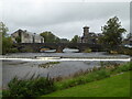
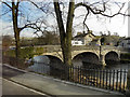
Kendal, Nether Bridge
by David Dixon
geograph for square SD5191
Nether Bridge, over the River Kent in Kendal, is listed as a monument of special... (more)
|
|
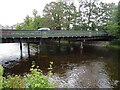
Damaged footbridge, Kendal
by Chris Allen
geograph for square SD5192
This bridge was closed due to damage by Storm Desmond and has now been replaced... (more)
|
|
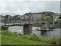
New footbridge, Kendal
by Chris Allen
for square SD5192
This is the new Gooseholme Bridge that opened in 2022 to replace an earlier... (more)
|
|
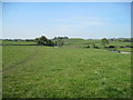
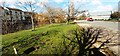
Grass area between A65 and River Kent
by Luke Shaw
geograph for square SD5192
The crocus a reminder that spring is here
|
|
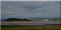
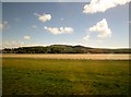
View From Grange-Over-Sands
by Peter Trimming
geograph for square SD4077
Looking across the salt-marsh and River Kent, towards Arnside, some three miles away.
|
|
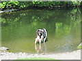
I've got your number
by Martin Dawes
for square SD5087
Having a drink in the River Kent at Wilson Place
|
|
River Kent and Power Lines crossing
by Martin Dawes
geograph for square SD5188
|
|
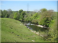
River Kent upstream of Hawes Bridge
by Martin Dawes
geograph for square SD5189
Behind the low wall on the far bank is the remains of a mill race to a now... (more)
|
|
River Kent with Prizet in the distance
by Martin Dawes
geograph for square SD5189
|
|
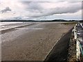
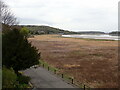
Milnthorpe Sands at Sandside
by David Dixon
geograph for square SD4780
|
|
Salt marsh on the Kent Estuary from train
by Martin Dawes
geograph for square SD4479
On the far bank Arnside and the hills of Arnside Knott
|
|
Falls at Force Bridge
by Martin Dawes
geograph for square SD5086
|
|
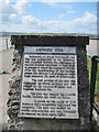
Plaque on Arnside Pier
by Martin Dawes
for square SD4578
|
|
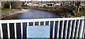
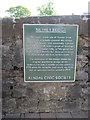
Nether Bridge info
by Martin Dawes
for square SD5191
|
|
Salt Marsh, Grange-Over Sands
by Eirian Evans
geograph for square SD4077
|