|
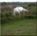
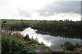
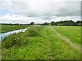
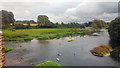
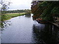
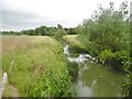
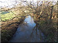
River Stour from the Stour Valley Walk
by Christopher Hilton
geograph for square TM0933
|
|
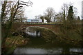
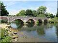
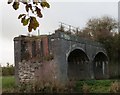
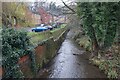
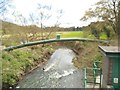
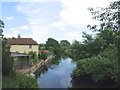
Stratford Bridge, over the River Stour
by Christopher Hilton
geograph for square TM0433
This is the view down the River Stour from the old bridge, looking at the A12... (more)
|
|
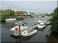
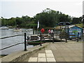
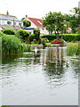
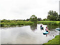
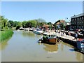
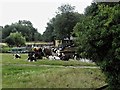
Boats on the Stour, Christchurch
by Malc McDonald
geograph for square SZ1492
Boats moored on the River Stour at Christchurch.
|
|
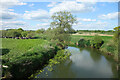
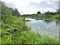
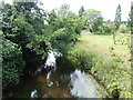
View up the River Stour from the bridge at Flatford
by Christopher Hilton
geograph for square TM0733
|
|
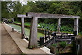
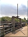
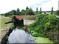
Flatford Lock
by Christopher Hilton
geograph for square TM0733
The frames over the lock-gates are characteristic of the Stour Navigation, and... (more)
|
|
Iford Bridge, near Christchurch
by Malc McDonald
geograph for square SZ1393
Iford Bridge crosses the River Stour, which forms the border separating... (more)
|
|
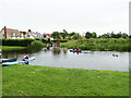
Wick ferry, Christchurch
by Malc McDonald
geograph for square SZ1592
Wick ferry runs to and fro across the River Stour between Christchurch and Wick,... (more)
|
|
Flatford Mill across the river Stour
by Christopher Hilton
geograph for square TM0733
|
|
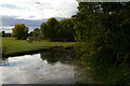
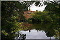
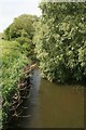
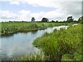
Confluence of rivers on the Stour Valley Way
by Becky Williamson
geograph for square ST7715
The River Divelish joins the River Stour from the south.
|
|
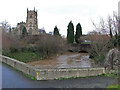
Broken viaduct, Sturminster Newton
by Becky Williamson
geograph for square ST7814
Once a railway serving the town, now sadly derelict and a poignant relic of the... (more)
|
|
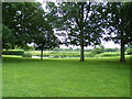
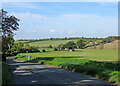
Across the Stour Valley
by John Sutton
geograph for square TL6653
Looking across the shallow valley of the infant River Stour from the B1061 at... (more)
|
|
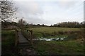
Footbridge over the River Stour near Sturminster Newton
by Becky Williamson
geograph for square ST7815
There is a bifurcation in the paths here, the westward path being the Stour... (more)
|
|
Hinton St Mary, Stour Valley Way
by Mike Faherty
geograph for square ST7715
Heading towards Marnhull; River Stour, looking upstream, left, and grazing land,... (more)
|
|
River Stour at Belle Vale, Cradley Heath
by Ian S
geograph for square SO9584
|
|
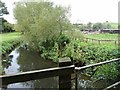
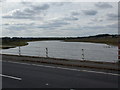
Sluice Gate, River Stour
by David Dixon
geograph for square TM0732
Part of the Environment Agency Flood Defence Barrier, "56 Gates",... (more)
|
|
River Stour at Nags Corner
by Geographer
geograph for square TL9634
Off the B1087 Bear Street at the junction with the A134 Horkesley Hill, A134... (more)
|
|
River Stour at Nags Corner
by Geographer
geograph for square TL9634
Off the B1087 Bear Street at the junction with the A134 Horkesley Hill, A134... (more)
|
|
River Stour at Nags Corner
by Geographer
geograph for square TL9634
Off the B1087 Bear Street at the junction with the A134 Horkesley Hill, A134... (more)
|
|
River Stour
by Geographer
geograph for square TL9634
Off the B1087 Bear Street
|
|
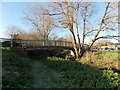
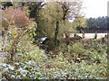
Remains of Somerset and Dorset railway bridge over River Stour
by Jonathan Hutchins
geograph for square ST8806
|
|
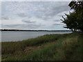
River Stour from White Mill Bridge, Shapwick, Dorset
by Phil Champion
geograph for square ST9500
|
|
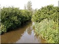
River Stour
by Chris Whippet
geograph for square TR3358
|
|
River Stour
by Chris Whippet
geograph for square TR3358
|
|
Cows by the Stour
by David Dixon
geograph for square TM0533
Cows grazing at the side of the River Stour.
|
|
Carlton Hill: across the Stour Valley
by John Sutton
geograph for square TL6453
John Constable's Stour is a Suffolk river, but it rises not far from here,... (more)
|
|
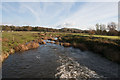
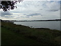
River Stour near Child Okeford
by Becky Williamson
geograph for square ST8212
|
|
River Stour near Hammoon
by Becky Williamson
geograph for square ST8214
With Hambledon Hill fort in the background.
|
|
River Stour footbridge in Gillingham
by Jaggery
geograph for square ST8026
Viewed from the west bank of the river, near Waitrose.... (more)
|
|
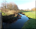
River Stour
by Geographer
geograph for square TM0533
Category: River
This scene featured in one of Constable's paintings, near the road bridge... (more)
|
|
River Stour from the Trailway Bridge
by Des Blenkinsopp
geograph for square ST8013
Along the old railway route east of Sturminster, now a cycleway.
|
|
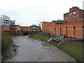
River Stour, Kidderminster town centre
by Chris Allen
geograph for square SO8376
It is hard to believe that less than a decade earlier this had been inside... (more)
|
|
River Stour and St Mary and All Saints Church, Kidderminster
by Chris Allen
geograph for square SO8276
The river was very high as it flowed under the aqueduct in the background... (more)
|
|
River View
by Gordon Griffiths
geograph for square SO8582
The view of the River Stour from the bridleway which links Horse Bridge Road... (more)
|
|
The River Stour off the B1352 The Walls
by Geographer
geograph for square TM1132
|
|
River Stour at Mistley
by Geographer
for square TM1132
Off B1352 The Walls
|
|
River Stour at Mistley
by Geographer
for square TM1132
Off B1352 The Walls
|
|
The River Stour at Cattawade
by Geographer
geograph for square TM0932
Off The White Bridge (Cattawade Bridge)
|
|
The River Stour at Cattawade
by Geographer
geograph for square TM0932
Off The White Bridge (Cattawade Bridge)
|
|
Hinton St Mary, River Stour
by Mike Faherty
geograph for square ST7715
A tranquil summer scene, looking downstream.
|
|
Hinton St Mary, River Stour
by Mike Faherty
geograph for square ST7815
A tranquil summer scene, looking upstream.
|
|
Wimpstone, River Stour
by Mike Faherty
geograph for square SP2149
Looking upstream from Wimpstone Bridge.
|
|
Stour View
by Gordon Griffiths
geograph for square SO8684
The view of the river from the A458 road bridge at Stourton.
|
|
River bend
by Gordon Griffiths
geograph for square SO8480
The view of the River Stour at Cookley.
|
|
River Stour flows towards Rolls Bridge, Gillingham
by Jaggery
geograph for square ST8026
Looking NW from this Link road bridge. |
|
River Stour near Buckingham Road, Gillingham
by Jaggery
geograph for square ST8026
Viewed from this footbridge. Link |
|
River Stour
by Chris Whippet
geograph for square TR1759
|
|
River Stour
by Chris Whippet
geograph for square TR1759
|
|
River Stour
by Chris Whippet
geograph for square TR1759
|
|
Cows Grazing Near Dedham Bridge
by David Dixon
geograph for square TM0533
Cows grazing at the side of the River Stour.
|
|
River Stour Drain at 56 Gates
by David Dixon
geograph for square TM0732
|