|
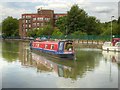
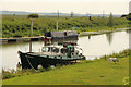
Narrowboat on the Witham Navigation
by David Dixon
geograph for square SK9871
Narrowboat "Foster's Folly" on the Witham Navigation, just to the... (more)
|
|
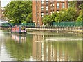
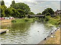
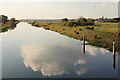
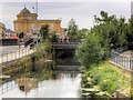
River Witham, Lincoln
by David Dixon
geograph for square SK9871
The River Witham (Witham Navigation) is navigable for 36 miles from Lincoln,... (more)
|
|
River Witham, Lincoln
by David Dixon
geograph for square SK9771
The River Witham (Witham Navigation) is navigable for 36 miles from Lincoln,... (more)
|
|
Witham Navigation from Lincoln High Bridge
by David Dixon
geograph for square SK9771
The River Witham (Witham Navigation) is navigable for 36 miles from Lincoln,... (more)
|
|
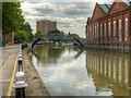
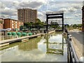
Witham Navigation, Stamp End Lock
by David Dixon
geograph for square SK9871
The River Witham (Witham Navigation) is navigable for 36 miles from Lincoln,... (more)
|
|
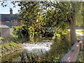
Witham Navigation, Stamp End Sluice and Boom
by David Dixon
geograph for square SK9871
The River Witham (Witham Navigation) is navigable for 36 miles from Lincoln,... (more)
|
|
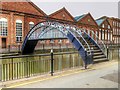
Footbridge over Witham Navigation, Lincoln
by David Dixon
geograph for square SK9871
The River Witham (Witham Navigation) is navigable for 36 miles from Lincoln,... (more)
|
|
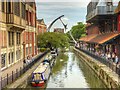
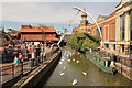
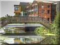
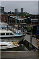
Lincoln Waterside
by David Dixon
geograph for square SK9771
The River Witham (Witham Navigation) is navigable for 36 miles from Lincoln,... (more)
|
|
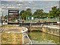
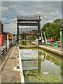
Guillotine Lock at Stamp End
by David Dixon
geograph for square SK9871
The River Witham (Witham Navigation) is navigable for 36 miles from Lincoln,... (more)
|
|
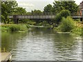
River Witham, Stamp End Bridge
by David Dixon
geograph for square SK9871
The railway bridge crossing the Witham Navigation here is "Stamp End... (more)
|
|
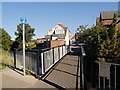
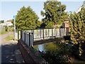
Footbridge, River Witham
by David Dixon
geograph for square SK9235
Footbridge crossing the River Witham, between Dudley Road and the Riverside Walk... (more)
|
|
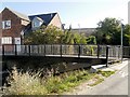
Footbridge Over River Witham
by David Dixon
geograph for square SK9235
Footbridge across the River Witham from the Riverside Walk at Witham Place to Dudley Road
|
|
River Witham Footbridge
by David Dixon
geograph for square SK9235
Footbridge crossing the River Witham, between Dudley Road and the Riverside Walk... (more)
|
|
Lincoln: looking up the River Witham from Brayford Pool
by Christopher Hilton
geograph for square SK9771
|

|
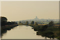
River Witham
by Richard Croft
geograph for square TF0571
View west along the River Witham from Five Mile Bridge, with Lincoln Cathedral... (more)
|
|
River Witham
by Richard Croft
geograph for square TF0571
View west along the River Witham from Five Mile Bridge, with Lincoln Cathedral... (more)
|
|
River Witham
by Richard Croft
geograph for square TF1956
View south (downstream) along the River Witham from Old Tattershall Bridge with... (more)
|
|
River Witham
by Richard Croft
geograph for square TF1366
Cruiser Le Fortune moored on the River Witham by the site of Southrey Station on... (more)
|
|
River Witham
by Richard Croft
geograph for square SK9771
View from the Waterside footbridge along the River Witham towards the High Bridge
|
|
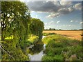
The Witham Meanders
by Bob Harvey
geograph for square SK9223
|
|
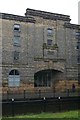
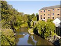
Lincoln: former Doughty's Oil Mill, Waterside South
by Christopher Hilton
for square SK9771
In the foreground, the navigable River Witham.
|
|
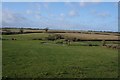
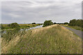
The Witham Valley
by Bob Harvey
geograph for square SK9223
The valley of the River Witham is small but lovely
|
|
Cattle by the River Witham
by Richard Croft
geograph for square TF0571
Cattle grazing by the River Witham near Five Mile Bridge
|
|
River Witham
by Richard Croft
geograph for square TF0571
Cattle grazing by the River Witham from Five Mile Bridge
|
|
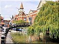
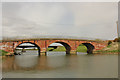
River Witham and High Bridge, Lincoln
by Julian P Guffogg
geograph for square SK9771
The oldest medieval bridge in Britain with houses on, it was built around 1160... (more)
|
|
Stamp End Bridge
by David Dixon
geograph for square SK9871
The railway bridge crossing the Witham Navigation here is "Stamp End... (more)
|
|
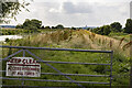
River Witham bank with Lincoln in the distance
by Julian P Guffogg
geograph for square TF0571
Access to the riverbank is to allow for river and drain clearance. The north... (more)
|
|
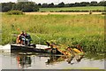
Weed clearance
by Richard Croft
geograph for square TF0170
After cutting weeds from the River Witham... (more)
|
|
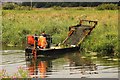
Weed clearance
by Richard Croft
geograph for square TF0170
An ingenious and effective boat clearing weeds on the River Witham.
The... (more)
|
|
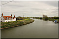
Grantham, River Witham
by David Dixon
geograph for square SK9234
|
|
River Witham, Grantham
by David Dixon
geograph for square SK9234
|
|
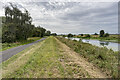
River Witham and Cycle Path
by Julian P Guffogg
geograph for square TF1565
Looking upstream towards Southrey.
|
|
River Witham
by Julian P Guffogg
geograph for square TF1663
The cycle Path and River diverge at this point.
|
|
Cycle path and River Witham
by Julian P Guffogg
geograph for square TF1663
The Water Rail path heading south east.
|
|
River Witham
by Richard Croft
geograph for square SK9771
View downstream from High Bridge
|
|
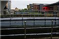
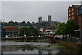
Lincoln: Brayford Pool and view up to the cathedral
by Christopher Hilton
geograph for square SK9771
|
|
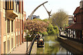
Shuttleworth House
by Richard Croft
geograph for square SK9871
Autumnal view across the River Witham to Shuttleworth House at Stamp End, at 50m... (more)
|
|
Five Mile Bridge
by Richard Croft
geograph for square TF0571
Footbridge over the River Witham at Fiskerton
|
|
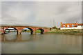
Old Tattershall Bridge
by Richard Croft
geograph for square TF1956
Old Tattershall Bridge and River Witham from the mooring pontoon
|
|
Old Tattershall Bridge
by Richard Croft
geograph for square TF1956
River Witham, Old Tattershall Bridge and Tattershall Bridge Cottage... (more)
|
|
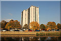
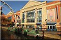
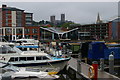
Waterside
by Richard Croft
geograph for square SK9771
The Waterside shopping centre and 'Moonraker' narrowboat tearoom on... (more)
|
|
Lincoln, River Witham
by David Dixon
geograph for square SK9770
Looking south-west (upstream) from the university bridge at Brayford Wharf.
|
|
Disused Footbridge over River Witham, Brayford Wharf
by David Dixon
geograph for square SK9770
|
|
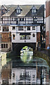
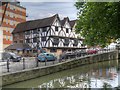
Lincoln, The Green Dragon
by David Dixon
geograph for square SK9771
Restored sixteenth century riverside pub on Waterside North. A grade II listed... (more)
|
|
River Witham from Marston North Bridge
by David Dixon
geograph for square SK8943
Looking towards the north west from Marston's North Bridge.
|
|
Witham view
by Richard Croft
geograph for square SK9771
View west from the Waterside footbridge towards the High Bridge and Glory Hole
|
|
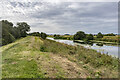
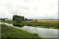
The River Witham at Witham Bank
by Graham Robson
geograph for square TF1069
Looking across the River Witham. The farm at Witham Bank stands beside the watercourse.
|
|
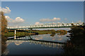
Lincoln: Brayford Pool and view up to the cathedral
by Christopher Hilton
geograph for square SK9771
On the far side of Brayford Pool can be seen one of the distinctive hyperbolic... (more)
|
|
Lincoln: Brayford Pool and view up to the cathedral
by Christopher Hilton
geograph for square SK9771
On the far side of Brayford Pool can be seen one of the distinctive hyperbolic... (more)
|
|
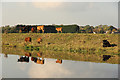
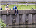
Fishing lads
by Julian P Guffogg
for square SK9871
A couple of boys fishing in the River Witham.
|