About tags on Geograph

Public Tags

Related Tags | Coverage Map
Prefix: river    Tag:  Sowe  

Showing latest 50 of 140 images tagged with river:Sowe tag.

View all tagged images - In Browser
:

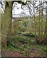
SP3677 : Sowe Viaduct, Willenhall, southeast Coventry by Robin Stott Sowe Viaduct, Willenhall, southeast Coventry by Robin Stott
geograph for square SP3677
This splendid structure carries the main railway line over the River Sowe on the... (more)
Tags: place:Coventry   postcode district:CV3   type:Geograph   top:Historic Sites and Artefacts   top:Lowlands   bridge:Railway Over River   top:Railways   top:Rivers, Streams, Drainage   river:Sowe   subject:Viaduct   near:Willenhall  
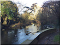
SP3677 : River Sowe beneath Sowe Viaduct, southeast Coventry by Robin Stott River Sowe beneath Sowe Viaduct, southeast Coventry by Robin Stott
geograph for square SP3677
Looking upstream on a sunny morning a few days before Christmas. The impressive... (more)
Tags: near:Binley   place:Coventry   postcode district:CV3   type:Geograph   top:Lowlands   Mixed Use   bridge:Railway Over River   top:Rivers, Streams, Drainage   river:Sowe   top:Suburb, Urban Fringe   near:Willenhall  
SP3677 : Underside of central arch, railway viaduct over the River Sowe, Willenhall, Coventry by Robin Stott Underside of central arch, railway viaduct over the River Sowe, Willenhall, Coventry by Robin Stott
for square SP3677
As stated in the listing, "The underside of the central arch has a sprayed... (more)
Tags: type:Close Look   place:Coventry   postcode district:CV3   top:Lowlands   bridge:Railway Over River   Railway Viaduct   top:Railways   top:Rivers, Streams, Drainage   Soffit   river:Sowe   season:Spring   building material:Stone and Brick   top:Suburb, Urban Fringe   near:Willenhall  
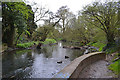
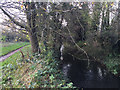
SP3677 : River Sowe immediately upstream from the railway viaduct, Willenhall, Coventry by Robin Stott River Sowe immediately upstream from the railway viaduct, Willenhall, Coventry by Robin Stott
geograph for square SP3677
Tags: place:Coventry   postcode district:CV3   type:Geograph   top:Lowlands   bridge:Railway Over River   Railway Viaduct   top:Railways   top:Rivers, Streams, Drainage   river:Sowe   season:Spring   top:Suburb, Urban Fringe   near:Willenhall  
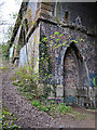
SP3677 : Corner of side arch, railway viaduct over the River Sowe, Willenhall, southeast Coventry by Robin Stott Corner of side arch, railway viaduct over the River Sowe, Willenhall, southeast Coventry by Robin Stott
for square SP3677
On the right is one of the "smaller pointed arches with blind panels"... (more)
Tags: type:Close Look   place:Coventry   postcode district:CV3   Footpath   top:Lowlands   Railway Embankment   bridge:Railway Over River   Railway Viaduct   top:Railways   top:Rivers, Streams, Drainage   river:Sowe   season:Spring   Steep Slope   building material:Stone and Brick   top:Suburb, Urban Fringe   Vermiculation   near:Willenhall  
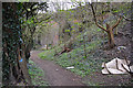
SP3677 : Southern approach to the railway viaduct over the River Sowe, Willenhall, Coventry by Robin Stott Southern approach to the railway viaduct over the River Sowe, Willenhall, Coventry by Robin Stott
geograph for square SP3677
Tags: place:Coventry   postcode district:CV3   Footpath   type:Geograph   top:Lowlands   Railway Embankment   bridge:Railway Over River   Railway Viaduct   top:Railways   top:Rivers, Streams, Drainage   river:Sowe   season:Spring   top:Suburb, Urban Fringe   near:Willenhall  
SP3677 : Steep drop to the River Sowe near the railway viaduct, Willenhall, southeast Coventry by Robin Stott Steep drop to the River Sowe near the railway viaduct, Willenhall, southeast Coventry by Robin Stott
geograph for square SP3677
Tags: place:Coventry   postcode district:CV3   type:Geograph   top:Lowlands   bridge:Railway Over River   Railway Viaduct   top:Railways   Riverbank   top:Rivers, Streams, Drainage   river:Sowe   season:Spring   Steep Slope   near:Willenhall  
SP3677 : 1838 railway viaduct over the River Sowe, Willenhall, southeast Coventry by Robin Stott 1838 railway viaduct over the River Sowe, Willenhall, southeast Coventry by Robin Stott
geograph for square SP3677
Historic England's listing notes the number of repairs made in blue... (more)
Tags: place:Coventry   postcode district:CV3   type:Geograph   top:Lowlands   bridge:Railway Over River   Railway Viaduct   top:Railways   top:Rivers, Streams, Drainage   river:Sowe   season:Spring   building material:Stone and Brick   near:Willenhall  
SP3677 : Side arches, east side of railway viaduct over the River Sowe, Willenhall, Coventry by Robin Stott Side arches, east side of railway viaduct over the River Sowe, Willenhall, Coventry by Robin Stott
geograph for square SP3677
As the Historic England listing notes, there are many repairs in blue... (more)
Tags: place:Coventry   postcode district:CV3   type:Geograph   top:Lowlands   bridge:Railway Over River   Railway Viaduct   top:Railways   top:Rivers, Streams, Drainage   river:Sowe   season:Spring   near:Willenhall  
SP3779 : River Sowe under Sowe Bridge, Walsgrave, Coventry by Robin Stott River Sowe under Sowe Bridge, Walsgrave, Coventry by Robin Stott
for square SP3779
The footbridge is that shown in SP3779 : Footbridge alongside Sowe Bridge, Walsgrave, Coventry. The view is from the Sowe Valley... (more)
Tags: type:Close Look   place:Coventry   bridge:Footbridge Over River   top:Lowlands   Postcode Area CV2   top:Rivers, Streams, Drainage   bridge:Road Over River   river:Sowe   top:Suburb, Urban Fringe   area:Walsgrave  
SP3677 : Retained stone dressing, Sowe railway viaduct, Willenhall, southeast Coventry by Robin Stott Retained stone dressing, Sowe railway viaduct, Willenhall, southeast Coventry by Robin Stott
for square SP3677
It may be that in the course of repairs to, or replacement of the original... (more)
Tags: type:Close Look   place:Coventry   postcode district:CV3   top:Lowlands   bridge:Railway Over River   Railway Viaduct   top:Railways   top:Rivers, Streams, Drainage   river:Sowe   season:Spring   top:Suburb, Urban Fringe   Vermiculation   near:Willenhall  
SP3677 : Accessible side arch, railway viaduct over the Sowe, Willenhall, southeast Coventry by Robin Stott Accessible side arch, railway viaduct over the Sowe, Willenhall, southeast Coventry by Robin Stott
geograph for square SP3677
Tags: place:Coventry   postcode district:CV3   type:Geograph   top:Lowlands   bridge:Railway Over River   Railway Viaduct   top:Railways   top:Rivers, Streams, Drainage   river:Sowe   season:Spring   building material:Stone and Brick   near:Willenhall  
SP3779 : River Sowe above Sowe Bridge on a frosty morning, Walsgrave, northeast Coventry by Robin Stott River Sowe above Sowe Bridge on a frosty morning, Walsgrave, northeast Coventry by Robin Stott
geograph for square SP3779
Looking upstream from the Sowe Valley path. Ripples, upper left, are where the... (more)
Tags: Confluence   place:Coventry   postcode district:CV2   type:Geograph   weather:Hoar Frost   top:Lowlands   top:Rivers, Streams, Drainage   river:Sowe   top:Suburb, Urban Fringe   area:Walsgrave   season:Winter  
SP3677 : River Sowe and the Sowe Valley path duck under Allard Way, Stoke Aldermoor, Coventry by Robin Stott River Sowe and the Sowe Valley path duck under Allard Way, Stoke Aldermoor, Coventry by Robin Stott
geograph for square SP3677
The path leads out of Lindfield Park into a much more natural, unmanaged space.... (more)
Tags: place:Coventry   postcode district:CV3   type:Geograph   top:Lowlands   top:Paths   Public Footpath   Public Open Space   top:Rivers, Streams, Drainage   bridge:Road Over River   river:Sowe   area:Stoke (Coventry)   top:Suburb, Urban Fringe  
SP3879 : River Sowe and the Sowe Valley path on a misty frosty morning, Walsgrave, east Coventry by Robin Stott River Sowe and the Sowe Valley path on a misty frosty morning, Walsgrave, east Coventry by Robin Stott
geograph for square SP3879
Looking downstream, approaching Sowe Bridge. The path has been carved through a... (more)
Tags: plant:Blackthorn   place:Coventry   postcode district:CV2   type:Geograph   weather:Hoar Frost   top:Lowlands   top:Paths   top:Rivers, Streams, Drainage   river:Sowe   top:Suburb, Urban Fringe   area:Walsgrave   season:Winter  
SP3677 : Banks of the River Sowe north of the railway viaduct, Coventry by Robin Stott Banks of the River Sowe north of the railway viaduct, Coventry by Robin Stott
geograph for square SP3677
A local train is crossing.
Tags: place:Coventry   postcode district:CV3   type:Geograph   top:Lowlands   bridge:Railway Over River   Railway Viaduct   top:Railways   Riverbank   top:Rivers, Streams, Drainage   river:Sowe   season:Spring  
SP3879 : Rear of supermarket by the River Sowe floodplain, Walsgrave, east Coventry by Robin Stott Rear of supermarket by the River Sowe floodplain, Walsgrave, east Coventry by Robin Stott
geograph for square SP3879
This Tesco store is reached from Clifford Bridge Road north of Sowe Bridge.
SP3576 : River Sowe downstream from the footbridge out of Whitley Grove, southeast Coventry by Robin Stott River Sowe downstream from the footbridge out of Whitley Grove, southeast Coventry by Robin Stott
geograph for square SP3576
The contours of Whitley Grove turn away from the river, right of centre, the... (more)
Tags: place:Coventry   postcode district:CV3   type:Geograph   top:Lowlands   Public Open Space   top:Rivers, Streams, Drainage   river:Sowe   season:Spring   top:Suburb, Urban Fringe   Urban Woodland   area:Whitley  
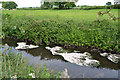
SP3879 : Mats of petals on the River Sowe, Walsgrave, Coventry by Robin Stott Mats of petals on the River Sowe, Walsgrave, Coventry by Robin Stott
geograph for square SP3879
The white petals of hawthorn and cow parsley have fallen to the river,... (more)
SP3780 : River Sowe after rain, near Clifford Bridge Road, Walsgrave, Coventry by Robin Stott River Sowe after rain, near Clifford Bridge Road, Walsgrave, Coventry by Robin Stott
geograph for square SP3780
The Sowe is running fast and turbid. Above centre is a flood gauge with nearly a... (more)
Tags: season:Autumn   place:Coventry   type:Geograph   top:Lowlands   Postcode Area CV2   top:Rivers, Streams, Drainage   river:Sowe   top:Suburb, Urban Fringe   area:Walsgrave  
SP3780 : The Sowe Valley footpath and the River Sowe, Walsgrave, Coventry by Robin Stott The Sowe Valley footpath and the River Sowe, Walsgrave, Coventry by Robin Stott
geograph for square SP3780
The river is flowing away from the camera. The path to the right is a link to... (more)
Tags: season:Autumn   place:Coventry   type:Geograph   top:Lowlands   top:Paths   Postcode Area CV2   Public Open Space   top:Rivers, Streams, Drainage   river:Sowe   top:Suburb, Urban Fringe   area:Walsgrave  
SP3780 : River Sowe and the Sowe Valley footpath, Walsgrave, Coventry by Robin Stott River Sowe and the Sowe Valley footpath, Walsgrave, Coventry by Robin Stott
geograph for square SP3780
This is the stretch north of Dorchester Way and south of the University... (more)
Tags: season:Autumn   place:Coventry   type:Geograph   top:Lowlands   top:Paths   Postcode Area CV2   Public Open Space   top:Rivers, Streams, Drainage   river:Sowe   top:Suburb, Urban Fringe   area:Walsgrave  
SP3780 : River Sowe north of Dorchester Way, Walsgrave, Coventry by Robin Stott River Sowe north of Dorchester Way, Walsgrave, Coventry by Robin Stott
geograph for square SP3780
The viewpoint is by the Sowe Valley footpath, the stretch south of the... (more)
Tags: season:Autumn   place:Coventry   type:Geograph   top:Lowlands   top:Paths   Postcode Area CV2   top:Rivers, Streams, Drainage   river:Sowe   top:Suburb, Urban Fringe   area:Walsgrave  
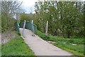
SP3779 : Footbridge over the River Sowe near St Gregory's primary school, Binley, Coventry by Robin Stott Footbridge over the River Sowe near St Gregory's primary school, Binley, Coventry by Robin Stott
geograph for square SP3779
The pair of barriers may be configured to allow people to pass on foot or with a... (more)
Tags: area:Binley   place:Coventry   postcode district:CV3   Floodplain   type:Geograph   top:Lowlands   top:Paths   Public Open Space   top:Rivers, Streams, Drainage   Riverside Walk   river:Sowe   season:Spring   top:Suburb, Urban Fringe  
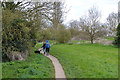
SP3779 : Couple with a dog on the Sowe Valley footpath, Binley, Coventry by Robin Stott Couple with a dog on the Sowe Valley footpath, Binley, Coventry by Robin Stott
geograph for square SP3779
The view is roughly north from the footpath east of the footbridge over the... (more)
Tags: area:Binley   place:Coventry   postcode district:CV3   Floodplain   type:Geograph   top:Lowlands   top:Paths   Public Open Space   top:Rivers, Streams, Drainage   Riverside Walk   river:Sowe   season:Spring   top:Suburb, Urban Fringe   Walking  
SP3779 : Floodplain of the River Sowe above Sowe Bridge, Walsgrave, Coventry by Robin Stott Floodplain of the River Sowe above Sowe Bridge, Walsgrave, Coventry by Robin Stott
geograph for square SP3779
The river runs among the bushes and trees in shadow: see SP3779 : East on a footpath by the River Sowe, Walsgrave, Coventry. This view... (more)
SP3880 : West wing of University Hospital, Walsgrave, Coventry from the south by Robin Stott West wing of University Hospital, Walsgrave, Coventry from the south by Robin Stott
geograph for square SP3880
It's colossal – a double wall of buildings enclosing sterile courtyards... (more)
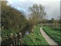
SP3879 : Sowe Valley path approaching Sowe Bridge, Walsgrave, east Coventry by Robin Stott Sowe Valley path approaching Sowe Bridge, Walsgrave, east Coventry by Robin Stott
geograph for square SP3879
Hoar frost glazes the floodmeadow on a gloomy Sunday morning in January. The... (more)
Tags: place:Coventry   postcode district:CV2   Floodmeadow   type:Geograph   top:Grassland   weather:Hoar Frost   top:Lowlands   top:Paths   top:Rivers, Streams, Drainage   river:Sowe   top:Suburb, Urban Fringe   area:Walsgrave   season:Winter  
SP3779 : The Smite Brook joins the River Sowe, Walsgrave, east Coventry by Robin Stott The Smite Brook joins the River Sowe, Walsgrave, east Coventry by Robin Stott
geograph for square SP3779
The Smite Brook, above centre, has come about 10 kilometres southwest from near... (more)
Tags: Brook   Confluence   place:Coventry   postcode district:CV2   type:Geograph   weather:Hoar Frost   top:Lowlands   top:Rivers, Streams, Drainage   river:Sowe   top:Suburb, Urban Fringe   area:Walsgrave   season:Winter  
SP3879 : Downstream on the River Sowe through Walsgrave, east Coventry by Robin Stott Downstream on the River Sowe through Walsgrave, east Coventry by Robin Stott
geograph for square SP3879
SP3576 : The River Sowe nearing Whitley Grove, Whitley, southeast Coventry by Robin Stott The River Sowe nearing Whitley Grove, Whitley, southeast Coventry by Robin Stott
geograph for square SP3576
Whitley Grove is a hillside oakwood with bluebells in spring. The City... (more)
Tags: place:Coventry   postcode district:CV3   type:Geograph   top:Lowlands   Public Open Space   top:Rivers, Streams, Drainage   river:Sowe   season:Spring   top:Suburb, Urban Fringe   Urban Woodland   area:Whitley   top:Woodland, Forest  
SP3879 : River Sowe beneath big poplars, Walsgrave, Coventry by Robin Stott River Sowe beneath big poplars, Walsgrave, Coventry by Robin Stott
geograph for square SP3879
The view is from the Sowe Valley footpath across to Hungerley Hall Farm pasture.
SP3779 : River Sowe, looking downstream past Caludon Castle School, Coventry by Robin Stott River Sowe, looking downstream past Caludon Castle School, Coventry by Robin Stott
geograph for square SP3779
The blocks of flats in the distance are William Malcolm House and Vincent Wyles... (more)
Tags: place:Coventry   Floodplain   type:Geograph   top:Lowlands   Postcode Area CV2   top:Rivers, Streams, Drainage   Riverside Walk   river:Sowe   season:Spring   top:Suburb, Urban Fringe  
SP3779 : Caludon Castle School seen from the Sowe Valley footpath, Coventry by Robin Stott Caludon Castle School seen from the Sowe Valley footpath, Coventry by Robin Stott
geograph for square SP3779
It could be mistaken for a prison or a factory… The school takes its name from... (more)
Tags: place:Coventry   top:Educational Sites   Floodplain   type:Geograph   top:Lowlands   Postcode Area CV2   top:Rivers, Streams, Drainage   river:Sowe   top:Suburb, Urban Fringe   area:Wyken  
SP3779 : River Sowe downstream from Sowe Bridge, Walsgrave, Coventry by Robin Stott River Sowe downstream from Sowe Bridge, Walsgrave, Coventry by Robin Stott
geograph for square SP3779
Tags: season:Autumn   place:Coventry   top:Lowlands   Postcode Area CV2   top:Rivers, Streams, Drainage   river:Sowe   top:Suburb, Urban Fringe   area:Walsgrave  
SP3780 : River Sowe southeast of the University Hospital approach road, Walsgrave, Coventry by Robin Stott River Sowe southeast of the University Hospital approach road, Walsgrave, Coventry by Robin Stott
geograph for square SP3780
Looking upstream; the Sowe Valley footpath runs alongside.
SP3780 : Sowe Valley Footpath near Dorchester Way, Walsgrave, Coventry by Robin Stott Sowe Valley Footpath near Dorchester Way, Walsgrave, Coventry by Robin Stott
geograph for square SP3780
The River Sowe runs among the trees on the left.
Tags: place:Coventry   top:Flat Landscapes   top:Paths   Postcode Area CV2   Public Open Space   top:Rivers, Streams, Drainage   river:Sowe   area:Walsgrave  
SJ9123 : Yellow Water-lilies on the River Sow by Jonathan Hutchins Yellow Water-lilies on the River Sow by Jonathan Hutchins
for square SJ9123
SP3879 : The Sowe Valley footpath through a blackthorn thicket, Walsgrave, east Coventry by Robin Stott The Sowe Valley footpath through a blackthorn thicket, Walsgrave, east Coventry by Robin Stott
geograph for square SP3879
The path is carried by a sleeper bridge across a ditch. The River Sowe is just... (more)
Tags: plant:Blackthorn   place:Coventry   postcode district:CV2   type:Geograph   weather:Hoar Frost   top:Lowlands   top:Paths   river:Sowe   top:Suburb, Urban Fringe   area:Walsgrave   season:Winter  
SP3780 : River Sowe below Clifford Bridge, Walsgrave, east Coventry by Robin Stott River Sowe below Clifford Bridge, Walsgrave, east Coventry by Robin Stott
geograph for square SP3780
Clifford Bridge carries Ansty Road A4600 across the river.
Tags: place:Coventry   type:Geograph   top:Lowlands   Postcode Area CV2   top:Rivers, Streams, Drainage   river:Sowe   top:Suburb, Urban Fringe   area:Walsgrave  
SP3576 : River Sowe upstream from the footbridge out of Whitley Grove, southeast Coventry by Robin Stott River Sowe upstream from the footbridge out of Whitley Grove, southeast Coventry by Robin Stott
geograph for square SP3576
Whitley Grove drops down to the river, left; holly and wild cherry can be... (more)
Tags: place:Coventry   postcode district:CV3   bridge:Footbridge   type:Geograph   top:Lowlands   top:Rivers, Streams, Drainage   river:Sowe   season:Spring   top:Suburb, Urban Fringe   Urban Woodland   area:Whitley  
SP3576 : Pipe across the River Sowe, Whitley, southeast Coventry by Robin Stott Pipe across the River Sowe, Whitley, southeast Coventry by Robin Stott
geograph for square SP3576
A sewer, perhaps, en route to Finham treatment works. It is shown on the 1:25k... (more)
Tags: place:Coventry   postcode district:CV3   Footpath   type:Geograph   top:Lowlands   Public Open Space   top:Rivers, Streams, Drainage   river:Sowe   season:Spring   top:Suburb, Urban Fringe   top:Waste, Waste Management   area:Whitley  
SP3576 : Wet ground, open space by the River Sowe, Whitley, southeast Coventry by Robin Stott Wet ground, open space by the River Sowe, Whitley, southeast Coventry by Robin Stott
geograph for square SP3576
The rushes suggest permanently wet here. The puddles may be from recent showers.... (more)
Tags: place:Coventry   postcode district:CV3   Footpath   type:Geograph   top:Grassland   top:Lowlands   Public Open Space   top:Rivers, Streams, Drainage   river:Sowe   season:Spring   top:Suburb, Urban Fringe   area:Whitley  
SP3576 : River Sowe downstream from Southport Close, Willenhall, southeast Coventry by Robin Stott River Sowe downstream from Southport Close, Willenhall, southeast Coventry by Robin Stott
geograph for square SP3576
The water is clear, burbling along in businesslike fashion. The view is from the... (more)
Tags: place:Coventry   postcode district:CV3   type:Geograph   top:Lowlands   Residential Area   top:Rivers, Streams, Drainage   river:Sowe   top:Suburb, Urban Fringe   Urban River   near:Willenhall  
SP3576 : Willenhall Bridge and pipes cross the River Sowe, Willenhall, southeast Coventry by Robin Stott Willenhall Bridge and pipes cross the River Sowe, Willenhall, southeast Coventry by Robin Stott
geograph for square SP3576
Willenhall Bridge, widened in 1930, carries the London Road over the river.
Tags: road:B4110   place:Coventry   postcode district:CV3   type:Geograph   top:Lowlands   top:Rivers, Streams, Drainage   top:Roads, Road Transport   river:Sowe   top:Suburb, Urban Fringe   area:Willenhall  
SP3576 : River Sowe floodplain and wetland between Whitley and Willenhall, southeast Coventry by Robin Stott River Sowe floodplain and wetland between Whitley and Willenhall, southeast Coventry by Robin Stott
geograph for square SP3576
Reeds line the river, with a grassy floodmeadow beyond. The buildings were... (more)
Tags: place:Coventry   postcode district:CV3   type:Geograph   top:Lakes, Wetland, Bog   top:Lowlands   top:Rivers, Streams, Drainage   river:Sowe   top:Suburb, Urban Fringe   near:Whitley   area:Willenhall  
SP3576 : Open space between the River Sowe and the back of Chace Avenue, Willenhall, Coventry by Robin Stott Open space between the River Sowe and the back of Chace Avenue, Willenhall, Coventry by Robin Stott
geograph for square SP3576
The river meanders through blackthorn scrub. The viewpoint is at the rear of... (more)
Tags: plant:Blackthorn   place:Coventry   postcode district:CV3   type:Geograph   top:Lowlands   Public Open Space   top:Rivers, Streams, Drainage   river:Sowe   top:Sport, Leisure   Sports Pitches   top:Suburb, Urban Fringe   near:Willenhall  
SP3576 : Downstream on the River Sowe past Willenhall, southeast Coventry by Robin Stott Downstream on the River Sowe past Willenhall, southeast Coventry by Robin Stott
geograph for square SP3576
While litter and junk disfigure the river in places, its natural character... (more)
Tags: plant:Blackthorn   place:Coventry   postcode district:CV3   type:Geograph   top:Heath, Scrub   top:Lowlands   Public Open Space   top:Rivers, Streams, Drainage   river:Sowe   top:Suburb, Urban Fringe   near:Willenhall  
SP3879 : Hungerley Hall Farm across the River Sowe, Walsgrave, Coventry by Robin Stott Hungerley Hall Farm across the River Sowe, Walsgrave, Coventry by Robin Stott
geograph for square SP3879
The farm is sandwiched between the river and the A46 Coventry Eastern Bypass.... (more)
SP3677 : The Alan Higgs Centre and the railway viewed from Willenhall, Coventry by Robin Stott The Alan Higgs Centre and the railway viewed from Willenhall, Coventry by Robin Stott
geograph for square SP3677
The trees across the middle of the photo are along the River Sowe. This stretch... (more)
Tags: place:Coventry   postcode district:CV3   type:Geograph   top:Lowlands   Natural Area   near:Pinley   Public Open Space   top:Rivers, Streams, Drainage   river:Sowe   season:Spring   top:Suburb, Urban Fringe   area:Willenhall  
View more in the Image Search or in Browser
View images matching 'Sowe' anywhere in the tags
Don't click these: PotMel 1 PotMel 2