Public Tags
Showing latest 50 of 91 images tagged with river:Taw tag.

|
River Tawe below Heol Giedd, Ystradgynlais
by Jaggery geograph for square SN7810 For about 650 metres, the road named Heol Giedd is above the west bank of the... (more)
|

|
Upstream along the Tawe towards the confluence of the Afon Giedd, Ystradgynlais
by Jaggery geograph for square SN7910 Looking north along the River Tawe from this... (more)
|

|
River Tawe, Ystradgynlais
by Jaggery geograph for square SN7810 Looking downstream along the Tawe from Heol Giedd. The Tawe here is 15 metres... (more)
|

|
Downstream along the Tawe, Ystradgynlais
by Jaggery geograph for square SN7910 Looking south along the River Tawe from this... (more)
|

|
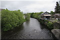
River Tawe towards Teddy Bear Bridge, Ystradgynlais
by Jaggery geograph for square SN7810 Viewed from Heol Giedd look downstream along the Tawe towards Teddy Bear Bridge.... (more)
|
|
Upstream along the River Tawe, Ystradgynlais
by Jaggery geograph for square SN7810 Looking NE from Commercial Street. The flow of the river accelerates near the... (more)
|
|
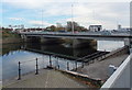
Tawe Bridge, Swansea
by Jaggery geograph for square SS6693 This is one of two parallel road bridges across the River Tawe, 100 metres... (more)
|

|
Footbridge over the River Tawe, Ystradgynlais
by Jaggery geograph for square SN7910 Located nearly 400 metres upstream from Teddy Bear Bridge,... (more)
Tags:
Footbridge Over River
type:Geograph
top:Paths
River Tawe
top:Rivers, Streams, Drainage
river:Tawe
|
|
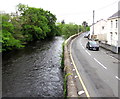
Bend in river and road, Ystradgynlais
by Jaggery geograph for square SN7810 The River Tawe and Heol Giedd viewed from the western end of this... (more)
Tags:
Afon Tawe
type:Geograph
River Tawe
top:Rivers, Streams, Drainage
top:Roads, Road Transport
river:Tawe
|
|
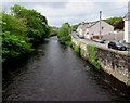
River Tawe downstream from Teddy Bear Bridge, Ystradgynlais
by Jaggery geograph for square SN7810 Viewed from this Link footbridge. The road... (more)
|

|
Upstream along the River Tawe, Ystradgynlais
by Jaggery geograph for square SN7810 Viewed from Teddy Bear Bridge. Link
The... (more)
|
|
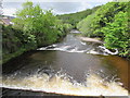
White water on the River Tawe, Ystradgynlais
by Jaggery geograph for square SN7810 The Tawe flows across two ledges. Viewed from Commercial Street.... (more)
|

|
Sail Bridge, River Tawe
by David Dixon for square SS6692 Looking downstream from Tawe Bridge towards Sail Bridge, a modern footbridge... (more)
|

|
Ainon Welsh Baptist chapel, Ystradgynlais
by Jaggery geograph for square SN7810 Viewed from Teddy Bear Bridge Link over the... (more)
Tags:
Afon Tawe
Baptist Chapel
Chapel
type:Geograph
Late Victorian
top:Religious Sites
River Tawe
top:Rivers, Streams, Drainage
river:Tawe
Welsh Baptist Chapel
|

|
River Taw, from Newland Bridge
by Stephen McKay geograph for square SS6500 Looking downstream from the A3072 bridge. The River Taw flows for about 45 miles... (more)
|

|
Taw Bridge, Barnstaple
by PAUL FARMER geograph for square SS5533 Tags:
place:Barnstaple
subject:Bridge
Bridge
top:City, Town Centre
type:Geograph
River
River Taw
top:Rivers, Streams, Drainage
bridge:Road Bridge
Road Bridge
top:Roads, Road Transport
river:Taw
|

|
Long Bridge, Barnstaple
by PAUL FARMER for square SS5532 Tags:
place:Barnstaple
subject:Bridge
Bridge
top:City, Town Centre
type:Cross Grid
top:Historic Sites and Artefacts
River
River Taw
top:Rivers, Streams, Drainage
Road Bridge
bridge:Road Bridge
top:Roads, Road Transport
river:Taw
|

|
River Taw and Taw Bridge
by Chris Allen geograph for square SS5533 From Castle Quay, Barnstaple. The bridge opened in 2007.
Tags:
place:Barnstaple
type:Geograph
subject:River
top:Rivers, Streams, Drainage
top:Roads, Road Transport
river:Taw
|

|
Taw and Torridge Estuary
by Ian Capper geograph for square SS4631 Rocky foreshore below Western Hill, looking across the estuary of the Rivers Taw... (more)
Tags:
place:Appledore
top:Coastal
place:Crow Point
top:Estuary, Marine
type:Geograph
river:Taw
river:Torridge
|

|
Taw and Torridge Estuary
by Ian Capper geograph for square SS4630 Looking across the estuary of the Rivers Taw and Torridge at the point where the... (more)
Tags:
place:Appledore
top:Coastal
place:Crow Point
top:Estuary, Marine
type:Geograph
river:Taw
river:Torridge
|

|
Cars on the A4067 bridge over the Tawe in Pontardawe
by Jaggery geograph for square SN7203 Viewed from the A474. A few metres behind the A4067 bridge, the Upper Clydach... (more)
|

|
Bondleigh Bridge over River Taw
by David Smith geograph for square SS6504 Tags:
Bridge
top:Rivers, Streams, Drainage
top:Roads, Road Transport
river:Taw
top:Village, Rural Settlement
|

|
Tawe Bridge, Swansea
by David Dixon geograph for square SS6693 Road bridge over the River Tawe at Swansea.
Tags:
road:A483
Bridge
top:City, Town Centre
River
top:Rivers, Streams, Drainage
Road Bridge
river:Tawe
|

|
Himalayan Balsam by the Taw
by Derek Harper geograph for square SS6617 Impatiens glandulifera thriving beside the River Taw, seen here looking... (more)
Tags:
Impatiens Glandulifera
top:Lowlands
top:Rivers, Streams, Drainage
Riverside Trees
river:Taw
top:Wild Animals, Plants and Mushrooms
|

|
Tawe Bridge, Swansea
by David Dixon geograph for square SS6693 Looking towards the docks from Tawe Bridge.
|

|
Taw and Torridge Estuary
by Ian Capper geograph for square SS4531 Looking towards the estuary of the Rivers Taw and Torridge from the end of the... (more)
Tags:
place:Appledore
top:Coastal
top:Estuary, Marine
type:Geograph
Lifeboat
lifeboat:Mollie Hunt
river:Taw
river:Torridge
|

|
Taw and Torridge Estuary
by Ian Capper geograph for square SS4531 Looking across the estuary of the Rivers Taw and Torridge from the foreshore... (more)
Tags:
place:Appledore
top:Coastal
top:Estuary, Marine
type:Geograph
Lifeboat
lifeboat:Mollie Hunt
river:Taw
river:Torridge
|

|
Taw and Torridge Estuary
by Ian Capper for square SS4531 Looking across the estuary of the Rivers Taw and Torridge from Western Hill. In... (more)
Tags:
place:Appledore
top:Coastal
type:Cross Grid
top:Estuary, Marine
Lifeboat
lifeboat:Mollie Hunt
river:Taw
river:Torridge
|

|
Lane to the Taw valley
by Derek Harper geograph for square SS6124 Although, as explained at SS6124 : Lane to Hoe (taken a few metres further up the... (more)
Tags:
top:Farm, Fishery, Market Gardening
Farmland
type:Geograph
Houses
top:Housing, Dwellings
Lane
top:Lowlands
top:Rivers, Streams, Drainage
top:Roads, Road Transport
Roadside Hedges
river:Taw
Telegraph Poles
Valley
Woods
Young Woodland
|

|
Mound by the Taw
by Derek Harper geograph for square SX6086 A reverse view of SX6086 : Mound by the Taw, looking across the River Taw to the mound that... (more)
Tags:
Access Land
national park:Dartmoor
Erosion
Firing Range
Moorland
top:Moorland
Mound
top:Rivers, Streams, Drainage
river:Taw
top:Uplands
Valley
|

|
Upper Taw valley
by Derek Harper geograph for square SX6086 Looking up the valley from beside SX6086 : Ted Hughes memorial stone, with the infant river curving... (more)
Tags:
Access Land
national park:Dartmoor
Firing Range
top:Moorland
Moorland
top:Rivers, Streams, Drainage
river:Taw
top:Uplands
Valley
|

|
River Taw at Colleton Bridge
by Derek Harper geograph for square SS6615 Looking across the river from the bridge shown in SS6615 : River Taw at Colleton Bridge, and showing the... (more)
Tags:
top:Farm, Fishery, Market Gardening
Flood Plain
Frost
type:Geograph
top:Lowlands
Meadow
former:River Channel
top:Rivers, Streams, Drainage
Riverside Trees
river:Taw
Wood
top:Woodland, Forest
|

|
River Taw
by Derek Harper geograph for square SS6808 Erosion taking place on the left bank of the river at the foot of the field... (more)
Tags:
top:Farm, Fishery, Market Gardening
top:Lowlands
fence:Post and Wire
River Bank Erosion
top:Rivers, Streams, Drainage
Riverside Trees
river:Taw
|

|
Tarka Line bridge over River Taw near Eggesford
by David Smith geograph for square SS6910 The bridge carries the Ridge and Valley Walk across the river using the footway... (more)
Tags:
top:Paths
Railway Bridge Over River
top:Railways
long distance path:Ridge and Valley Walk
top:Rivers, Streams, Drainage
river:Taw
|

|
Falling tide at Fremington Quay
by David Smith geograph for square SS5133 The combination of river and falling tide meant that there was a slight fall... (more)
|

|
Horseshoe bend in River Taw, Belstone Common
by David Smith geograph for square SX6191 |

|
River Taw at Sticklepath
by David Smith geograph for square SX6493 Reached by a footpath from the Finch Foundry
Tags:
type:Geograph
subject:River
top:Rivers, Streams, Drainage
river:Taw
top:Village, Rural Settlement
|

|
River Taw
by Derek Harper geograph for square SS6807 Looking upstream from around the same place as SS6808 : River Taw. The field ahead is... (more)
Tags:
top:Farm, Fishery, Market Gardening
top:Lowlands
Pasture
top:Rivers, Streams, Drainage
Riverside Trees
river:Taw
Trees on Field Boundaries
|

|
The River Taw at Hawkridge Bridge
by David Smith geograph for square SS7008 |

|
River Taw at Coldridge Bridge
by David Smith geograph for square SS6807 |

|
River Taw near Coldridge Bridge
by David Smith geograph for square SS6807 |

|
River Taw at Newnham Bridge
by Derek Harper geograph for square SS6617 The downstream view from SS6617 : Newnham Bridge with, as in SS6617 : Himalayan Balsam by the Taw, masses of... (more)
Tags:
Bridge
top:Farm, Fishery, Market Gardening
Grass Field
plant:Himalayan Balsam
Impatiens Glandulifera
top:Lowlands
top:Rivers, Streams, Drainage
Shingle
river:Taw
Trees
Wood
top:Woodland, Forest
|

|
River Taw by Bridge Wood
by Derek Harper for square SS6517 Looking across the river from the wooded lane south of Newnham Bridge.
|

|
Eggesford level crossing and bridge over River Taw
by David Smith geograph for square SS6811 Tags:
Level Crossing
top:Railways
top:Rivers, Streams, Drainage
bridge:Road Over River
top:Roads, Road Transport
Tarka Line
river:Taw
|

|
River Taw, Barnstaple
by Robin Drayton geograph for square SS5631 A view looking upriver towards a railway bridge.
|

|
River Taw, Barnstaple
by Robin Drayton for square SS5632 Taken from a former railway bridge that crosses the river... (more)
|

|
River Taw below Scoope Bridge
by Derek Harper geograph for square SS6220 From a train on the railway line between Umberleigh and Portsmouth Arms, about... (more)
Tags:
top:Farm, Fishery, Market Gardening
type:Geograph
Grass Field
top:Lowlands
top:Rivers, Streams, Drainage
Riverside Trees
river:Taw
Wood
top:Woodland, Forest
|

|
River Taw at Weirmarsh Bridge
by Derek Harper geograph for square SS6221 From a train on the railway line between Portsmouth Arms and Umberleigh. The... (more)
Tags:
top:Farm, Fishery, Market Gardening
Farmland
type:Geograph
Hedges
top:Lowlands
top:Rivers, Streams, Drainage
Riverside Trees
river:Taw
Trees on Field Boundaries
top:Woodland, Forest
|

|
River Taw at Colleton Bridge
by Derek Harper geograph for square SS6615 Like SS6615 : River Taw at Colleton Bridge, looking across the river from the bridge shown in SS6615 : River Taw at Colleton Bridge.
Tags:
Bushes
top:Farm, Fishery, Market Gardening
Flood Plain
Frost
type:Geograph
top:Lowlands
Meadow
plant:Old Mans Beard
top:Rivers, Streams, Drainage
river:Taw
Wood
top:Woodland, Forest
|

|
Minor bridge near Hawkridge Bridge
by David Smith geograph for square SS7008 Hawkridge Bridge is in the middle distance. The nearer bridge crosses a small... (more)
|
