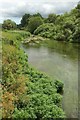
|
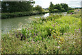
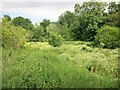
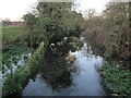
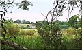
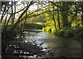
Rich riverbank by the River Thames
by Bill Boaden
geograph for square SU2598
A profusion and variety of rich growth.
|
|
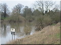
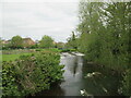
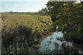
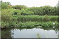
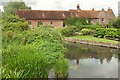
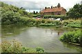
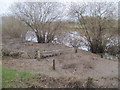
Moreby Reach River Ouse
by Martin Dawes
geograph for square SE5943
Moreby Hall can be seen through the trees to the right. Riverbank notice to the... (more)
|
|
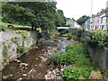
Summertime vegetation in the River Honddu, Brecon
by Jaggery
geograph for square SO0428
A July view of the Honddu from this Link bridge. |
|
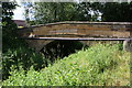
Wiske Bridge, taking Danby Lane over River Wiske
by Roger Templeman
geograph for square SE3398
|
|
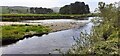
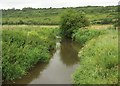
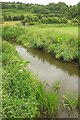
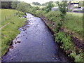
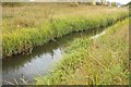
Course of the Ebble
by Derek Harper
geograph for square ST9723
|
|
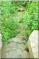
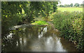
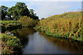
River Lydden
by Derek Harper
geograph for square ST6805
The rather murky stream drops down rocks after emerging from beneath the lane... (more)
|
|
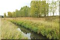
View across River Ure from its north bank south of Low Lane
by Roger Templeman
geograph for square SE1089
|
|
Weir on Pickering Beck from Mill Lane bridge
by Martin Dawes
geograph for square SE7983
|
|
Nafferton Beck upstream from footbridge
by Martin Dawes
geograph for square TA0558
|
|
River Bride
by Derek Harper
geograph for square SY4889
|
|
Driffield Beck from Beverley Road
by Martin Dawes
geograph for square TA0256
The beck runs under the road
|
|
Driffield Trout Stream from Sunderlandwick Bridge
by Martin Dawes
geograph for square TA0156
The clear water of a northern chalk stream. The bridge carries the A164
|
|
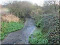
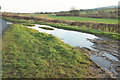
Flooded lay-by, Low Lane
by Derek Harper
geograph for square SE1189
Well, a large puddle, anyway. This looks in the opposite direction to... (more)
|
|
River Axe near Forde Abbey
by Derek Harper
geograph for square ST3505
|

|
River Axe near Forde Abbey
by Derek Harper
geograph for square ST3505
Looking upstream from the footbridge carrying footpath 40UD116 CH 30/21 out of... (more)
|
|
River Wey channel
by Derek Harper
geograph for square SU8346
|
|
A4055 road bridge, Ely River
by M J Roscoe
geograph for square ST1772
Looking upstream, concrete bridge viewed from Pont y Werin.
|
|
River Till at Weetwood Bridge
by Bill Harrison
geograph for square NU0129
|
|
Kingswood Brook
by Derek Harper
geograph for square SP1765
|
|
Kingswood Brook
by Derek Harper
geograph for square SP1765
|
|
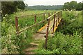
Footbridge over the Cary
by Derek Harper
geograph for square ST5228
Carrying the Macmillan Way West. On this side it is using footpath 40UD022 L... (more)
|
|
River Cary near Charlton Mackrell
by Derek Harper
geograph for square ST5228
|
|
River Cary near Charlton Mackrell
by Derek Harper
geograph for square ST5228
Looking upstream from the footbridge carrying the Macmillan Way West;... (more)
|
|
River Cary near Charlton Mackrell
by Derek Harper
geograph for square ST5228
Looking downstream from the footbridge carrying the Macmillan Way West;... (more)
|
|
Pink bales by the Cary
by Derek Harper
geograph for square ST5228
A bit of a shock, spotting these across the river, which flows in the... (more)
|
|
Ebbw River, Cwm
by M J Roscoe
geograph for square SO1805
Looking upstream as the river flows past a school, right. In the background a... (more)
|
|
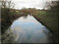
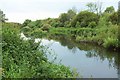
River Avon
by Derek Harper
geograph for square SU1337
|
|
River Avon
by Derek Harper
geograph for square SU1337
The Wiltshire Avon, looking downstream near Upper Woodford (the village is on... (more)
|
|
River Avon
by Derek Harper
geograph for square SU1337
|
|
Across the Avon
by Derek Harper
geograph for square SU1337
|
|
Kings Weston Rhyne
by Derek Harper
geograph for square ST5379
Looking in the other direction along the rhyne from the same spot as... (more)
|
|
Kings Weston Rhyne
by Derek Harper
geograph for square ST5379
Here accompanying Kings Weston Lane on its western side.
|
|
River Nidd by New Farm
by Chris Heaton
geograph for square SE4754
At the curve of a particularly severe meander that incorporates Thistleforth... (more)
|
|
Breamore Mill
by Derek Harper
geograph for square SU1617
|
|
Mill stream, Breamore
by Derek Harper
geograph for square SU1617
Heading downstream to its confluence with the River Avon 200 metres from the... (more)
|
|
The Shallows, Breamore
by Derek Harper
geograph for square SU1617
Looking downstream across the mill stream below Breamore Mill; a little islet... (more)
|
|
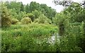
In the Simene valley
by Derek Harper
geograph for square SY4593
Looking across the river from footpath W3 8 to a meadow below Ryeberry Hill.
|
|
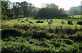
Sheep by the Simene
by Derek Harper
geograph for square SY4593
Looking across the River Simene from footpath W3 8, which actually runs through... (more)
|
|
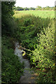
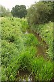
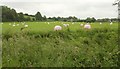
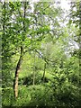
Trees by the Ebble
by Derek Harper
geograph for square ST9723
The little River Ebble is flowing to the left somewhere amidst the grass and... (more)
|
|
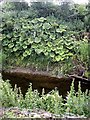
Wild rhubarb on the bank of Leet Water, Coldstream
by Stanley Howe
for square NT8439
Opposite Penitent's Walk camp site.
|
|
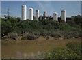
Gas cylinders, BOC, Bristol
by Derek Harper
geograph for square ST6172
Seen from the Avon (flowing to the right) from the River Avon Trail.
|
|
River Yarty
by Derek Harper
geograph for square ST2602
|
|
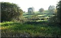
Will it ever open
by Martin Dawes
geograph for square SE5943
The river bank has silted up badly and this gate has fallen victim to it.
|
|
Downstream Water of Feugh
by Stanley Howe
geograph for square NO7095
Below the Bridge of Feugh.
|