
|
Triple Underpass
by Nigel Mykura
geograph for square SU6453
The road going over the bridge on top is the A339 main Basingstoke northern... (more)
|

|
Bridges on the East Coast Main Line : ECM7/179 Cheswick, Northumberland
by Richard West
geograph for square NU0346
Heading towards the coast, this bridge carries a minor road over the railway to... (more)
|

|
Parallel Station Road bridges near Llanishen railway station, Cardiff
by Jaggery
geograph for square ST1882
The road bridge carries the B4562 Station Road over railway lines immediately... (more)
|

|
Northumberland Landscape : Network Rail track information board at Cheswick bridge
by Richard West
for square NU0346
All you ever wanted to know about railway bridge ECM7/179 but were afraid to ask.
|

|
Farnham Business Park and the railway, Farnham
by Derek Harper
geograph for square SU8346
From the footbridge carrying Farnham footpath 128 over the railway west of... (more)
|

|
Rheola Bridge, Porth
by Jaggery
geograph for square ST0291
Two road bridges are in view from Porth railway station footbridge.
Dominating... (more)
|

|
Two road bridges viewed from Johnston railway station
by Jaggery
geograph for square SM9310
The nearer bridge carries the A4076 St Peter's Road over the single track... (more)
|

|
East across Shelone Road railway bridge, Briton Ferry
by Jaggery
geograph for square SS7494
The bridge carries the road over railway lines immediately north of Briton Ferry... (more)
|

|
Bridge identification plate, Stoke Gifford
by Derek Harper
for square ST6379
|

|
East side of Cardiff Road railway bridge, Caerphilly
by Jaggery
geograph for square ST1586
Viewed from Caerphilly railway station. The bridge carries the B4263 Cardiff... (more)
|

|
Two bridges north of Lisvane & Thornhill railway station, Cardiff
by Jaggery
geograph for square ST1783
Cherry Orchard Road bridge is in the foreground. The M4 motorway bridge is in... (more)
|

|
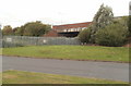
Station Road bridge, Leamside
by Malc McDonald
geograph for square NZ3146
This bridge carries the road over a railway line. The railway is now disused.
|
|
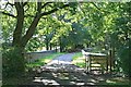
Spytty Road railway bridge viewed from Moorland Park, Newport
by Jaggery
geograph for square ST3487
Viewed from the NE corner of Moorland Park housing estate. The bridge carries... (more)
|
|
Stokesheath Road railway bridge
by Hugh Craddock
geograph for square TQ1461
Bridge over the Guildford to Surbiton railway line, carrying the private... (more)
|

|
Hob Lane railway bridge
by Jeff Buck
geograph for square SJ4672
Hob Lane as it goes over the Chester to Warrington railway line.
|

|
Fence by the railway, Shiphay Bridge
by Derek Harper
geograph for square SX9065
The fence borders TQ bridleway 21, now a cyclepath running towards the hospital.... (more)
|

|
Sandplace station
by Derek Harper
geograph for square SX2457
An important notice by the camera; with only one platform, you might end up... (more)
|
|
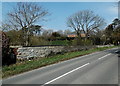
Stone edge of a railway bridge north of Ewenny
by Jaggery
geograph for square SS9078
The bridge carries the B4265 Ewenny Road over a railway.
|

|
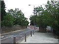
Railway bridge, Leamside
by Malc McDonald
geograph for square NZ3146
The railway line through Leamside formed part of the original railway route from... (more)
|
|
Vanbrugh Hill railway bridge, near Greenwich
by Malc McDonald
geograph for square TQ3977
Vanbrugh Hill crosses over a railway line here. The bridge itself is fairly... (more)
|

|
North across a railway bridge, Caldicot
by Jaggery
geograph for square ST4787
The bridge carries Station Road over the South Wales Main Line between
Severn... (more)
|

|
Bridges On The East Coast Main Line : Identification plate on ECM8/141, near Reston
by Richard West
for square NT8762
|

|
Southern approach to Rose Hill bridge
by Oliver Dixon
geograph for square SD3416
The "hill" in question is a bridge on the A5267 which spanned two... (more)
|

|
Bridges on the East Coast Main Line : Bridge ECM7/199 East of A1 (T)
by Richard West
for square NT9954
The Railway Authority really ran out of inspiration when naming this bridge... (more)
|
|
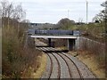
High Cross Bank Roundabout Bridge
by Ian Calderwood
geograph for square SK2817
Carrying the A444 over the railway.
|

|
Summerlane Bridge
by Derek Harper
geograph for square SX8475
Over the Moretonhampstead and South Devon Railway. Maps have "Summerlane... (more)
|

|
Oldfield Park Station
by Derek Harper
geograph for square ST7364
Thoroughly dampened by a heavy shower. Seen from Brook Road.
|

|
Bridge over railway by Coker Wood
by Derek Harper
geograph for square ST5310
The wood is in the background. This is taken from the foot of Kit Hill. The... (more)
|
|
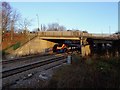
A train under Raynesway
by Ian Calderwood
geograph for square SK3835
An East Midlands Trains Class 222 heading for Nottingham passes under the A5111... (more)
|
|
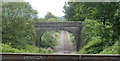
Stone railway bridge viewed across a cast-iron aqueduct, Resolven
by Jaggery
geograph for square SN8302
The bridge and aqueduct Link cross above the... ( more) |

|
Bridge over the Middleton Railway, John Charles Approach
by Stephen Craven
geograph for square SE3030
The Middleton Colliery that the railway served once occupied this area.
|

|
Bridges On The East Coast Main Line : Bridge ECM8/141 between Grantshouse and Reston
by Richard West
geograph for square NT8762
|

|
The summit of Rose Hill
by Oliver Dixon
geograph for square SD3416
The "hill" in question is a bridge on the A5267 which spanned two... (more)
|

|
Road bridge at the NW end of Tirphil station
by Jaggery
geograph for square SO1403
The bridge carries the A4049 over the Rhymney Line.
|
|
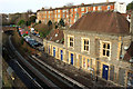
Clifton Down station
by Derek Harper
geograph for square ST5774
Seen from the car park at Clifton Down shopping centre. The terrace behind is on... (more)
|

|
Traffic lights, New Fryston
by Derek Harper
geograph for square SE4526
|

|
Railway at the site of St Luke's Station
by Oliver Dixon
geograph for square SD3416
St Luke's Station operated from 1883 to 1968 on the Manchester and Preston... (more)
|
|
Station Approach, South Brent
by Derek Harper
geograph for square SX6960
The main railway line is on the left over the wall, but no station is there now.... (more)
|

|
Kit Hill railway bridge
by Derek Harper
geograph for square ST5310
The bridge is also shown at Link. |

|
Railway line at Parson's Bridge
by Derek Harper
geograph for square SX8866
From footpath TQ262 as it crosses the bridge, with a view to the Hamelin Way... (more)
|

|
Railway north to Filey Sunshine and shadows in the cutting
by Martin Dawes
geograph for square TA1273
The bridge ahead carries North Burton Road, Eastfield Farm is to the left of bridge
|

|
Waverley Station from the top of the Scott Memorial
by Martin Dawes
geograph for square NT2573
After 287 steps this is the view,Waverley Bridge in the foreground North Bridge... (more)
|

|
Station Road bridge, Treorchy
by Jaggery
geograph for square SS9596
Viewed from the edge of Treorchy railway station. The boundary marker... (more)
|

|
Disused railway, Epping
by Malc McDonald
geograph for square TL4601
Epping is now the furthest extremity of London Underground's Central Line.... (more)
|

|
Bath Road bridge viewed from Bristol Temple Meads station
by Jaggery
geograph for square ST5972
A view south towards the bridge Link... ( more) |

|
Tunstead Road bridge
by Glen Denny
geograph for square TG2820
This is a view from the Aylsham side of the bridge, looking towards Wroxham.... (more)
|

|
The Chester to Warrington line
by Jeff Buck
geograph for square SJ4672
The line as it heads towards Helsby, from Hob Lane railway bridge at Dunham-on-the-Hill.
|

|
Station Brae, Galashiels
by Jim Barton
geograph for square NT4936
Just above the bridge over the Borders railway with Meigle Hill in the... (more)
|

|
South side of Shelone Road railway bridge, Briton Ferry
by Jaggery
geograph for square SS7494
Part of this Link bridge. |

|
Noticeboard at Noss Marina
by Derek Harper
geograph for square SX8852
Describing the Dart Valley Trail, which crosses the road into the marina a few... (more)
|
