Public Tags
Tag: Road·Humps·Sign
Showing images tagged with Road Humps Sign tag.
|
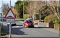
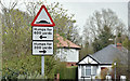
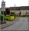
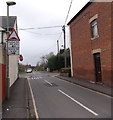
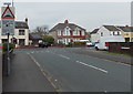
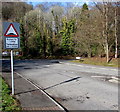
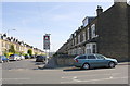
"Road humps" sign, Lambeg
by Albert Bridge geograph for square J2766 Road humps, as traffic calming measures, are now widespread. This sign is at... (more)
|
|
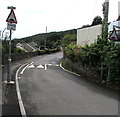
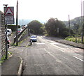
Humps and humps warning sign, School Lane, Govilon
by Jaggery geograph for square SO2613 This way for Stephens Crescent and the B4246.
|
|
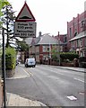
"Road humps" sign, Gilnahirk, Belfast (January 2018)
by Albert Bridge for square J3972 Road humps sign on the Middle Braniel Road as it approaches the Lower Braniel... (more)
Tags:
place:BelfastX
type:Close LookX
Road Humps Sign
Road SignX
top:Roads, Road TransportX
Traffic CalmingX
|
|
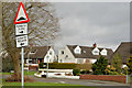
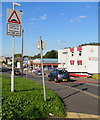
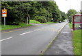
"Road humps" sign, Lisburn
by Albert Bridge geograph for square J2666 A sign warning drivers, emerging from Sharry Drive and Cloverdale Crescent... (more)
|
|
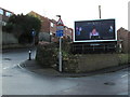
Road humps sign, Finaghy, Belfast (April 2016)
by Albert Bridge for square J3169 Traffic-calming road humps sign at the Sicily Park end of Locksley Gardens ... (more)
Tags:
place:BelfastX
place:Finaghy (Belfast)X
Road HumpsX
Road Humps Sign
Road SignX
top:Roads, Road TransportX
Traffic CalmingX
|
|
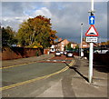
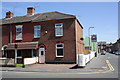
Junction of Hopton Road and Barrs Court Road, Hereford
by Jaggery geograph for square SO5140 The sign facing Hopton Road shows speed humps along Barrs Court Road
to the... (more)
|
|
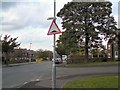
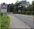
Humps for 500 yards along Osborne Road, Pontypool
by Jaggery geograph for square SO2701 Viewed across the road name Riverside. The sign on the left shows
that there... (more)
|
|
Warning sign - humps for 385 yards, Chapel Street, Pontnewydd, Cwmbran
by Jaggery geograph for square ST2995 The sign faces the roundabout at the Maendy Way/Cwmbran Drive junctions
at the... (more)
|
|
"Humps" sign, Belfast (February 2018)
by Albert Bridge for square J3673 Traffic-calming humps are widespread in Belfast. This sign is in Martinez... (more)
|
|
Southern end of Pillory Street, Nantwich
by Jaggery geograph for square SJ6552 From the corner of Station Road along Pillory Street towards the town centre.... (more)
|
|
Grange Road South
by Gerald England geograph for square SJ9594 At the corner with The Grange. I'm not certain whether the "road... (more)
|
|
Humps to the right and more to the left, Varteg
by Jaggery geograph for square SO2605 The sign showing humps for 35 yards (along Penylan Road) to the right and for... (more)
|
|
Humps to the left and humps to the right ahead along Hensington Road Woodstock
by Jaggery geograph for square SP4416 The sign is alongside Green Lane.
Tags:
Road Humps Sign
top:Roads, Road TransportX
|
|
Humps ahead for 500 yards, Bisley Road, Stroud
by Jaggery geograph for square SO8505 The humps triangular sign is on top of a pole, above a timetable alongside a... (more)
Tags:
Road Humps Sign
top:Roads, Road TransportX
|
|
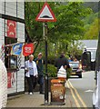
Humps warning sign, Castle Lane, Warwick
by Jaggery geograph for square SP2864 Traffic calming humps are ahead. Double yellow lines on both sides of the lane... (more)
|
|
Signs on Station Road
by Gerald England geograph for square SH7956 Coffee or ice-cream? Mind the hump!
|
|
Humps ahead to the left and right, Didcot
by Jaggery geograph for square SU5289 High Street approaches Wessex Road where there are speed humps across the road.
Tags:
Road Humps Sign
top:Roads, Road TransportX
|
|
Humps for half a mile ahead sign, Abersychan
by Jaggery geograph for square SO2603 Alongside Church Road on the approach to High Street.
Tags:
Road Humps Sign
top:Roads, Road TransportX
|
|
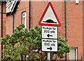
Humps for 200 yards on the approach to Caerphilly Park & Ride
by Jaggery geograph for square ST1686 The traffic calming measures begin ahead - white triangles are painted on humps... (more)
|
|
Humps for ¾ mile, Penywaun
by Jaggery geograph for square SN9704 The sign is alongside the southern end of Arfryn, near the Hirwaun Road junction.
Tags:
Road Humps Sign
top:Roads, Road TransportX
|
|
Humps left and right along Liswerry Road, Newport
by Jaggery geograph for square ST3487 The sign is in Greenmeadow Road at the approach to the Liswerry Road junction.
|
|
Humps for 330 yards sign, Newbridge
by Jaggery geograph for square ST2096 Traffic calming measures on High Street.
Tags:
Road Humps Sign
top:Roads, Road TransportX
|
|
Humps for 80 yards sign, Llangennech
by Jaggery geograph for square SN5602 Part of a traffic calming area along Pontarddulais Road.
|
|
Junction of Lansdown and Brick Row, Stroud
by Jaggery geograph for square SO8505 Brick Row is on the left. A Clear Channel advertising billboard dominates the... (more)
|
|
Humps for half a mile ahead on Ffordd Treforgan, Morganstown, Cardiff
by Jaggery geograph for square ST1281 The sign is at the corner of the B4262 Ty-Nant Road.
|
|
Junction of Winchester Avenue and Church Road, Hereford
by Jaggery geograph for square SO5240 Viewed from Winchester Avenue. A black arrow pointing left is part of a sign... (more)
|
|
Entering Bucknell on the Bicester Road
by Roger Templeman geograph for square SP5625 Speed control gate and humps to calm traffic
|
|
Humps for 520 yards ahead, Rogiet
by Jaggery geograph for square ST4687 Viewed from the Severn Tunnel Junction railway station access road.
Tags:
Road Humps Sign
top:Roads, Road TransportX
|
|
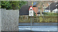
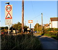
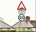
20mph speed limit sign, Finaghy, Belfast (May 2016)
by Albert Bridge for square J3069 Green-bordered 20mph advisory speed limit sign at the Finaghy Road South end of... (more)
|
|
Humps for 400 yards ahead, Caerau
by Jaggery geograph for square SS8694 Warning of speed bumps across Brynglas Terrace ahead.
|
|
Boundary wall of #4 Oak Lane at North Park Road junction
by Roger Templeman for square SE1534 There is an Ordnance Survey benchmark SE1534 : Benchmark on wall fronting #4 Oak Lane at North Park Road junction on the corner of the wall... (more)
|
|
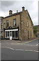
#95 Skipton Road: unoccupied shop at Temple Street junction
by Roger Templeman geograph for square SD8940 There is an OS benchmark SD8940 : Benchmark on #95 Skipton Road on the near corner, left hand face, of the shop
|
|
Houses on Westfield Road from Scotchman Road junction
by Roger Templeman geograph for square SE1434 Ordnance Survey documents indicate that in 1957 a benchmark levelled at 191.076m... (more)
|
|
Junction of Branston Road and Trent Street
by Roger Templeman geograph for square SK2422 There is an OS benchmark SK2422 : Benchmark on #56 Branston Road on the corner of the corner house on the... (more)
|
|
Junction of Woodborough Road and Magdala Road
by Roger Templeman geograph for square SK5741 There is an OS benchmark SK5741 : Benchmark at Woodborough Road / Magdala Road junction on a stone in the wall (pointed to by the... (more)
Tags:
Ordnance SurveyX
Road Humps Sign
top:Roads, Road TransportX
Stone WallX
top:Suburb, Urban FringeX
TreesX
Urban Road JunctionX
postbox:VRX
|
|
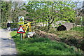
Approach to Great Oaks Park bridge
by M J Roscoe geograph for square ST2689 View from gated end of private lane at entrance to Newport Golf Club... (more)
Tags:
top:Boundary, BarrierX
subject:BridgeX
type:GeographX
Grassy VergeX
Road Hump SignX
top:Roads, Road TransportX
top:Suburb, Urban FringeX
|
|
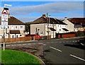
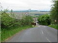
Harthill Road, entering Fauldhouse
by M J Richardson geograph for square NS9260 Tags:
top:Energy InfrastructureX
near:FauldhouseX
type:GeographX
top:Housing, DwellingsX
Road Hump SignX
top:Roads, Road TransportX
Speed Limit 20mphX
top:UplandsX
subject:VillageX
place:West LothianX
Wind FarmX
|
|
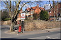
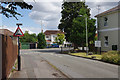
Griffiths Avenue, Cheltenham
by Stephen McKay geograph for square SO9222 Looking towards the junction with Libertus Road in the St Mark's district... (more)
Tags:
top:Housing, DwellingsX
Residential Care HomeX
Road Humps Sign
subject:StreetX
top:Suburb, Urban FringeX
|