About tags on Geograph

Public Tags

Related Tags | Coverage Map
Prefix: road    Tag:  A35  
Other tags: A35     without the windscreen:A35    

Showing latest 50 of 93 images tagged with road:A35 tag.

View all tagged images - In Browser
:

SY8194 : A35 slip road near Tolpuddle, Dorset by Malc McDonald A35 slip road near Tolpuddle, Dorset by Malc McDonald
geograph for square SY8194
A slip road onto and from the eastbound carriageway of the trunk A35 road in... (more)
Tags: A35   road:A35   A35 Road   near:Dorchester   near:Dorchester (Dorset)   county:Dorset   ceremonial county:Dorset   type:Geograph   subject:Road   top:Roads, Road Transport   Slip Road   near:Tolpuddle  
SU3512 : Spicers Hill, Totton, near Southampton by Malc McDonald Spicers Hill, Totton, near Southampton by Malc McDonald
geograph for square SU3512
Spicers Hill in Totton is a busy dual-carriageway. It is on the route of the A35.
SZ1793 : A35 Christchurch by-pass by Malc McDonald A35 Christchurch by-pass by Malc McDonald
geograph for square SZ1793
A view of the A35 road as it by-passes the eastern part of Christchurch. The... (more)
Tags: road:A Road   A35   road:A35   A35 Road   near:Bournemouth   By Pass   By-Pass   near:Christchurch   county:Dorset   road:Dual Carriageway   Dual Carriageway   Dual Carriageway Road   weather:Dull   Dull Day   Dull Weather   type:Geograph   subject:Road   top:Roads, Road Transport  
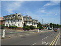
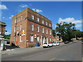
SZ1292 : Marlborough Mansions, Pokesdown, Bournemouth by Malc McDonald Marlborough Mansions, Pokesdown, Bournemouth by Malc McDonald
geograph for square SZ1292
Marlborough Mansions is a black of flats on Christchurch Road in Pokesdown, a... (more)
Tags: road:A Road   A Road Through Town   A35   road:A35   A35 Road   building type:Apartment Block   Apartment Block   Block of Flats   place:Bournemouth   type:Geograph   top:Housing, Dwellings   place:Pokesdown   near:Southbourne   subject:Suburb   top:Suburb, Urban Fringe   Suburban Main Road  
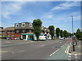
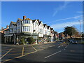
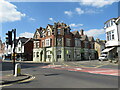
SZ1292 : Christchurch Road, Bournemouth by Malc McDonald Christchurch Road, Bournemouth by Malc McDonald
geograph for square SZ1292
Christchurch Road forms part of the route of the A35 as it passes through the... (more)
Tags: road:A Road   A Road Through Town   A35   road:A35   A35 Road   place:Bournemouth   type:Geograph   top:Roads, Road Transport   near:Southbourne   subject:Suburb   top:Suburb, Urban Fringe   Suburban Main Road  
SZ0491 : Mansfield Road, Parkstone, Poole by Malc McDonald Mansfield Road, Parkstone, Poole by Malc McDonald
geograph for square SZ0491
Mansfield Road is a residential road in Parkstone, a suburb of Poole. The... (more)
SZ0391 : Commercial Road, Ashley Cross, Poole by Malc McDonald Commercial Road, Ashley Cross, Poole by Malc McDonald
geograph for square SZ0391
Commercial Road passing Ashley Cross Green in Parkstone, a suburb of Poole. The... (more)
Tags: road:A35   A35   A35 Road   place:Ashley Cross   near:Bournemouth   type:Geograph   place:Parkstone   near:Poole   subject:Road   top:Roads, Road Transport   top:Suburb, Urban Fringe  
SU2908 : Lyndhurst High Street by Malc McDonald Lyndhurst High Street by Malc McDonald
geograph for square SU2908
The High Street in the village of Lyndhurst. This road forms part of a one-way... (more)
Tags: A337   road:A337   A35   road:A35   A35 Road   type:Geograph   county:Hampshire   place:Lyndhurst   One Way Road   One Way System   One-Way System   subject:Village   top:Village, Rural Settlement  
SU2908 : The Crown hotel, Lyndhurst by Malc McDonald The Crown hotel, Lyndhurst by Malc McDonald
geograph for square SU2908
The Crown hotel in the village of Lyndhurst. The hotel is situated on... (more)
Tags: A337   road:A337   A35   road:A35   A35 Road   top:Business, Retail, Services   type:Geograph   county:Hampshire   Hotel   building type:Hotel   subject:Hotel   Inn   Inn and Hotel   place:Lyndhurst   One Way Road   One Way System   One-Way System   top:Roads, Road Transport   top:Village, Rural Settlement  
SU2908 : Steps to the High Street, Lyndhurst by Malc McDonald Steps to the High Street, Lyndhurst by Malc McDonald
geograph for square SU2908
A flight of steps leading down from St. Michael's and All Angels church... (more)
Tags: A337   road:A337   A35   road:A35   A35 Road   type:Geograph   county:Hampshire   building type:Hotel   Hotel   place:Lyndhurst   One Way Road   One Way System   One-Way System   top:Paths   subject:Steps   top:Village, Rural Settlement  
SU3007 : Gosport Lane, Lyndhurst by Malc McDonald Gosport Lane, Lyndhurst by Malc McDonald
geograph for square SU3007
Gosport Lane forms part of a one-way system taking the A35 and A337 roads... (more)
Tags: road:A337   A337   A35   road:A35   A35 Road   type:Geograph   county:Hampshire   place:Lyndhurst   One Way Road   One Way System   One-Way System   subject:Road   top:Roads, Road Transport  
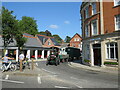
SU3008 : Traction engine in Lyndhurst by Malc McDonald Traction engine in Lyndhurst by Malc McDonald
geograph for square SU3008
A traction engine pulling a couple of trailers on the A35 entering the village... (more)
Tags: road:A35   A35   A35 Road   type:Geograph   county:Hampshire   place:Lyndhurst   subject:Road   top:Roads, Road Transport   Traction Engine   top:Village, Rural Settlement  
SZ1393 : River Stour in flood, Iford, near Bournemouth by Malc McDonald River Stour in flood, Iford, near Bournemouth by Malc McDonald
geograph for square SZ1393
Iford Bridge carries the A35 road across the River Stour, on the boundary... (more)
Tags: A35   road:A35   A35 Road   Arch Bridge   Borough Boundary   top:Boundary, Barrier   near:Bournemouth   near:Christchurch   ceremonial county:Dorset   county:Dorset   Flood   subject:Flood   type:Geograph   place:Iford   top:Rivers, Streams, Drainage   Road Bridge Over River   river:Stour(Dorset)  
SY9393 : Road junction near Poole by Malc McDonald Road junction near Poole by Malc McDonald
geograph for square SY9393
A staggered junction on the trunk A35 road in Dorset. This image was taken on... (more)
Tags: road:A Road   road:A35   A35   Bare Trees   Bare Trees in Winter   Bare Winter Trees   county:Dorset   ceremonial county:Dorset   weather:Dull   Dull Day   Dull Weather   type:Geograph   Junction of A-Road and Minor Road   near:Lytchett Matravers   near:Poole   Road Junction   subject:Road Junction   top:Roads, Road Transport   Staggered Junction   Trunk Road  
SZ0391 : Ashley Cross, Lower Parkstone, Poole by Malc McDonald Ashley Cross, Lower Parkstone, Poole by Malc McDonald
geograph for square SZ0391
A parade of shops at Ashley Cross in Lower Parkstone, a suburb of Poole. The... (more)
SZ0391 : Parkstone post office by Malc McDonald Parkstone post office by Malc McDonald
geograph for square SZ0391
The post office at Parkstone, a suburb of Poole. The road passing in front of... (more)
Tags: road:A35   A35   A35 Road   place:Ashley Cross   near:Bournemouth   top:Business, Retail, Services   type:Geograph   place:Parkstone   near:Poole   subject:Post Office   Post Office   building type:Post Office  
SZ0391 : The Ox brasserie, Ashley Cross, Poole by Malc McDonald The Ox brasserie, Ashley Cross, Poole by Malc McDonald
geograph for square SZ0391
The Ox is a Thai brasserie at Ashley Cross in Parkstone, a suburb of Poole.... (more)
Tags: road:A35   A35   A35 Road   place:Ashley Cross   near:Bournemouth   Brasserie   top:Business, Retail, Services   type:Geograph   place:Parkstone   near:Poole   subject:Restaurant   restaurant:Thai   Thai Restaurant  
SU3007 : Houses on Gosport Lane, Lyndhurst by Malc McDonald Houses on Gosport Lane, Lyndhurst by Malc McDonald
geograph for square SU3007
A short terrace of houses on Gosport Lane, in the village of Lyndhurst. The... (more)
Tags: road:A35   A35   A35 Road   type:Geograph   county:Hampshire   top:Housing, Dwellings   place:Lyndhurst   houses:Terrace   subject:Terrace (Housing)   Terrace Houses   building type:Terraced House   Terraced Houses   top:Village, Rural Settlement  
SU3008 : Pubs in Lyndhurst by Malc McDonald Pubs in Lyndhurst by Malc McDonald
geograph for square SU3008
The Stag Hotel and The Mailman's Arms in the village of Lyndhurst. The... (more)
Tags: A35   road:A35   A35 Road   top:Business, Retail, Services   type:Geograph   county:Hampshire   place:Lyndhurst   Pub   building type:Public House   Public House   subject:Public House   Public Houses   Pubs   top:Village, Rural Settlement  
SZ2095 : A35 at Hinton Admiral, near Christchurch by Malc McDonald A35 at Hinton Admiral, near Christchurch by Malc McDonald
geograph for square SZ2095
The A35 road on the edge of the New Forest National Park at Hinton Admiral. The... (more)
Tags: road:A Road   A-Classifed Road   A35   road:A35   A35 Road   near:Christchurch   type:Geograph   county:Hampshire   place:Hinton Admiral   New Forest   national park:New Forest   New Forest National Park   near:New Milton   subject:Road   top:Roads, Road Transport  
SY6690 : A35 and footpath near Poundbury by Malc McDonald A35 and footpath near Poundbury by Malc McDonald
geograph for square SY6690
A footpath crossing the busy A35 trunk road near Poundbury in Dorset.
Tags: road:A   road:A Road   A35   road:A35   A35 Road   near:Dorchester (Dorset)   county:Dorset   type:Geograph   top:Paths   near:Poundbury   sign:Public Footpath   Public Footpath Sign   Public Footpath Signpost   subject:Road   top:Roads, Road Transport   Trunk Road  
SY6690 : A35 and footpath near Poundbury by Malc McDonald A35 and footpath near Poundbury by Malc McDonald
geograph for square SY6690
A footpath and stile by the trunk A35 road near Poundbury in Dorset. This... (more)
SU3310 : Lyndhurst Road, Ashurst, near Totton by Malc McDonald Lyndhurst Road, Ashurst, near Totton by Malc McDonald
geograph for square SU3310
Lyndhurst Road is on the route of the A35 as it passes through the village of... (more)
Tags: road:A Road   A-Classifed Road   road:A35   A35   A35 Road   place:Ashurst   type:Geograph   county:Hampshire   near:Lyndhurst   place:New Forest   New Forest   national park:New Forest   New Forest National Park   Road Through Village   top:Roads, Road Transport   near:Totton   Village   subject:Village   Village Main Road   top:Village, Rural Settlement  
SZ2095 : Cat & Fiddle, Hinton Admiral, near Christchurch by Malc McDonald Cat & Fiddle, Hinton Admiral, near Christchurch by Malc McDonald
geograph for square SZ2095
The Cat & Fiddle is a pub on the A35 road on the edge of the New Forest... (more)
Tags: road:A Road   A-Classifed Road   road:A35   A35   A35 Road   top:Business, Retail, Services   near:Christchurch   type:Geograph   county:Hampshire   place:Hinton Admiral   place:New Forest   New Forest   national park:New Forest   New Forest National Park   near:New Milton   subject:Public House   Thatched   Thatched Building   Thatched Pub   Thatched Roof  
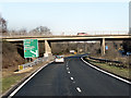
SY9693 : A35 Eastbound, Dorchester Road Bridge by David Dixon A35 Eastbound, Dorchester Road Bridge by David Dixon
geograph for square SY9693
The Bridge carrying Dorchester Road (B3067) over the A35 near Lytchett Minster.
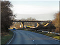
SY9693 : A35 Westbound, Dorchester Road Bridge by David Dixon A35 Westbound, Dorchester Road Bridge by David Dixon
geograph for square SY9693
The Bridge carrying Dorchester Road (B3067) over the westbound A35 near Lytchett Minster.
SY9793 : A35/A350/B3068 Junction (Westbound) by David Dixon A35/A350/B3068 Junction (Westbound) by David Dixon
geograph for square SY9793
The exit slip road from the westbound A35 to the roundabout at the junction with... (more)
SZ2299 : A35 near Little Wootton Inclosure by David Dixon A35 near Little Wootton Inclosure by David Dixon
geograph for square SZ2299
An unimproved single carriageway section of the A35 runs in a north-easterly... (more)
Tags: road:A35   Direction Sign   type:Geograph   camera:Panasonic Lumix TZ60   Road Sign   top:Roads, Road Transport  
SY9793 : A350 Crossing A35 (Eastbound) by David Dixon A350 Crossing A35 (Eastbound) by David Dixon
geograph for square SY9793
The bridges carrying the A350 roundabout over the eastbound A35 at Upton.
SY9793 : Eastbound A35 Junction with A350 by David Dixon Eastbound A35 Junction with A350 by David Dixon
geograph for square SY9793
The exit sliproad from the eastbound A35 to the A350.
SY9592 : Bakers Arms Roundabout, A35 by David Dixon Bakers Arms Roundabout, A35 by David Dixon
geograph for square SY9592
The end of the dual carriageway section of the A35 near Lytchett Minster.
SY9793 : A350 Crossing A35 (Westbound) by David Dixon A350 Crossing A35 (Westbound) by David Dixon
geograph for square SY9793
The bridges carrying the A350 roundabout over the A35 at Upton.
SZ0192 : Poole, Wimborne Road by David Dixon Poole, Wimborne Road by David Dixon
geograph for square SZ0192
Wimborne Road (A35), approaching the junction with Vicarage Road and Dorchester Road.
SZ0192 : Poole, Fernside Road by David Dixon Poole, Fernside Road by David Dixon
geograph for square SZ0192
Fernside Road (A35), approaching the New Inn Junction.
SZ1894 : Southbound A35 towards Christchurch by David Dixon Southbound A35 towards Christchurch by David Dixon
geograph for square SZ1894
SZ2095 : A35 Lyndhurst Road, Southbound near Hinton by David Dixon A35 Lyndhurst Road, Southbound near Hinton by David Dixon
geograph for square SZ2095
SZ2094 : Southbound A35, Lyndhurst Road by David Dixon Southbound A35, Lyndhurst Road by David Dixon
geograph for square SZ2094
SZ2196 : Southbound A35 near Hinton Park by David Dixon Southbound A35 near Hinton Park by David Dixon
geograph for square SZ2196
Tags: road:A35   type:Geograph   camera:Panasonic Lumix TZ60   Road Junction   top:Roads, Road Transport   Trees   top:Woodland, Forest  
SZ2197 : Southbound A35 near North Hinton by David Dixon Southbound A35 near North Hinton by David Dixon
geograph for square SZ2197
SZ2198 : Southbound A35 "High Risk Route" by David Dixon Southbound A35 "High Risk Route" by David Dixon
geograph for square SZ2198
SZ2198 : Southbound A35, Holmsley by David Dixon Southbound A35, Holmsley by David Dixon
geograph for square SZ2198
SU2300 : A35 Southbound through the New Forest by David Dixon A35 Southbound through the New Forest by David Dixon
geograph for square SU2300
SU2605 : A35 Lyndhurst Road by David Dixon A35 Lyndhurst Road by David Dixon
geograph for square SU2605
SU2300 : Northbound A35 Through the New Forest by David Dixon Northbound A35 Through the New Forest by David Dixon
geograph for square SU2300
SZ2299 : Northbound A35 near to Wootton by David Dixon Northbound A35 near to Wootton by David Dixon
geograph for square SZ2299
SZ1894 : Lyndhurst Road (A35) near to Mudeford by David Dixon Lyndhurst Road (A35) near to Mudeford by David Dixon
geograph for square SZ1894
SZ1994 : A35, Lyndhurst Road, Hinton by David Dixon A35, Lyndhurst Road, Hinton by David Dixon
geograph for square SZ1994
SZ1994 : A35, Lyndhurst Road, County Boundary Sign by David Dixon A35, Lyndhurst Road, County Boundary Sign by David Dixon
geograph for square SZ1994
SZ1893 : Christchurch Bypass (A35) near Watermans Park by David Dixon Christchurch Bypass (A35) near Watermans Park by David Dixon
geograph for square SZ1893
The short dual carriageway Christchurch Bypass first opened in 1958.
SZ0591 : Branksome, Poole Road by David Dixon Branksome, Poole Road by David Dixon
geograph for square SZ0591
The junction of Poole Road (A35) with Langley Road and Cromer Road, just to the... (more)
View more in the Image Search or in Browser
View images matching 'A35' anywhere in the tags
Don't click these: PotMel 1 PotMel 2