About tags on Geograph

Public Tags

Related Tags | Coverage Map
Prefix: road    Tag:  A41  
Other tags: A41     without the windscreen:A41    

Showing latest 50 of 87 images tagged with road:A41 tag.

View all tagged images - In Browser
:

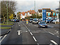
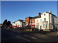
SO9098 : Wolverhampton, Chapel Ash (A41) by David Dixon Wolverhampton, Chapel Ash (A41) by David Dixon
geograph for square SO9098
Tags: road:A41   top:City, Town Centre   type:Geograph   camera:Panasonic DMC-G7   Primary Road   top:Roads, Road Transport  
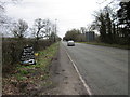
SJ5340 : Layby on the A41 Whitchurch Bypass by David Dixon Layby on the A41 Whitchurch Bypass by David Dixon
geograph for square SJ5340
Tags: road:A41   Bypass   type:Geograph   type:Geograph   Heavy Goods Vehicle   HGV   camera:IPhone 7   Layby   Parking Area   top:Roads, Road Transport  
SJ4366 : A41 Road Bridge No 122B by Mat Fascione A41 Road Bridge No 122B by Mat Fascione
geograph for square SJ4366
Tags: road:A41   subject:Bridge   Canal Towpath   top:Canals   type:Geograph   top:Lowlands   top:Paths   Road Bridge   top:Roads, Road Transport  
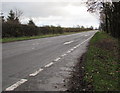
SJ5538 : Southbound A41 at Prees Heath by David Dixon Southbound A41 at Prees Heath by David Dixon
geograph for square SJ5538
SJ5538 : A41 Southbound near to Prees Heath by David Dixon A41 Southbound near to Prees Heath by David Dixon
geograph for square SJ5538
SJ5539 : Southbound A41 near Whitchurch by David Dixon Southbound A41 near Whitchurch by David Dixon
geograph for square SJ5539
SJ5539 : A41 Heath Road, South of Whitchurch by David Dixon A41 Heath Road, South of Whitchurch by David Dixon
geograph for square SJ5539
Tags: road:A41   Dual Carriageway   type:Geograph   camera:Nikon P100   Primary Road   top:Roads, Road Transport  
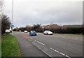
SP0191 : The Expressway, West Bromwich by David Dixon The Expressway, West Bromwich by David Dixon
geograph for square SP0191
SO9892 : Bridge over Black Country New Road by David Dixon Bridge over Black Country New Road by David Dixon
geograph for square SO9892
SO9892 : Black Country New Road, West Bromwich by David Dixon Black Country New Road, West Bromwich by David Dixon
geograph for square SO9892
SO9991 : West Bromwich, The Expressway by David Dixon West Bromwich, The Expressway by David Dixon
geograph for square SO9991
SP0091 : The Expressway, West Bromwich by David Dixon The Expressway, West Bromwich by David Dixon
geograph for square SP0091
SJ5240 : Bridge over A41 near Belton by David Smith Bridge over A41 near Belton by David Smith
geograph for square SJ5240
Tags: road:A41   subject:Bridge   type:Geograph   top:Roads, Road Transport  
TQ2586 : Flats along the A41 Hendon Way by Christopher Hilton Flats along the A41 Hendon Way by Christopher Hilton
geograph for square TQ2586
Tags: road:A41   A41   road:Dual Carriageway   Dual Carriageway   Dual Carriageway Road   building type:Flats   housing:Flats   Flats   type:Geograph   top:Housing, Dwellings   subject:Road   Road   top:Roads, Road Transport  
SJ8104 : Junction of the Albrighton Bypass and Station Road by Jaggery Junction of the Albrighton Bypass and Station Road by Jaggery
geograph for square SJ8104
The white arrow points WNW along the A41 Albrighton Bypass at the Station Road... (more)
SP9411 : Keepers Lodge by Bikeboy Keepers Lodge by Bikeboy
geograph for square SP9411
On the A4251 which is the old A41 and before that, Akeman Street (Roman Road).... (more)
Tags: road:A41   subject:House   top:Roads, Road Transport   near:Tring   top:Village, Rural Settlement  
SJ4856 : The A41 (Whitchurch Road) by Jeff Buck The A41 (Whitchurch Road) by Jeff Buck
geograph for square SJ4856
The A41 (Whitchurch Road) heading north from Chowley Lodge. Taken from the... (more)
Tags: A Road (Classified A)   road:A41   county:Cheshire   place:Chowley   country:England   Road   top:Roads, Road Transport  
SP1381 : A41, Warwick Road, near Olton by David Dixon A41, Warwick Road, near Olton by David Dixon
geograph for square SP1381
The A41, Warwick Road at its junction with Westbourne Road.
SP1480 : A41, Warwick Road, Solihull by David Dixon A41, Warwick Road, Solihull by David Dixon
geograph for square SP1480
Warwick Road, just north of Seven Star Road. At this point, Warwick Road is now... (more)
SJ8005 : Cycle route, Cosford by Jaggery Cycle route, Cosford by Jaggery
geograph for square SJ8005
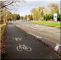
National Cycle Network route 81 alongside the A41 Newport Road.
SJ5340 : The A41 (Whitchurch Bypass) by Jeff Buck The A41 (Whitchurch Bypass) by Jeff Buck
geograph for square SJ5340
The A41 heading south west around Whitchurch.
Tags: road:A41   Bypass   country:England   subject:Road   top:Roads, Road Transport   county:Shropshire   place:Whitchurch  
SJ5340 : The A41 (Whitchurch Bypass) by Jeff Buck The A41 (Whitchurch Bypass) by Jeff Buck
geograph for square SJ5340
Looking north-west along the A41 from a lay-by to the south-west of Whitchurch.
Tags: road:A41   Bypass   country:England   subject:Road   top:Roads, Road Transport   county:Shropshire   place:Whitchurch  
SJ5242 : The A41 near Whitchurch by Jeff Buck The A41 near Whitchurch by Jeff Buck
geograph for square SJ5242
The A41 heading towards the junction/roundabout with the A49.
Tags: road:A41   country:England   Road   top:Roads, Road Transport   county:Shropshire   place:Whitchurch  
SJ4851 : The A41 at Duckington by Jeff Buck The A41 at Duckington by Jeff Buck
geograph for square SJ4851
The A41 heading north from the junction with Duckington Lane at Duckington Grange.
Tags: A Road (Classified A)   road:A41   county:Cheshire   place:Duckington   country:England   Junction   Road   top:Roads, Road Transport   top:Village, Rural Settlement  
SJ4561 : The A41 (Whitchurch Road) at Hatton Heath by Jeff Buck The A41 (Whitchurch Road) at Hatton Heath by Jeff Buck
geograph for square SJ4561
The A41 heading south at Hatton Heath.
Tags: A Road (Classified A)   road:A41   county:Cheshire   country:England   place:Hatton Heath   top:Roads, Road Transport   top:Village, Rural Settlement  
SJ4561 : The A41 (Whitchurch Road) at Hatton Heath by Jeff Buck The A41 (Whitchurch Road) at Hatton Heath by Jeff Buck
geograph for square SJ4561
The A41 heading north at Hatton Heath.
Tags: A Road (Classified A)   road:A41   county:Cheshire   country:England   place:Hatton Heath   top:Roads, Road Transport   top:Village, Rural Settlement  
SJ5242 : The A41 near Whitchurch by Jeff Buck The A41 near Whitchurch by Jeff Buck
geograph for square SJ5242
The A41 heading south west around Whitchurch.
Tags: road:A41   country:England   Road   county:Shropshire   place:Whitchurch  
SP1183 : A41, Warwick Road, Acock's Green by David Dixon A41, Warwick Road, Acock's Green by David Dixon
geograph for square SP1183
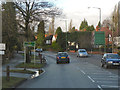
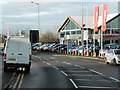
The A41 passing the Nissan car dealership at Acock's Green.
SO9793 : Black Country Spine Road crossing the Tame Valley Canal by David Dixon Black Country Spine Road crossing the Tame Valley Canal by David Dixon
geograph for square SO9793
SO9795 : Black Country New Road, Moxley by David Dixon Black Country New Road, Moxley by David Dixon
geograph for square SO9795
SJ4560 : The A41 (Whitchurch Road) by Jeff Buck The A41 (Whitchurch Road) by Jeff Buck
geograph for square SJ4560
Approaching Platt's Lane.
SP0489 : The corner of Grove Lane and Soho Road by Gerald England The corner of Grove Lane and Soho Road by Gerald England
geograph for square SP0489
The A41 into Birmingham.
Tags: road:A41   type:Geograph   bank:Lloyds   top:Roads, Road Transport   top:Suburb, Urban Fringe  
SP0290 : Birmingham Road by Gerald England Birmingham Road by Gerald England
geograph for square SP0290
The A41 towards West Bromwich.
Tags: road:A41   type:Geograph   top:Roads, Road Transport  
SP0290 : Allied Bakeries, West Bromwich by Gerald England Allied Bakeries, West Bromwich by Gerald England
geograph for square SP0290
By the A41, Birmingham Road.
Tags: road:A41   Allied Bakery   Bakery   type:Geograph   top:Industry   top:Roads, Road Transport   place:West Bromwich  
SJ4365 : Christleton Road Bridge carrying A55 over A41 by David Smith Christleton Road Bridge carrying A55 over A41 by David Smith
geograph for square SJ4365
Tags: road:A41   road:A55   subject:Bridge   type:Geograph   top:Roads, Road Transport   top:Suburb, Urban Fringe  
SO9894 : Railway Bridge crossing Black Country New Road near Wednesbury Parkway by David Dixon Railway Bridge crossing Black Country New Road near Wednesbury Parkway by David Dixon
geograph for square SO9894
TQ2486 : Hendon Way by Stephen McKay Hendon Way by Stephen McKay
geograph for square TQ2486
Seen from the footbridge at the Junction with Cricklewood Lane, heavy Friday... (more)
Tags: road:A41   Dual Carriageway   type:Geograph   subject:Road   top:Roads, Road Transport   top:Suburb, Urban Fringe  
SJ8005 : Cosford Filling Station by Gordon Griffiths Cosford Filling Station by Gordon Griffiths
geograph for square SJ8005
The view of the Esso Filling station alongside the A41 Newport Road near Albrighton.
Tags: road:A41   place:Albrighton   Esso Filling Station   subject:Filling Station   type:Geograph   top:Roads, Road Transport  
SJ8104 : East along the Albrighton  Bypass by Jaggery East along the Albrighton Bypass by Jaggery
geograph for square SJ8104
The A41 Albrighton Bypass viewed from near the corner of Station Road at the... (more)
SP0389 : Holyhead Road, Handsworth by Chris Whippet Holyhead Road, Handsworth by Chris Whippet
geograph for square SP0389
SJ5147 : The A41 (Whitchurch Road) near No Man's Heath by Jeff Buck The A41 (Whitchurch Road) near No Man's Heath by Jeff Buck
geograph for square SJ5147
Taken at the junction with Coach Road.
Tags: A Road (Classified A)   road:A41   county:Cheshire   country:England   Junction   place:No Mans Heath   Road   top:Roads, Road Transport   Whitchurch Road  
SJ4949 : The Roundabout at Hampton Heath by Jeff Buck The Roundabout at Hampton Heath by Jeff Buck
geograph for square SJ4949
The roundabout on the A41 (Whitchurch Road) at Hampton Heath.
SJ4856 : Green Lane, Chowley by Jeff Buck Green Lane, Chowley by Jeff Buck
geograph for square SJ4856
Green Lane as it heads towards Chowley from the junction with the A41 (Whitchurch Road).
Tags: A Road (Classified A)   road:A41   county:Cheshire   place:Chowley   country:England   Lane   top:Roads, Road Transport   top:Village, Rural Settlement  
SJ4754 : The Broxton Roundabout by Jeff Buck The Broxton Roundabout by Jeff Buck
geograph for square SJ4754
The Broxton roundabout is hardly bigger than a mini roundabout but is where the... (more)
Tags: A Road (Classified A)   road:A41   road:A534   place:Broxton   county:Cheshire   country:England   top:Roads, Road Transport   Roundabout   top:Village, Rural Settlement  
SJ4851 : Duckington Lane by Jeff Buck Duckington Lane by Jeff Buck
geograph for square SJ4851
Duckington Lane heading towards the junction with the A41 at Duckington Grange.
Tags: A Road (Classified A)   road:A41   county:Cheshire   place:Duckington   country:England   Junction   Lane   Road   top:Roads, Road Transport   top:Village, Rural Settlement  
SJ3873 : A41 (Liverpool Road) near Backford Cross by Jeff Buck A41 (Liverpool Road) near Backford Cross by Jeff Buck
geograph for square SJ3873
Wikipedia LinkExternal link
Tags: road:A41   place:Backford   place:Backford Cross   county:Cheshire   country:England   Road   top:Roads, Road Transport   top:Village, Rural Settlement  
SJ3873 : A41 (Chester Road), Backford Cross by Jeff Buck A41 (Chester Road), Backford Cross by Jeff Buck
geograph for square SJ3873
Wikipedia LinkExternal link
Tags: road:A41   place:Backford   place:Backford Cross   county:Cheshire   country:England   Road   top:Roads, Road Transport   Suburb   top:Suburb, Urban Fringe   top:Village, Rural Settlement  
SP0984 : Warwick Road (A41) Sparkhill by David Dixon Warwick Road (A41) Sparkhill by David Dixon
geograph for square SP0984
SP1083 : Warwick Road, Tyseley by David Dixon Warwick Road, Tyseley by David Dixon
geograph for square SP1083
Warwick Road (A41) passing through Tyseley.
SP1283 : Acock's Green, Warwick Road by David Dixon Acock's Green, Warwick Road by David Dixon
geograph for square SP1283
The A41, Warwick Road, passing through Acock's Green.
View more in the Image Search or in Browser
View images matching 'A41' anywhere in the tags
Don't click these: PotMel 1 PotMel 2