|
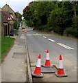
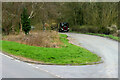
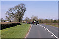
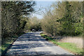
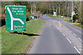
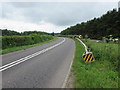
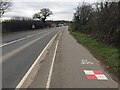
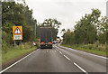
South along the A429 Fosse Way, Stow-on-the-Wold
by Jaggery
geograph for square SP1925
Viewed on September 18th 2018. This part of the A429 is closed to through... (more)
|
|
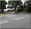
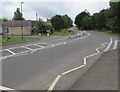
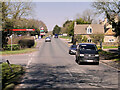
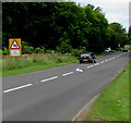
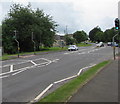
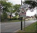
Junction of the A424 and A429 in Stow-on-the-Wold
by Jaggery
geograph for square SP1926
The A424 Evesham Road is on the left. The A429 Fosse Way is on the right.
|
|
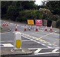
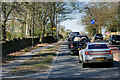
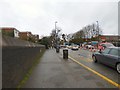
Road closed - access only, A429, Stow-on-the-Wold
by Jaggery
geograph for square SP1925
Viewed from the corner of High Street on September 18th 2018.
The closure of... (more)
|
|
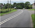
Halford, Fosse Way
by David Dixon
geograph for square SP2645
Halford is a village about 3 miles (5 km) north of Shipston-on-Stour. The... (more)
|

|
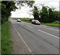
HGV on the A429 at Halford
by David Dixon
geograph for square SP2645
|
|
Layby on the A429 near Ettington
by David Dixon
geograph for square SP2648
|
|
Park Farm
by David Dixon
geograph for square SP2646
At the side of the A429 between Ettington and Halford.
|
|
Warwick Road
by Bob Harvey
geograph for square SP3277
|
|
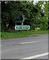
Directions sign facing the A429 in Kemble
by Jaggery
geograph for square ST9897
Ahead on the A429 for Crudwell and Malmesbury.
Turn left for Ewen and South... (more)
|
|
A429 in Kemble
by Jaggery
geograph for square ST9897
The Windmill Road junction is on the right. The West Lane junction is on the... (more)
|
|
From A433 to A429 SW of Cirencester
by Jaggery
for square SP0000
8 miles from Tetbury, the A433 Tetbury Road becomes the A429 Tetbury Road.
|
|
HS2 works, Crackley, June 2022
by Robin Stott
for square SP2974
The view is northwest from a bus on the A429 Kenilworth Road. The approximate... (more)
|
|
Queues likely sign facing the A429 near Cirencester
by Jaggery
geograph for square SU0099
Facing traffic on the A429 approaching the A433 junction SW of Cirencester.
A... (more)
|

|
A429, Moreton-in-Marsh
by David Dixon
geograph for square SP2031
|
|
A429 Fosse Way near Moreton-in-Marsh
by David Dixon
geograph for square SP2030
|
|
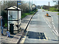
Bus Stop on the A429 at Moreton-in-Marsh
by David Dixon
geograph for square SP2031
|
|
A429, Fosse Way
by David Dixon
geograph for square SP1929
|
|
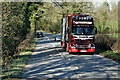
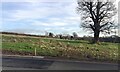
Scania R580 on the A429 near Donnington
by David Dixon
geograph for square SP1928
|
|
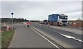
Northbound A429 near Donnington
by David Dixon
geograph for square SP1928
|
|
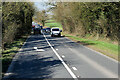
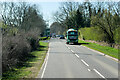
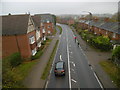
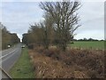
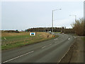
A429 Fosse Way Southbound towards Stow-on-the-Wold
by David Dixon
geograph for square SP1926
|
|
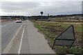
Fosse Way (A429)
by David Dixon
geograph for square SP1927
|
|
A429, Fosse Way, Stow-on-the-Wold
by David Dixon
geograph for square SP1825
|
|
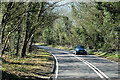
A429 near Maugersbury
by David Dixon
geograph for square SP1824
|
|
A429 Fosseway near Lower Slaughter
by David Dixon
geograph for square SP1722
|
|
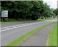
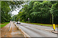
Kenilworth Road
by Ian Capper
geograph for square SP3176
The A429 Kenilworth Road passing through woodland on Stivichall Common.
|
|
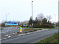
Roundabout on the A429 at Tournament Fields
by Stephen Craven
geograph for square SP2762
The roundabout serves a business park to the west of the main road.
|
|
Crackley, A429
by Mike Faherty
geograph for square SP2973
|
|
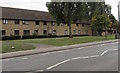
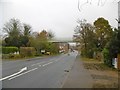
Stow Road housing, Moreton-in-Marsh
by Jaggery
geograph for square SP2032
Viewed across the A429 between Walnut Close and Jameson Court.
|

|
SLOW on the A429 northeast of Kemble
by Jaggery
geograph for square ST9998
On the approach to the junction with this... (more)
|
|
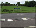
A429 directions facing the road from Ewen, Gloucestershire
by Jaggery
geograph for square ST9998
Turn left for Chippenham, right for Cirencester.
|
|
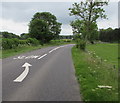
White arrow and SLOW on the A429 near Kemble
by Jaggery
geograph for square ST9998
Double white lines in the middle of the road ahead indicate no overtaking.
|
|
Roadside barrier at a bend in the road near Kemble
by Jaggery
geograph for square ST9998
Black and yellow stripes draw attention to the metal barrier at the edge of the A429.
|
|
Warning sign - bends for three-quarters of a mile, Kemble
by Jaggery
geograph for square ST9997
Facing northbound traffic on the A429.
|
|
Warwick Road
by Gerald England
geograph for square SP3378
The A429 over the railway line to the west of Coventry Station.
|
|
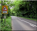
Warning sign - School, Kemble
by Jaggery
geograph for square ST9897
Alongside the A429, the main road through the village,
on the approach to... (more)
|
|
Pelican crossing in Kemble
by Jaggery
geograph for square ST9897
Across the A429 near the Windmill Road junction. Chambers Dictionary states that... (more)
|
|
Tetbury Road towards Cirencester
by Jaggery
geograph for square SP0000
The A429 Tetbury Road heads NE away from the A433 junction.
|
|
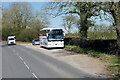
Coach in a Layby near Stow-on-the-Wold
by David Dixon
geograph for square SP1824
Mercedes-Benz Tourismo (CP15 CHP), operated by Chauffeurhire, is parked in a... (more)
|
|
HS2 works, Crackley, June 2022
by Robin Stott
for square SP3073
HS2 in a cutting will pass under the realigned A429 Kenilworth Road on an... (more)
|
|
HS2 works at Crackley, January 2021 (7)
by Robin Stott
geograph for square SP3073
A view across the A429 Kenilworth Road / Coventry Road towards a property beside... (more)
|
|
HS2 enabling works, Crackley, February 2021 (6)
by Robin Stott
geograph for square SP3073
A truck in the livery of Balfour Beatty is parked on a closed length of the... (more)
|
|
A429 Kenilworth Road enters Coventry from the south
by Robin Stott
geograph for square SP3074
This is the start of a magnificent avenue of mature oak and beech that runs... (more)
|
|
HS2 enabling works at Crackley, February 2021 (5)
by Robin Stott
for square SP3073
The approach to an extensive area of works where HS2 will cross the A429... (more)
|
|
HS2 enabling works at Crackley, February 2021 (4)
by Robin Stott
geograph for square SP3074
The approach to an extensive area of works where HS2 will cross the A429... (more)
|
|
A429 approaching M40 junction 15
by Stephen Craven
geograph for square SP2662
|
|
Crackley, footbridge
by Mike Faherty
geograph for square SP2973
Crossing Coventry Road (A429), on the site of a former railway bridge, and on... (more)
|
|
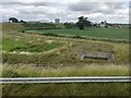
Crop and drainage at Longbridge near Warwick
by Robin Stott
geograph for square SP2662
Longbridge is the local name for the six-way interchange at junction 15 of the... (more)
|
|
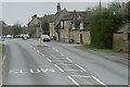
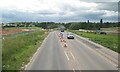
Traffic queue on the A429 Fosse Way
by Julian P Guffogg
geograph for square SP2340
Ongoing roadworks at the time, heading south.
|
|
Wild fowl warning sign alongside the A429, Moreton-in-Marsh
by Jaggery
geograph for square SP2032
On the approach to a duck pond. Link |
|
Mini-roundabout in Moreton-in-Marsh
by Jaggery
geograph for square SP2032
In the A429 High Street at the A44 Oxford Street junction.
|