Public Tags
Showing images tagged with road:A586 tag.
|
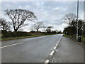
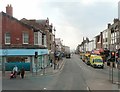
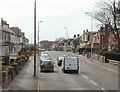
A586, Garstang Road
by David Dixon geograph for square SD3639 |
|
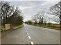
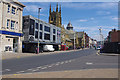
Garstang Road (A586) near Poulton-le-Fylde
by David Dixon geograph for square SD3639 |
|
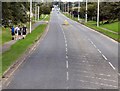
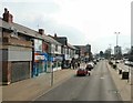
Garstang Road West
by Gerald England geograph for square SD3338 The A586 out of Blackpool.
|
|
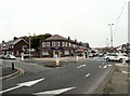
Westcliffe Drive, Layton
by Gerald England geograph for square SD3237 The A586 out of Blackpool. The RBS bank is on the corner of Annesley Avenue.
Tags:
road:A586
Bank (Financial Institution)X
subject:RoadX
top:Roads, Road TransportX
Royal Bank of ScotlandX
|
|
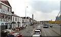
Talbot Road
by Gerald England geograph for square SD3036 The final stretch of the A586 from Poulton-le-Fylde.
|
|
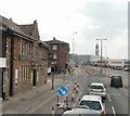
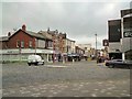
George Street
by Gerald England geograph for square SD3136 The A586 from Poulton-le-Fylde approaching Blackpool around the Talbot Gateway.
|
|
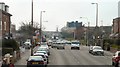
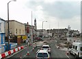
Roadworks on Talbot Road
by Gerald England geograph for square SD3136 The A586 from Poulton-le-Fylde passing the Jennings' New Road Inn.
SD3136 : Sign of the New Road Inn.
Tags:
A Road (Classified A)X
road:A586
Blackpool TowerX
top:Business, Retail, ServicesX
brewer:JenningsX
Public HouseX
top:Roads, Road TransportX
RoadworksX
|
|
Talbot Road, Queenstown
by Gerald England geograph for square SD3137 The A586 from Poulton-le-Fylde to Blackpool.
|
|
Talbot Road, Layton
by Gerald England geograph for square SD3237 The A586 from Poulton-le-Fylde near Layton Cemetery.
|
|
Westcliffe Drive, Layton
by Gerald England geograph for square SD3237 The A586 from Poulton-le-Fylde to Blackpool
|
|
Talbot Road
by Gerald England geograph for square SD3036
The A586 leads down into Talbot Square to end by the North Pier. Lloyds... (more)
Tags:
road:A586
top:Business, Retail, ServicesX
top:City, Town CentreX
type:GeographX
LloydsX
PharmacyX
top:Roads, Road TransportX
Traffic RoundaboutX
|
|
George Street
by Gerald England geograph for square SD3136 The A586 from Poulton-le-Fylde approaching Blackpool around the Talbot Gateway.
|
|
Talbot Road
by Ian Taylor geograph for square SD3036 The west end of Talbot Road at Talbot Square, before building of the tram line... (more)
Tags:
road:A586
top:City, Town CentreX
type:GeographX
Road JunctionX
top:Roads, Road TransportX
subject:StreetX
|