Public Tags
Showing images tagged with road:A594 tag.

|
The old A594 near Long Bridge
by Adrian Taylor
geograph for square NY2523
Prior to the construction of Portinscale by-pass, this was the main A594 road... (more)
|
|
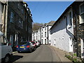
Old A594 road, Portinscale
by Adrian Taylor
geograph for square NY2523
This narrow street in Portinscale was formerly the A594 road linking west... (more)
|

|
Road beside The Derwentwater Hotel
by Adrian Taylor
geograph for square NY2523
This road beside The Derwentwater Hotel in Portinscale was formerly the A594... (more)
|
|
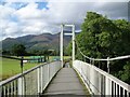
Long Bridge, Portinscale
by Adrian Taylor
geograph for square NY2523
Prior to the construction of Portinscale by-pass, the main A594 road from... (more)
|

|
Leicester City Centre, Burley's Way
by David Dixon
geograph for square SK5805
|

|
St George's Way, Leicester City Centre
by David Dixon
geograph for square SK5904
|

|
Gote Road, Cockermouth
by Graham Robson
geograph for square NY1131
Gote Road, or the A594, on the outskirts of Cockermouth.
|

|
Main Street, Keswick
by Adrian Taylor
geograph for square NY2623
This was the main A594 road from Penrith to Cockermouth and West Cumberland... (more)
|
|
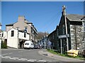
Portinscale
by Adrian Taylor
geograph for square NY2523
This narrow street in Portinscale, urban in appearance, was once the main A594... (more)
|

|
The approach to Long Bridge
by Adrian Taylor
geograph for square NY2523
Formerly the A594 road before Portinscale was by-passed, the original Long... (more)
|
