|
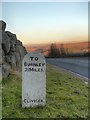
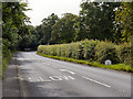
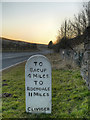
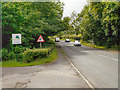
Milestone on the A671
by David Dixon
geograph for square SD8528
Milestone at the side of Bacup Road (A671) near the entrance to Deerplay Quarry.... (more)
|
|
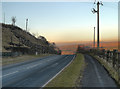
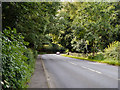
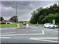
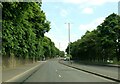
A671 to Burnley
by David Dixon
geograph for square SD8528
Looking towards Burnley on the A671 (Bacup Road) near the entrance to Deerplay Quarry.
|
|
A663 Broadway
by Gerald England
geograph for square SD9207
The A663 towards Chadderton from the slip road off the A671.
|
|
A663 Broadway
by Gerald England
geograph for square SD9207
The A663 towards Shaw crossing the A671 from Oldham to Rochdale.
|
|
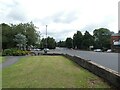
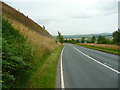
Whalley Road
by David Dixon
geograph for square SD7534
The A671, Whalley Road, passing a milestone.
|
|
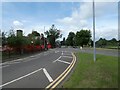
Whalley Road (A671)
by David Dixon
geograph for square SD7534
|
|
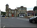
St James Square
by Gerald England
geograph for square SD8623
The roundabout in the centre of town is where the A671 from Rochdale to... (more)
|
|
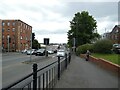
A671, John Street, Rochdale
by Gerald England
geograph for square SD8913
|
|
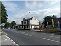
White Hart, Oldham Road, Royton
by Gerald England
geograph for square SD9206
|
|
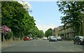
Oldham Road
by Gerald England
geograph for square SD9207
The A671 out of Royton.
|
|
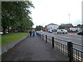
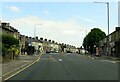
Rochdale Road, Royton
by Gerald England
geograph for square SD9107
The A671 through Royton. On the right is the former Royton Town Hall. Next to... (more)
|
|
The A671 passing Dyneley Knoll, Cliviger
by Humphrey Bolton
geograph for square SD8628
|
|
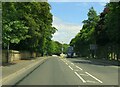
Whalley Road (A671)
by David Dixon
geograph for square SD7439
|
|
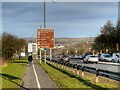
Burnley, Westway
by David Dixon
geograph for square SD8232
The A671 approaching Burnley town centre from Junction 10 of the M65 motorway.
|
|
To Bacup and Rochdale
by David Dixon
geograph for square SD8528
Milestone at the side of Bacup Road (A671) near the entrance to Deerplay Quarry.... (more)
|
|
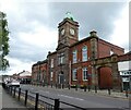
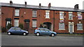
456 to 452 Oldham Road, Rochdale
by Steven Haslington
geograph for square SD9010
From left to right are numbers 456 to 452 Oldham Road, which are terraced... (more)
|
|
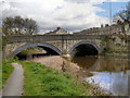
River Calder, Padiham Bridge
by David Dixon
geograph for square SD7933
The bridge taking the A671, Burnley Road, over the River Calder at Padiham.
|
|
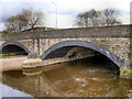
Padiham Bridge, River Calder
by David Dixon
geograph for square SD7933
The bridge carrying Burnley Road (A671) over the River Calder at Padiham.
|

|
Bridge Inn
by David Dixon
geograph for square SD7933
The Bridge Inn, a public house at the junction of the A671, Burnley Road, with... (more)
|
|
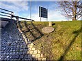
Marker Post and Shaft Cover above Gannow Tunnel
by David Dixon
geograph for square SD8232
Two stone items near the entrance to the underpass below the A671 Cavalry Way... (more)
|
|
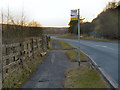
Bus Stop on Bacup Road
by David Dixon
geograph for square SD8528
|
|
Whalley Road at Bridge Hey Wood
by David Dixon
geograph for square SD7534
|
|
Padiham Road heading to Burnley
by Steve Daniels
geograph for square SD8233
|
|
Padiham Road heading to Burnley
by Steve Daniels
geograph for square SD8133
|
|
Padiham Road heading to Burnley
by Steve Daniels
geograph for square SD8133
|
|
Padiham Road heading to Burnley
by Steve Daniels
geograph for square SD8133
|
|
Padiham Road heading to Burnley
by Steve Daniels
geograph for square SD8033
|
|
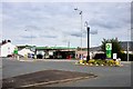
Roundabout Service Station, Clitheroe
by David Dixon
geograph for square SD7442
|
|
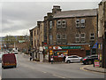
Padiham Post Office, Burnley Road
by David Dixon
geograph for square SD7933
|
|
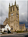
St Leonard's Parish Church
by David Dixon
geograph for square SD7933
St Leonard's Church, on Church Street, is the town's parish church... (more)
|