Public Tags
Other tags: A69
Showing images tagged with road:A69 tag.
|
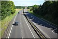
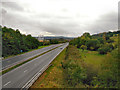
The A69 at Thornbrough
by Jeff Buck geograph for square NZ0164 The A69 at Thornbrough near Corbridge.
Tags:
road:A69
A69
place:CorbridgeX
Dual CarriagewayX
country:EnglandX
type:GeographX
county:NorthumberlandX
top:Roads, Road TransportX
|
|
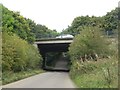
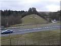
Underpass under the A69
by Graham Robson geograph for square NZ1467 An underpass allowing Drove Road to pass under the A69 to the north of Throckley.
|
|
View west along the A69
by Graham Robson geograph for square NY9365 Looking west along the A69 which passes to the north of Hexham. The bridge the... (more)
|
|
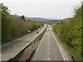
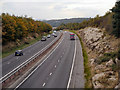
The A69 south of Haltwhistle
by Graham Robson geograph for square NY7063 Looking westbound along the A69 bypass around Haltwhistle.
|
|
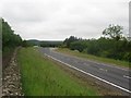
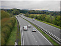
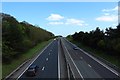
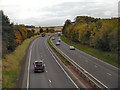
A69 Towards Hexham
by David Dixon geograph for square NY9565 Looking westwards along the A69 between Corbridge and Hexham.
|
|
A69 Towards Corbridge
by David Dixon geograph for square NY9565 Looking eastwards along the A69 between Hexham and Corbridge.
|
|
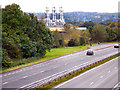
A69 and Chipboard Factory, Bridge End, Hexham
by David Dixon geograph for square NY9565 Looking westwards along the A69, NY9464 : Egger's Chipboard Factory, Hexham is prominent in the background,
Tags:
road:A69
ChimneyX
FactoryX
top:IndustryX
Major RoadX
top:Roads, Road TransportX
top:Suburb, Urban FringeX
Trunk RoadX
|
|
Layby on the A69
by David Dixon geograph for square NY9665 Layby between Hexham and Corbridge on the eastbound A69.
|
|
A69 Between Hexham and Corbridge
by David Dixon geograph for square NY9665 Looking eastwards (towards Corbridge) from the lay by on the A69 between Hexham... (more)
|
|
Bee on the former railway embankment, A69, Haltwhistle
by Christine Johnstone geograph for square NY7163 This is the former branch line to Alston, bisected by the A69 Haltwhistle... (more)
Tags:
road:A69
Bee SculptureX
By-PassX
BypassX
subject:EmbankmentX
type:GeographX
place:HaltwhistleX
former:Railway EmbankmentX
top:RailwaysX
top:Roads, Road TransportX
Roadside ArtworkX
|

|
A69 Eastbound, near Warwick-on-Eden
by David Dixon geograph for square NY4656 A tractor travels eastwards on the A69 towards Warwick-on-Eden.
|
|
"A wide track which goes under the road bridge"
by Christine Johnstone geograph for square NY7163 On Walk 06 [Bastles and Burn, Railways and Reivers] in The Haltwhistle Rings... (more)
Tags:
road:A69
path:FootpathX
type:GeographX
place:HaltwhistleX
Public FootpathX
top:Roads, Road TransportX
subject:TrackX
|
|
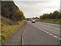
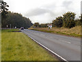
The A69 north of Heddon-on-the-Wall
by Graham Robson geograph for square NZ1267 A dual carriageway section of the busy cross country road passing north of... (more)
|
|
A69 near Corbridge
by David Dixon geograph for square NZ0065 Looking east from the bridge at Aydon Road.
Tags:
road:A69
top:Roads, Road TransportX
|
|
A69 at Gallowhill
by David Dixon geograph for square NZ0065 Looking west from the bridge at Aydon Road.
Tags:
road:A69
top:Roads, Road TransportX
|
|
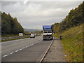
A69 Westbound
by David Dixon geograph for square NY4556 Tags:
road:A69
top:Roads, Road TransportX
|
|
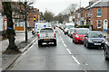
Warwick Road (A69) near Brunton Park
by David Dixon geograph for square NY4155 Tags:
road:A69
type:GeographX
camera:Panasonic DMC-G7X
top:Roads, Road TransportX
top:Suburb, Urban FringeX
Traffic LightsX
|
|
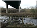
The A69 crossing Haltwhistle Burn
by Christine Johnstone geograph for square NY7163 On the eastern edge of Haltwhistle.
Tags:
road:A69
type:GeographX
place:HaltwhistleX
Haltwhistle BurnX
top:Rivers, Streams, DrainageX
top:Roads, Road TransportX
subject:ViaductX
|
|
A red sandstone bus stop
by Rose and Trev Clough geograph for square NY4656 On the A69 at Warwick-on-Eden.
|
|
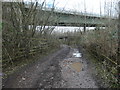
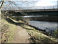
"Going under the road bridge"
by Christine Johnstone geograph for square NY7163 On Walk 06 [Bastles and Burn, Railways and Reivers] in The Haltwhistle Rings... (more)
Tags:
road:A69
structure:Concrete BridgeX
path:FootpathX
type:GeographX
place:HaltwhistleX
subject:PathX
top:PathsX
Public FootpathX
River South TyneX
Riverbank PathX
Riverside PathX
river:South TyneX
|