About tags on Geograph

Public Tags

Related Tags | Coverage Map
Prefix: road    Tag:  A7  
Other tags: A7     without the windscreen:A7    

Showing latest 50 of 97 images tagged with road:A7 tag.

View all tagged images - In Browser
:

NY4055 : Carlisle Market Cross by Adrian Taylor Carlisle Market Cross by Adrian Taylor
geograph for square NY4055
Also known as the Carliol Cross or less commonly by the antiquated name of the... (more)
NY4055 : The Crescent, Carlisle by Alan Murray-Rust The Crescent, Carlisle by Alan Murray-Rust
geograph for square NY4055
The curved frontage complements the circular eastern tower of the Citadel. Built... (more)
NY4055 : County Hotel, Court Square, Carlisle by Alan Murray-Rust County Hotel, Court Square, Carlisle by Alan Murray-Rust
geograph for square NY4055
Not to be confused with the former County Hotel next to the railway station (now... (more)
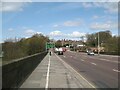
NY3959 : Road sign on the A7 at Carlisle by M J Richardson Road sign on the A7 at Carlisle by M J Richardson
geograph for square NY3959
The A7 from Carlisle approaching J44 of the M6, where one has the option to take... (more)
Tags: road:A7   place:Carlisle   place:Cumbria   type:Geograph   top:Grassland   top:Lowlands   M6 Motorway   Motorway J44   subject:Road Junction   top:Roads, Road Transport   top:Suburb, Urban Fringe   Trees  
NT3167 : The A7 southward by Barbara Carr The A7 southward by Barbara Carr
geograph for square NT3167
The A7 junction from the roundabout on the City of Edinburgh Bypass (the A720).
Tags: road:A7   top:Roads, Road Transport   Roundabout  
NY3956 : Eden Bridge, Carlisle by Adrian Taylor Eden Bridge, Carlisle by Adrian Taylor
for square NY3956
Eden Bridge carries the main A7 road northwards from Carlisle City Centre; it is... (more)
Tags: A7   road:A7   subject:Bridge   place:Carlisle   Carlisle   top:City, Town Centre   type:Cross Grid   long distance footpath:Cumbria Coastal Way   long distance path:Cumbria Coastal Way   Cumbria Coastal Way   river:Eden (Cumbria)   Eden Bridge   top:Lowlands   Pavement   river:River Eden   top:Roads, Road Transport   Stanwix  
NY3768 : South parapet of Longtown Bridge by Adrian Taylor South parapet of Longtown Bridge by Adrian Taylor
geograph for square NY3768
Longtown Bridge carries the A7 Carlisle to Edinburgh road over the River Esk.... (more)
NT4249 : The A7 at Fountainhall by M J Richardson The A7 at Fountainhall by M J Richardson
geograph for square NT4249
One of several stretches of contraflow on the A7, the result of road works... (more)
Tags: road:A7   near:Fountainhall   top:Lowlands   top:Roads, Road Transport   subject:Roadworks   Roadworks   place:Scottish Borders   Traffic Cones   Traffic Lights  
NT3265 : The A7 at Hardengreen by M J Richardson The A7 at Hardengreen by M J Richardson
geograph for square NT3265
At Hardengreen roundabout. The longest new bridge on the 'new'... (more)
NT3264 : Newbattle Viaduct - 3 by Alan Murray-Rust Newbattle Viaduct - 3 by Alan Murray-Rust
geograph for square NT3264
As seen from the adjacent A7.
Tags: road:A7   top:Business, Retail, Services   Car Repairers   listed building:Category B   top:Historic Sites and Artefacts   place:Lothianbridge   name:Newbattle Viaduct   former:Railway Viaduct   top:Railways   top:Roads, Road Transport   building material:Sandstone   building material:Stone and Brick  
NT4727 : The A7 at Ladylands by M J Richardson The A7 at Ladylands by M J Richardson
geograph for square NT4727
Heading south on the 'A7 Borders historic route to Carlisle and M6'
Tags: road:A7   top:Farm, Fishery, Market Gardening   top:Lowlands   top:Roads, Road Transport   place:Selkirk  
NY3894 : Sykefoot and the A7 by M J Richardson Sykefoot and the A7 by M J Richardson
geograph for square NY3894
An isolated cottage on the A7, not far from the head of the Ewes Water.
Tags: road:A7   Cottage   Dumfries and Galloway   near:Ewes   top:Farm, Fishery, Market Gardening   type:Geograph   top:Grassland   subject:Hill   top:Housing, Dwellings   top:Roads, Road Transport   top:Uplands  
NT4055 : The A7 at Nettlingflat roadend by M J Richardson The A7 at Nettlingflat roadend by M J Richardson
geograph for square NT4055
Looking across the Gala Water valley, where there are considerable works going... (more)
Tags: road:A7   subject:Construction   top:Farm, Fishery, Market Gardening   river:Gala Water   top:Grassland   place:Heriot   top:Lowlands   top:Railways   top:Roads, Road Transport   place:Scottish Borders   Valley  
NT4250 : The A7 and the Borders Railway by M J Richardson The A7 and the Borders Railway by M J Richardson
geograph for square NT4250
The new Borders Railway sharing the valley of the Gala Water with the A7.... (more)
Tags: road:A7   railway:Borders Railway   subject:Construction   top:Construction, Development   near:Fountainhall   top:Grassland   top:Lowlands   top:Railways   top:Rivers, Streams, Drainage   top:Roads, Road Transport   place:Scottish Borders   subject:Valley   top:Woodland, Forest  
NT4053 : Hangingshaw Quarry by M J Richardson Hangingshaw Quarry by M J Richardson
geograph for square NT4053
Rejuvenated by the reconstruction of the Borders Railway and the A7. The track... (more)
Tags: road:A7   railway:Borders Railway   top:Construction, Development   top:Farm, Fishery, Market Gardening   subject:Farmland   place:Heriot   top:Lowlands   Quarry   subject:Quarry   top:Quarrying, Mining   top:Railways   top:Roads, Road Transport   place:Scottish Borders  
NT3957 : Rushy grassland by the A7 by M J Richardson Rushy grassland by the A7 by M J Richardson
for square NT3957
A low wet patch, part of the Cakemuir Burn, between the A7 and the line of the... (more)
Tags: road:A7   top:Farm, Fishery, Market Gardening   subject:Farmland   top:Grassland   top:Lowlands   place:Midlothian   Pasture   top:Rivers, Streams, Drainage   place:Tynehead   Waverley Route  
NY4055 : Behind the Earl of Lonsdale by Gerald England Behind the Earl of Lonsdale by Gerald England
geograph for square NY4055
The Grade II listed... (more)
Tags: date:1802   date:1844   date:1845   road:A6   road:A7   place:Carlisle   top:City, Town Centre   Earl of Lonsdale   type:Geograph   Grade II Listed   top:Historic Sites and Artefacts   person:M L Watson   top:Roads, Road Transport   Sculpture   Statue  
NT4054 : New bridge and road at Heriot by M J Richardson New bridge and road at Heriot by M J Richardson
geograph for square NT4054
A new access to Heriot from the A7 Edinburgh-Galashiels road, over the... (more)
Tags: road:A7   road:B709   railway:Borders Railway   river:Gala Water   place:Heriot   top:Lowlands   top:Moorland   New Railway Line   subject:Railway   top:Railways   subject:Road Junction   top:Roads, Road Transport   place:Scottish Borders   Traffic Cones   top:Village, Rural Settlement  
NT3364 : The Borders Railway at Newtongrange by M J Richardson The Borders Railway at Newtongrange by M J Richardson
geograph for square NT3364
Looking south from Station Road to the bridge carrying Murderdean Road [A7] over... (more)
Tags: road:A7   railway:Borders Railway   subject:Bridge   top:Construction, Development   top:Lowlands   place:Midlothian   place:Newtongrange   subject:Railway   bridge:Road Over Railway   top:Roads, Road Transport   top:Village, Rural Settlement  
NT4153 : The A7 at Stagebank by M J Richardson The A7 at Stagebank by M J Richardson
geograph for square NT4153
Looking north from the junction with the road to the houses at Stagebank. The... (more)
Tags: road:A7   top:Farm, Fishery, Market Gardening   top:Grassland   near:Heriot   top:Lowlands   Road Junction   subject:Road Junction   top:Roads, Road Transport   place:Scottish Borders  
NT3857 : The A7 at Middleton Moor by M J Richardson The A7 at Middleton Moor by M J Richardson
geograph for square NT3857
With a profusion of signs - seventeen in total - county boundary; road junction... (more)
Tags: road:A7   railway:Borders Railway   top:Boundary, Barrier   County Boundary   top:Lowlands   place:Midlothian   subject:Road   Road Signs   top:Roads, Road Transport   place:Scottish Borders  
NT4820 : Junction with the A7, Synton Mossend by Barbara Carr Junction with the A7, Synton Mossend by Barbara Carr
geograph for square NT4820
I had to show the bus-driver my OS map to get dropped-off here!
NY3684 : High Street, Langholm by Richard Dorrell High Street, Langholm by Richard Dorrell
geograph for square NY3684
Viewed from its junction with Thomas Telford Road. The High Street is part of the A7.
Tags: road:A7   top:City, Town Centre   place:Langholm   top:Roads, Road Transport  
NT4726 : The A7 south of Selkirk by M J Richardson The A7 south of Selkirk by M J Richardson
geograph for square NT4726
Looking north.
Tags: road:A7   type:Geograph   Lay-by   subject:Road   top:Roads, Road Transport   Roadside Trees   place:Scottish Borders   near:Selkirk   top:Uplands   top:Woodland, Forest  
NT4624 : Spoil heap by a disused road by M J Richardson Spoil heap by a disused road by M J Richardson
geograph for square NT4624
A by-passed section of the A7, cutting out what was quite a sharp bend.
Tags: road:A7   top:Boundary, Barrier   top:Derelict, Disused   Gate   type:Geograph   top:Grassland   top:Moorland   subject:Road   top:Roads, Road Transport   place:Scottish Borders   near:Selkirk   Spoil Heap   top:Uplands  
NY3959 : Premier Inn, J44, M6 by M J Richardson Premier Inn, J44, M6 by M J Richardson
geograph for square NY3959
Actually on the A7 in Kingstown Industrial Estate, just off the exit from the M6, J44.
Tags: road:A7   top:Business, Retail, Services   place:Carlisle   place:Cumbria   type:Geograph   subject:Hotel   top:Lowlands   M6 Motorway   hotel:Premier Inn   top:Roads, Road Transport   top:Suburb, Urban Fringe  
NY4056 : Eden Bridge by Adrian Taylor Eden Bridge by Adrian Taylor
geograph for square NY4056
Eden Bridge carrying the A7 road over the River Eden near to Carlisle City... (more)
NY4099 : The A7 at Mosspaul by M J Richardson The A7 at Mosspaul by M J Richardson
geograph for square NY4099
With pylon and road monitoring cameras, clouds and the western slope of Dod Hill.
Tags: road:A7   Cameras   Clouds   Electricity Pylon   top:Energy Infrastructure   type:Geograph   Hillside   Lay-by   subject:Road   top:Roads, Road Transport   place:Scottish Borders   near:Teviothead   top:Uplands  
NY4099 : Mosspaul on the A7 by M J Richardson Mosspaul on the A7 by M J Richardson
geograph for square NY4099
Labelled as a hotel on some scales of map, but fenced off and certainly not... (more)
Tags: road:A7   Dumfries and Galloway   type:Geograph   former:Hotel   top:Housing, Dwellings   top:Moorland   subject:Road   top:Roads, Road Transport   place:Scottish Borders   near:Teviothead   Trees   top:Uplands  
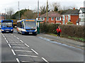
NY3957 : Carlisle, Bus Stop on Scotland Road (A7) by David Dixon Carlisle, Bus Stop on Scotland Road (A7) by David Dixon
geograph for square NY3957
Stagecoach Cumbria & North Lancashire 25226 (PX08 FMV), an Optare V1110... (more)
NY4057 : Carlisle, Scotland Road (A7) by David Dixon Carlisle, Scotland Road (A7) by David Dixon
geograph for square NY4057
Tags: road:A7   top:City, Town Centre   type:Geograph   camera:Panasonic DMC-G7   top:Roads, Road Transport  
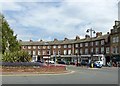
NY4055 : English Street, Carlisle... by Bill Harrison English Street, Carlisle... by Bill Harrison
geograph for square NY4055
...basking in August sunshine. This marks the start of the A7 road to... (more)
NT2573 : North Bridge, Edinburgh by M J Richardson North Bridge, Edinburgh by M J Richardson
geograph for square NT2573
The bridge carrying the A7 over Edinburgh Waverley Station, extensively... (more)
NT4737 : The A7 northwest of Galashiels by M J Richardson The A7 northwest of Galashiels by M J Richardson
geograph for square NT4737
Looking southwest to Meigle Hill
Tags: road:A7   top:Farm, Fishery, Market Gardening   Farmland   near:Galashiels   type:Geograph   top:Grassland   top:Lowlands   Pasture   subject:Road   top:Roads, Road Transport   place:Scottish Borders   top:Woodland, Forest  
NT4737 : The A7 near Galashiels by M J Richardson The A7 near Galashiels by M J Richardson
geograph for square NT4737
Looking across to pasture on the lower slopes of Buckholm Hill.
Tags: road:A7   Farmland   subject:Field   near:Galashiels   type:Geograph   top:Lowlands   Pasture   top:Roads, Road Transport   place:Scottish Borders   Tourist Information   top:Woodland, Forest  
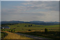
NT5018 : The A7 north of Hawick by Christopher Hilton The A7 north of Hawick by Christopher Hilton
geograph for square NT5018
The farm in the middle distance is at Newton, in NT5017.
Tags: road:A Road   A Road (Classified A)   road:A7   Farm   top:Farm, Fishery, Market Gardening   Fields   type:Geograph   Hills   Road   View   subject:View  
NT2672 : Clerk Street, Edinburgh by M J Richardson Clerk Street, Edinburgh by M J Richardson
geograph for square NT2672
Looking south along the A7, early afternoon.
Tags: road:A7   top:Business, Retail, Services   place:Edinburgh   top:Housing, Dwellings   top:Lowlands   place:Newington   top:Roads, Road Transport   subject:Street   Street Scene   top:Suburb, Urban Fringe   Tenements   Traffic  
NT3265 : Scotrail train on the Borders Railway by M J Richardson Scotrail train on the Borders Railway by M J Richardson
geograph for square NT3265
Crossing the A7 at Hardengreen on the day of the Royal opening of the new line... (more)
Tags: road:A7   railway:Borders Railway   Bridge   top:Lowlands   place:Midlothian   place:Newtongrange   subject:Railway   top:Railways   top:Roads, Road Transport   Train  
NY3868 : Milestone on the A7, south side of Longtown by Rose and Trev Clough Milestone on the A7, south side of Longtown by Rose and Trev Clough
geograph for square NY3868
The milestone is opposite the Memorial Hall. It has been restored quite... (more)
NT4936 : The Borders Railway in Galashiels by M J Richardson The Borders Railway in Galashiels by M J Richardson
geograph for square NT4936
A tight squeeze between the retaining embankment of the High Road [B6452, above]... (more)
NT4836 : The Borders Railway passes under the A7 by M J Richardson The Borders Railway passes under the A7 by M J Richardson
geograph for square NT4836
As it enters Galashiels from the west. Sleepers down, but no rails yet.
NT4054 : The Borders Railway at Heriot by M J Richardson The Borders Railway at Heriot by M J Richardson
geograph for square NT4054
Looking north from the new bridge carrying the B709 over the Gala... (more)
Tags: road:A7   railway:Borders Railway   top:Construction, Development   place:Heriot   top:Lowlands   New Railway Line   subject:Railway   top:Railways   top:Roads, Road Transport   place:Scottish Borders   top:Village, Rural Settlement  
NT3265 : Train at Hardengreen by M J Richardson Train at Hardengreen by M J Richardson
geograph for square NT3265
What is probably one of the first on the new Borders Railway, consisting of... (more)
Tags: road:A7   railway:Borders Railway   top:Construction, Development   top:Lowlands   place:Midlothian   Network Rail   place:Newtongrange   subject:Railway   Railway Bridge Over Road   subject:Railway Train   Railway Wagons   top:Railways   top:Roads, Road Transport  
NT4540 : The A7 in Wedale by M J Richardson The A7 in Wedale by M J Richardson
geograph for square NT4540
Just a glimpse, in the centre of the picture, as it follows the Gala Water down... (more)
Tags: road:A7   Cattle   top:Farm, Fishery, Market Gardening   subject:Farmland   top:Grassland   top:Lowlands   top:Roads, Road Transport   place:Scottish Borders   top:Uplands   Valley   place:Wedale   top:Woodland, Forest  
NT4449 : Retaining wall at Burnhouse Mains by M J Richardson Retaining wall at Burnhouse Mains by M J Richardson
geograph for square NT4449
Presumably necessitated by the widening of the A7 at some point.
Tags: road:A7   Farm Building   top:Farm, Fishery, Market Gardening   top:Lowlands   Retaining Wall   top:Roads, Road Transport   place:Scottish Borders   near:Stow   subject:Wall  
NT4449 : Farmhouse and buildings at Burnhouse Mains by M J Richardson Farmhouse and buildings at Burnhouse Mains by M J Richardson
geograph for square NT4449
Hard by the A7 north of Stow.
Tags: road:A7   top:Farm, Fishery, Market Gardening   subject:Farmhouse   Farmhouse   House   subject:House   top:Housing, Dwellings   top:Lowlands   top:Roads, Road Transport   place:Scottish Borders   near:Stow  
NT4153 : Houses at Stagebank by M J Richardson Houses at Stagebank by M J Richardson
geograph for square NT4153
Looking south along the A7 to the small group of houses in the valley of the Gala Water.
NT4055 : Bridge over the Borders Railway by M J Richardson Bridge over the Borders Railway by M J Richardson
geograph for square NT4055
Being altered rather than renewed, for the Borders Railway as it approaches... (more)
Tags: road:A7   railway:Borders Railway   top:Farm, Fishery, Market Gardening   subject:Farmland   near:Heriot   top:Housing, Dwellings   subject:Landscape   top:Lowlands   Pasture   top:Railways   top:Rivers, Streams, Drainage   top:Roads, Road Transport   place:Scottish Borders   subject:Valley   Waverley Line  
NT4054 : New bridge for the Borders Railway by M J Richardson New bridge for the Borders Railway by M J Richardson
geograph for square NT4054
Looking across the valley of Shoestanes Burn, which becomes the Gala Water in... (more)
Tags: road:A7   railway:Borders Railway   Bridge Construction   top:Construction, Development   place:Heriot   top:Lowlands   subject:Railway   top:Railways   top:Roads, Road Transport   place:Scottish Borders   top:Village, Rural Settlement  
NT4054 : Communication hub at Heriot by M J Richardson Communication hub at Heriot by M J Richardson
geograph for square NT4054
Junction of the A7 and B709, bus stop, telephone box. Also the Borders Railway,... (more)
Tags: road:A7   railway:Borders Railway   Bus Stop   subject:Communications   top:Communications   place:Heriot   top:Lowlands   top:Railways   Road Junction   top:Roads, Road Transport   place:Scottish Borders   Telephone Box   top:Village, Rural Settlement  
View more in the Image Search or in Browser
View images matching 'A7' anywhere in the tags
Don't click these: PotMel 1 PotMel 2