Public Tags
Other tags:
road classification:B4101
Showing images tagged with road:B4101 tag.
|
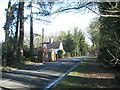
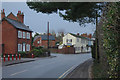
B4101 Pound House Lane past Umberslade Park
by Robin Stott
geograph for square SP1371
The drive to the Business Centre and the Hall is opposite the buildings.
|
|
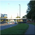
The B4101 Spring Lane crosses M40
by Robin Stott
geograph for square SP1471
|
|
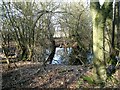
Pond by the B4101 Pound House Lane, Browns Green
by Robin Stott
geograph for square SP1371
|
|
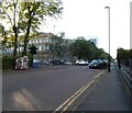
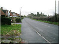
Butts Road
by Gerald England
geograph for square SP3278
The B4101 coming out from the Ringway.
|
|
Kenilworth Road, Knowle
by Stephen McKay
geograph for square SP1876
The B4101 seen looking towards the centre of Knowle from near the end of Kixley Lane.
|
|
Herald Avenue
by Gerald England
geograph for square SP3078
The B4101 from Tile Hill towards Coventry.
|
|
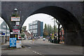
Spon End
by Stephen McKay
geograph for square SP3279
Spon End is a stretch of the B4101 to the west of Coventry city centre. Spon End... (more)
|
|
The Butts
by Gerald England
geograph for square SP3278
But for the fact it is a one-way street towards the camera The Butts would... (more)
|
|
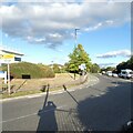
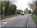
Start of 30mph zone, B4101, approaching Hockley Heath
by Robin Stott
geograph for square SP1573
|
|
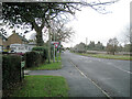
Aylesbury Road B4101, a continuation of Vicarage Road towards Hockley Heath
by Robin Stott
geograph for square SP1673
The tall conifers, right of centre, are on the former Aylesbury House hotel site.
|
|
Junction of Vicarage Road and Grange Road B4101, approaching Hockley Heath
by Robin Stott
geograph for square SP1673
The tall conifers, right of centre, are on the former Aylesbury House hotel site.
|
|
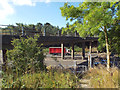
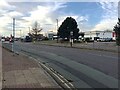
Citroën dealership, Herald Avenue, Coventry Business Park
by Robin Stott
geograph for square SP3078
|
|
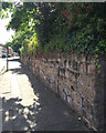
Old stone boundary wall, Hearsall Lane, Earlsdon, west Coventry
by Robin Stott
geograph for square SP3278
|
|
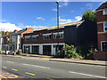
Abandoned showroom/offices, 69-71 Hearsall Lane, Earlsdon, west Coventry
by Robin Stott
geograph for square SP3178
|