
|
B4585 bus stop and shelter, Manorbier
by Jaggery
geograph for square SS0698
On the north side of the B4585, between Vicarage Fields and Longfield.
This... (more)
|

|
Warning sign - road narrows, B4585 Manorbier
by Jaggery
geograph for square SS0698
Facing traffic on the B4585 heading towards the centre of the village.
A... (more)
|
|
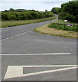
Bier Cross junction, Manorbier
by Jaggery
geograph for square SS0698
On the right, the B4585 towards the centre of Manorbier diverges from the A4139... (more)
|
|
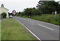
Start of the 30 zone at the eastern edge of Manorbier
by Jaggery
geograph for square SS0798
The 40mph speed limit along the B4585 drops to 30mph. The Sabre website states... (more)
|
|
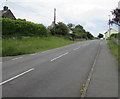
East along the B4585 Manorbier
by Jaggery
geograph for square SS0798
Viewed from opposite the Longfield junction... (more)
|

|
B4585 passes the Manorbier boundary sign
by Jaggery
geograph for square SS0698
South along the B4585 past this Link green sign. |
|
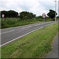
End of the 30 zone at the eastern edge of Manorbier
by Jaggery
geograph for square SS0798
The 40mph speed limit signs alongside the B4585 mark the end of the 30mph speed... (more)
|

|
Road towards Warlow's Cottage, Manorbier
by Jaggery
geograph for square SS0697
The B4585 towards Grade II listed Warlow's Cottage.... (more)
|

|
Row of three cottages, Manorbier
by Jaggery
geograph for square SS0697
Alongside the B4585, the main road through the village.
Double yellow lines on... (more)
|

|
Warning sign - bends ahead on the B4585 towards the centre of Manorbier
by Jaggery
geograph for square SS0698
June vegetation obscures the text (For ½ mile) below the red-edged triangular sign.
|

|
Minor road junction in Manorbier
by Jaggery
geograph for square SS0698
An unnamed minor road heads east away from the B4585 towards the A4139 out of... (more)
|

|
Grade II listed Warlow's Cottage, Manorbier
by Jaggery
geograph for square SS0697
The early 19th century single-storey cottage on the corner
of the B4585 and... (more)
|

|
Virgin Media telecoms cabinet, Manorbier
by Jaggery
geograph for square SS0697
On the west side of the B4585, the main road through Manorbier.
|

|
High stone wall, Manorbier
by Jaggery
geograph for square SS0697
On the east side of the B4585, the main road through Manorbier.
|

|
From stone wall to Pound Walls, Manorbier
by Jaggery
geograph for square SS0697
Pound Walls is a house Link on the east side... ( more) |

|
Wall flowers and hedge, Manorbier
by Jaggery
geograph for square SS0698
On opposite sides of the B4585 in south Pembrokeshire.
|

|
Queen Elizabeth II postbox alongside the B4585, Manorbier
by Jaggery
geograph for square SS0698
Located between a hedge and a public footpath.
|

|
Warning sign - No footway for 650 yards, Manorbier
by Jaggery
geograph for square SS0698
The sign faces southbound traffic on the B4585. The text is also in Welsh.
|

|
End of the 30 zone in Manorbier
by Jaggery
geograph for square SS0698
The speed limit on the B4585 increases to the National Speed Limit.
|

|
Wall postbox, Manorbier
by Jaggery
geograph for square SS0697
On the south side of the B4585, the main road through the village.
|

|
Bus shelter and tree, Manorbier
by Jaggery
geograph for square SS0697
Viewed across the B4585, the main road through the village.
|

|
Castle Cottages, Manorbier
by Jaggery
geograph for square SS0697
Row of three cottages opposite a bus stop on the B4585, the main road through the village.
|

|
Start of the 30 zone on the northern approach to central Manorbier
by Jaggery
geograph for square SS0698
The National Speed Limit on the B4585 drops to 30mph.
|

|
Houses east of Warlows Meadow, Manorbier
by Jaggery
geograph for square SS0697
Viewed across the B4585 from the corner of Warlows Meadow.
|

|
The Coach House and Fernley Lodge, Manorbier
by Jaggery
geograph for square SS0697
On the south side of the B4585. On June 15th 2016, an EU Referendum... (more)
|

|
Castle Inn, Manorbier
by Jaggery
geograph for square SS0697
Viewed across the B4585, the main road through the village.
|
|
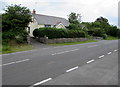
Sunnybank, Manorbier
by Jaggery
geograph for square SS0798
Holiday bungalow on the north side of the B4585 at the eastern edge of the village.
|
