|
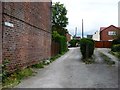
Chapel Street, off Portland Road
by Christine Johnstone
geograph for square SK4753
The track to the left [north] is Chapel Street. The track to the right [south]... (more)
|

|
Figure 20 in Chapel Street, Liverpool (2)
by David Hillas
for square SJ3490
This figure 20 is outside the Unity Building at 20 Chapel Street where Liverpool... (more)
|

|
Figure 20 in Chapel Street, Liverpool (1)
by David Hillas
for square SJ3490
This photo shows the figure 20 outside 20 Chapel Street L3 9AG where Liverpool... (more)
|

|
Chapel Market
by Ian Capper
geograph for square TQ3183
Originally Chapel Street, renamed Chapel Market in the 1930s. The building on... (more)
|

|
1 Chapel Street and side of 7 Smith Street, Warwick
by Robin Stott
geograph for square SP2865
No.1 is on the left. Maybe the street has been renumbered for convenience; all... (more)
|

|
Side of King's High, Chapel Street, Warwick
by Robin Stott
geograph for square SP2865
Much of Chapel Street is occupied by various departments of King's High, an... (more)
|

|
St Nicholas Creative Arts Centre, Chapel Street, Warwick
by Robin Stott
geograph for square SP2865
A department of King's High, an independent day school for girls. The... (more)
|

|
Lower end of Chapel Street
by Robin Stott
geograph for square SP2865
Chapel Street is a mix of houses, small businesses and parts of King's High... (more)
|

|
Shakespeare's Gardens, New Place, Stratford-upon-Avon
by Rod Grealish
geograph for square SP2054
A view across the Great Garden of Shakespeare's Gardens to the rear of... (more)
|

|
Chapel Street
by Ian Capper
geograph for square TQ4401
Victorian terraced housing on Chapel Street.
|
|
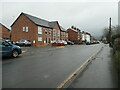
Newer houses on Chapel Street, Hazel Grove
by Christine Johnstone
geograph for square SJ9287
Built on the site of a 19th century school and a 20th century shirt factory.
|

|
6, 4, and 2 Chapel Street, Warwick
by Robin Stott
geograph for square SP2865
No.2 (right) is another outpost of King's High, an independent day school... (more)
|

|
16 (left) and 14 Chapel Street, Warwick
by Robin Stott
geograph for square SP2865
In between the departments and facilities of King's High (an independent... (more)
|

|
Chapel Street, looking west towards Hillam
by Christine Johnstone
geograph for square SE5128
There is an 8 metre spot height just beyond the road junction.
|

|
Chapel Street, looking east towards Hillam Common Lane
by Christine Johnstone
geograph for square SE5128
At the eastern edge of Hillam village.
|
|
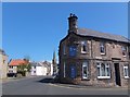
Junction of Walkergate and Chapel Street
by Barbara Carr
geograph for square NT9953
The Cobbled Yard Hotel stands at the junction: the church in the background is... (more)
|

|
Buxton Methodist Church
by Ian Capper
geograph for square SK0573
Methodist church on the corner of Chapel Street and Market Place originally... (more)
|

|
Cormorant sculpture
by Ian Capper
geograph for square TQ4401
Cormorant sculpture by local sculptor Christian Funnell on West Quay, unveiled... (more)
|

|
Right return of Nash's House, Stratford-upon-Avon
by Rod Grealish
geograph for square SP2054
Nash's House, Chapel Street. It contains the New Place Museum. It was... (more)
|

|
Border, Great Garden, New Place, Stratford upon Avon
by Rod Grealish
geograph for square SP2054
The border on the south side of the Great Garden, New Place, the site of... (more)
|

|
The Terrestrial Sphere, Shakespeare's Gardens
by Rod Grealish
for square SP2054
The Terrestrial Sphere illustrates the world as Shakespeare would have known it.... (more)
|

|
The Greenwood Tree, Shakespeare's Gardens
by Rod Grealish
for square SP2054
The Greenwood Tree was commissioned from local sculpture Adam Barrett by the... (more)
|

|
Shakespeare's Gardens, New Place, Stratford-upon-Avon
by Rod Grealish
geograph for square SP2054
The knot garden looking north-east. A knot garden is a garden style popular in... (more)
|
