|
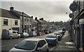
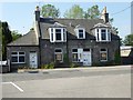
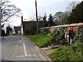
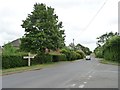
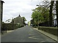
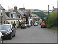
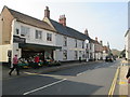
Main Street, Ballygawley
by Rossographer
geograph for square H6357
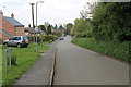
Main Street in the small County Tyrone village of Ballygawley.
|
|
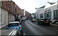
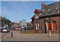
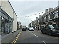
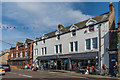
Main Street, Cavan
by Rossographer
geograph for square H4205
Main Street in Cavan town with a large branch of Dunnes Stores... (more)
|
|
The end of Main Street
by Ian Capper
geograph for square NU0050
The southern end of Main Street, with the East Coast Main Line on an embankment... (more)
|
|
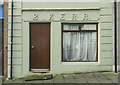
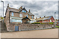
Old shop, Ballygawley
by Rossographer
for square H6357
"B. Kerr" on Main Street in Ballygawley. Such shopfronts are now... (more)
|
|
An anonymous inn (hotel?) on Alford Main Street
by Stanley Howe
geograph for square NJ5715
Facing the entrance road to Alford Station Museum (Stewart Street?). It (no name... (more)
|
|
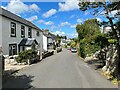
Main Street, Bardsea
by Adrian Taylor
geograph for square SD3074
|
|
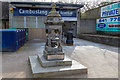
A small fountain outside Cambuslang train station in Glasgow
by Garry Cornes
geograph for square NS6360
A small fountain situated outside the entrance to Cambuslang train station on... (more)
|
|
Main Street, Cadoxton, Barry
by Jaggery
geograph for square ST1368
From the corner of Vere Street.
|
|
Village pump, Main Street, Bessingby
by Christine Johnstone
geograph for square TA1566
Once the source of drinking water for the villagers.
|
|
Leak in the estate wall, Main Street, Bessingby
by Christine Johnstone
geograph for square TA1566
There is a pond in the parkland to the right / north, and the ground is still... (more)
|
|
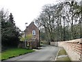
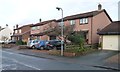
Detached houses, Hensall
by Christine Johnstone
geograph for square SE5923
On the north side of Main Street.
|
|
Extended houses, Main Street, Low Bradley
by Christine Johnstone
geograph for square SE0048
On with an attic conversion, one with a porch.
|
|
Main Street, Newtongrange
by Jim Barton
for square NT3364
Main Street from its junction with Lingerwood Road. In the foreground is one of... (more)
|
|
The Crescent and Main Street
by Ian Capper
geograph for square NU0050
c.1970s(?) housing at the southern end of Main Street, with the Victorian... (more)
|
|
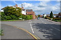
Main Street
by Ian Capper
geograph for square NU2131
Looking along Main Street from its junction with King Street.
|
|
Bend in Main Street, Thistleton
by Christine Johnstone
geograph for square SK9117
Looking eastwards from the edge of the village.
|
|
Right for Market Overton
by Christine Johnstone
geograph for square SK9117
Road junction as Fosse Lane turns into Thistleton's Main Street. Part of... (more)
|
|
Main Street
by Ian Capper
geograph for square NU0051
c.1970s(?) housing at the southern end of Main Street.
|
|
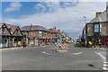
Junction of Main Street and college Street, East Bridgford
by Julian P Guffogg
geograph for square SK6942
|
|
Heading down Main Street, Seahouses
by Eirian Evans
geograph for square NU2132
|
|
181 - 183 Main Street
by Ian Capper
geograph for square NU0051
The rear of 181 - 183 Main Street, a pair of late 19th Century semi-detached... (more)
|
|
Main Street, Horkstow
by J.Hannan-Briggs
geograph for square SE9818
Heading south through the village.
|
|
Main Street, Dorrington
by Julian P Guffogg
geograph for square TF0852
Looking east.
|
|
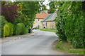
Main Street, near Digby
by Julian P Guffogg
geograph for square TF0754
Towards Ashby de la Launde.
|
|
Main Street, Fiskerton
by Julian P Guffogg
geograph for square SK7351
Heading north east.
|
|
Main Street, Laneham
by J.Hannan-Briggs
geograph for square SK8076
|
|
Junction of Drayton Road and Main Street
by J.Hannan-Briggs
geograph for square SK7876
Retford left, Rampton right.
|
|
Main Street leaving Stokeham
by J.Hannan-Briggs
geograph for square SK7776
Near Beardsall Farm.
|
|
Bend in Main Street
by J.Hannan-Briggs
geograph for square SK7777
Turning west, near Rampton Hospital.
|
|
Main Street, Woolsthorpe by Belvoir
by J.Hannan-Briggs
geograph for square SK8333
|
|
Main Street, Laxton
by J.Hannan-Briggs
geograph for square SK7167
St Michael's church in the distance.
|
|
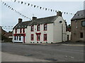
Red Lion Inn, Main Street, Chirnside
by M J Richardson
geograph for square NT8656
|

|
Main Street in Stanbury
by Steve Daniels
geograph for square SE0037
|
|
Main Street in Stanbury
by Steve Daniels
geograph for square SE0037
|
|
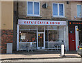
Cafe on Main Street, Newtongrange
by Jim Barton
for square NT3363
Cafe and takeaway business near the junction with Lingerwood Road.
|
|
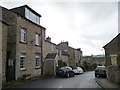
Main Street, Carnwath
by Jim Barton
geograph for square NS9846
Also the A70 to Carstairs and Cumnock.
|
|
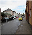
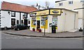
Corner shop, Lower Largo
by Bill Kasman
geograph for square NO4102
This small general store (previously a cafe) is situated at the bottom of... (more)
|
|
Public toilets
by Bill Kasman
geograph for square NO4202
In Temple car park off Main Street, Lower Largo can be found these public... (more)
|
|
Main Street, Oxton
by M J Richardson
geograph for square NT4953
With the valley of the Leader Water beyond. Do not be misled by the telephone... (more)
|
|
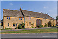
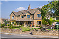
Farm Court
by Ian Capper
geograph for square SP1039
Housing on Main Street, converted from former farm buildings in the late 20th Century(?).
|
|
Seahouses Co-op
by Ian Capper
geograph for square NU2131
Small supermarket on Main Street. The buildings here are first shown on the... (more)
|
|
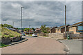
Path from car park, Lower Largo
by Bill Kasman
geograph for square NO4102
This path is Station Wynd. It runs from the rough car park in this image... (more)
|
|
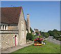
Cutting the Grass, East Challow
by Des Blenkinsopp
geograph for square SU3888
Looking down Main Street from outside what looks like the old school.
|
|
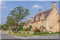
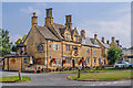
Sycamore House
by Ian Capper
geograph for square SP1039
16th/17th Century house on Main Street. Grade II listed - see... (more)
|
|
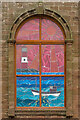
Window, Seahouses Methodist Church
by Ian Capper
for square NU2131
Stained glass window in the façade of Seahouses Methodist Church on Main Street... (more)
|
|
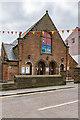
Seahouses Methodist Church
by Ian Capper
geograph for square NU2131
Methodist Church on Main Street, completed in 1926 with an opening date of 3... (more)
|
|
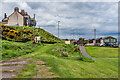
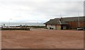
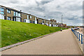
Spittal Promenade
by Ian Capper
geograph for square NU0051
Looking along the promenade alongside Spittal Beach with the rear of houses in... (more)
|
|
High Street. Holt
by Martin Dawes
geograph for square TG0738
|
|
Orchard Villa and Pear Tree Villa
by Ian Capper
geograph for square SP1039
Pair of early 20th Century semi-detached villas, first marked on the 1923 25 inch map.
|
|
The Bell Inn
by Ian Capper
geograph for square SP1039
17th Century pub with accommodation, previously The Blue Bell. Grade II listed... (more)
|