Public Tags
Other tags: Mill Lane
lane:Mill Lane
looking towards:Mill Lane
near:Mill Lane
off:Mill Lane
on:Mill Lane
place:Mill Lane
street:Mill Lane
taken from:Mill Lane
to:Mill Lane
Showing images tagged with road:Mill Lane tag.
|
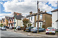
49 - 54 Mill Lane
by Ian Capper geograph for square TQ2865 Two late 19th Century three house terraces in Mill Lane, first marked on the... (more)
|

|
Mill Mount
by Ian Capper geograph for square SE5951 Looking along Mill Mount with Mill Mount Lodge (see SE5951 : Mill Mount Lodge) on the right.... (more)
Tags:
type:Geograph
road:Mill Lane
road:Mill Mount
building:Mill Mount Lodge
top:Suburb, Urban Fringe
place:York
|

|
Mill Lane
by Ian Capper geograph for square SS9943 Houses in Mill Lane. On the left is no 7, dating from the late 18th Century and... (more)
Tags:
building:7 Mill Lane
building:Castle Mill
place:Dunster
type:Geograph
Grade II Listed
Grade II(star) Listed
top:Housing, Dwellings
road:Mill Lane
top:Village, Rural Settlement
|
|
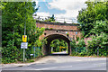
Mill Lane
by Ian Capper geograph for square TQ1656 Looking along Mill Lane (the name referring to the former Fetcham Mill) as it... (more)
Tags:
type:Geograph
place:Leatherhead
road:Mill Lane
top:Railways
top:Roads, Road Transport
top:Suburb, Urban Fringe
|

|
Mill Lane/Church Road junction
by Ian Capper geograph for square ST2122 Cottages at the junction of Mill Lane and Church Road.
Tags:
road:Church Road
type:Geograph
top:Housing, Dwellings
road:Mill Lane
top:Suburb, Urban Fringe
place:Taunton
place:Trull
|

|
Strawberry Lodge
by Ian Capper geograph for square TQ2865 House on the corner of Strawberry Lane and Mill Lane, built c.1685 for Josias... (more)
Tags:
place:Carshalton
church:Carshalton Baptist Church
top:Educational Sites
type:Geograph
Grade II Listed
school:Greenholm School
person:Josias Dewey
person:Josias Dewye
road:Mill Lane
top:Religious Sites
road:Strawberry Lane
building:Strawberry Lodge
top:Suburb, Urban Fringe
|

|
Off Mill Lane
by Ian Capper geograph for square SU1482 Field off Mill Lane with houses in Dunsley Vale, East Wichel, in the background.
Tags:
road:Dunsley Vale
place:East Wichel
top:Farm, Fishery, Market Gardening
type:Geograph
road:Mill Lane
place:Swindon
|
|
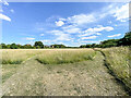
Off Mill Lane
by Ian Capper geograph for square SU1482 Field off Mill Lane with houses in Dunsley Vale, East Wichel, in the left background.
Tags:
road:Dunsley Vale
place:East Wichel
top:Farm, Fishery, Market Gardening
type:Geograph
road:Mill Lane
place:Swindon
|
|
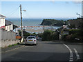
Mill Lane junction with Broadmeadow View, Teignmouth
by Robin Stott geograph for square SX9273 Mill Lane drops steeply down. In view is the mouth of the River Teign with the... (more)
Tags:
Edge of Town
Hill Slope
top:Housing, Dwellings
top:Lowlands
road:Mill Lane
Residential Area
top:Roads, Road Transport
top:Suburb, Urban Fringe
postcode district:TQ14
|

|
Mill Lane
by Ian Capper geograph for square TQ2864 Late 19th Century terraced housing in Mill Lane, first marked on the 1896 25 inch map.
|

|
Mill Lane
by Ian Capper geograph for square TQ2865 19th Century houses in Mill Lane, some in three house terraces and some... (more)
|

|
Sewer vent column, Mill Lane
by Ian Capper geograph for square TQ2865 Sewer vent column in Mill Lane, by Three Arch Bridge, one of at least 31 such... (more)
Tags:
place:Carshalton
type:Geograph
Grade II Listed
road:Mill Lane
top:Railways
Sewer Vent Column
Sewer Vent Pipe
Stink Pole
Stinkpipe
top:Suburb, Urban Fringe
bridge:Three Arch Bridge
|
|
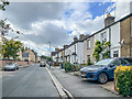
Mill Lane
by Ian Capper geograph for square TQ2865 Late 19th Century terraced housing in Mill Lane. The nearest block ha a name... (more)
|
|
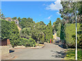
Mill Lane
by Ian Capper geograph for square SU1483 Short side stub off Mill Lane.
Tags:
type:Geograph
top:Housing, Dwellings
road:Mill Lane
place:Okus
top:Suburb, Urban Fringe
place:Swindon
|
|
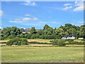
Off Mill Lane
by Ian Capper geograph for square SU1482 Field off Mill Lane with houses in Field Rise in the background and aWulfric... (more)
|

|
Mill Lane
by Ian Capper geograph for square SS9843 Houses in Mill Lane with West Street in the background.
Tags:
place:Dunster
type:Geograph
top:Housing, Dwellings
road:Mill Lane
top:Village, Rural Settlement
|
|
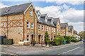
40 - 48 Mill Lane
by Ian Capper geograph for square TQ2864 Two terraces built c.2000 as part of the Grove Mill Place redevelopment behind the road.
|

|
Mill Lane
by Ian Capper geograph for square TL1396 Looking along Mill Lane to its junction with Church Street. On the left is the... (more)
Tags:
place:Alwalton
Coach House
type:Geograph
Grade II Listed
top:Housing, Dwellings
road:Mill Lane
near:Peterborough
Stables
top:Village, Rural Settlement
|
|
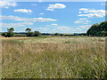
Off Mill Lane
by Ian Capper geograph for square SU1382 Field off Mill Lane at West Leaze, part of which is earmarked for inclusion in... (more)
Tags:
top:Construction, Development
top:Farm, Fishery, Market Gardening
type:Geograph
road:Mill Lane
place:Swindon
place:West Leaze
place:Wichelstowe
|
|
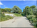
Mill Lane
by Ian Capper geograph for square SU1483 Lane connecting West Leaze and the Swindon suburb of Okus, seen here before it... (more)
|
|
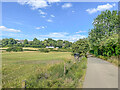
Mill Lane
by Ian Capper for square SU1482 Lane connecting West Leaze and the Swindon suburb of Okus and on to Old Town,... (more)
|
|
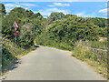
Mill Lane
by Ian Capper geograph for square SU1482 Lane connecting West Leaze and the Swindon suburb of Okus and on to Old Town,... (more)
|

|
Drive to River Cottage
by Ian Capper geograph for square TQ1656 Drive leading to River Cottage from the end of Mill Lane. The cottage itself is... (more)
Tags:
place:Fetcham
type:Geograph
road:Mill Lane
top:Paths
building:River Cottage
top:Roads, Road Transport
top:Suburb, Urban Fringe
|

|
Mill Lane is steep
by Robin Stott geograph for square SX9373 Tags:
Bikes
top:Coastal
Cyclists
building material:Limestone
road:Mill Lane
top:Roads, Road Transport
top:Suburb, Urban Fringe
postcode district:TQ14
Wall
|

|
Castle Mill
by Ian Capper geograph for square SS9943 Mill and gateway to Dunster Castle, dating from the late 17th Century, situated... (more)
Tags:
river:Avill
building:Castle Mill
place:Dunster
type:Geograph
Grade II(star) Listed
top:Housing, Dwellings
road:Mill Lane
top:Rivers, Streams, Drainage
top:Village, Rural Settlement
|

|
Mill Lane Bridge [No 1], from the south
by Christine Johnstone geograph for square SK5803 Crossing the Grand Union Canal in Leicester [a canalised section of the River Soar].
Tags:
subject:Bridge
top:Canals
type:Geograph
canal:Grand Union
place:Leicester
road:Mill Lane
bridge:Road Over Canal
river:Soar
|

|
View of the harbour from Mill Lane, Teignmouth
by Robin Stott geograph for square SX9373 The lighting masts are at the rugby ground behind Bitton Park Road. At sea, a... (more)
Tags:
top:Coastal
top:Docks, Harbours
road:Mill Lane
Steep
top:Suburb, Urban Fringe
postcode district:TQ14
|

|
Teignmouth Community School, Mill Lane
by Robin Stott geograph for square SX9273 So said a sign by the road at the time of the photo. Local street map says... (more)
Tags:
Edge of Town
top:Educational Sites
colour:Grey
top:Lowlands
road:Mill Lane
Residential Area
top:Suburb, Urban Fringe
Timberclad
postcode district:TQ14
|

|
Bridge House
by Ian Capper geograph for square ST6235 House on Mill Lane. Grade II listed - see... (more)
Tags:
place:Alhampton
building:Bridge House
type:Geograph
Grade II Listed
top:Housing, Dwellings
road:Mill Lane
top:Village, Rural Settlement
|

|
Three Arch Bridge
by Ian Capper geograph for square TQ2865 Bridge carrying the Mitcham Junction to Sutton railway over the River Wandle and... (more)
Tags:
place:Carshalton
type:Geograph
road:Mill Lane
top:Railways
Sewer Vent Column
Sewer Vent Pipe
Stink Pole
Stinkpipe
top:Suburb, Urban Fringe
bridge:Three Arch Bridge
|

|
Three Arches Bridge
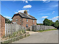
by Ian Capper geograph for square TQ2865 Bridge carrying the Mitcham Junction to Sutton railway over Mill Lane and the... (more)
|
|
3 Westleaze
by Ian Capper geograph for square SU1382 House on Mill Lane at West Leaze.
Tags:
building:3 Westleaze
type:Geograph
top:Housing, Dwellings
road:Mill Lane
place:Swindon
place:West Leaze
|

|
Reservoir by Mill Lane, Teignmouth
by Robin Stott geograph for square SX9273 The reservoir occupies a slightly elevated position on a ridge – the great... (more)
Tags:
Covered Reservoir
Edge of Town
top:Lowlands
road:Mill Lane
Residential Area
top:Suburb, Urban Fringe
postcode district:TQ14
top:Water Resources
|
|
The Palmerston
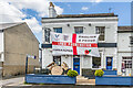
by Ian Capper geograph for square TQ2864 Pub in Mill Street, dating from 1868 and historically the Lord Palmerston but... (more)
Tags:
top:Business, Retail, Services
place:Carshalton
England Flag
type:Geograph
pub:Lord Palmerston
road:Mill Lane
Pub
top:Suburb, Urban Fringe
pub:The Palmerston
|

|
Narrow boats awaiting hire
by Rod Grealish geograph for square SJ9922 The narrow boats are moored on the Staffordshire and Worcestershire canal near... (more)
Tags:
operator:Anglo Welsh
top:Canals
type:Geograph
place:Great Haywood
location:Haywood Junction
road:Mill Lane
Moored Narrowboats
top:Sport, Leisure
postcode district:ST18
district council:Stafford
county:Staffordshire
top:Village, Rural Settlement
|

|
Bridge No 109 at start of Staffs and Worcs canal, Haywood Junction
by Rod Grealish geograph for square SJ9922 Bridge No 109 is the "last" bridge on the Staffordshire and... (more)
Tags:
Bridge No109
subject:Canal Junction
top:Canals
type:Geograph
Grade II Listed
place:Great Haywood
Haywood Junction
road:Mill Lane
top:Sport, Leisure
postcode district:ST18
district council:Stafford
county:Staffordshire
canal:Staffordshire and Worcestershire Canal
canal:Trent and Mersey Canal
top:Village, Rural Settlement
|
