Public Tags
Other tags: North Street
looking towards:North Street
off:North Street
on:North Street
to:North Street
Showing images tagged with road:North Street tag.

|
North Street, Belfast
by Rossographer geograph for square J3374 Lower North Street in Belfast. Yards from the main city centre, it remains... (more)
Tags:
place:Belfast
Belfast
Belfast City Centre
Black & White Photography
Black and White
Black and White Photograph
Black and White Photography
top:Business, Retail, Services
City Centre
top:City, Town Centre
top:Derelict, Disused
type:Geograph
on:Lower North Street
Lower North Street
on:North Street
North Street
road:North Street
top:Roads, Road Transport
subject:Street
|

|
2 Bridge Street and 1 North Street
by Ian Capper geograph for square TQ1656 2 Bridge Street, on the left, was built in 1928 for the National Provincial Bank... (more)
Tags:
building:1 North Street
building:2 Bridge Street
top:Business, Retail, Services
top:City, Town Centre
type:Geograph
Grade II Listed
place:Leatherhead
road:North Street
|

|
1A - 5 North Street
by Ian Capper geograph for square TQ1656 Buildings on the west side of North Street. On the left are nos 1A and 1B,... (more)
Tags:
building:1A North Street
building:1B North Street
building:3 North Street
top:Business, Retail, Services
top:City, Town Centre
church:Congregational Church
type:Geograph
place:Leatherhead
road:North Street
|

|
2 Bridge Street and 1 - 5 North Street
by Ian Capper geograph for square TQ1656 2 Bridge Street, on the left, was built in 1928 for the National Provincial Bank... (more)
Tags:
building:1 North Street
building:2 Bridge Street
top:Business, Retail, Services
top:City, Town Centre
type:Geograph
Grade II Listed
place:Leatherhead
road:North Street
|

|
North Street, Lurgan
by Rossographer geograph for square J0858 North Street in Lurgan.
Tags:
top:City, Town Centre
type:Geograph
place:Lurgan
Lurgan
North Street
road:North Street
top:Roads, Road Transport
subject:Street
|

|
Street Art, Belfast
by Rossographer geograph for square J3374 "Let me unsee" by Asbestos Link
 on North... (more) Tags:
subject:Art
near:Belfast
place:Belfast
top:City, Town Centre
type:Geograph
Hit the North
road:North Street
North Street
top:People, Events
top:Roads, Road Transport
Royal Avenue (Belfast)
Street Art
|

|
22 - 34 North Street
by Ian Capper geograph for square TQ1656 Buildings on North Street where it meets Station Road and Bull Hill. The... (more)
Tags:
building:32 - 34 North Street
road:Bull Hill
top:Business, Retail, Services
top:City, Town Centre
type:Geograph
place:Leatherhead
road:North Street
road:Station Road
building:The Approach
|

|
North Street, Belfast
by Rossographer geograph for square J3374 One of the few remaining shops still trading on North Street is the popular... (more)
Tags:
place:Belfast
Belfast
top:Business, Retail, Services
top:City, Town Centre
top:Derelict, Disused
type:Geograph
North Street
road:North Street
subject:Street
Vacant Building
Vacant Premises
Vacant Sites
|

|
North Street, Belfast
by Rossographer geograph for square J3374 The saga of North Street rumbles on with little change since 2019 J3374 : North Street, Belfast... (more)
Tags:
Belfast
place:Belfast
top:City, Town Centre
top:Derelict, Disused
type:Geograph
road:North Street
North Street
subject:Street
Vacant Building
Vacant Premises
Vacant Sites
|

|
Dunstan View
by Ian Capper geograph for square NU2131 Terrace of houses on a street marked with this end undeveloped on the 1897 25... (more)
Tags:
road:Dunstan View
type:Geograph
top:Housing, Dwellings
road:North Street
place:Seahouses
top:Village, Rural Settlement
|

|
Dunstan View
by Ian Capper geograph for square NU2131 Terrace of houses on a street marked with this end undeveloped on the 1897 25... (more)
Tags:
road:Dunstan View
type:Geograph
top:Housing, Dwellings
road:North Street
place:Seahouses
top:Village, Rural Settlement
|

|
Bridges ironwork
by Ian Capper geograph for square TQ1656 Ornamental ironwork by local firm Fire and Iron Gallery on the ramp at the end... (more)
Tags:
building:2 Bridge Street
road:Bridge Street
top:City, Town Centre
type:Geograph
Grade II Listed
road:High Street
Ironwork
place:Leatherhead
road:North Street
|

|
Sewer vent column, Denmark Road/North Street
by Ian Capper geograph for square TQ2765 Sewer vent column in Denmark Road by its junction with North Street, one of at... (more)
Tags:
place:Carshalton
road:Denmark Road
type:Geograph
Grade II Listed
road:North Street
top:Religious Sites
Sewer Vent Column
Sewer Vent Pipe
Stink Pole
Stinkpipe
top:Suburb, Urban Fringe
|

|
North Street
by Ian Capper geograph for square TQ2764 North Street at its junction with Honeywood Walk by the start of the causeway... (more)
Tags:
place:Carshalton
place:Carshalton Ponds
type:Geograph
road:North Street
top:Roads, Road Transport
top:Suburb, Urban Fringe
|

|
17 - 21 North Street
by Ian Capper geograph for square TQ1656 Row of shops in North Street.
Tags:
building:17 - 21 North Street
top:Business, Retail, Services
top:City, Town Centre
type:Geograph
place:Leatherhead
road:North Street
|

|
North Street
by Ian Capper geograph for square TQ1656 Looking along North Street from its junction with High Street and Bridge Street.
|

|
North Street, Belfast
by Rossographer geograph for square J3374 The frontage of the buildings seen in J3374 : Demolition, Belfast, derelict but still standing.... (more)
Tags:
Belfast
place:Belfast
top:City, Town Centre
top:Derelict, Disused
Former Snooker Club
type:Geograph
road:North Street
North Street
subject:Street
Vacant
Vacant Building
Vacant Premises
Vacant Sites
|

|
North Street
by Ian Capper geograph for square TL8506 Terrace of cottages on North Street. At the end of the row is The Old Castle, a... (more)
Tags:
type:Geograph
Grade II Listed
top:Housing, Dwellings
place:Maldon
road:North Street
top:Suburb, Urban Fringe
building:The Old Castle
|

|
The Granary, 10 North Street
by Ian Capper geograph for square TQ1649 c.1850s grain store built for local firm Attlee's (marked on the 1870 1:500... (more)
Tags:
building:10 North Street
top:City, Town Centre
place:Dorking
type:Geograph
Grade II Listed
top:Housing, Dwellings
road:North Street
building:The Granary
|

|
North Street
by Ian Capper geograph for square TQ1656 Premises along the east side of North Street.
Tags:
top:Business, Retail, Services
top:City, Town Centre
type:Geograph
place:Leatherhead
road:North Street
|

|
Grantham House
by Ian Capper geograph for square TQ1656 Retail/residential block at 11 - 15 North Street.
Tags:
Building 11 - 15 North Street
top:Business, Retail, Services
top:City, Town Centre
type:Geograph
building:Grantham House
top:Housing, Dwellings
place:Leatherhead
road:North Street
|

|
B277 sign
by Ian Capper for square TQ2764 Pre Worboys B277 sign on North Street at its junction with Honeywood Walk by the... (more)
Tags:
road:B277
place:Carshalton
type:Close Look
road:North Street
Pre Worboys
top:Roads, Road Transport
top:Suburb, Urban Fringe
|

|
The Railway Tavern
by Ian Capper geograph for square TQ2764 Pub on the corner of North Street and Camden Road, built around 1870 following... (more)
Tags:
top:Business, Retail, Services
road:Camden Road
place:Carshalton
type:Geograph
road:North Street
Pub
pub:Railway Tavern
Roman Catholic
top:Suburb, Urban Fringe
|

|
Depot with public footpath, North Street, Ashby-de-la-Zouch
by Oliver Mills for square SK3616 The edge of a messy depot, on the former site of a Georgian/Victorian stone... (more)
Tags:
place:Ashby
Ashby De La Zouch
long distance path:Cross Britain Way
type:Cross Grid
subject:Depot
top:Industry
Ivanhoe Way
road:North Street
top:Paths
Public Right of Way
top:Roads, Road Transport
|

|
Carshalton Ponds
by Ian Capper for square TQ2764 Causeway and bridge carrying North Street across Carshalton Ponds. Grade II... (more)
Tags:
Bridge
place:Carshalton
place:Carshalton Ponds
Causeway
type:Cross Grid
Grade II Listed
top:Lakes, Wetland, Bog
road:North Street
top:Roads, Road Transport
top:Suburb, Urban Fringe
|

|
Carshalton Ponds
by Ian Capper geograph for square TQ2764 Causeway and bridge carrying North Street across Carshalton Ponds. Grade II... (more)
Tags:
Bridge
place:Carshalton
place:Carshalton Ponds
Causeway
type:Geograph
Grade II Listed
top:Lakes, Wetland, Bog
road:North Street
top:Roads, Road Transport
top:Suburb, Urban Fringe
|
|
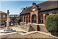
Leatherhead War Memorial
by Ian Capper geograph for square TQ1656 War memorial unveiled in 1921, situated on the corner of North Street and Gravel... (more)
Tags:
top:City, Town Centre
type:Geograph
Grade II Listed
road:Gravel Hill
place:Leatherhead
road:North Street
War Memorial
|
|
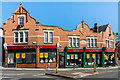
The Approach
by Ian Capper geograph for square TQ1656 Building on North Street, where it meets Station Road and Bull Hill, built in 1905.
Tags:
top:Business, Retail, Services
top:City, Town Centre
type:Geograph
place:Leatherhead
road:North Street
building:The Approach
|
|
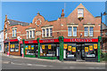
The Approach
by Ian Capper geograph for square TQ1656 Building on North Street, where it meets Station Road and Bull Hill, built in 1905.
Tags:
top:Business, Retail, Services
top:City, Town Centre
type:Geograph
place:Leatherhead
road:North Street
building:The Approach
|
|
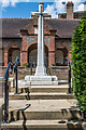
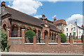
Leatherhead War Memorial
by Ian Capper geograph for square TQ1656 War memorial unveiled in 1921, situated on the corner of North Street and Gravel... (more)
Tags:
top:City, Town Centre
top:Defence, Military
type:Geograph
Grade II Listed
road:Gravel Hill
place:Leatherhead
road:North Street
War Memorial
|
|
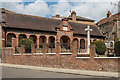
Leatherhead War Memorial
by Ian Capper geograph for square TQ1656 War memorial unveiled in 1921, situated on the corner of North Street and Gravel... (more)
Tags:
top:City, Town Centre
type:Geograph
Grade II Listed
road:Gravel Hill
place:Leatherhead
road:North Street
War Memorial
|
|
Leatherhead War Memorial
by Ian Capper for square TQ1656 War memorial unveiled in 1921, situated on the corner of North Street and Gravel... (more)
Tags:
top:City, Town Centre
type:Close Look
Grade II Listed
road:Gravel Hill
place:Leatherhead
road:North Street
War Memorial
|

|
Unilever coach
by Ian Capper for square TQ1656 The Anglo-Dutch conglomerate Unilever has a large office on Springfield Drive on... (more)
Tags:
top:Business, Retail, Services
top:City, Town Centre
type:Close Look
Coach
place:Leatherhead
road:North Street
top:Roads, Road Transport
Shuttle
business:Unilever
|

|
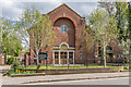
Abbot's Hospital
by Ian Capper geograph for square SU9949 Extension of Abbot's Hospital overlooking North Street, built in 1984... (more)
Tags:
building:Abbots Hospital
top:City, Town Centre
architect:David Nye
type:Geograph
place:Guildford
road:North Street
|
|
Holy Cross Church
by Ian Capper geograph for square TQ2764 Roman Catholic church on North Street opened in 1932 on the site of chapel which... (more)
Tags:
place:Carshalton
type:Geograph
church:Holy Cross
road:North Street
top:Religious Sites
Roman Catholic
top:Suburb, Urban Fringe
|

|
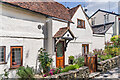
The Sun
by Ian Capper geograph for square TQ2764 Pub in North Street by its junction with Mill Lane, opened in 1866. For a close... (more)
Tags:
top:Business, Retail, Services
place:Carshalton
type:Geograph
road:North Street
Pub
top:Suburb, Urban Fringe
pub:Sun
|
|
Leslie Cottage
by Ian Capper for square TQ1649 17th Century cottage in North Street. Grade II listed - see... (more)
Tags:
top:City, Town Centre
type:Close Look
place:Dorking
Grade II Listed
top:Housing, Dwellings
building:Leslie Cottage
road:North Street
|

|
Abbot's Hospital and The Old Cloth Hall
by Ian Capper geograph for square SU9949 Buildings on North Street. In the centre is The Old Cloth Hall, built by... (more)
Tags:
building:Abbots Hospital
top:City, Town Centre
architect:David Nye
type:Geograph
Grade II Listed
place:Guildford
road:North Street
building:The Old Cloth Hall
building:The Old Fire Station
|

|
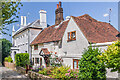
Door, The Sun
by Ian Capper for square TQ2764 Halloween and autumnal decorations around the door of The Sun, a pub in North... (more)
Tags:
top:Business, Retail, Services
place:Carshalton
type:Close Look
Halloween
road:North Street
Pub
Skeleton
top:Suburb, Urban Fringe
pub:Sun
|
|
Leslie House and Leslie Cottage
by Ian Capper geograph for square TQ1649 Pair of houses in North Street. Leslie House, on the left, has a date plaque of... (more)
Tags:
top:City, Town Centre
place:Dorking
type:Geograph
Grade II Listed
top:Housing, Dwellings
building:Leslie Cottage
building:Leslie House
road:North Street
|

|
Lloyds Bank
by Ian Capper geograph for square TQ1656 Neo-Flemish bank building in North Street, built around 1900.
Tags:
top:Business, Retail, Services
top:City, Town Centre
type:Geograph
place:Leatherhead
bank:Lloyds
style:Neo-Flemish
road:North Street
|

|
Lidl
by Ian Capper geograph for square TQ1656 Leatherhead branch of Lidl supermarket in North Street. Opened in February... (more)
Tags:
hotel:Bull
top:Business, Retail, Services
top:City, Town Centre
Discount Supermarket
type:Geograph
place:Leatherhead
business:Lidl
road:North Street
Supermarket
|

|
Ivanhoe College, Ashby-de-la-Zouch
by Oliver Mills geograph for square SK3516 The main gates to the 11-14 secondary school, opened to students in September... (more)
Tags:
place:Ashby
Ashby De La Zouch
subject:College
top:Educational Sites
type:Geograph
Ivanhoe College
road:North Street
top:Roads, Road Transport
subject:School
|

|
The "Cultural Quarter", Ashby-de-la-Zouch
by Oliver Mills geograph for square SK3516 With the physical development associated with the "Cultural Quarter"... (more)
Tags:
place:Ashby
Ashby De La Zouch
subject:Car Park
top:City, Town Centre
top:Educational Sites
type:Geograph
top:Historic Sites and Artefacts
building type:Leisure Centre
subject:Library
subject:Museum
road:North Street
top:Roads, Road Transport
top:Sport, Leisure
|

|
The Presbytery, Church of St Peter and St Paul, Wolverhampton
by Rod Grealish geograph for square SO9198 Known as Giffard House, it was built in 1727-9 for the Giffard family, a... (more)
Tags:
Built 1727-29
Chapel
metropolitan borough:City of Wolverhampton
top:City, Town Centre
type:Geograph
name:Giffard House
Grade II Star
top:Historic Sites and Artefacts
subject:House
top:Housing, Dwellings
road:North Street
Presbytery
top:Religious Sites
denomination:Roman Catholic
building type:Townhouse
place:Wolverhampton
postcode district:WV1
|

|
Penny Black
by Ian Capper geograph for square TQ1656 Former post office, built in the 1890s. Following closure it was converted into... (more)
Tags:
top:Business, Retail, Services
top:City, Town Centre
type:Geograph
place:Leatherhead
road:North Street
pub:Penny Black
Post Office
Pub
|

|
Penny Black
by Ian Capper geograph for square TQ1656 Former post office, built in the 1890s. Following closure it was converted into... (more)
Tags:
top:Business, Retail, Services
top:City, Town Centre
type:Geograph
place:Leatherhead
road:North Street
pub:Penny Black
Post Office
Pub
|
