
|
Information Board in Lowndes Park
by David Hillas
for square SP9501
This information board is at the north end of Lowndes Park by Park Road, and has... (more)
|

|
Metal Plaque at Lowndes Park
by David Hillas
for square SP9501
This metal plaque is located at the north end of Lowndes Park by Park Road. It... (more)
|

|
Closed Bus Stop, Park Road
by David Hillas
for square TQ0694
This bus stop is in Park Road outside Our Lady Help of Christians RC Church. It... (more)
|
|
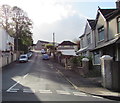
Up Park Road, Penygraig
by Jaggery
geograph for square ST0091
From the south side of Vicarage Road, Park Road ascends towards Belle Vue Park.
|

|
Entrance to Lister Park from North Park Road
by Roger Templeman
geograph for square SE1435
|

|
Park Road
by Ian Capper
geograph for square TQ2205
Bungalows in Park Road, first shown on the 1961 1:1250 map (although the route... (more)
|

|
Fortune Common and Park Road, Rickmansworth
by David Hillas
geograph for square TQ0694
Taken from near Scotsbridge Mill, this photo shows Fortune Common looking west... (more)
|

|
Roads in Lister Park passing Cartright Hall
by Roger Templeman
geograph for square SE1535
|

|
Park Road
by Ian Capper
geograph for square TQ2559
Mixed age housing in Park Road. Furthest away is Park Cottage (18th Century)... (more)
|

|
Park Cottage and Old Bell Cottages
by Ian Capper
geograph for square SO5174
Early 19th Century cottages in Park Road, Ludford, with Park Cottage on the... (more)
|

|
Park Road
by Ian Capper
geograph for square TQ7307
Late Victorian housing in Park Road.
|

|
Park Road
by Ian Capper
geograph for square TQ2559
Housing in Park Road first shown on the 1938-45 1:10,000, built on the grounds... (more)
|

|
The Old Bell House
by Ian Capper
geograph for square SO5174
House in Park Road, Ludford, with a date of 1614 carved in the porch. The first... (more)
|
|
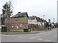
Houses on the west side of Park Road, Bath
by Christine Johnstone
geograph for square SP4440
A mixture of semis and detached. Built from the 1930s onwards.
|

|
Park Road, Moira
by Oliver Mills
geograph for square SK3114
Largely isolated by road, but a convenient connection between the Ashby Woulds... (more)
|

|
Park Road
by J.Hannan-Briggs
geograph for square TF1193
Towards Claxby.
|
|
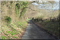
Park Road along East Woods
by J.Hannan-Briggs
geograph for square TQ6752
A small country lane towards Nettlestead.
|
|
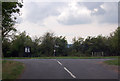
Park Road joins the road to Upleadon
by Julian P Guffogg
geograph for square SO7623
At Highleadon Green.
|

|
Park Road, Skirbeck Quarter, Boston
by J.Hannan-Briggs
geograph for square TF3242
|

|
Park Road
by Ian Capper
geograph for square TL1998
Row of small shops, dating form the c.1920s.
|
|
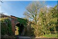
An old railway bridge on Park Road, Moira
by Oliver Mills
geograph for square SK3114
The Ashby Woulds Heritage Trail runs along the disused railway, over the bridge.
|
|
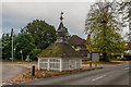
Well head
by Ian Capper
geograph for square TQ2559
18th Century well head at the junction of Woodmansterne Land and Park Road,... (more)
|

|
Well head
by Ian Capper
geograph for square TQ2559
18th Century well head at the junction of Woodmansterne Land and Park Road,... (more)
|
|
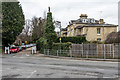
Park Road
by Ian Capper
geograph for square TQ2750
Victorian villas built in the mid 19th century as part of the Warwick Town, an... (more)
|

|
A mature Araucaria Araucana, Park Road
by Julian P Guffogg
geograph for square TQ8010
|

|
Gate Piers and Grille, Trinity College, Parks Road, Oxford
by Rod Grealish
geograph for square SP5106
The grade II* listed gate-piers and grille are situated in the east wall of the... (more)
|
|
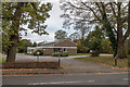
Banstead Community Hall
by Ian Capper
geograph for square TQ2559
Community centre in Park Road.
|

|
Galleries, Museum of Natural History, Oxford
by Rod Grealish
for square SP5106
The ground floor gallery provides circulation space for visitors. The first... (more)
|

|
Museum of Natural History, University of Oxford
by Rod Grealish
geograph for square SP5106
The museum was built in 1855-60. The architects were Sir Thomas Deane... (more)
|

|
Castle House
by Ian Capper
geograph for square TQ2559
Originally built in 1770 as Rooks Nest. In 1903 it was purchased by a Mr A... (more)
|

|
Ludford Almshouses
by Ian Capper
geograph for square SO5174
A terrace of six almshouses built in 1672 by Sir Job Charlton of Ludford House... (more)
|

|
The Lodge
by Ian Capper
geograph for square SO5174
Early 19th Century lodge, situated at the entrance to St Giles' Church.... (more)
|
