|
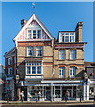
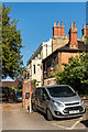
62 & 64 South Street
by Ian Capper
geograph for square TQ1649
Building at the corner of South Street and Junction Road, for many years housing... (more)
|
|
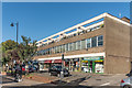
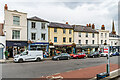
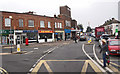
21 - 37 South Street
by Ian Capper
geograph for square TQ1649
c1960s shopping parade in South Street. The 1914 and 1935 1:2,500 maps show... (more)
|
|
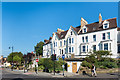
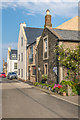
Victoria Terrace
by Ian Capper
geograph for square TQ1649
Late 19th Century terrace on Butter Hill, above South Street. Below it (behind... (more)
|
|
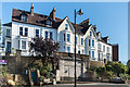
Victoria Terrace
by Ian Capper
geograph for square TQ1649
Late 19th Century terrace on Butter Hill, above South Street. Below it is the... (more)
|
|
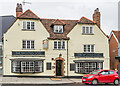
1 - 5 South Street
by Ian Capper
geograph for square TQ1649
Building on South Street by its junction with High Street at Pump Corner. The... (more)
|
|
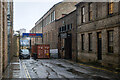
The Boiler Shop, Newcastle
by Rossographer
geograph for square NZ2463
Entrance to The Boiler Shop on South Street in Newcastle - dating from 1823 and... (more)
|
|
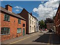
Lower Church Street, Ashby-de-la-Zouch
by Oliver Mills
for square SK3616
This section of the road is one-way, heading in this direction. Following the... (more)
|
|
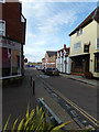
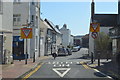
South Street, Manningtree
by Geographer
geograph for square TM1031
At the junction with the B1352 High Street
|
|
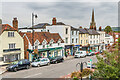
16 - 34 South Street
by Ian Capper
geograph for square TQ1649
Looking along South Street, with the spire of St Martin's Church in the... (more)
|
|
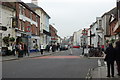
South Street
by Ian Capper
geograph for square TQ1649
Looking along South Street, with nos 38 - 40 nearest on the left (see... (more)
|
|
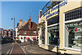
38 & 40 South Street
by Ian Capper
geograph for square TQ1649
16th Century building with 18th/19th Century front. Grade II listed - see... (more)
|
|
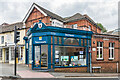
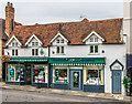
15 - 19 South Street
by Ian Capper
geograph for square TQ1649
Low parade of shops on South Street dating from the c1950s. Beyond is The... (more)
|
|
South Street
by Ian Capper
geograph for square NU2232
Buildings in South Street.
|
|
South Street, Seaford
by J.Hannan-Briggs
geograph for square TV4898
At the junction with the High Street.
|
|
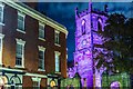
St Helen's Church, Ashby-de-la-Zouch
by Oliver Mills
for square SK3616
Taken from Lower Church Street, on the corner which meets South Street. The... (more)
|
|
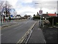
The only roundabout in Falkland!
by Bill Kasman
geograph for square NO2507
At this mini roundabout the B936 Newton Road (from where this photograph was... (more)
|
|
South Street, Lancing
by Julian P Guffogg
geograph for square TQ1804
At the junction with Freshbrook road.
|
|
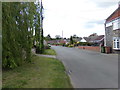
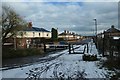
South Street, Hockwold cum Wilton
by Geographer
geograph for square TL7287
|
|
South Street, Hockwold cum Wilton
by Geographer
geograph for square TL7287
|
|
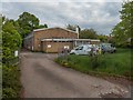
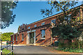
Telephone Exchange, Ashby-de-la-Zouch
by Oliver Mills
geograph for square SK3516
Located on South Street.
|
|
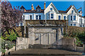
Dorking War Memorial
by Ian Capper
geograph for square TQ1649
Town war memorial, unveiled in 1921. It was designed by Thomas Braddock, whose... (more)
|
|
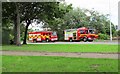
Fire engines
by Bill Kasman
geograph for square NO3700
These two fire engines are attending an incident off South Street, Methil.... (more)
|
|
South Street, Chichester
by Julian P Guffogg
geograph for square SU8604
|
|
Friends' Meeting House
by Ian Capper
geograph for square TQ1649
Quaker meeting house on Butter Hill, above South Street, dating from 1846.
|
|
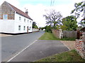
Butterhill House and Rose Hill House
by Ian Capper
geograph for square TQ1649
Conjoined pair of 18th Century houses above South Street. Grade II listed -... (more)
|
|
South Street, Highfields, from Roman Ridge
by Christine Johnstone
geograph for square SE5306
With a 43 metre spot height at the road junction. This village was built to... (more)
|
|
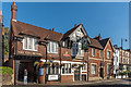
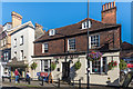
The Spotted Dog
by Ian Capper
geograph for square TQ1649
Pub in South Street with records going back tho the 1830s. Grade II listed -... (more)
|
|
The Cricketers
by Ian Capper
geograph for square TQ1649
Victorian pub in South Street.
|
|
The Bull's Head
by Ian Capper
geograph for square TQ1649
Former coaching inn on South Street. Grade II listed - see... (more)
|