Public Tags
Showing latest 50 of 104 images tagged with road:Class R Irish Road tag.
|
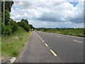
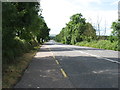
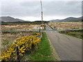
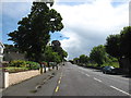
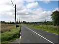
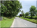
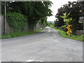
The R639 heading for Caher
by David Purchase geograph for square R9921 Before the M8 Dublin to Cork motorway was opened (the adjacent stretch in July... (more)
|
|
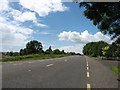
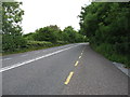
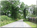
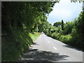
The R639 heading for Mitchelstown
by David Purchase geograph for square R9821 Before the M8 Dublin to Cork motorway was opened (the adjacent stretch in July... (more)
|
|
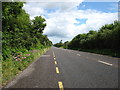
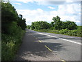
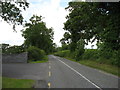
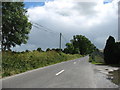
The R639 heading for Caher
by David Purchase geograph for square R9721 Before the M8 Dublin to Cork motorway was opened (the adjacent stretch in July... (more)
|
|
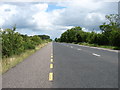
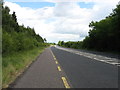
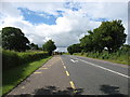
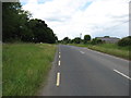
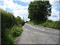
The R639 heading for Caher
by David Purchase geograph for square R9419 Before the M8 Dublin to Cork motorway was opened (the adjacent stretch in July... (more)
|
|
The R639 heading for Caher
by David Purchase geograph for square R9318 Before the M8 Dublin to Cork motorway was opened (the adjacent stretch in July... (more)
|
|
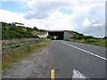
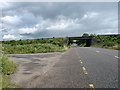
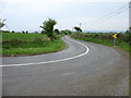
The R639 passing under the M8
by David Purchase geograph for square R9218 It intrigues me that it was considered cheaper to build a long tunnel on the... (more)
|
|
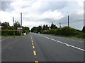
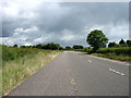
The R639 heading for Caher
by David Purchase geograph for square R9118 Before the M8 Dublin to Cork motorway was opened (the adjacent stretch in July... (more)
|
|
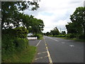
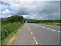
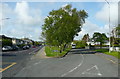
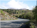
The R639 south of Galtymore
by David Purchase geograph for square R9017 I was intrigued to spot the brown sign "L7315 Galtymore Climb". When I... (more)
|
|
The M8 crossing the R639 (the former N8)
by David Purchase geograph for square R8816 Before the M8 Dublin to Cork motorway was opened (the adjacent stretch in July... (more)
|
|
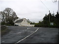
The R639 leaving Kilbeheny
by David Purchase geograph for square R8616 Before the M8 Dublin to Cork motorway was opened (the adjacent stretch in July... (more)
|
|
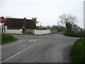
The R639 approaching Kilbeheny
by David Purchase geograph for square R8515 Before the M8 Dublin to Cork motorway was opened (the adjacent stretch in July... (more)
|
|
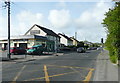
The R639 nearing Fermoy
by David Purchase geograph for square R8000 Before the M8 Dublin to Cork motorway was opened (this stretch in May 2009),... (more)
|
|
The R639 heading for Fermoy
by David Purchase geograph for square R8203 Before the M8 Dublin to Cork motorway was opened (this stretch in May 2009),... (more)
|
|
The R639 heading for Mitchelstown
by David Purchase geograph for square R8105 Before the M8 Dublin to Cork motorway was opened (this stretch in May 2009),... (more)
|
|
The R639 heading for Fermoy
by David Purchase geograph for square R8104 Before the M8 Dublin to Cork motorway was opened (this stretch in May 2009),... (more)
|
|
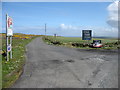
Junction of the Coast Road (L2000) and the R487
by David Purchase geograph for square Q7047 About 2 kilometres ENE of Loop Head.
Tags:
road:Class L Irish RoadX
road:Class R Irish Road
type:GeographX
subject:Road JunctionX
top:Roads, Road TransportX
|
|
The L4074 approaches the R568
by David Purchase geograph for square V7973 Lough Brin is about 4.5km ahead.
Tags:
road:Class L Irish RoadX
road:Class R Irish Road
subject:Road JunctionX
top:Roads, Road TransportX
|
|
The R639 heading for Caher
by David Purchase geograph for square S0223 Before the M8 Dublin to Cork motorway was opened (the adjacent stretch in July... (more)
|
|
The R639 heading for Mitchelstown
by David Purchase geograph for square S0123 Before the M8 Dublin to Cork motorway was opened (the adjacent stretch in July... (more)
|
|
The R689 north of Glencoole
by David Purchase geograph for square S2452 I found the Irish 'Yellow on Grey' (or sometimes 'Yellow on... (more)
|
|
Leaving Fermoy on the R666
by David Purchase geograph for square W8198 I was surprised that the Irish had numbered one of their roads '666' -... (more)
|
|
The R471 heading for Cloonlara
by David Purchase geograph for square R5566 |
|
The R483 heading for Cooraclare
by David Purchase geograph for square R0160 |
|
The R483 heading for Kilrush
by David Purchase geograph for square R0159 |
|
Approaching the R483
by David Purchase geograph for square R0058 |
|
Woodlee, Tralee
by Humphrey Bolton geograph for square Q8315 A residential road off the R556.
Tags:
road:Class R Irish Road
type:GeographX
road:R556X
subject:RoadX
top:Roads, Road TransportX
top:Suburb, Urban FringeX
|
|
St Brendan's Road (the R556), Tralee
by Humphrey Bolton geograph for square Q8315 Tags:
road:Class R Irish Road
type:GeographX
top:LowlandsX
road:R556X
subject:RoadX
top:Roads, Road TransportX
top:Suburb, Urban FringeX
|
|
Reaching the R744 at Crosshue Cross Roads
by David Purchase geograph for square T1134 |
|
The R673 heading for Ardmore
by David Purchase geograph for square X1980 The corner just to the left of this photo is a very sharp left-hander.
|
|
The R673 from Ardmore to Dungarvan
by David Purchase geograph for square X1979 In case there is any doubt, the R673 is the road on the right.
|
|
The R673 heading for Dungarvan
by David Purchase geograph for square X1879 |
|
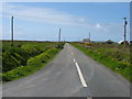
The R487 heading for Loop Head
by David Purchase geograph for square Q7549 |
|
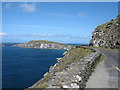
The R559 at Slea Head
by David Purchase geograph for square V3196 Looking towards Dunmore Head.
|
|
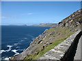
The R559 near Slea Head
by David Purchase geograph for square V3296 In the distance, from right to left, are Great Blasket Island, Inishnabro, and... (more)
|
|
The R561 heading for Inch
by David Purchase geograph for square Q7502 If coming from the south, this is a much better way of reaching Dingle than... (more)
|
|
The R569 heading for Kilgarvan
by David Purchase geograph for square W0679 |
|
The R569 north-east of Kilgarvan
by David Purchase geograph for square W0478 The cloud-covered mountain is Crohane, 656m in W0482.
|
|
The R568 heading for Killarney
by David Purchase geograph for square V7470 |
|
The R747 heading for Tinahely
by David Purchase geograph for square S9975 |
|
The R747 at Ballinnagilky Bridge
by David Purchase geograph for square S9976 The bridge ahead crosses a tributary of the Derry River, itself quite a minor... (more)
|
|
The R747 heading for Tinahely
by David Purchase geograph for square S9878 |
|
The R695 heading for Callan
by David Purchase geograph for square S3949 |
|
The R695 heading for Kilmanagh
by David Purchase geograph for square S3948 |
|
The R695 heading for Kilmanagh
by David Purchase geograph for square S3947 |
|
The R691 heading east
by David Purchase geograph for square S3746 |
|
The R691 heading for Callan
by David Purchase geograph for square S3546 |
|
The R691 heading for Callan
by David Purchase geograph for square S3447 |

|
The R691 heading for Callan
by David Purchase geograph for square S3347 |
|
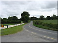
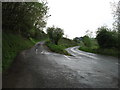
Joining the R690
by David Purchase geograph for square S2855 Emerging on a minor road from Grange.
|
|
The L2113 joins the R690
by David Purchase geograph for square S2857 Heading south, towards Ballingarry.
|