About tags on Geograph

Public Tags

Related Tags | Coverage Map
Prefix: roman road    Tag:  Ermine·Street  
Other tags: Ermine Street     near:Ermine Street     off:Ermine Street     on:Ermine Street     road:Ermine Street     to:Ermine Street    

Showing images tagged with roman road:Ermine Street tag.

View all tagged images - In Browser
:

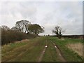
SK9951 : Ermine Street [High Dike] heading north from Long Lane by Christine Johnstone Ermine Street [High Dike] heading north from Long Lane by Christine Johnstone
geograph for square SK9951
This part of the Roman road between London, Lincoln and York is now the route of... (more)
Tags: subject:Bridleway   boundary:Civil Parish   on:Ermine Street   roman road:Ermine Street   type:Geograph   top:Paths   Public Bridleway   Route of Roman Road   long distance path:Viking Way  
SK9951 : Ermine Street [High Dike] heading south from Long Lane by Christine Johnstone Ermine Street [High Dike] heading south from Long Lane by Christine Johnstone
geograph for square SK9951
This part of the Roman road between London, Lincoln and York is now the route of... (more)
Tags: subject:Bridleway   boundary:Civil Parish   roman road:Ermine Street   on:Ermine Street   type:Geograph   top:Paths   Public Bridleway   Route of Roman Road   long distance path:Viking Way  
SK9950 : High Dike by Richard Croft High Dike by Richard Croft
for square SK9950
Ermine Street Roman Road and The Viking Way
SK9951 : High Dike by Richard Croft High Dike by Richard Croft
geograph for square SK9951
Ermine Street Roman Road approaching Long Lane
SK9950 : High Dike by Richard Croft High Dike by Richard Croft
geograph for square SK9950
Ancient byway, parish boundary and course of the Viking Way along Ermine Street Roman Road
SK9950 : High Dike by Richard Croft High Dike by Richard Croft
geograph for square SK9950
Ancient byway, parish boundary and course of the Viking Way along Ermine Street Roman Road
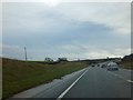
SK9686 : A15 Ermine Street heading south by J.Hannan-Briggs A15 Ermine Street heading south by J.Hannan-Briggs
geograph for square SK9686
Tags: road:A15   roman road:Ermine Street   top:Roads, Road Transport  
SK9810 : A1 along Ermine Street by Julian P Guffogg A1 along Ermine Street by Julian P Guffogg
geograph for square SK9810
Tags: road:A1   roman road:Ermine Street   top:Roads, Road Transport   near:Tickencote  
SK9959 : Ermine Street  by Julian P Guffogg Ermine Street by Julian P Guffogg
geograph for square SK9959
Nearby it crosses Heath Lane, near Boothby Graffoe.
Tags: near:Boothby Graffoe   roman road:Ermine Street   top:Roads, Road Transport  
SO9512 : A bend in Roman Ermin Street (now the A417) by David Smith A bend in Roman Ermin Street (now the A417) by David Smith
geograph for square SO9512
Ermin Street turns through a few degrees here; the route was probably chosen to... (more)
SK9909 : Old Great North Road, Great Casterton by Christine Johnstone Old Great North Road, Great Casterton by Christine Johnstone
geograph for square SK9909
Once the Roman Ermine Street, now national cycle route 63. At the 42 metre spot height.
SK9954 : Ermine Street mosaic by Andy Stephenson Ermine Street mosaic by Andy Stephenson
for square SK9954
Presumably to remind the passer-by that this is an ancient Roman road.
Tags: Ermine Street   roman road:Ermine Street   top:Lowlands   Mosaic   top:Roads, Road Transport   long distance path:Viking Way   Viking Way  
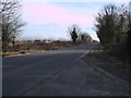
SU0896 : Ermin Way near Cerney Wick by Vieve Forward Ermin Way near Cerney Wick by Vieve Forward
geograph for square SU0896
Before it was dualled and diverted, the old A419 ran along the course of the... (more)
Tags: roman road:Ermine Street   top:Roads, Road Transport   former:Roman Road  
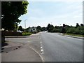
SU0995 : The Street, Latton by Des Blenkinsopp The Street, Latton by Des Blenkinsopp
geograph for square SU0995
Latton is not far from Cirencester, Corinium in Roman times, and the village... (more)
Tags: roman road:Ermine Street   type:Geograph   top:Housing, Dwellings   top:Village, Rural Settlement  
SK9950 : High Dike by Richard Croft High Dike by Richard Croft
geograph for square SK9950
North on High Dike Roman Road
SK9684 : A15 northbound by Julian P Guffogg A15 northbound by Julian P Guffogg
geograph for square SK9684
The old Roman Road heads away from Lincoln.
Tags: road:A15   roman road:Ermine Street   near:Fillingham   type:Geograph   subject:Road   top:Roads, Road Transport  
SK9959 : Ermine Street, Roman Road by Alex McGregor Ermine Street, Roman Road by Alex McGregor
geograph for square SK9959
Tags: roman road:Ermine Street   type:Geograph   top:Historic Sites and Artefacts   top:Roads, Road Transport   subject:Roman Remains  
SK9958 : Ermine Street, Roman Road by Alex McGregor Ermine Street, Roman Road by Alex McGregor
geograph for square SK9958
Tags: roman road:Ermine Street   type:Geograph   top:Historic Sites and Artefacts   top:Roads, Road Transport   subject:Roman Remains  
SK9958 : Ermine Street, Roman Road by Alex McGregor Ermine Street, Roman Road by Alex McGregor
geograph for square SK9958
Tags: roman road:Ermine Street   type:Geograph   top:Historic Sites and Artefacts   top:Roads, Road Transport   subject:Roman Remains  
SE9503 : Ermine Street Roman Road by Sandy Gerrard Ermine Street Roman Road by Sandy Gerrard
geograph for square SE9503
Now A15.
Tags: A15   roman road:Ermine Street   type:Geograph   top:Historic Sites and Artefacts   top:Lowlands   subject:Road   top:Roads, Road Transport  
SK9777 : Lincolnshire  Showground  alongside  A15  and  Speed  Camera by Martin Dawes Lincolnshire Showground alongside A15 and Speed Camera by Martin Dawes
geograph for square SK9777
The A15 is the modern name for Ermine Street the major Roman Road that ran from... (more)
Tags: road:A15   County Showground   roman road:Ermine Street   top:Flat Landscapes   type:Geograph   top:Roads, Road Transport   top:Sport, Leisure  
SE9419 : Approaching a blind summit on Ermine Street  by Graham Hogg Approaching a blind summit on Ermine Street by Graham Hogg
geograph for square SE9419
The 193 mile Roman Road which ran from London to York here is a minor road to... (more)
Tags: Blind Summit   roman road:Ermine Street   type:Geograph   subject:Road   top:Roads, Road Transport   place:Winterton  
SK9320 : A1 (Ermine Street) layby by Steve  Fareham A1 (Ermine Street) layby by Steve Fareham
geograph for square SK9320
Tags: road:A1   roman road:Ermine Street   road:Ermine Street   top:Roads, Road Transport  
SE9600 : Layby on A15 Ermine Street (Roman Road) by Steve  Fareham Layby on A15 Ermine Street (Roman Road) by Steve Fareham
geograph for square SE9600
Tags: road:A15   roman road:Ermine Street   Layby   county:Lincolnshire   top:Roads, Road Transport  
SK9322 : The Great North Road (A1) heading north by J.Hannan-Briggs The Great North Road (A1) heading north by J.Hannan-Briggs
geograph for square SK9322
Part of Roman Ermine Street.
Tags: road:A1   roman road:Ermine Street   road:Great North Road   top:Roads, Road Transport  
SK9849 : Byard's Leap by Richard Croft Byard's Leap by Richard Croft
geograph for square SK9849
Motor Engineers and café at Byard's Leap
TL3445 : Ermine Street by Hugh Venables Ermine Street by Hugh Venables
geograph for square TL3445
Tags: road:A1198   roman road:Ermine Street   type:Geograph   top:Roads, Road Transport  
TL2863 : Ermine Street leaving Papworth Everard by M J Richardson Ermine Street leaving Papworth Everard by M J Richardson
geograph for square TL2863
At the northern end of the Papworth Everard by-pass. With diversion signs... (more)
Tags: place:Cambridgeshire   roman road:Ermine Street   type:Geograph   top:Lowlands   place:Papworth Everard   subject:Road Junction   Road Signs   top:Roads, Road Transport   top:Village, Rural Settlement  
TL3629 : Buntingford from the air by M J Richardson Buntingford from the air by M J Richardson
for square TL3629
Looking south across Ermine Street and the bypass [A10].
Tags: road:A10   type:Aerial   Aerial Photograph   Buntingford   type:Cross Grid   roman road:Ermine Street   place:Hertfordshire   top:Lowlands   top:Roads, Road Transport   subject:Village   top:Village, Rural Settlement  
TL3530 : Buntingford from the air by M J Richardson Buntingford from the air by M J Richardson
for square TL3530
Looking south along Ermine Street and the bypass [A10].
Tags: road:A10   type:Aerial   Aerial Photograph   Buntingford   type:Cross Grid   roman road:Ermine Street   top:Farm, Fishery, Market Gardening   place:Hertfordshire   top:Lowlands   top:Roads, Road Transport   subject:Village   top:Village, Rural Settlement  
TL2960 : Roundabout at Caxton Gibbet by M J Richardson Roundabout at Caxton Gibbet by M J Richardson
geograph for square TL2960
The A428 crosses the A1198 [Ermine Street]
Tags: place:Cambridgeshire   near:Caxton Gibbet   roman road:Ermine Street   top:Lowlands   top:Roads, Road Transport  
SK9909 : Traffic management on the Old Great North Road by Christine Johnstone Traffic management on the Old Great North Road by Christine Johnstone
geograph for square SK9909
As this links to the current A1, vehicles are squeezed through a narrow gap at... (more)
SU0796 : The Ermine Way towards Latton by Jeff Gogarty The Ermine Way towards Latton by Jeff Gogarty
geograph for square SU0796
View more in the Image Search or in Browser
View images matching 'Ermine Street' anywhere in the tags
Don't click these: PotMel 1 PotMel 2