Public Tags
Tag: Rough·Track
Showing latest 50 of 53 images tagged with Rough Track tag.
|
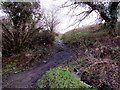
Brook and rough track, Penywaun
by Jaggery geograph for square SN9704 The brook on the right flows past the camera towards a river, Afon Cynon.
The... (more)
|

|
Rough track descends south from Penrhys
by Jaggery geograph for square ST0094 Viewed from the corner of this Link track to... (more)
|

|
Clashgour Estate, near Bridge of Orchy
by Malc McDonald geograph for square NN2642 A rough track leads onto the Clashgour Estate a few miles from Bridge of Orchy... (more)
Tags:
Argyll and Bute
near:Bridge of Orchy
Footpath
Gate
sign:No Vehicles
No Vehicles . Public Footpath
No Vehicular Access
top:Paths
Rough Track
country:Scotland
Track
subject:Track
top:Uplands
|

|
Very rough track to the north of Lough Alurgan - Lettershinna Townland
by Mac McCarron geograph for square L8242 Category: Track A 4x4 or tractor would definitely be needed to travel along this track.
Tags:
top:Farm, Fishery, Market Gardening
Rough Track
|

|
Muddy dip in the track
by Robert Graham geograph for square NZ0748 A muddy patch in the rough trackway leading to Dean Howl Farm.
Tags:
type:Geograph
top:Lowlands
Muddy Farm Track
top:Roads, Road Transport
Rough Track
subject:Track
Woodland
top:Woodland, Forest
|

|
Track down into the Sirhowy Valley
by M J Roscoe geograph for square SO1703 A rough track, near the start of the alternative route for the Sirhowy Valley... (more)
Tags:
top:Boundary, Barrier
Deciduous Trees
type:Geograph
Grassy Verges
Long Distance Route
place:Near Manmoel
top:Roads, Road Transport
Rough Track
subject:Track
|

|
Farm track in Bannisdale
by Karl and Ali geograph for square NY5202 The rough track provides the only link to the outside world for Bannisdale Head... (more)
|

|
Track on the edge of Morecambe Bay
by Malc McDonald geograph for square SD4767 An uneven track on the edge of Morecambe Bay.
Earlier in the day this image... (more)
Tags:
top:Coastal
near:Hest Bank
place:Lancashire
Large Puddle
place:Morecambe Bay
Prevailing Winds
Puddles
top:Roads, Road Transport
Rough Track
|

|
Track, Twyn yr Oerfel, Mynydd y Grug Common
by M J Roscoe geograph for square ST1890 This rough track, a byway, is part of the Rhymney Valley Ridgeway Walk on the... (more)
Tags:
Coniferous Plantation
type:Geograph
place:Near Cwmfelinfach
long distance path:Rhymney Valley Ridgeway Walk
top:Roads, Road Transport
Rough Track
subject:Track
Trees in Spring
top:Woodland, Forest
|
|
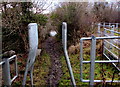
Rough track to the river's edge, Penywaun
by Jaggery geograph for square SN9704 From a footpath and cycleway, the track descends to the edge of Afon Cynon,... (more)
Tags:
top:Paths
Rough Track
|

|
Rough track towards a disused tramway, Gilfach Goch
by Jaggery geograph for square SS9890 Viewed from a path NW of High Street. The track heads NNW towards a former tramway.
Tags:
top:Paths
Rough Track
|

|
Track leading onto Langbar Moor
by Chris Heaton geograph for square SE1051 Rough track leaving the lane beside Moor End Farm
Tags:
top:Paths
Rough Track
|

|
Rough track in the north of Merthyr Mawr Warren
by eswales geograph for square SS8677 Probably created by an agricultural vehicle. Farmland is to be found a very... (more)
|

|
Track at the head of Bannisdale
by Karl and Ali geograph for square NY5104 A rough vehicle track descends off the open fell towards the aptly named farm of... (more)
|

|
Fells Above Hollin How, Eskdale
by Peter Trimming geograph for square NY1400 The rough track climbed for nearly a mile. To the right of the picture some tyre... (more)
Tags:
county:Cumbria
place:Eskdale Valley
top:Paths
top:Rocks, Scree, Cliffs
Rough Track
top:Uplands
|

|
Rough track past brambles near Ryde
by Jaggery geograph for square SZ5990 Part of Public Footpath R50 a few metres east of Smallbrook Lane.
|
|
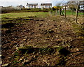
Up a rough track to Clydach Road, Ynysybwl
by Jaggery geograph for square ST0594 Ascending towards Clydach Road from the valley of a stream named Y Ffrwd.
Tags:
top:Paths
Rough Track
|
|
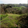
Rough track from Clydach Road to Mill Road, Ynysybwl
by Jaggery geograph for square ST0594 Descending towards the valley of a stream named Y Ffrwd.
Tags:
top:Paths
Rough Track
|
|
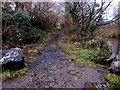
Rough track up from the Afon Cynon, Penywaun
by Jaggery geograph for square SN9704 Leading up to a riverbank footpath and cycleway.
Tags:
top:Paths
Rough Track
|

|
Grouse butt line on north side of Horseshoe Hill
by Trevor Littlewood geograph for square NY9945 A well constructed set of grouse butts accessed by a roughly-made track. The... (more)
Tags:
type:Geograph
subject:Grouse Butts
Grouse Butts
Heather Moorland
top:Moorland
top:Roads, Road Transport
Rough Track
Smoke
top:Sport, Leisure
top:Uplands
|

|
Rough track and bridleway Burn Howe Rigg
by Martin Dawes geograph for square SE9098 This goes up to the Lyke Wake Walk
Tags:
Bridleway
type:Geograph
Heather Moorland
top:Moorland
North York Moors National Park
top:Paths
Rough Track
top:Uplands
|

|
Rough track up onto Burn Howe Rigg
by Martin Dawes geograph for square SE9198 Tags:
Bridleway
type:Geograph
Heather Moorland
top:Moorland
North York Moors National Park
top:Paths
Rough Track
top:Uplands
|

|
Rough track to a wooden gate, Fownhope
by Jaggery geograph for square SO5834 From the south side of the B4224.
|

|
Gateway in Sleddale
by Karl and Ali geograph for square SD8587 On the rough track which leads up the western side of the dale.
|

|
A rough track alongside Allt Dourie
by Dorothy Carse geograph for square NO1794 South of Creag a' Chait on Invercauld Estate.
|

|
View Towards Fell End, Eskdale
by Peter Trimming geograph for square NY1400 Seen from the rough track, which climbs up the fell.
Tags:
county:Cumbria
place:Eskdale Valley
top:Paths
top:Rocks, Scree, Cliffs
Rough Track
top:Uplands
|

|
On the West Devon Way
by Graham Horn geograph for square SX4975 The West Devon Way runs for 37 miles from Okehampton to Plymouth, mainly... (more)
|

|
Farm track near Ingatestone
by Malc McDonald geograph for square TQ6697 This track leads to a farm in the Essex countryside, near Ingatestone.
Tags:
county:Essex
Farm Track
Farmland Track
near:Ingatestone
top:Roads, Road Transport
Rough Track
subject:Track
|

|
Track junction next to Sirhowy Valley Country Walk
by M J Roscoe geograph for square ST1890 The narrow track on the right, a public footpath, goes into the Park. The track... (more)
Tags:
type:Geograph
place:Near Cwmfelinfach
top:Paths
Restricted Byway
long distance path:Rhymney Valley Ridgeway Walk
top:Roads, Road Transport
Rough Track
subject:Track
Trees in Spring
top:Woodland, Forest
|

|
Track to Corrichoich and Morven, Caithness
by Andrew Tryon geograph for square ND0429 A view facing west along the track towards the bothy at Corrichoich, at about... (more)
Tags:
place:Berriedale
Breamore
place:Caithness
Corrichoich
Desolate Landscape
Estate Track
type:Geograph
top:Moorland
Morven
subject:Mountain
Path to the Hills
Remote Track
top:Roads, Road Transport
Rough Track
place:Scotland
place:Scottish Highlands
top:Uplands
|

|
Farm track towards Rank Sir Henry
by M J Roscoe geograph for square SO1800 Track, a public footpath, southwest of Hafodrisclawdd-isaf on the side of a small valley.
Tags:
top:Boundary, Barrier
type:Geograph
Grass Bank
top:Grassland
top:Roads, Road Transport
Rough Track
subject:Track
Trees and Bushes in Spring
|

|
Track with a view over Loch Tulla
by Malc McDonald geograph for square NN2641 This view, taken near Bridge of Orchy, looks north-eastwards over Loch Tulla.
Tags:
Argyll and Bute
near:Bridge of Orchy
place:Loch Tulla
top:Paths
Rough Track
country:Scotland
subject:Track
Track
loch:Tulla
top:Uplands
View
|

|
Track to Barfs Hill
by Pauline E geograph for square SE5666 Heading West.
|

|
Track to Manmoel from Mynydd Pen-y-fan
by M J Roscoe geograph for square SO1902 The track is towards the end of the byway from Pentrapeod; this section is on... (more)
Tags:
Beech Trees in Winter
top:Boundary, Barrier
top:Farm, Fishery, Market Gardening
subject:Field
type:Geograph
top:Grassland
place:Near Manmoel
Pasture
top:Roads, Road Transport
Rough Track
Trees in Winter
|

|
Rural landscape near Stanford Rivers
by Malc McDonald geograph for square TQ5199 A track leading into a field in the Essex countryside.
|

|
Drain crossing
by Stanley Howe geograph for square NJ5802 On track between Hillside of Dess and Newton of Auchlossan (in left distance).... (more)
|

|
Track along the edge of Whitehall Moss
by Robert Graham geograph for square NZ0746 This track runs south from the Waskerley Railway path to Oxen Law, along the... (more)
|

|
Fork in the track, near Hest Bank
by Malc McDonald geograph for square SD4666 Tracks fork near Hest Bank, Lancashire.
|

|
Track between Newton of Auchlossan and Hillside of Dess
by Stanley Howe geograph for square NJ5802 Uphill from a field drain crossing; and badly eroded after winter rains.
|

|
View from the lane along to Page Bank East
by Robert Graham geograph for square NZ2336 Looking SE from the track.
|

|
The track to Kirriereoch
by Ann Cook geograph for square NX3586 The bridge is over the Water of Minnoch.
|

|
The track past Animal Paradise kennels, Clapham
by David Gearing geograph for square SX8986 Tags:
top:Roads, Road Transport
Rough Track
|

|
Track on Dunwich Heath toward former Coastguard Cottages
by Martin Dawes geograph for square TM4768 Long white building on skyline left of centre
Tags:
on:Dunwich Heath
top:Flat Landscapes
type:Geograph
top:Heath, Scrub
National Trust Property
top:Paths
Rough Track
|

|
Sirhowy Valley Walk, east of Argoed
by M J Roscoe geograph for square SO1800 Looking north heading towards the site of a former colliery from the bottom of an incline.
Tags:
Footpath Waymarker
type:Geograph
Long Distance Path
place:Near Argoed
top:Roads, Road Transport
Rough Track
subject:Track
top:Woodland, Forest
|

|
Track in Sleddale
by Karl and Ali geograph for square SD8587 Heading up the western side of the dale.
|

|
Track near Tollesbury, Essex
by Malc McDonald geograph for square TL9511 The buildings in the distance are the village of West Mersea.
|

|
Bridge over Abhainn Araig, Bunnahabhain, Islay
by Lorna Williamson geograph for square NR4173 The Paps of Jura in the background. I can find no translation for 'Araig'.
|

|
The path down from Foel Cwmcerwyn
by Bill Harrison geograph for square SN0930 Tags:
top:Boundary, Barrier
Fence and Gate
type:Geograph
Grassy Moorland
top:Moorland
Mynydd Preseli
top:Paths
Rough Track
Sheep
top:Uplands
|

|
Path across the moor to Foel Cwmcerwyn
by Bill Harrison geograph for square SN0931 |

|
Marston Moor cottages, Church Road, Earsham
by Bill Harrison geograph for square TM3288 Tags:
housing:Cottages
type:Geograph
top:Housing, Dwellings
Rough Track
top:Village, Rural Settlement
|
