Public Tags
Showing images tagged with ruin:Jetty tag.

|
Remains of a jetty
by Lairich Rig geograph for square NS3974 Category: Jetty The same ruins are shown in NS3974 : Remains of a jetty, but the present photograph is a view in... (more)
|

|
Remains of a jetty
by Lairich Rig geograph for square NS3974 Category: Jetty These ruins are located alongside the River Leven, not far from the base of... (more)
|

|
Landguard Fort: view from Darell's Battery over the jetty towards Harwich
by Christopher Hilton geograph for square TM2831 One of Landguard Fort's military functions over the years was to act,... (more)
Tags:
Church Spire
Church with Spire
top:Coastal
top:Defence, Military
Distant Spire
Estuary
top:Estuary, Marine
type:Geograph
top:Historic Sites and Artefacts
disused:Jetty
Jetty
subject:Jetty
ruin:Jetty
former:Jetty
Jetty (Ruined)
Spire
Submarine Mining
View
|

|
View across old jetty
by Lairich Rig geograph for square NS3974 Category: Jetty See NS3974 : Remains of a jetty and NS3974 : Remains of a jetty for views along the jetty from its eastern and... (more)
|

|
Remains of a jetty
by Lairich Rig geograph for square NS4473 Category: Jetty The jetty is first shown, although apparently incomplete, on OS maps from 1914;... (more)
|

|
Remains of the south jetty
by Lairich Rig geograph for square NS4672 Category: Jetty From the Erskine Bridge (see NS4672 : Remains of the south jetty for that view), this feature resembles... (more)
|

|
Ruined jetty, below Weston Marsh Lock
by Christine Johnstone geograph for square SJ5079 On the north side of the lock gates.
Tags:
top:Canals
top:Derelict, Disused
type:Geograph
disused:Jetty
subject:Jetty
ruin:Jetty
Lock Mooring
Manchester Ship Canal
Weaver Navigation
|

|
Remains of a jetty
by Lairich Rig geograph for square NS4473 Category: Jetty Some much more recognizable remains of a jetty can be seen on this shore, 200... (more)
|

|
Remains of the south jetty
by Lairich Rig for square NS4672 Category: Jetty The photograph was taken from the Erskine Bridge.
The remains of the jetty... (more)
|

|
Princes Jetty, Liverpool
by Jeff Buck geograph for square SJ3390 The now derelict Princes Jetty is at the northern end of the Liverpool Landing... (more)
Tags:
top:City, Town Centre
Disused Jetty
top:Docks, Harbours
country:England
top:Historic Sites and Artefacts
ruin:Jetty
Jetty
disused:Jetty
place:Liverpool
place:Merseyside
place:Pier Head
Pier Head
|

|
The north jetty and St Patrick's Light
by Lairich Rig geograph for square NS4672 Category: Jetty See NS4672 : The north jetty and St Patrick's Light for the main description. The present photograph was taken... (more)
Tags:
river:Clyde
landmark:Erskine Bridge
Erskine Bridge
top:Estuary, Marine
ruin:Jetty
Navigation Beacon
St Patricks Light
|

|
The north jetty and St Patrick's Light
by Lairich Rig geograph for square NS4672 Category: Jetty See NS4672 : The north jetty and St Patrick's Light for a later photograph, taken on a better day.
The base of... (more)
Tags:
river:Clyde
Erskine Bridge
landmark:Erskine Bridge
top:Estuary, Marine
ruin:Jetty
Navigation Beacon
St Patricks Light
|

|
Remains of Landing Stage, Glaceriska Bay
by Mick Garratt geograph for square NM9144 Tags:
Coast
Coastal
top:Coastal
Coastline
top:Derelict, Disused
top:Docks, Harbours
ruin:Jetty
Jetty
Landing Stage
ruin:Landing Stage
Loch
Loch Creran
Loch Shore
Old Jetty
Sea Loch
Shore
Shoreline
|

|
Remains of the south jetty
by Lairich Rig geograph for square NS4672 Category: Jetty See NS4672 : Remains of the south jetty for the main description. The present photograph was taken on a... (more)
|

|
Heysham South Jetty
by Gerald England geograph for square SD3959
The abandoned jetty in front of the power station is slowly disintegrating.
Tags:
top:Coastal
top:Docks, Harbours
top:Energy Infrastructure
type:Geograph
place:Heysham
Heysham Docks
Heysham Power Station
ruin:Jetty
Nuclear Power Station
South Jetty
Wooden Jetty
|

|
Heysham South Jetty
by Gerald England geograph for square SD3959
The abandoned jetty in front of the power station is slowly disintegrating.
Tags:
top:Coastal
top:Derelict, Disused
top:Docks, Harbours
top:Energy Infrastructure
type:Geograph
place:Heysham
Heysham Docks
Heysham Power Station
ruin:Jetty
Nuclear Power Station
South Jetty
Wooden Jetty
|

|
The former jetty along the River Humber
by Ian S geograph for square TA0927 Tags:
top:Estuary, Marine
disused:Jetty
ruin:Jetty
Marine Jetty
top:Rivers, Streams, Drainage
Wooden Jetty
|

|
The former jetty along the River Humber
by Ian S for square TA0927 Tags:
top:Docks, Harbours
top:Estuary, Marine
disused:Jetty
ruin:Jetty
Marine Jetty
top:Rivers, Streams, Drainage
Wooden Jetty
|

|
The former jetty along the River Humber
by Ian S geograph for square TA0927 Tags:
top:Derelict, Disused
top:Estuary, Marine
disused:Jetty
ruin:Jetty
Marine Jetty
top:Rivers, Streams, Drainage
Wooden Jetty
|

|
Remains of flying boat jetty
by Jonathan Thacker geograph for square TA1620 A stark contrast with the busy, noisy, new jetties just to the south. This jetty... (more)
|

|
Remains of a jetty
by Lairich Rig geograph for square NS4473 Category: Jetty For the main description, see NS4473 : Remains of a jetty, which includes a view in the opposite... (more)
|

|
Heysham Port at night
by Oliver Mills geograph for square SD3960 Leaving Heysham Port on the 'Ben-My-Chree' ferry. Heysham A and B... (more)
Tags:
top:Coastal
top:Derelict, Disused
top:Docks, Harbours
top:Energy Infrastructure
type:Geograph
place:Heysham
Heysham Docks
Heysham Power Station
ruin:Jetty
subject:Jetty
Nuclear Power Station
subject:Port
South Jetty
|

|
The riverside path towards Hull City Centre
by Ian S geograph for square TA0927 Tags:
top:Estuary, Marine
disused:Jetty
ruin:Jetty
Marine Jetty
top:Paths
top:Rivers, Streams, Drainage
Trans Pennine Trail
Wooden Jetty
|

|
The remains of Heacham Harbour
by Richard Humphrey geograph for square TF6535 This harbour is now a land locked lagoon with no access from the sea.The remains... (more)
|

|
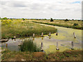
Ruined jetty, Fahan
by Kenneth Allen geograph for square C3326 Pictured at Lough Swilly
|
|
Remains of a jetty
by Stephen Craven geograph for square TQ6475 A few rotting timber posts are all that remains of some structure, probably a... (more)
Tags:
ruin:Jetty
top:Rivers, Streams, Drainage
|

|
Remains of the jetty, Ardersier
by Craig Wallace for square NH7854 The old jetty extended quite far out into the Moray Firth. Though not much is... (more)
Tags:
place:Ardersier
type:Close Look
top:Coastal
top:Docks, Harbours
top:Historic Sites and Artefacts
ruin:Jetty
top:Village, Rural Settlement
|

|
Derelict jetty and the Humber estuary
by Mat Fascione geograph for square TA1620 Tags:
top:Coastal
top:Derelict, Disused
top:Estuary, Marine
type:Geograph
Humber Estuary
subject:Jetty
ruin:Jetty
|

|
Old jetty, River Lagan, Stranmillis, Belfast (October 2014)
by Albert Bridge geograph for square J3471 A disused and partly-collapsed jetty - a short distance upstream from the Lagan... (more)
Tags:
place:Belfast
ruin:Jetty
River
River Lagan
top:Rivers, Streams, Drainage
top:Sport, Leisure
Stranmillis (Belfast)
|

|
Remains of a Jetty, The Swale
by Chris Whippet geograph for square TQ9267 |

|
Remains of an old jetty, Manchester Ship Canal
by Christine Johnstone geograph for square SJ7294 On the north bank, just above Irlam locks.
|

|
Remains of a wooden jetty
by Pauline E geograph for square NU1341 The jetty was used to import coal and export lime during the days when a lime... (more)
|

|
Jetty remains
by Alexander P Kapp geograph for square NU1341 The remains of the jetty which was used to export cement from the island to... (more)
|

|
Birds of a feather
by Stephen Craven geograph for square TQ2675 Category: Jetty Hundreds of cormorants crowding this disused jetty on the Thames at Battersea.
|

|
Jetty remains, Loch Affric
by Craig Wallace geograph for square NH1421 It seems most of the jetty has collapsed into the loch.
Tags:
top:Derelict, Disused
top:Docks, Harbours
type:Geograph
place:Glen Affric
ruin:Jetty
top:Lakes, Wetland, Bog
Loch Affric
top:Uplands
|

|
Derelict jetty at Hawkcraig Point
by Mat Fascione geograph for square NT1984 Tags:
top:Coastal
top:Derelict, Disused
place:Firth of Forth
type:Geograph
subject:Jetty
ruin:Jetty
top:Rocks, Scree, Cliffs
Shoreline
|

|
Derelict jetty in Inverkeithing Bay
by Mat Fascione geograph for square NT1380 Tags:
Bay
top:Coastal
top:Derelict, Disused
place:Firth of Forth
type:Geograph
subject:Jetty
ruin:Jetty
top:Rocks, Scree, Cliffs
|

|
Windswept tree at Jenny Brown's Point, Silverdale
by Karl and Ali geograph for square SD4673 A haggard-looking hawthorn has managed to survive, growing in the shingle and... (more)
Tags:
top:Air, Sky, Weather
top:Coastal
top:Derelict, Disused
top:Docks, Harbours
Dusk
top:Estuary, Marine
disused:Jetty
ruin:Jetty
place:Morecambe Bay
top:Rocks, Scree, Cliffs
Single Tree
Solitary Tree
Tidal Sands
Wet Sand
|

|
Old Jetty at Battersea
by PAUL FARMER geograph for square TQ2977 Tags:
Bank of the River Thames
Battersea
place:Battersea
top:City, Town Centre
ruin:Jetty
London
place:London
Old Jetty
place:River Thames
River Thames
river:Thames
|

|
Remains of a jetty
by Lairich Rig geograph for square NS3476 The structure shown here extends for about 160 metres from the shoreline. It is... (more)
|

|
Shoreline by Corgrain Point
by Craig Wallace geograph for square NH6048 Just down the beach from the old boathouse, the remains of a jetty, with some... (more)
Tags:
Beauly Firth
top:Coastal
top:Derelict, Disused
top:Docks, Harbours
top:Estuary, Marine
type:Geograph
ruin:Jetty
|

|
View from the hide
by John Myers geograph for square TM0519 Jetty remains on the River Colne
Tags:
top:Coastal
Estuary
subject:Estuary
top:Estuary, Marine
place:Fingringhoe Wick Nature Reserve
type:Geograph
ruin:Jetty
top:Lowlands
River Colne
|

|
Sunset approaches at Jenny Brown's Point
by Karl and Ali geograph for square SD4673 Evening draws closer on the last day of British Summer Time. The jumble of... (more)
Tags:
top:Air, Sky, Weather
top:Coastal
top:Derelict, Disused
top:Docks, Harbours
top:Estuary, Marine
Evening Light
ruin:Jetty
top:Rocks, Scree, Cliffs
shore:Rocky
Single Tree
Solitary Tree
|
|
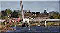
The Bann railway bridge, Coleraine (2)
by Albert Bridge for square C8433 The Bann railway bridge showing the bascule span in the raised position. The... (more)
|

|
Detectorist on the Shore
by Des Blenkinsopp geograph for square SU7205 A guy with a metal detector seeing what he can find around the remains of an old... (more)
|

|
Hole in the old embankment, Jenny Brown's Point
by Karl and Ali for square SD4673 I noticed a large void when standing on the top. It looks as though storms and... (more)
|

|
Remains of the old quay, Jenny Brown's Point
by Karl and Ali geograph for square SD4673 The quay was built around the end of the 18th Century to bring in materials and... (more)
Tags:
top:Coastal
top:Derelict, Disused
top:Docks, Harbours
top:Estuary, Marine
ruin:Jetty
place:Morecambe Bay
Tidal Mudflats
|
