About tags on Geograph

Public Tags

Related Tags | Coverage Map
Prefix: ruin    Tag:  Pier  
Other tags: Pier     building type:Pier     category:Pier     disused:Pier     former:Pier     place:Pier     subject:Pier    

Showing images tagged with ruin:Pier tag.

View all tagged images - In Browser
:

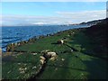
TQ2904 : West Pier from the shore by Ian Paterson West Pier from the shore by Ian Paterson
geograph for square TQ2904
The ruined West Pier photographed from a stone bulwark at low tide.
Tags: top:Air, Sky, Weather   top:Coastal   top:Derelict, Disused   top:Estuary, Marine   Old Pier   ruin:Pier   Pier   Pier (Disused)   West Pier   place:West Pier  
ST3062 : Birnbeck Pier and its shadow by Gerald England Birnbeck Pier and its shadow by Gerald England
for square ST3062
A low strong sun spreads a shadow of the pier over the mudflats.
Tags: Birnbeck Island   Birnbeck Pier   pier:Birnbeck Pier   top:Coastal   type:Cross Grid   Derelict   top:Estuary, Marine   Mudflats   Pier   disused:Pier   ruin:Pier   place:Weston Super Mare  
TV6198 : Fire Damage at Eastbourne Pier by PAUL FARMER Fire Damage at Eastbourne Pier by PAUL FARMER
for square TV6198
In spite of the fire the pier reopened on 27.9.14
Tags: top:City, Town Centre   top:Coastal   Eastbourne   place:Eastbourne   Fire Damage   Fire Damaged   Fire Damaged Pier   top:Historic Sites and Artefacts   Pier   subject:Pier   ruin:Pier   top:Public Buildings and Spaces   county:Sussex   Sussex   place:Sussex  
TQ8108 : Hastings Pier by PAUL FARMER Hastings Pier by PAUL FARMER
for square TQ8108
Tags: top:City, Town Centre   top:Coastal   place:Hastings   Hastings Pier   top:Historic Sites and Artefacts   Pier   ruin:Pier   Seaside   Seaside Scene   place:Sussex   county:Sussex   Sussex  
ST3062 : Looking over Birnbeck Pier by Gerald England Looking over Birnbeck Pier by Gerald England
geograph for square ST3062
On the horizon are the islands of Steep Holm and Flat Holm in the Bristol Channel.
Tags: Birnbeck Island   pier:Birnbeck Pier   Birnbeck Pier   Bristol Channel   top:Coastal   top:Estuary, Marine   island:Flat Holm   Flat Holm   type:Geograph   top:Islands   ruin:Pier   Pier   disused:Pier   Steep Holm   island:Steep Holm   place:Weston Super Mare  
NM7417 : Seil - Ellenabeich - Remains of pier from Easdale Sound by Rob Farrow Seil - Ellenabeich - Remains of pier from Easdale Sound by Rob Farrow
geograph for square NM7417
Taken as we passed by the ruins of NM7417 : Seil - Ellenabeich - Wooden former steamer pier on the little passenger ferry... (more)
Tags: top:Coastal   top:Docks, Harbours   type:Geograph   top:Islands   former:Pier   subject:Pier   ruin:Pier   top:Village, Rural Settlement  
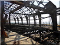
TQ3003 : West Pier by Lauren West Pier by Lauren
geograph for square TQ3003
Tags: Beach   subject:Beach   place:Brighton   Brighton   place:Brighton Beach   Coast   subject:Coast   top:Coastal   top:Derelict, Disused   top:Estuary, Marine   type:Geograph   subject:Pier   Pier   disused:Pier   former:Pier   building type:Pier   ruin:Pier   subject:Sea   Sea   top:Sport, Leisure   place:West Pier   West Pier   pier:West Pier  
TQ3003 : West Pier by Lauren West Pier by Lauren
for square TQ3003
Tags: Beach   subject:Beach   Brighton   place:Brighton   top:Coastal   type:Cross Grid   top:Derelict, Disused   top:Estuary, Marine   disused:Pier   subject:Pier   ruin:Pier   former:Pier   building type:Pier   Pier   Sea   subject:Sea   top:Sport, Leisure   West Pier   place:West Pier   pier:West Pier  
TV6198 : Fire Damage at Eastbourne Pier by PAUL FARMER Fire Damage at Eastbourne Pier by PAUL FARMER
geograph for square TV6198
In spite of the fire the pier reopened on 27.9.14
Tags: top:Coastal   Eastbourne   place:Eastbourne   Fire Damage   Fire Damaged   Fire Damaged Pier   top:Historic Sites and Artefacts   Pier   subject:Pier   ruin:Pier   county:Sussex   Sussex   place:Sussex  
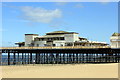
SH8579 : Entrance to the Victoria Pier,  Colwyn Bay by Jeff Buck Entrance to the Victoria Pier, Colwyn Bay by Jeff Buck
geograph for square SH8579
Building of the Victoria Pier at Colwyn Bay was started in 1899 and completed in... (more)
Tags: top:Coastal   place:Colwyn Bay   county:Conwy   top:Derelict, Disused   type:Geograph   Grade II Listed   Grade II Listed Structure   subject:Pier   ruin:Pier   Pier   Pier (Disused)   country:Wales  
SH8579 : Victoria Pier, Colwyn Bay by Jeff Buck Victoria Pier, Colwyn Bay by Jeff Buck
geograph for square SH8579
Building of the Victoria Pier at Colwyn Bay was started in 1899 and completed in... (more)
Tags: top:Coastal   place:Colwyn Bay   county:Conwy   top:Derelict, Disused   type:Geograph   Grade II Listed   Grade II Listed Structure   ruin:Pier   Pier   subject:Pier   Pier (Disused)   country:Wales  
SH8579 : Victoria Pier, Colwyn Bay by Jeff Buck Victoria Pier, Colwyn Bay by Jeff Buck
geograph for square SH8579
Building of the Victoria Pier at Colwyn Bay was started in 1899 and completed in... (more)
Tags: top:Coastal   place:Colwyn Bay   county:Conwy   top:Derelict, Disused   type:Geograph   Grade II Listed   Grade II Listed Structure   subject:Pier   ruin:Pier   Pier   Pier (Disused)   country:Wales  
NS3081 : Old piers at Craigendoran by Lairich Rig Old piers at Craigendoran by Lairich Rig
geograph for square NS3081
Category: Piers
This panoramic view is intended to complement another contributor's earlier... (more)
Tags: period:19th Century   river:Clyde   top:Coastal   place:Craigendoran   top:Docks, Harbours   ruin:Pier   bucket:Wideangle  
TQ3003 : The derelict West Pier at Brighton by Mat Fascione The derelict West Pier at Brighton by Mat Fascione
geograph for square TQ3003
Tags: Beach   top:Coastal   top:Derelict, Disused   type:Geograph   subject:Pier   ruin:Pier  
TQ3003 : Passing the Brighton Pier West Buoy by Mat Fascione Passing the Brighton Pier West Buoy by Mat Fascione
geograph for square TQ3003
Tags: subject:Buoy   Buoy   top:Coastal   top:Estuary, Marine   type:Geograph   ruin:Pier  
TQ3003 : Passing the Brighton Pier West Buoy by Mat Fascione Passing the Brighton Pier West Buoy by Mat Fascione
geograph for square TQ3003
Tags: place:Brighton   subject:Buoy   Buoy   top:City, Town Centre   top:Coastal   type:Geograph   ruin:Pier  
NM7417 : Seil - Ellenabeich - Wooden former steamer pier by Rob Farrow Seil - Ellenabeich - Wooden former steamer pier by Rob Farrow
geograph for square NM7417
All that is left of the former steamer pier at Ellenabeich. This wooden... (more)
Tags: top:Coastal   top:Docks, Harbours   type:Geograph   top:Islands   former:Pier   subject:Pier   ruin:Pier   top:Village, Rural Settlement  
TQ3003 : The West Pier viewed from the Golden Spiral by Mat Fascione The West Pier viewed from the Golden Spiral by Mat Fascione
for square TQ3003
These cast-iron columns were originally part of the substructure of the West... (more)
Tags: top:Coastal   Columns   type:Cross Grid   top:Historic Sites and Artefacts   ruin:Pier   subject:Pier  
TQ3003 : West Pier, Brighton by Oliver Mills West Pier, Brighton by Oliver Mills
for square TQ3003
A long-exposure night view of the pier, from underneath the remaining shoreward... (more)
Tags: place:Brighton   top:City, Town Centre   top:Derelict, Disused   type:Extra   bird:Gull   top:Historic Sites and Artefacts   Long Exposure   taken:Night   subject:Pier   subject:Ruin   pier:West Pier   subject:Wind Farm  
ST3062 : Birnbeck Pier by Oliver Mills Birnbeck Pier by Oliver Mills
geograph for square ST3062
The pier at low tide, on the outskirts of Weston Super Mare. The building in the... (more)
Tags: Birnbeck Island   Birnbeck Pier   top:Coastal   top:Derelict, Disused   top:Estuary, Marine   Former Tollhouse   type:Geograph   top:Paths   subject:Pier   ruin:Pier   top:Suburb, Urban Fringe   Tollhouse   place:Weston Super Mare  
NT1280 : North Queensferry piers and Forth Road Bridge, 1968 by Derek Harper North Queensferry piers and Forth Road Bridge, 1968 by Derek Harper
for square NT1280
Taken a little further south than NT1380 : Approaching the Forth Bridge, 1968, with the railway pier and, to... (more)
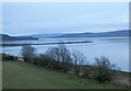
NH5749 : Beauly Firth at Garguston by Gerald England Beauly Firth at Garguston by Gerald England
geograph for square NH5749
View along the northern shoreline of the Firth. In the foreground is the... (more)
ST3062 : Birnbeck Pier, Weston Super Mare by Ian S Birnbeck Pier, Weston Super Mare by Ian S
geograph for square ST3062
Tags: top:Coastal   top:Derelict, Disused   type:Geograph   ruin:Pier  
ST3062 : Birnbeck Pier, Weston Super Mare by Ian S Birnbeck Pier, Weston Super Mare by Ian S
geograph for square ST3062
Tags: top:Coastal   top:Derelict, Disused   type:Geograph   ruin:Pier  
TQ3003 : The West Pier at Brighton by Mat Fascione The West Pier at Brighton by Mat Fascione
geograph for square TQ3003
Tags: Beach   top:Coastal   top:Derelict, Disused   type:Geograph   ruin:Pier   subject:Pier  
TQ3003 : The West Pier at Brighton by Mat Fascione The West Pier at Brighton by Mat Fascione
geograph for square TQ3003
Tags: Beach   top:Coastal   type:Geograph   subject:Pier   ruin:Pier  
NH8095 : Remains of Littleferry South Pier by valenta Remains of Littleferry South Pier by valenta
geograph for square NH8095
All that remains of the south pier, where the ferry ran across the mouth of Loch... (more)
Tags: top:Coastal   top:Derelict, Disused   top:Docks, Harbours   top:Estuary, Marine   type:Geograph   top:Historic Sites and Artefacts   place:Loch Fleet   subject:Pier   ruin:Pier   place:Sutherland  
NS2478 : Kempock Point: remains of a pier by Lairich Rig Kempock Point: remains of a pier by Lairich Rig
geograph for square NS2478
The same remains are shown, viewed in the opposite direction, in NS2478 : Kempock Point: remains of a pier. As... (more)
Tags: top:Derelict, Disused   top:Docks, Harbours   type:Geograph   ruin:Pier  
TF6120 : River Great Ouse, West Lynn by Dave Hitchborne River Great Ouse, West Lynn by Dave Hitchborne
geograph for square TF6120
The King's Lynn to West Lynn ferry has just brought the last passenger to... (more)
Tags: Ferry   ruin:Pier   Pier   top:Rivers, Streams, Drainage  
TF6120 : River Great Ouse, West Lynn by Dave Hitchborne River Great Ouse, West Lynn by Dave Hitchborne
geograph for square TF6120
The King's Lynn to West Lynn ferry is just bringing the last passenger to... (more)
Tags: Ferry   ruin:Pier   Pier   top:Rivers, Streams, Drainage  
NU1535 : Derelict pier near Budle by Karl and Ali Derelict pier near Budle by Karl and Ali
geograph for square NU1535
There are no signs of what used to be loaded and unloaded here. The surface of... (more)
SE2778 : Ruined Footbridge Across the Ure by Mick Garratt Ruined Footbridge Across the Ure by Mick Garratt
geograph for square SE2778
Tags: top:Derelict, Disused   ruin:Footbridge   top:Paths   ruin:Pier   River   top:Rivers, Streams, Drainage   Ruin   river:Ure  
NN0801 : Old pier, Strachur Bay by Callum Black Old pier, Strachur Bay by Callum Black
geograph for square NN0801
A remnant from days when most goods to the area would have arrived by sea.... (more)
Tags: top:Coastal   ruin:Pier   Pier  
TF6120 : West Pier, West Lynn by Dave Hitchborne West Pier, West Lynn by Dave Hitchborne
geograph for square TF6120
The rotting hulk of the old pier looks almost like a wrecked galleon.
Tags: ruin:Pier   top:Rivers, Streams, Drainage  
TF6120 : West Pier, West Lynn by Dave Hitchborne West Pier, West Lynn by Dave Hitchborne
geograph for square TF6120
The rotten remains of the old pier, from the steps of the new.
Tags: ruin:Pier   top:Rivers, Streams, Drainage   Steps  
TQ3003 : The derelict West Pier at Brighton by Mat Fascione The derelict West Pier at Brighton by Mat Fascione
for square TQ3003
Tags: Beach   top:Coastal   type:Cross Grid   top:Derelict, Disused   subject:Pier   ruin:Pier  
NS3081 : Old quay and piers at Craigendoran by Lairich Rig Old quay and piers at Craigendoran by Lairich Rig
geograph for square NS3081
Category: Quay
The side of the quay can be seen on the left, with grass on top. For other... (more)
Tags: period:19th Century   top:Coastal   top:Docks, Harbours   ruin:Pier   former:Quayside  
ST3062 : Birnbeck Pier, Weston Super Mare by Ian S Birnbeck Pier, Weston Super Mare by Ian S
geograph for square ST3062
Tags: top:Coastal   top:Derelict, Disused   type:Geograph   ruin:Pier  
NS2478 : Kempock Point: remains of a pier by Lairich Rig Kempock Point: remains of a pier by Lairich Rig
geograph for square NS2478
For a view in the opposite direction, see NS2478 : Kempock Point: remains of a pier. At the upper left of... (more)
Tags: top:Derelict, Disused   top:Docks, Harbours   type:Geograph   ruin:Pier  
TF6120 : River Great Ouse, West Lynn by Dave Hitchborne River Great Ouse, West Lynn by Dave Hitchborne
geograph for square TF6120
A lone passenger has just arrived on the ferry, from King's Lynn. At... (more)
Tags: Ferry   ruin:Pier   Pier   top:Rivers, Streams, Drainage  
TQ2904 : Hove beach opposite Brunswick Square by nick macneill Hove beach opposite Brunswick Square by nick macneill
geograph for square TQ2904
Tags: Beach   top:City, Town Centre   top:Coastal   ruin:Pier   top:Sport, Leisure   West Pier  
NH5949 : Track heading down to Redcastle by valenta Track heading down to Redcastle by valenta
geograph for square NH5949
In Gallowhill Wood as the track drops down towards Redcastle, views open up of... (more)
Tags: firth:Beauly Firth   top:Coastal   top:Country Estates   top:Estuary, Marine   Gallowhill Wood   type:Geograph   place:Milton of Redcastle   ruin:Pier   Redcastle Estate   top:Roads, Road Transport   subject:View   top:Woodland, Forest  
NM7317 : Easdale Sound by Oliver Dixon Easdale Sound by Oliver Dixon
geograph for square NM7317
Seen at a very low state of the tide. Ellenabeich village NM7417 and its... (more)
Tags: subject:Channel   top:Coastal   top:Docks, Harbours   ruin:Pier   Seaweed   Shore   Sound  
HU2980 : Old herring processing plant at the Blade by Oliver Dixon Old herring processing plant at the Blade by Oliver Dixon
geograph for square HU2980
An old chimney stack and disused pier can also be seen at this abandoned fishing... (more)
NH5748 : End of Redcastle pier by Craig Wallace End of Redcastle pier by Craig Wallace
geograph for square NH5748
Looking south across the Beauly Firth in the mist. The low tide reveals a large... (more)
View more in the Image Search or in Browser
View images matching 'Pier' anywhere in the tags
Don't click these: PotMel 1 PotMel 2