Public Tags
Showing images tagged with ruin:Structure tag.
|
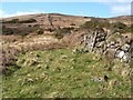
East Cameron: end of narrow structure
by Lairich Rig geograph for square NS4683 The same area is shown, in a side-on view, in NS4683 : East Cameron: end of narrow structure. The present view is... (more)
|
|
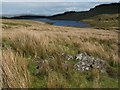
Remains of an L-shaped structure
by Lairich Rig geograph for square NS4778 Category: Ruins There are two ruined buildings in this area, located less than fifty metres... (more)
Tags:
ArchaeologyX
landmark:Burncrooks ReservoirX
near:Burncrooks ReservoirX
top:Historic Sites and ArtefactsX
ruin:Structure
|
|
Ruined structure alongside Weeton Lane
by Christine Johnstone geograph for square SE2946 Close to the junction with Green Lane. Perhaps once an animal fold?
Tags:
top:Derelict, DisusedX
subject:RuinX
ruin:Structure
Unidentified StructureX
ruin:Unknown Building TypeX
|
|
Remains of a structure near Poachy Glen
by Lairich Rig geograph for square NS3779 Category: Ruins For the main description, see: NS3779 : Remains of a structure near Poachy Glen.
This photo shows the other side... (more)
|
|
Remains of a structure near Poachy Glen
by Lairich Rig geograph for square NS3779 Category: Ruins Although the much more visible NS3779 : Ruins of Carman Cottage are located about 100 metres to the... (more)
|
|
|
Remains of a structure
by Lairich Rig geograph for square NS4277 In the foreground is the faint outline of a structure, its interior lower than... (more)
|

|
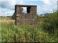
Structure beside the River Leven
by Lairich Rig geograph for square NS3976 Category: Tower This small brick structure stands just beside the point where (NS3976 : Whiteleys Burn flows... (more)
|
|
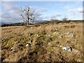
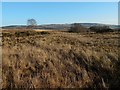
Possible outline of a structure
by Lairich Rig geograph for square NS3778 Near the centre of the image is what appeared to be the outline of an enclosure... (more)
|
|
Structure beside the River Leven
by Lairich Rig geograph for square NS3976 Category: Tower For the main description, see NS3976 : Structure beside the River Leven. In this view, the main opening is on... (more)
|
|
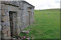
Haws House, South East Side
by Mick Garratt geograph for square SD7478 Tags:
top:Derelict, DisusedX
DoorX
ruin:Farm BuildingX
top:Farm, Fishery, Market GardeningX
FieldX
Limestone CountryX
PastureX
RuinX
ruin:Structure
top:UplandsX
Yorkshire DalesX
|
|
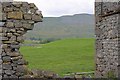
View of Whernside from Haws House
by Mick Garratt geograph for square SD7478 Whernside is in SD7381.
Tags:
top:Derelict, DisusedX
ruin:Farm BuildingX
top:Farm, Fishery, Market GardeningX
FieldX
HillX
Limestone CountryX
MountainX
PastureX
RuinX
ruin:Structure
top:UplandsX
WhernsideX
Yorkshire DalesX
|
|
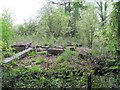
Ruins by the path
by Bill Nicholls geograph for square SU3987 I wonder about these as I think they could be some old filter beds from a sewage system.
|