Public Tags
Tag: Ruined·Buildings
Showing latest 50 of 359 images tagged with Ruined Buildings tag.
|
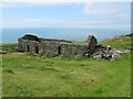
Ruined building above Barmouth
by Malc McDonald geograph for square SH6116 A ruined building on the hillside overlooking Barmouth, on the coast of north Wales.
Tags:
place:Abermaw
place:Barmouth
place:Barmouth/Abermaw
top:Derelict, Disused
type:Geograph
county:Gwynedd
subject:Ruin
Ruined Building
Ruined Cottage
Ruined Farm Building
Ruined Farmhouse
Sea View
country:Wales
|

|
Brambletye House, near Forest Row
by Malc McDonald geograph for square TQ4135 Tags:
former:Country House
Country House Ruins
top:Derelict, Disused
near:East Grinstead
county:East Sussex
near:Forest Row
type:Geograph
Grade II (Star)
listed:Grade II(star)
Grade II(star) Listed
Grade II(star) Listed Building
Grade II(star) Listed Structure
top:Historic Sites and Artefacts
subject:Ruin
Ruin
Ruined Building
|

|
Ruined farm building, west of Bank Farm
by Christine Johnstone geograph for square SE2514 Seen from the public footpath, which [on the ground] goes closer to the ruin... (more)
|

|
Ruined building above Barmouth
by Malc McDonald geograph for square SH6116 A ruined building on the hillside above Barmouth in north Wales.
Tags:
place:Abermaw
place:Barmouth
place:Barmouth/Abermaw
top:Derelict, Disused
type:Geograph
county:Gwynedd
subject:Ruin
Ruined Building
Ruined Farm Building
country:Wales
|

|
Ruin overlooking Barmouth
by Malc McDonald geograph for square SH6116 Ruined buildings on the hillside overlooking Barmouth on the north Wales coast.
Tags:
place:Abermaw
place:Barmouth
place:Barmouth/Abermaw
top:Derelict, Disused
type:Geograph
county:Gwynedd
subject:Ruin
Ruined Buildings
Ruined Farm Buildings
Sea View
country:Wales
|

|
Ruined building, upper Fusedale
by Christine Johnstone geograph for square NY4417 With the dale's only bench standing in front, alongside the path.
Tags:
Bench
path:Footpath
Footpath
place:Fusedale
place:Lake District
national park:Lake District
top:Moorland
Open Access Land
top:Paths
Public Footpath
Ruined Building
Ruined Building - Small
building material:Stone
ruin:Unknown Building Type
top:Uplands
Valley
|

|
Ruined building in Bannerdale
by Christine Johnstone geograph for square NY4215 Alongside the path from Angle Tarn.
Tags:
Bannerdale
ruin:Farm Building
Farm Building (Ruined)
top:Farm, Fishery, Market Gardening
place:Lake District
national park:Lake District
fence:Post and Wire
Ruined Building
building material:Stone
top:Uplands
Valley
Wire and Post Fence
|

|
Ruined building, Hellingly Hospital
by nick macneill for square TQ5912 The hospital has stood ruined and dilapidated since closure, but many of the... (more)
|

|
Ruined stone building with slate roof
by Karl Peet geograph for square NN9848 No idea what this building was used for. First thoughts are a small dwelling... (more)
Tags:
place:Craigvinean Forest
top:Derelict, Disused
type:Geograph
top:Housing, Dwellings
subject:Ruin
Ruined Building
subject:Ruins
place:Sophia
top:Village, Rural Settlement
|

|
Ruined Building near High Billinge
by Jeff Buck geograph for square SJ5565 A ruined farm building off Quarry Bank near High Billinge.
Tags:
county:Cheshire
top:Derelict, Disused
country:England
top:Farm, Fishery, Market Gardening
type:Geograph
place:Kelsall
Ruined Building
Ruined Farm Building
|

|
Ruined buildings on slope of Byerhope
by Trevor Littlewood geograph for square NY8646 The valley cutting through the image is Byerhope, hope being a term meaning... (more)
Tags:
top:Derelict, Disused
top:Farm, Fishery, Market Gardening
Fields
type:Geograph
top:Moorland
top:Rivers, Streams, Drainage
subject:Ruin
Ruined Buildings
top:Uplands
Valley
|

|
Ruined building close to Creag Sgeanach
by Trevor Littlewood geograph for square NM8644 The ruin also lies close to the trig point at Fennachrochan; there's... (more)
Tags:
top:Derelict, Disused
top:Farm, Fishery, Market Gardening
type:Geograph
top:Geological Interest
Limestone Outcrops
top:Lowlands
top:Rocks, Scree, Cliffs
subject:Ruin
Ruined Building
|

|
Ruined structure with iron artefacts
by Trevor Littlewood geograph for square NY6635 The ruins of a stone building with various pieces of ironwork scattered about.... (more)
Tags:
Boulderfield
top:Derelict, Disused
type:Geograph
Iron Artefacts
top:Rocks, Scree, Cliffs
subject:Ruin
Ruined Building
top:Uplands
|

|
Ruined building below Bedafell Knott
by Trevor Littlewood geograph for square NY4215 Bedafell Knott is a knoll on the ridge of which Beda Fell is the terminal high... (more)
Tags:
Bridleway
Mountain Slopes
top:Paths
top:Rivers, Streams, Drainage
subject:Ruin
Ruined Building
top:Uplands
Valley
|

|
Ruined building near the Old Coach Road
by Graham Robson geograph for square NY3223 A ruined building adjacent to the Old Coach Road. The building was probably... (more)
|

|
Path to the ruin, south of Broad Oak Hill
by Christine Johnstone geograph for square SE2514 On the ground, this public footpath is slightly east of the mapped route.
|

|
Ruin on summit ridge of Mickle Fell
by Trevor Littlewood geograph for square NY8124 The ruin which must in its day have been a contender for the title of the most... (more)
|
|
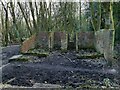
Ruined building in Calverley Wood
by Stephen Craven geograph for square SE2037 This part of the wood contains ruins of numerous buildings from former uses... (more)
|

|
Ruined building near head of Clargill Burn
by Trevor Littlewood geograph for square NY7736 The isolated building is close to the watershed between Teesdale and the valley... (more)
Tags:
top:Derelict, Disused
type:Geograph
Grassy Moorland
Mined Ground
top:Moorland
top:Quarrying, Mining
subject:Ruin
Ruined Building
top:Uplands
|

|
Ruined building at Chapel Mill near Mains of Usan
by Adrian Diack geograph for square NO7255 This substantial and detached, ruined building is one of a number of similar,... (more)
Tags:
subject:Building
top:Coastal
top:Derelict, Disused
type:Geograph
Ruined Building
top:Village, Rural Settlement
|

|
Ruined stone building beside the river
by Graham Robson geograph for square NT9250 A ruined stone building on grassland beside the River Tweed.
|

|
Ruined building adjacent to the Afon Llugwy
by TCExplorer geograph for square SH7757 I couldn't find much information about this, but old OS Six Inch mapping... (more)
|

|
Ruined buildings at The Pans
by Mat Fascione geograph for square NO6006 A ruined salt store on the left and a ruined bothy on the right, both are along... (more)
Tags:
top:Coastal
Coastline
top:Derelict, Disused
long distance path:Fife Coast Path
place:Firth of Forth
type:Geograph
top:Grassland
subject:Path
top:Paths
Ruined Building
|

|
Ruined building on moorland above Allenheads
by Trevor Littlewood geograph for square NY8645 The ruin is close to a hill road above the village to the north-east; its use,... (more)
Tags:
top:Derelict, Disused
type:Geograph
Grassy Moorland with Rushes
top:Moorland
subject:Ruin
Ruined Building
top:Uplands
|

|
Ruined building among trees
by Trevor Littlewood geograph for square NZ0539 The ruin is barely noticeable among the two stands of conifers at the edge of... (more)
Tags:
Coniferous Trees
Dead Bracken
top:Derelict, Disused
type:Geograph
top:Moorland
subject:Ruin
Ruined Building
top:Uplands
|

|
Ruined building at Haining Head
by Graham Robson geograph for square NY7275 A ruined house in the large expanse of grassland around Haining Head.
Tags:
top:Derelict, Disused
top:Farm, Fishery, Market Gardening
type:Geograph
Grassland
Ruined Building
Ruined House
|

|
Ruins on Cnoc Mòr
by Trevor Littlewood geograph for square NR2057 Cnoc Mòr is a minor hill close to the farm at Cultoon. The near-to-camera ridges... (more)
Tags:
top:Derelict, Disused
Earthwork
type:Geograph
top:Historic Sites and Artefacts
Mountain Walker
subject:Ruin
Ruined Building
top:Sport, Leisure
top:Uplands
|

|
Ruin on east ridge of Beinn Tart a' Mhill
by Trevor Littlewood geograph for square NR2157 The tiny ruin is clearly of some age but perhaps not sufficiently remote to be... (more)
Tags:
top:Derelict, Disused
top:Farm, Fishery, Market Gardening
type:Geograph
subject:Ruin
Ruined Building
top:Uplands
|

|
Ruined building, Pembroke
by Alan Hunt geograph for square SM9701 A ruined building near the former medieval priory on the outskirts of Pembroke.
|

|
Ruin beside A686
by Trevor Littlewood geograph for square NY5833 The ruined building of red sandstone stands at the south side of the A686 west... (more)
Tags:
top:Derelict, Disused
top:Farm, Fishery, Market Gardening
Field
top:Lowlands
Pile of Rubble
subject:Ruin
Ruined Building
Stone Wall
|

|
Ruined building, Buston Links
by Graham Robson geograph for square NU2409 Looking across the dunes towards a low ruined building which looks like it was... (more)
|

|
Ruin beside A849 at Torness
by Trevor Littlewood geograph for square NM6432 The building stands on the south side of the A849 close to the naming on OS maps... (more)
Tags:
Abandoned Stretch of Road
top:Derelict, Disused
Mountain Slopes
top:Roads, Road Transport
subject:Ruin
Ruined Building
top:Uplands
|

|
Ruined building, Middlesbrough
by Christine Johnstone geograph for square NZ4921 At the junction of Commercial Road and Stockton Street.
|

|
Ruined buildings at Caudale Quarry
by Graham Robson for square NY4010 Looking across the valley from Hartsop Dodd to a small area of the long... (more)
|
|
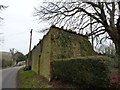
Ruined building, Hindover, Cattistock
by Becky Williamson geograph for square SY5999 There is an Ordnance Survey benchmark on this building. For description, see... (more)
|

|
Ruins of building on vicinity of Sheriff's Pit
by Trevor Littlewood geograph for square SE6996 The ruin is high on the western side of Rosedale beside the route of an... (more)
|

|
Ruined building at Lamberton Skerrs
by Graham Robson geograph for square NT9659 A ruined stone building at Lamberton Skerrs.
|

|
Ruined building at Lamberton Skerrs
by Graham Robson for square NT9659 A ruined building, which looks like a former house, sits at the bottom of the... (more)
|

|
Brick-built, ruined building on slope of Tinside Rigg
by Trevor Littlewood geograph for square NY7619 The ruined building is on the west slope of Tinside Rigg and presumably had a... (more)
|

|
Ruined building at Old Ridge
by Karl and Ali geograph for square SD3849 This may have been a house - there is another ruin a few metres away to the east... (more)
Tags:
top:Derelict, Disused
top:Flat Landscapes
top:Grassland
top:Housing, Dwellings
top:Lowlands
Ruin
Ruined Building
Trees
|

|
Ruined building at Old Ridge
by Karl and Ali geograph for square SD3949 It is difficult to tell if this was a house or a barn, the destruction is so... (more)
Tags:
top:Derelict, Disused
top:Flat Landscapes
top:Grassland
top:Lowlands
Ruin
Ruined Building
top:Village, Rural Settlement
|

|
Ruined buildings at Penny Rigg mine and quarry site
by Trevor Littlewood geograph for square NY3000 Penny Rigg close to Tilberthwaite has the remains of a copper smelting mill and... (more)
Tags:
Crags
Dead Bracken
top:Derelict, Disused
type:Geograph
Hill Slopes
top:Paths
top:Quarrying, Mining
top:Rocks, Scree, Cliffs
Ruined Buildings
top:Uplands
|

|
Ruined building on north side of Ellerton Moor
by Trevor Littlewood geograph for square SE0796 The small building is beside a public footpath which runs along the north side... (more)
Tags:
top:Boundary, Barrier
top:Derelict, Disused
Dry Stone Wall
type:Geograph
Hill Slope
subject:Ruin
Ruined Building
top:Uplands
|

|
Footpath near Staward Peel
by Adrian Taylor geograph for square NY7960 Much of the stone from Staward Peel was removed for use as building stone... (more)
|

|
Ruined building on rough grazing land
by Trevor Littlewood geograph for square NY7541 The building is on land to the west of the B6277. The view beyond is across the... (more)
Tags:
top:Derelict, Disused
top:Farm, Fishery, Market Gardening
type:Geograph
Rough Grazing with Rushes
subject:Ruin
Ruined Building
|

|
Ruined outbuilding, Dowan Road
by Richard Sutcliffe geograph for square NS5774 This ruined outbuilding (possible something to do with the nearby Baldernock... (more)
Tags:
subject:Building
top:Derelict, Disused
former:Doocot
type:Geograph
top:Historic Sites and Artefacts
Ruined Building
|

|
Ruined outbuilding, Dowan Road
by Richard Sutcliffe geograph for square NS5774 This ruined outbuilding (possible something to do with the nearby Baldernock... (more)
Tags:
subject:Building
top:Derelict, Disused
type:Geograph
top:Historic Sites and Artefacts
top:Roads, Road Transport
Ruined Building
|

|
Ruined outbuilding, Dowan Road
by Richard Sutcliffe geograph for square NS5774 This ruined outbuilding (possible something to do with the nearby Baldernock... (more)
Tags:
subject:Building
top:Derelict, Disused
type:Geograph
Goose
top:Historic Sites and Artefacts
top:Roads, Road Transport
Ruined Building
Weather Vane
|

|
Ruined building beside the Ravenglass and Eskdale Railway
by Jeff Buck geograph for square SD1098 Ruined building beside the Ravenglass and Eskdale Railway.... (more)
Tags:
subject:Abbey
county:Cumbria
top:Derelict, Disused
country:England
type:Geograph
Heritage Railway
national park:Lake District
Lake District
Minimum Gauge Railway
Narrow Gauge Railway
top:Railways
Ravenglass and Eskdale Railway
Ruined Building
|

|
Ruined building beside tree
by Trevor Littlewood geograph for square NY8801 The building is above the north side of the River Swale close to a feature named... (more)
Tags:
top:Boundary, Barrier
top:Derelict, Disused
Dry Stone Wall
top:Farm, Fishery, Market Gardening
type:Geograph
Lone Tree
subject:Ruin
Ruined Building
|
