Public Tags
Tag: Ruined·Farm·Buildings
Showing latest 50 of 375 images tagged with Ruined Farm Buildings tag.
|
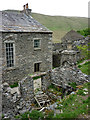
Ruined outbuilding, Mountain View, Westerdale
by Karl and Ali geograph for square SD6998 The derelict farmhouse at Mountain View is still largely intact although... (more)
|
|
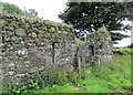
Ruined farm buildings at Wester Barnego
by Alan O'Dowd for square NS7884 Wester Barnego and Easter Barnego have fallen by the wayside, but farming... (more)
|
|
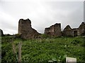
Ruins at Hill Top
by Robert Graham geograph for square NZ0854 This ruined farm stands beside a back road between Shotley Bridge and Ebchester.... (more)
|

|
Rowan tree and ruined house at Jerah
by Alan O'Dowd geograph for square NS8399 Ruins of a substantial farm building. Menstrie Glen has been uninhabited since... (more)
|

|
The ruins of Whinhowe
by Karl and Ali geograph for square SD5798 It's hard to tell if part of the ruins was ever a house but the central... (more)
|

|
Ruined Farmstead, Lan Fawr
by Mick Garratt geograph for square SN7865 |

|
Ruined buildings off Grasmere Lane
by Rob Farrow geograph for square SX2670 In fields on the opposite side of Grasmere Lane to SX2670 : House at Pontons Piece on Grasmere Lane there are... (more)
|
|
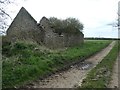
Ruined farm building near Hilton Moor
by Christine Johnstone geograph for square NZ1622 Alongside the lane to Hindberries Farm.
|

|
Ruined building at Orchard Field
by Robert Graham geograph for square NZ0751 This was probably a cattle byre. There was a farm here from the mid C19 at... (more)
Tags:
top:Derelict, Disused
subject:Farm Building
top:Farm, Fishery, Market Gardening
type:Geograph
top:Lowlands
Ruined Farm Building
Site of Former Farm
|

|
Ruined Building near High Billinge
by Jeff Buck geograph for square SJ5565 A ruined farm building off Quarry Bank near High Billinge.
Tags:
county:Cheshire
top:Derelict, Disused
country:England
top:Farm, Fishery, Market Gardening
type:Geograph
place:Kelsall
Ruined Building
Ruined Farm Building
|

|
Ruined farm building in the bed of the Charnwood Forest Canal
by Ian Calderwood geograph for square SK4519 Tags:
former:Canal
top:Canals
name:Charnwood Forest Canal
top:Derelict, Disused
subject:Farm Building
former:Farm Building
top:Farm, Fishery, Market Gardening
Ruin
Ruined Farm Building
|

|
Peat Rigg: ruined farm and barn attached
by Christopher Hilton geograph for square NY7568 |

|
Ruined farm building at Hyner Farm
by Robin Stott geograph for square SX8382 The northeast corner of the south-facing C-form range of New Hyner, all ruined.... (more)
Tags:
top:Derelict, Disused
top:Farm, Fishery, Market Gardening
civil parish:Hennock
top:Lowlands
Ruined Farm Buildings
building material:Stone
|
|
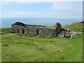
Ruined building above Barmouth
by Malc McDonald geograph for square SH6116 A ruined building on the hillside overlooking Barmouth, on the coast of north Wales.
Tags:
place:Abermaw
place:Barmouth
place:Barmouth/Abermaw
top:Derelict, Disused
type:Geograph
county:Gwynedd
subject:Ruin
Ruined Building
Ruined Cottage
Ruined Farm Building
Ruined Farmhouse
Sea View
country:Wales
|

|
Ruined farm building at Roughhazie
by Alan O'Dowd geograph for square NS6238 The name of this long-abandoned farm seems to bear a resemblance to Ruchazie, a... (more)
|

|
Ruined farm buildings at Cairnsaigh
by Alan O'Dowd geograph for square NS6136 A long-abandoned farm on the slopes of Cairnsaigh Hill.
Tags:
Abandoned Farm
top:Derelict, Disused
top:Farm, Fishery, Market Gardening
type:Geograph
top:Housing, Dwellings
subject:Ruin
Ruined Farm Buildings
Ruined Farmhouse
|

|
Roofless farm building, above Cwmcynfelin Woods
by Christine Johnstone geograph for square SN6083 Looks as if it never had a front wall. On the south side of the public bridleway.
Tags:
Derelict Farm Building
top:Derelict, Disused
ruin:Farm Building
Roofless
subject:Ruin
Ruined Farm Building
|
|
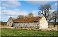
Ruined building beside track east from Moor Lane
by Trevor Littlewood geograph for square NZ1622 A farm road, also a 'route with other public access' connects the... (more)
Tags:
top:Derelict, Disused
top:Farm, Fishery, Market Gardening
Field
top:Lowlands
subject:Ruin
Ruined Farm Building
|

|
Ruins alongside Rowantree Gill
by Christine Johnstone geograph for square SD7793 The remains of an old farm? Only the shed is habitable [by hens].
|
|
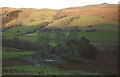
The ruins of Tenter Howe, Longsleddale
by Karl and Ali geograph for square NY5100 A ruined farmhouse and outbuildings in the middle dale. Whiteside Pike catches... (more)
|

|
Ruined farm buildings at Moy
by Trevor Littlewood geograph for square NN4282 The ruins of farm buildings at Moy once on the line of the A86 now bypassed by... (more)
|

|
Ruined farm buildings by Biggin Farm
by Andrew Hill geograph for square SK4462 A cluster of ruined farm buildings in a fine setting, looking north.
|

|
Passing ruined buildings at Glenside
by Alan O'Dowd geograph for square NS6079 The name Glenside appears on old OS maps in relation to this derelict farm.
Tags:
top:Derelict, Disused
top:Farm, Fishery, Market Gardening
type:Geograph
top:Paths
subject:Ruin
Ruined Farm Buildings
Ruined Farmhouse
top:Uplands
|

|
Ruined building above Barmouth
by Malc McDonald geograph for square SH6116 A ruined building on the hillside above Barmouth in north Wales.
Tags:
place:Abermaw
place:Barmouth
place:Barmouth/Abermaw
top:Derelict, Disused
type:Geograph
county:Gwynedd
subject:Ruin
Ruined Building
Ruined Farm Building
country:Wales
|

|
Ruined barn or farmhouse
by Trevor Littlewood geograph for square SD9876 The ruin stands at an altitude of over 520 m. on moorland between East Stone... (more)
Tags:
top:Boundary, Barrier
top:Farm, Fishery, Market Gardening
type:Geograph
subject:Ruin
Ruined Dry Stone Wall
Ruined Farm Building
top:Uplands
|

|
Ruins of the farmstead at Fell Close
by Robert Graham geograph for square NZ0647 This is probably an old byre, with the house behind on the left. English... (more)
Tags:
top:Derelict, Disused
top:Farm, Fishery, Market Gardening
type:Geograph
subject:Ruin
Ruined Farm Buildings
|

|
Ruined farm buildings at South Holme, Southowram
by Humphrey Bolton geograph for square SE1223 The farm at South Holme was part of the Shibden Hall estate in 1825, when... (more)
Tags:
top:Derelict, Disused
top:Farm, Fishery, Market Gardening
type:Geograph
top:Grassland
top:Lowlands
subject:Ruin
Ruined Farm Buildings
|

|
Ruined buildings at Nether Tarrioch
by Alan O'Dowd geograph for square NS6326 Long-abandoned farm buildings on a bank above the River Ayr, at the edge of Airds Moss
Tags:
Abandoned Farm
top:Derelict, Disused
top:Farm, Fishery, Market Gardening
type:Geograph
top:Grassland
top:Housing, Dwellings
top:Moorland
subject:Ruin
Ruined Farm Buildings
|

|
Ruins at Kinloch
by Ian Taylor geograph for square NG7016 Ruined farm buildings. Part of the wall has been rebuilt to its full height.
Tags:
top:Derelict, Disused
top:Farm, Fishery, Market Gardening
type:Geograph
subject:Ruin
Ruined Farm Buildings
|

|
Trees and ruined building at East Loups's
by Trevor Littlewood geograph for square NY9717 All of the buildings at the location of East Loups's are ruins; the view is... (more)
Tags:
top:Derelict, Disused
top:Farm, Fishery, Market Gardening
subject:Ruin
Ruined Farm Building
Wintry Trees
|

|
Ruins of Sterts Farm, near Upper Inglesham
by Vieve Forward geograph for square SU1896 Ruins of farm buildings at Sterts Farm.
|

|
Edale (ruined farm building)
by Stephen Burton geograph for square SK1085 This ruined farm building is situated on the lower slopes of Broadlea-bank Tor... (more)
|

|
Peak Side
by Mick Garratt geograph for square NZ0036 A ruined farmhouse.
|

|
Peak Side
by Mick Garratt geograph for square NZ0036 A ruined farmhouse.
|

|
Abandoned steading at Craigentarrie
by Alan O'Dowd geograph for square NT1964 There has been a house on this site since at least the 18th Century, but the... (more)
|

|
Ruin overlooking Barmouth
by Malc McDonald geograph for square SH6116 Ruined buildings on the hillside overlooking Barmouth on the north Wales coast.
Tags:
place:Abermaw
place:Barmouth
place:Barmouth/Abermaw
top:Derelict, Disused
type:Geograph
county:Gwynedd
subject:Ruin
Ruined Buildings
Ruined Farm Buildings
Sea View
country:Wales
|

|
Remains of farm buildings at Roughhazie
by Alan O'Dowd geograph for square NS6238 The name of this long-abandoned farm seems to bear a resemblance to Ruchazie, a... (more)
Tags:
top:Farm, Fishery, Market Gardening
type:Geograph
top:Grassland
top:Lowlands
subject:Ruin
Ruined Farm
Ruined Farm Buildings
|

|
Ruins at High Farm
by Trevor Littlewood geograph for square NY9539 High Farm is a complete ruin. It's located just to the north of the also... (more)
Tags:
top:Boundary, Barrier
Deciduous Trees in Winter
top:Derelict, Disused
top:Farm, Fishery, Market Gardening
type:Geograph
subject:Ruin
Ruined Dry Stone Wall
Ruined Farm Buildings
top:Uplands
|

|
Ruined farm building on north side of the A684
by Roger Templeman geograph for square SD9889 There is an Ordnance Survey benchmark SD9889 : Benchmark on ruined farm building on north side of A684 on the left hand corner of the... (more)
Tags:
road:A Road
top:Derelict, Disused
Dry Stone Wall
top:Farm, Fishery, Market Gardening
type:Geograph
Grass Verge
Ordnance Survey
top:Roads, Road Transport
Ruined Farm Building
|

|
Ruins at Jerah
by Alan O'Dowd geograph for square NS8399 A ruined farm steading in upper Menstrie Glen in the Ochil Hills.
|

|
Rustic charm or rural neglect? - West of Little Walsingham
by Richard Humphrey geograph for square TF9137 This old farm building is either waiting for demolition or conversion to a... (more)
|

|
Ruin at High Whinhowe
by Karl and Ali geograph for square NY5905 Many farms in the area of Birkbeck Fells and Bretherdale appear to have been... (more)
|

|
Ruins at Kerrow
by Trevor Littlewood geograph for square NO1269 In its day Kerrow (if that is indeed the name of the property) must have been a... (more)
|

|
Ruined farm building at Hackensall
by Christine Johnstone geograph for square SD3447 This building is shown on the large-scale OS map surveyed in 1844-5.
|

|
Ruins largely concealed by trees
by Trevor Littlewood geograph for square NY9539 Large scale OS mapping names these remains of farm buildings as Laverock Seat.... (more)
|

|
Ruined farm buildings, Glenside
by Alan O'Dowd for square NS5979 The name Glenside appears on old OS maps.
Tags:
type:Cross Grid
top:Derelict, Disused
top:Housing, Dwellings
subject:Ruin
Ruined Farm Building
Ruined Farmhouse
top:Uplands
|

|
Ruins at West Thorpe
by Trevor Littlewood geograph for square NZ0914 Abandoned farm buildings at West Thorpe in a field corner south of the River Tees.
Tags:
top:Derelict, Disused
Dry Stone Wall
top:Farm, Fishery, Market Gardening
type:Geograph
top:Lowlands
subject:Ruin
Ruined Farm Buildings
|

|
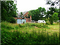
Derelict buildings at Wolf Cleugh
by Trevor Littlewood geograph for square NY9043 The stream is Rookhope Burn, the main stream in the valley, Rook Hope.
The... (more)
Tags:
top:Derelict, Disused
top:Farm, Fishery, Market Gardening
type:Geograph
Hill Slopes
top:Moorland
top:Rivers, Streams, Drainage
subject:Ruin
Ruined Farm Buildings
Stream
top:Uplands
|
|
Ruined farm buildings, Rakehill Farm, Barwick-in-Elmet
by Humphrey Bolton geograph for square SE3937 Taken with a bit of zoom from the road on the bridge over Rake Beck.
Tags:
top:Derelict, Disused
top:Farm, Fishery, Market Gardening
type:Geograph
top:Grassland
top:Lowlands
subject:Ruin
Ruined Farm Buildings
|

|
Old ruined privy
by Robert Graham geograph for square NZ1047 One of a number of old buildings at the ruined farmstead at High House. I think... (more)
Tags:
top:Derelict, Disused
Dry Stone Wall
top:Farm, Fishery, Market Gardening
type:Geograph
top:Lowlands
subject:Ruin
Ruined Farm Building
|
