Public Tags
Tag: Sand·Dune
Other tags: subject:Sand Dune
Showing latest 50 of 2,274 images tagged with Sand Dune tag.

|
Dunes at Studland Beach
by Malc McDonald geograph for square SZ0384 Sand dunes overlooking Studland Beach, with a view to Old Harry Rocks. The... (more)
Tags:
Beach and Dunes
top:Coastal
county:Dorset
Dune
subject:Dune
Dune Grass
Dunes
top:Estuary, Marine
type:Geograph
Grassy Dunes
Low Sand Dunes
near:Poole
Sand Dune
Sand Dunes
near:Studland
Studland Beach
|

|
Dunes at Studland Beach
by Malc McDonald geograph for square SZ0384 Sand dunes overlooking Studland Beach, on the Dorset coast. The dunes are... (more)
Tags:
Beach and Dunes
top:Coastal
county:Dorset
Dune
subject:Dune
Dune Grass
Dunes
top:Estuary, Marine
type:Geograph
Grassy Dunes
Low Sand Dunes
near:Poole
Sand Dune
Sand Dunes
near:Studland
Studland Beach
|

|
Sand dunes at Ynyslas
by I Love Colour geograph for square SN6094 An April evening at the Ynyslas Sand Dunes, looking across the Dyfi estuary to... (more)
Tags:
place:Aberdovey
Afon Leri
river:Afon Leri
place:Borth
top:Coastal
Dune
Dunes
top:Estuary, Marine
top:Flat Landscapes
place:North Wales
beach:Sand
Sand
Sand Dune
subject:Sand Dune
Sand Dunes
Sky
top:Sport, Leisure
place:Wales
place:Ynyslas
|

|
Upton Towans - Large sand dune
by Rob Farrow geograph for square SW5740 Taken from the track through Upton Towans looking at one of the larger sand... (more)
|

|
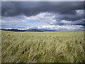
Sand dunes at Redcar
by Malc McDonald geograph for square NZ5825 A view along sand dunes towards Redcar's steelworks.
Tags:
top:Coastal
type:Geograph
Grassed Sand Dunes
place:Redcar
Sand Dune
subject:Sand Dune
Sand Dunes
Steelworks
|
|
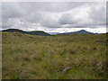
Sand dunes, Rossbeigh
by Rossographer geograph for square V6493 Deep in the heart of the sand dune system at Rossbeigh.
Tags:
top:Coastal
Coastal Dunes
County Kerry
Dune Grass
Duneland
Dunes
top:Estuary, Marine
type:Geograph
place:Rossbeigh
subject:Sand Dune
Sand Dunes
Vegetated Dunes
|
|
Sand dunes, Rossbeigh
by Rossographer geograph for square V6593 Deep in the heart of the sand dune system at Rossbeigh.
Tags:
top:Coastal
Coastal Dunes
County Kerry
Dune Grass
Duneland
Dunes
top:Estuary, Marine
type:Geograph
place:Rossbeigh
subject:Sand Dune
Sand Dunes
Vegetated Dunes
|

|
Sand dunes at Forvie
by William Starkey geograph for square NK0125 Extensive dunes at Forvie in Aberdeenshire. Sands stretch almost 25km northwards... (more)
|

|
Coatham Sands, Redcar
by Malc McDonald geograph for square NZ5825 A view eastwards along the dunes at Coatham Sands, looking towards Redcar.
Tags:
top:Coastal
type:Geograph
Grassed Sand Dunes
place:Redcar
subject:Sand Dune
Sand Dune
Sand Dunes
|

|
Lossiemouth - Sand Dune Restoration
by Colin Smith geograph for square NJ2370 February 2025 - volunteers from RAF Lossiemouth and local community volunteers... (more)
Tags:
Christmas Trees
top:Coastal
top:Construction, Development
Dune Erosion
East Beach
type:Geograph
place:Lossiemouth
plant:Marram Grass
Restoration Project
subject:Restoration Site
Sand Dune
Sands
|

|
Camber Dunes
by Stephen McKay geograph for square TQ9618 This is one of several routes over the dunes between the clumps of marram grass.... (more)
|

|
Gwithian Towans - General view across grass-covered dunes
by Rob Farrow geograph for square SW5741 A view across the gently undulating landscape of Gwithian Towans composed of... (more)
|

|
Camber Dunes
by Stephen McKay geograph for square TQ9618 Looking across the marram grass to the huge expanse of Camber Sands and the Rye... (more)
|

|
Camber Sands
by Stephen McKay geograph for square TQ9618 With the tide out and seen from high up on the dunes, the beach seems to stretch forever.
|

|
Sand dunes and flat sand, Formby Point
by David Hawgood for square SD2706 At low tide there is a wide expanse of flat sand, at highest tides the sea comes... (more)
Tags:
Beach
top:Coastal
type:Cross Grid
subject:Dune
top:Estuary, Marine
place:Formby Point
Sand Dunes
Sands at Low Tide
top:Suburb, Urban Fringe
|

|
New sand dune
by Oliver Dixon geograph for square NU1537 A new sand dune is in process of formation far out from the main body of dunes... (more)
|
|
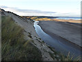
Crimdon Beck and Hart Warren Dunes
by Oliver Dixon geograph for square NZ4936 The course of Crimdon Beck is diverted southwards by a belt of low sand dunes on... (more)
Tags:
Beach
Beck
top:Coastal
subject:Dune
top:Grassland
top:Rivers, Streams, Drainage
Sand Cliff
Sand Dunes
|

|
Dune Flora at Porth Hellick, St Mary's, Scilly
by John Rostron geograph for square SV9210 There is not really a sand dune system at Porth Hellick, but there is an... (more)
|

|
Coastal East Lothian : Wind-blown sand on Spike Island dunes
by Richard West geograph for square NT6479 Tags:
bay:Belhaven Bay
beach:Belhaven Sands
top:Coastal
subject:Dune
top:Estuary, Marine
type:Geograph
Grassed Sand Dunes
Sand Dunes
place:Spike Island
Windblown Sand
|

|
Upton Towans - Sandy path
by Rob Farrow geograph for square SW5740 The minor path here cuts through a low sand dune in Upton Towans.
|

|
Eroding dunes, Newborough Forest
by Andy Waddington geograph for square SH4063 Category: Sand dunes Corsican Pine is remarkably good at withstanding wind and salt spray and is... (more)
|

|
Path near Studland Beach
by Malc McDonald geograph for square SZ0383 A path on the dunes behind Studland Beach. This view looks towards Old Harry... (more)
Tags:
near:Bournemouth
top:Coastal
county:Dorset
type:Geograph
Grassed Sand Dunes
Isle of Purbeck
place:Isle of Purbeck
Low Sand Dunes
National Trust
National Trust Land
National Trust Site
subject:Path
Path to Beach
top:Paths
near:Poole
Sand Dune
Sand Dunes
Sandy Path
near:Studland
near:Swanage
|

|
Path onto Studland Beach
by Malc McDonald geograph for square SZ0383 A sandy path on the dunes leading onto Studland Beach. The beach is owned and... (more)
Tags:
Beach
near:Bournemouth
top:Coastal
county:Dorset
type:Geograph
Grassed Sand Dunes
Isle of Purbeck
place:Isle of Purbeck
Low Sand Dunes
National Trust
National Trust Land
National Trust Site
subject:Path
Path to Beach
top:Paths
near:Poole
Sand Dune
Sand Dunes
Sandy Path
near:Studland
near:Swanage
|

|
Bantham Estate Vehicle Tracks 2
by Nick Cotter geograph for square SX6644 Bantham estate vehicle tracks towards the scheduled monument The large Roman and... (more)
Tags:
AONB
river:Avon (Devon)
Bantham Sands
top:Coastal
Coastal Dunes
Coastal Scrub
top:Country Estates
Disturbed Ground
Dunes
Environmental Damage
top:Estuary, Marine
type:Geograph
Grassed Sand Dunes
top:Grassland
top:Historic Sites and Artefacts
bucket:Landscape
Low Sand Dunes
top:Paths
Pheasant Shooting
Sand Dunes
subject:Scheduled Monument
Scheduled Monuments
Scrub Grassland
Scrub in Winter
South Devon
Undeveloped Land
Uninhabited Landscape
subject:Vehicle Tracks
|

|
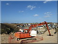
Bantham Estate Vehicle Tracks
by Nick Cotter geograph for square SX6643 Established footpath grass now being used as route for estate vehicles, on a... (more)
Tags:
AONB
river:Avon (Devon)
Bantham Sands
top:Coastal
Coastal Dunes
Coastal Scrub
top:Country Estates
Disturbed Ground
Dunes
Environmental Damage
subject:Estuary
top:Estuary, Marine
type:Geograph
Grassed Sand Dunes
top:Grassland
top:Historic Sites and Artefacts
bucket:Landscape
Low Sand Dunes
top:Paths
Pheasant Shooting
Rural Landscape
Sand Dunes
Scheduled Ancient Monument
Scheduled Monument
subject:Scheduled Monument
Scheduled Monuments
Scrub Grassland
Scrub in Winter
South Devon
Undeveloped Land
Uninhabited Landscape
subject:Vehicle Tracks
|
|
Camber Sands
by PAUL FARMER geograph for square TQ9618 |

|
Benar Beach looking towards the sand dunes of Morfa Dyffryn
by I Love Colour for square SH5525 The beach at Benar, looking north towards the sand dunes of Morfa Dyffryn and Harlech
Tags:
top:Air, Sky, Weather
Beach
Beach Shells
Beachcombing
Beaches
Blue Skies White Clouds
Clouds
Clouds Reflected
Cloudscape
Coast
subject:Coast
Coastal
top:Coastal
Coastal Area
Coastal Dunes
Coastline
Dog
Dog Walkers
Dog Walking
Dunes
top:Estuary, Marine
Man
Reflection
Reflections
Reflections in the Water
Sand
Sand Dunes
Sea Shells
Shells
Sky
top:Sport, Leisure
Waves
|

|
WW2 bunkers, Holme Dunes
by Pauline E geograph for square TF7144 Alongside the White Trail through the Holme Dunes NNR. Holme Dunes (Norfolk... (more)
|
|
Blowout in the sand dunes at Rattray Head
by Oliver Dixon geograph for square NK1057 |

|
Sand dunes and scrubland Whiteness Head
by valenta geograph for square NH7958 Area of scrub/sand dunes around the former oil rig construction site at... (more)
|

|
Lytham St Annes Local Nature Reserve
by Gerald England geograph for square SD3030 The sand dunes of the Fylde coast may only be a fragment of a once extensive... (more)
|

|
The Sand Dune Boardwalk (Notice)
by Gerald England for square SD3227 The notice reads "The Sand Dune Boardwalk is being placed here to enable... (more)
|

|
The River Bush near Bushfoot (3)
by Albert Bridge geograph for square C9342 The River Bush, looking upstream, with the official path well marked by the... (more)
|

|
Path, Portballintrae (1)
by Albert Bridge geograph for square C9342 One of the paths, through the dunes, on the western side of the Bush. Thistles,... (more)
|

|
Dunes below Losgaintir
by Rob Farrow geograph for square NG0699 The expansive sands that border Fadhail Losgaintir sweep into the distance,... (more)
|

|
Crimdon Beck eroding dunes, Hart Warren
by Andy Waddington geograph for square NZ4936 Category: Stream channel Crimdon beck cuts through the Hart Warren sand dunes below Crimdon House Farm,... (more)
Tags:
category:Beach
top:Coastal
top:Estuary, Marine
type:Geograph
category:Sand Dunes
category:Stream Channel
|

|
Barra - Huge sand dune on Tràigh Eais
by Rob Farrow geograph for square NF6905 This enormous sand dune was towards the southern end of NF6906 : Barra - Tràigh Eais. This... (more)
Tags:
island:Barra
top:Coastal
subject:Dune
top:Estuary, Marine
type:Geograph
top:Islands
Sand Dunes
|

|
Growing dunes at Holme
by Hugh Venables geograph for square TF7145 The many posts, and some remaining fabric, were put in to trap sand and help the... (more)
|

|
Blowout of sand dune at Lunan Bay
by Adrian Diack geograph for square NO6951 The photo shows a blowout in a sand dune at Lunan Bay. Recreation and visitor... (more)
Tags:
top:Coastal
Dune Blowout
top:Estuary, Marine
type:Geograph
top:Geological Interest
top:Rocks, Scree, Cliffs
subject:Sand Dune
|

|
Beach, Paterson-Island, Ross and Cromarty
by Claire Pegrum geograph for square NH8784 Looking along the base of the sand dunes which form Paterson-Island, towards the... (more)
|

|
Dunes at Sand Bay
by Derek Harper geograph for square ST3263 "The dune system is very delicate and easily damaged at the southern end of... (more)
|

|
Hart Warren Dunes
by Oliver Dixon geograph for square NZ4936 An area of high sand dunes flanking the beach of North Sands. The large pool on... (more)
|
|
End of Lifeboat Road
by Steven Haslington geograph for square SD2706 Lifeboat Road in Formby, Merseyside, seen here at its western end at the Raven... (more)
Tags:
Beach
Beach Scene
top:Coastal
Dune
Duneland
Dunes
Formby
near:Formby Beach
Formby Beach
place:Merseyside
Merseyside
Sand
Sand Dune
Sand Dunes
Sand Path
|

|
The River Bush near Bushfoot (2)
by Albert Bridge geograph for square C9342 The River Bush, looking downstream, with the official path well marked by the... (more)
|

|
Sand dunes, Camber
by Maigheach-gheal geograph for square TQ9518 Several species of grasses have adapted themselves to the inhospitable seashore.... (more)
|

|
Upton Towans - Grassland in the midst of the dunes
by Rob Farrow geograph for square SW5740 An area of fairly flat grassland in the midst of the dune system of Upton... (more)
Tags:
top:Coastal
Dunes
type:Geograph
subject:Grassland
top:Grassland
top:Heath, Scrub
Sand Dunes
place:Upton Towans
|

|
Sand Dune at Whiteness Head
by valenta geograph for square NH7958 Close inspection of the rather precarious face of the sand dunes reveal the nest... (more)
Tags:
near:Ardersier
top:Coastal
top:Estuary, Marine
type:Geograph
subject:Sand
Sand Dunes
place:Whiteness Head
|

|
Sand dunes at Allonby
by Richard Thomas geograph for square NY0844 These sand dunes beside the beach at Allonby are home to Ringed Plovers and Sand... (more)
|

|
Sand dune stabilization
by Bill Boaden geograph for square ST3159 The sand dunes are fenced off to allow them to recover. This prevents access to... (more)
|
