
|
Sandy Track
by Keith Evans
geograph for square TM2848
Sandy track near to Sutton, Suffolk.
|

|
Sandy Track
by Keith Evans
geograph for square TM3147
Sandy track near to Sutton, Suffolk.
|

|
Sandy Track And Footpath
by Keith Evans
geograph for square TM3341
Sandy farm track and footpath near to Alderton, Suffolk.
|

|
Sandy Track
by Keith Evans
geograph for square TM3242
Sandy track near to Shottisham, Suffolk.
|

|
Long Sandy Track
by Keith Evans
geograph for square TM3146
Long sandy track near to Sutton, Suffolk.
|

|
Sandy Track on Olddean Common
by Des Blenkinsopp
geograph for square SU8862
The map is very definite about the spelling here, even though the residential... (more)
|

|
Up from the beach, St Ishmaels
by Jaggery
geograph for square SN3607
A sandy pebbly track ascends towards Old Parish Road level crossing... (more)
|

|
Heathland Track
by Nigel Mykura
geograph for square SY8691
This sandy track on Philliols Heath roughly follows the line of a large... (more)
|

|
Sandy Track leading onto Birkdale Sands
by Chris Heaton
geograph for square SD3116
Track through salt marsh onto a beach that is mudflats in part - and still a... (more)
|

|
Sandy track fork, Ferryside
by Jaggery
geograph for square SN3610
Track through Ferryside beach dunes.
|

|
Sandy track through dunes, St Ishmael
by Jaggery
geograph for square SN3607
Looking NNW from the edge of Old Parish Road level crossing.... (more)
|

|
Sandy track above the beach, St Ishmael
by Jaggery
geograph for square SN3607
Looking SE from the edge of Old Parish Road level crossing.... (more)
|

|
Green Field And Track
by Keith Evans
geograph for square TM3242
Green field and sandy track near to Shottisham, Suffolk.
|

|
Sandy Track to Gugh
by Des Blenkinsopp
geograph for square SV8808
Gugh island is accessed at low tide over a sand bar from St Agnes. Once across,... (more)
|

|
Track to saltmarsh, Donna Nook NNR, Stonebridge
by M J Roscoe
geograph for square TF4299
The sign next to the sandy track warns that this is a weapons range and not to... (more)
|

|
Trackway, South Warren
by Des Blenkinsopp
geograph for square TM4458
A sandy track heads onto the heath from Saxmundham Road.
|

|
Tractor on the Track
by Des Blenkinsopp
geograph for square TM4661
Farm vehicles use this quite a bit judging by the wheel marks, but this sandy... (more)
|

|
Sandy Track on Chobham Common
by Des Blenkinsopp
geograph for square SU9763
|

|
Sandy track at the edge of Ferryside beach
by Jaggery
geograph for square SN3610
The beach is on the east side of the estuary of the River Towy (Afon Tywi in Welsh).
|
|
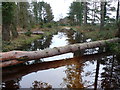
Flooded Forestry Track
by Nigel Mykura
geograph for square SY8792
The track was flooded to a depth of one foot and the fallen tree made this part... (more)
|
|
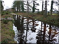
Flooded Forestry Track
by Nigel Mykura
geograph for square SY8792
This flooded track through the woods was only passable by clambering from one... (more)
|

|
Along The Broom
by Des Blenkinsopp
geograph for square TM4150
The map names this sandy trackway as The Broom
|

|
Road Trees And Track
by Keith Evans
geograph for square TM3243
Track leading to Shottisham, Suffolk.
|
|
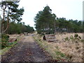
Forestry Track Philliols Heath
by Nigel Mykura
geograph for square SY8792
Much of this heath is criss-crossed with forestry tracks lined with stacks of... (more)
|

|
Track near Frogs Hole
by Chris Holifield
geograph for square TM3147
|

|
Track to The Broom
by Des Blenkinsopp
geograph for square TM4049
A road to a premises called The Broom. On the right is Broom Covert, on the left... (more)
|
|
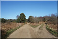
Tracks on the Common
by Des Blenkinsopp
geograph for square TM4660
|

|
Quiet Please, We Are Sleeping
by Des Blenkinsopp
geograph for square TA4213
The last of the dunes, where the track goes onto the semi tidal sand bar which... (more)
|

|
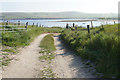
St Peter's church, Chillesford, from the north
by Christopher Hilton
geograph for square TM3852
|
|
Access track to Pool of Cletts
by Bill Boaden
geograph for square ND4690
Access from the north. You can get to it from the south too.
|

|
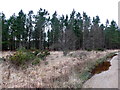
Shortwood and Hayeswood Lanes junction
by Hugh Craddock
geograph for square SY0484
Shortwood Lane (on the right) turns right into Hayeswood Lane (straight ahead):... (more)
|
|
Forestry on Philliols Heath
by Nigel Mykura
geograph for square SY8692
The heath in this area has a patchwork of open heathland alternating with wooded... (more)
|

|
Shortwood Lane
by Hugh Craddock
geograph for square SY0484
Shortwood Lane on the ascent towards Shortwood Common and Knowle. Shortwood Lane... (more)
|

|
Bridleway passing well in Pant Mari Flanders
by eswales
geograph for square SS8875
The well was once a source of drinking water for those who lived in the area. It... (more)
|
