Public Tags
Tag: Sca·Fell
Showing images tagged with Sca Fell tag.
|
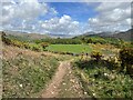
Track near Rabbit How
by Adrian Taylor geograph for square SD1399 The track is a public footpath from Eskdale Green to Muncaster. The fields and... (more)
|

|
Wastwater and the Fells
by Peter Trimming geograph for square NY1505 Fells, left to right, are Lingmell, Scafell Pike, Sca Fell and the far end of The Screes.
Tags:
county:Cumbria
top:Lakes, Wetland, Bog
Lingmell
Sca Fell
Scafell Pike
The Screes
top:Uplands
Wastwater
|

|
View From Dalegarth
by Peter Trimming geograph for square NY1700 Looking towards the cloud-covered Sca Fell.
Tags:
county:Cumbria
place:Eskdale Valley
type:Geograph
top:Grassland
Sca Fell
top:Uplands
subject:View
top:Woodland, Forest
|

|
View From Dalegarth
by Peter Trimming geograph for square NY1700 Looking up the valley, towards the distant Sca Fell.
Tags:
county:Cumbria
place:Eskdale Valley
type:Geograph
Sca Fell
top:Uplands
subject:View
top:Woodland, Forest
|

|
View From Dalegarth
by Peter Trimming geograph for square NY1700 Looking over the village of Boot, towards Sca Fell.
Tags:
place:Boot
county:Cumbria
place:Eskdale Valley
type:Geograph
Sca Fell
top:Uplands
subject:View
top:Village, Rural Settlement
|

|
View Towards Sca Fell
by Peter Trimming geograph for square SD1299 Seen from the public footpath (which terminates in a wood, following a very... (more)
Tags:
county:Cumbria
place:Eskdale Green
type:Geograph
top:Grassland
Sca Fell
subject:View
top:Woodland, Forest
|

|
View Towards Wast Water
by Peter Trimming geograph for square NY1506 In the background are Lingmell (left), Scafell Pike and Sca Fell.
Tags:
county:Cumbria
type:Geograph
top:Lakes, Wetland, Bog
Lingmell
top:Moorland
Sca Fell
Scafell Pike
top:Uplands
place:Wasdale
Wast Water
|

|
View Across Wast Water
by Peter Trimming geograph for square NY1606 Lingmell (left), Scafell Pike and Sca Fell (centre right) in the background.
Tags:
county:Cumbria
type:Geograph
top:Lakes, Wetland, Bog
Lingmell
Sca Fell
Scafell Pike
top:Uplands
place:Wasdale
Wast Water
|

|
Wast Water
by Peter Trimming geograph for square NY1707 The head of the lake, with Lingmell (left), Scafell Pike and Sca Fell (right) in... (more)
Tags:
county:Cumbria
type:Geograph
top:Lakes, Wetland, Bog
Lingmell
Sca Fell
Scafell Pike
top:Uplands
place:Wasdale
Wast Water
|

|
Wast Water
by Peter Trimming geograph for square NY1707 The head of the lake, with Lingmell (left), Scafell Pike and Sca Fell (right) in... (more)
Tags:
county:Cumbria
type:Geograph
Lingmell
top:Rivers, Streams, Drainage
Sca Fell
Scafell Pike
top:Uplands
place:Wasdale
Wast Water
|

|
View Towards Sca Fell
by Peter Trimming geograph for square NY1807 Seen from Wasdale Road, with the lower slopes of Lingmell to the left of picture.
|

|
View Towards the Sca Fell Range
by Peter Trimming geograph for square SD1798 Seen from the restricted byway, just below Low Ground.
Tags:
county:Cumbria
top:Farm, Fishery, Market Gardening
Low Ground
top:Moorland
top:Paths
Restricted Byway
Sca Fell
top:Uplands
subject:View
|

|
Sheep on the Byway
by Peter Trimming geograph for square SD1798 Just as I thought that I had a deal to photograph these herdwicks, the mother... (more)
Tags:
county:Cumbria
top:Farm, Fishery, Market Gardening
sheep:Herdwick
Low Ground
top:Paths
Restricted Byway
Sca Fell
subject:Sheep
top:Uplands
|

|
View Towards Low Ground
by Peter Trimming geograph for square SD1798 Seen from a restricted byway, with the Sca Fell range in the distance.
Tags:
county:Cumbria
top:Farm, Fishery, Market Gardening
top:Grassland
Low Ground
top:Lowlands
Sca Fell
subject:View
|

|
Barns at High Ground
by Peter Trimming geograph for square SD1798 Looking north, over the farm at Whincop, towards the Sca Fell range.
Tags:
Barns
county:Cumbria
top:Farm, Fishery, Market Gardening
farm:High Ground Farm
Sca Fell
top:Uplands
top:Village, Rural Settlement
|
